-
 9721 Hits
-
 72.08% Score
-
 2 Votes
|
|
Trailhead |
|---|---|
|
|
46.50034°N / 114.20248°W |
|
|
Ravalli |
|
|
Spring, Summer, Fall, Winter |
|
|
6850 ft / 2088 m |
Access for St Mary Peak and the Heavenly Twins
From the NorthTo reach the "normal" trailhead used to reach these peaks, take US 93 south from Missoula. About 1.5 miles south of the Stevensville intersection, turn right (west) when you see the sign for the "St Mary Peak Road".
The road leads straight west for almost 2 miles before making a 90 degree left (south) turn. It continues south for less than .5 mile, then makes a jog to the right (west), then quickly back left (south).
A half mile after this dogleg, turn right (west) onto FR 739 which was unmarked the last time I checked.
In less than a mile the road forks. Take the right (north) fork onto St. Mary’s Peak Road. Follow it for 10.3 miles to its end.
You will pass a couple of unsigned turns before reaching the end. Stay to the left both times.
The trailhead has ample parking and restroom facilities.
From the South
To reach the "normal" trailhead used to reach these peaks, from Victor, MT, go north on US Hwy 93 for four(4) miles to Indian Prairie Loop. Turn left (west) and travel 1.3 miles to St. Mary road.
Turn right (north) and go for .5 mile, then turn left (west) onto FR 739 which was unmarked the last time I checked.
In less than a mile the road forks. Take the right (north) fork onto St. Mary Peak Road. Follow it for 10.3 miles to its end.
You will pass a couple of unsigned turns before reaching the end. Stay to the left both times.
The trailhead has ample parking and restroom facilities.
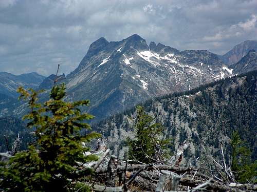
For information about the climbers' route accessed from this trailhead, see the links included in the picture's description.
 |
|---|

