
-
 35165 Hits
-
 73.06% Score
-
 3 Votes
|
|
Trailhead |
|---|---|
|
|
48.09155°N / 113.90024°W |
|
|
Flathead |
|
|
Spring, Summer, Fall, Winter |
|
|
5800 ft / 1768 m |
Overview:
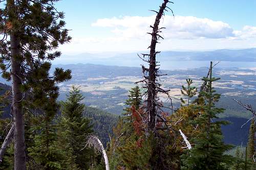 The Flathead Valley
The Jewel Basin Hiking Area is located in northwestern Montana.
The locals say that Camp Misery was named for the place that a local tribe spent a terrible winter. It is not impossible to imagine such a winter as the snowfall in this particular area is measured in feet not inches.
Access:
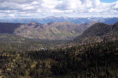 View into Glacier National Park
The primary access to the Jewel Basin is from Camp Misery which is reached by following U.S. Highway 83 to the Swan River Elementary School which is at an intersection with a blinking caution light. At this junction turn North on Echo Lake Road and drive another 2-3 miles to Foothills Road where you take a right and travel to Jewel Basin Road (Forest Service Road No. 5392).
This rough 5 miles of gravel road will eventually lead to Camp Misery. Use caution when returning down this road. Use a low gear and watch out for vehicles traveling in the opposite direction.
The east side of the Jewel Basin can also be reached from taking the Westside Hungry Horse Reservoir Road #895 and driving to trailheads in Wounded Buck, Clayton, Graves Creek, or Wheeler Creek.
On the west side another trailhead, Strawberry Lake, is accessed via the Krause Creek Road off of Foothill Road. Strawberry Lake is not in the Jewel Basin but this trail does give access to Alpine Trail # 7 which access the Jewel Basin.
A map is highly recommended and can be purchased at the most local sporting goods stores. A downloadable map is also available at this link, Map of Jewel Basin Lakes and Hiking Area.