
|
|
Trailhead |
|---|---|
|
|
40.53970°N / 105.88254°W |
|
|
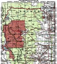
Larimer |
|
|
Spring, Summer, Fall, Winter |
|
|
10020 ft / 3054 m |
Overview
 Across Hwy 14 from the TH
Located in the Roosevelt National Forest just east of Cameron Pass, this TH provides access to the extreme southern portion of the Medicine Bow Range as well as providing access to some northern fringe areas of the Never Summer Range.
This trailhead is heavily used in winter by skiers and snowshoers. Summer usage is lighter as this is not a primary access to either the Medicine Bow or Never Summer Ranges.
The 73,068 acre Rawah Wilderness is located on the north side Hwy 14, the 9,924 acre Neota Wilderness is located south of Hwy 14.
Facilities - Large paved parking lot / restrooms / no water available
Directions

Destinations


The Zimmerman Lake Trail starts south of Hwy 14, behind the parking lot.
Camping options
None in the immediate area. Nearest campgrounds are located in the Colorado State Forest on the west side of Cameron Pass, along Hwy 14 before you reach the TH and near the end of the Long Draw Road.Nearest Services
Services are few and far between in this part of Colorado. Nearest gas east of the TH would be found at Archer's. To the west, Walden is the only option.North Park KOA-Approx 20 miles east of Walden, Colorado. Limited supplies and lodging.
Sportsmans Lodge-Approx 45 miles west of Ted's Place. Limited supplies and lodging.
Trading Post-Approx. 45 miles west of Ted's Place. Limited supplies and lodging.
Archer's Poudre River Resor-Approx. 32 miles west of Ted's Place, 25 miles east of the TH. Limited supplies, lodging and the last gas before the TH.
Maps
National Forest Map - Arapaho and Roosevelt NF MapUSGS Quads
Chambers Lake
Clark Peak