Stats
Distance: 10.4 miles
Elevation Gain: 4800'
Twin Peaks
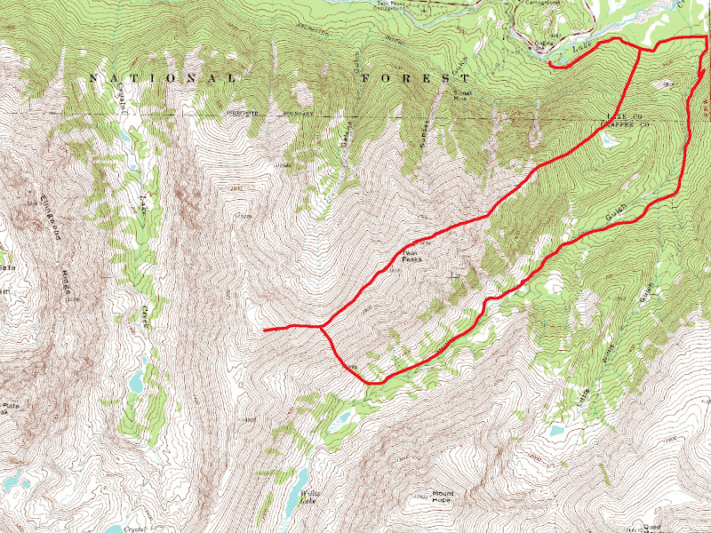
Scott and I left Boulder at 5 am. We arrived at the Willis Gulch Trailhead at 7 am. We began hiking up the Willis Gulch Trail at 7:10 am. We soon left the trail at a small cairn and continued up good game trails and gained Twin Peaks' northeast ridge. We passed many signs of human presence: a deteriorating house, fire rings and litter. We never traveled through the meadow described by Kane in his northeast ridge route
description and must have been just west of it.

Hiking Twin Peaks' Northeast Ridge Route
The terrain became quite steep near treeline. The ridge had a few oppurtunities for some easy scrambling if staying true to it, but were easily avoidable. The views northeast towards Twin Lakes and southeast of Mount Hope were great. I got to the summit of North Twin Peak at 10:29 am and South Twin Peak at 10:48 am. There were no summit registers on either summit.

Mount HopeRinker Peak
We descended Twin Peaks' southwest ridge and climbed Rinker Peak's northeast ridge. The terrain was mostly second class talus. I reached the summit at 11:44 am. The summit had a glass jar and two pieces of paper for a register. There were also two bricks on the summit. The views of La Plata Peak were great. We spent a while on the summit since the weather was so pleasant. We descended the South Slopes route finding steep grass slopes at first, then a good trail switchbacking down to just above the Big Willis Gulch Trail. The trail near timberline was overgrown with willows. I didn't notice the Big Willis Gulch-Little Willis Gulch Trail intersection. This made the descent seem faster since I thought I was higher than I really was. I reached the trailhead at 2:50 pm.

South Twin Peak & Rinker Peak from North Twin Peak
Map


Comments
Post a Comment