Golden Hinde Trip Report; August 21-26 2007
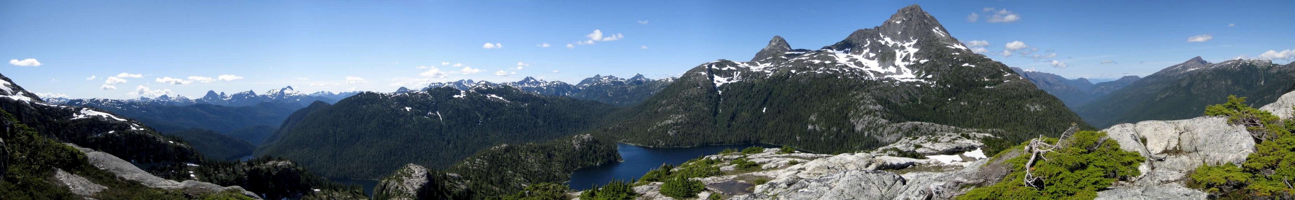
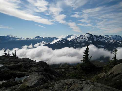
![Enlarge]() ~200° Panorama of the Golden Hinde and its neighbours from our camp high on the north ridge of Mt Burman. Click at left. ~200° Panorama of the Golden Hinde and its neighbours from our camp high on the north ridge of Mt Burman. Click at left. |
|
Introduction
No prizes for guessing why anyone would want to climb the Golden Hinde. It’s the highest peak on Vancouver Island and, beside any other of its many recommendable attributes, it offers the successful climber the unique experience that, at the moment he or she steps on the summit, and for a few fleeting minutes thereafter, they are on a point higher than any other human being on the land mass.
So far, so good. But the Hinde has to earned. By any approach it’s a long and effortful way in. If the devil is in the details, as the old saying goes, there’s plenty of detail to get lost in on the way to the bottom of the mountain.
First, one must decide from which direction to approach. North, south or east. The
parent page gives all the particulars. We decided on the approach from the south and that we would exit the same way.
How long was it going to take? The record for this route car to car is now about 15 hours. This time was established quite recently by a young gentleman of astonishing physical ability and is not for consideration by old farts such as myself, or too many other people of sound mind for that matter. We reckoned with 2 days each to approach and get out, a summit day and extra food for a lay/rain day. That’s about right for the average mortal.
What to take? Easily solved that one. An ACC local section trip had been that way the previous week and had all the beta. Don’t bother with a rope and pro. Axes very useful. Helmets essential. Crampons optional.
Right then, that’s it. I’ll carry this, you carry that and I’ll meet you at your place at 7.30 on Tuesday.
Tuesday, August 21
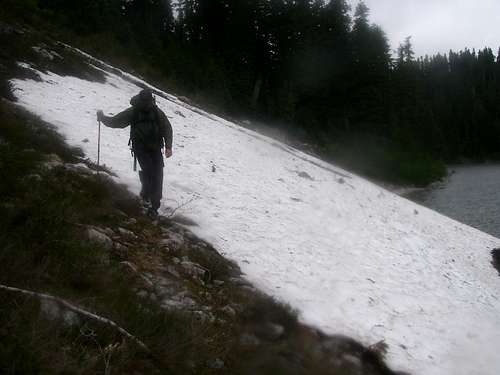
“You” is my usual climbing partner, Graham, meet him I did at the appointed hour and off we went in my truck. Stately progress up-Island with all the usual stops had us at the Westmin trailhead at 12.30 and after lunch and a final pack we were off up the Arnica Lake/Phillips Ridge trail at 1.15pm in passable weather. It had poured down over the last 2 or 3 days but the promised clearing trend looked like coming about. Starting altitude at the trailhead is 350 metres.
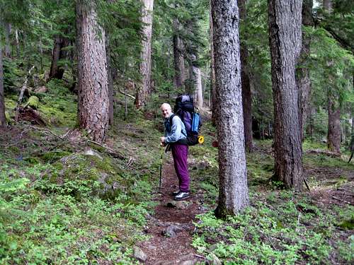
There are not too many engineered trails in Strathcona Park. Ironically, however, all three approaches to the Hinde start off on such. The route up to Arnica Lake is well benched, nicely switch-backed such that the maximum gradient is never more than 10 or 12° and, being all in the trees, really quite boring. It does a lovely job though and even with full packs got us to the camping area at the north end of the lake at 1,180 metres in a tad over 3 hours.
![Arnica Lake Trail]() Arnica Lake Trail
Arnica Lake Trail
| ![Camp 1]() Camp 1 on Phillips Ridge
Camp 1 on Phillips Ridge |
Arnica is not that attractive a place at the best of times and several million mosquitoes conspired very effectively to make it considerably less so. After a few minutes rest we were soon on our way higher in search of breezes.
After Arnica the engineered trail ends. However, lots of traffic goes this way and the path remains very, very clear and easy to follow. This we did, first north out of the bowl that holds the lake and then west, through a few rain showers, up onto the lower reaches of Phillips Ridge. At about 6pm we found a lovely camping spot at 1,420 metres, with good water and a nice view across the Myra Creek valley to
Mt Myra and called that the end of day 1.
Wednesday, August 22
A good sleep and we were up at 6 and away by 7.45. There had been heavy cloud when I got up to make a duty call at about 2am but now the morning was fine and mostly clear.
The route over the first part of the approach ridge heads generally west over the first of many sub-summits that we would climb and descend and descend and climb over the next several days. Views to the south soon opened up and we could see not only Myra, our nearest neighbour across the valley but also Mts Septimus, Big Interior,
Tom Taylor, Thelwood and many, many more.
The route begins to turn north after one passes Peak 1732, the highest sub-summit on Phillips Ridge. The problem was, we didn’t pass 1732 before turning north and ended up right on the summit instead of by-passing it to the south as we should have done. Oh well, we’ll just look on this one as a bonus. We could see the path heading west towards the next bump on the ridge below us but how do we get down from here?
Go back the way we’d come? No way! We opted for a descending traverse west down heathery bluffs to the correct saddle 130 vertical metres below. I hated giving up that altitude and I hated the hairy route down even more. We got to go climbing even before reaching the Hinde and with heavy packs too! At least we got a great first view of our objective from the top of 1732; still looking a fair distance away.
![View S from Camp 1]() View S from Camp 1
View S from Camp 1
| ![View South from Lower Phillips Ridge]() View S from Lower Phillips Ridge
View S from Lower Phillips Ridge
| ![Peak 1732]() Peak 1732
Peak 1732
| ![View S from Phillips Ridge]() View S from Phillips Ridge
View S from Phillips Ridge |
After investing an hour in our unplanned conquest of Peak 1732, we completed the next bump by 11.25 and decided on an early lunch.
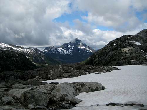
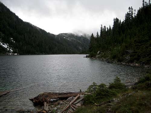
Over the next 3 hours or so we climbed up and down and down and up over what seemed to be an unending series of bumps on the ridge. Finally at about 3pm, we arrived at the last bump before the big drop down to the low point of Phillips Ridge which is found above and to the southeast of Carter Lake. Ahead of us to the north were Carter and Schjelderup Lakes, the Hinde providing a superb backdrop with Mt Burman to the west and the last of Phillips Ridge to the east framing it all. Super view but it was also decision time.
During our preparations for the trip we had, of course, researched all the variations that people take on this approach. From the spot we were in, it was very apparent that the key to the south approach now lay before us.
One is faced with essentially 3 choices when it comes to the passage from Phillips Ridge to Mt Burman on the other side of the watershed. All three are described on
the parent page. Considerable elevation loss and gain has to be reckoned with and, of course, reversed on the way out, so the choice is critical.
The “traditional” route takes one almost to the junction of the Phillips/Greig ridge system to a point know locally as “Mt Judy” almost 500 metres above Schjelderup Lake and down to the lake outflow end from there on a route involving possible rappels.
A second option involves a descent from Phillips Ridge to the head of Schjelderup Lake down interconnecting snow slopes from a point at about 350-400 metres above the lake that avoids the last two bumps on the ridge and the associated 250-300 metres loss and gain.
A third choice drops off Phillips Ridge at its low point (GR 520991) of 1,360 metres down a gully to just below Carter Lake that avoids ALL of the unnecessary elevation loss and gain involved in the last 4 bumps on Phillips Ridge but that gets one into some bushy terrain.
![Phillips Ridge]() Phillips Ridge nearing the turn N
Phillips Ridge nearing the turn N
| ![Descending Phillips Ridge]() Approaching the low point on Phillips Ridge
Approaching the low point on Phillips Ridge
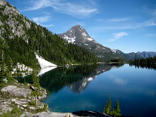
| ![The Golden Hinde from Carter Lake]() The Hinde from Carter Lake
The Hinde from Carter Lake
| ![Camp 2]() Camp 2 at Carter Lake
Camp 2 at Carter Lake |
Graham and I were already pretty sold on the third option before we even got there. There’s something about the statement “avoids ALL of the unnecessary elevation loss and gain” that we found somehow quite compelling. Once we got there, plenty of evidence of travel west from the 1360 metres saddle quickly helped us make our final choice and down the gully we went.
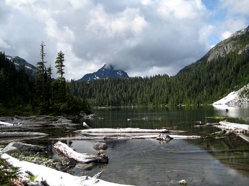
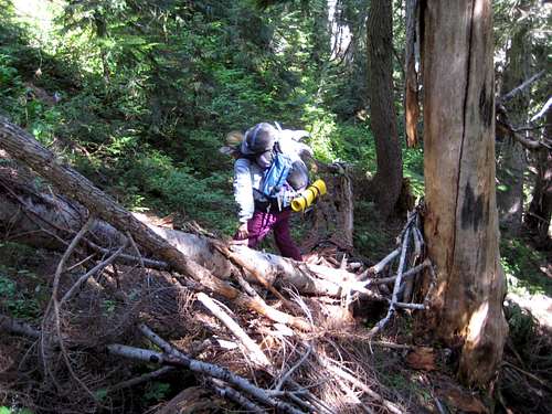
The route went very steeply at first down classic Island near-vertical mud/roots. This eases off after perhaps 100 vertical metres and begins to traverse rightwards (NW) out of the initial gully and onto easier and well-flagged ground. We reached the unnamed river flowing out of Carter Lake in about 45 minutes from the saddle and crossed two branches to the west bank. This put us about 50 vertical metres below Carter Lake but, again, on a well-flagged if occasionally steep route. Certainly it was bushy. Bushy enough, in fact, that at the end of the day I found that my mosquito head net had been quietly stolen off my cap by some covetous tree or other. Luckily, Graham had a spare.
After a rest at the outflow of Carter we traversed the west side of the lake to its head. Travel was approximately 50% right along the shoreline with some boulder hopping and the balance a mix of one snowfield and some small bluffs to get around. We thought it was quite reasonable. However after nearly 11 hours on the go and a lot of elevation gain (and don’t forget loss) I was pretty bagged. Although we would have liked to go further, I just couldn’t and we opted to camp for the night at the head of the lake right by the river. The evening chores were soon over and we were in the land of nod before 9, lulled to sleep by the sound of the water just a few feet from our heads.
Thursday, August 23
The morning of our third day dawned fair and bright. However, we were in a bit of a quandary. We were now on the correct side of the watershed to approach the Hinde (although still very low) but too far away to hope to summit it and return to where we were in one day. On the other hand, we didn’t want to schlep heavy packs all the way to the base of the mountain – although time-wise this would have been easily possible today - and then have schlep them all the way out again . So we opted for a compromise. We would cache all the extra food, fuel and garbage at the head of Carter Lake and take just what we needed over to and around Schjelderup Lake and up to the north ridge of Mt Burman. There would be anti-mozzie breezes up there, fabulous views, a short day to enjoy and summit day tomorrow, which would involve a total of 1500 metres elevation gain, would be with light packs. We would return to Carter tomorrow night with the big packs but, at least, this leg would be mostly downhill.
![Mt Burman East Ridge]() Mt Burman East Ridge
Mt Burman East Ridge
| ![The Golden Hinde from Schjelderup Lake]() The Golden Hinde from Schjelderup Lake
The Golden Hinde from Schjelderup Lake
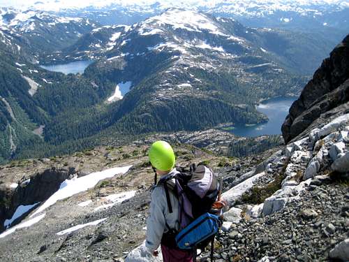
| ![Thrashing around Schjelderup Lake]() Thrashing around Schjelderup Lake
Thrashing around Schjelderup Lake |
This decided, we got up late, had a leisurely breakfast, cached all the unneeded stuff carefully and left Carter Lake only at about 10am.
Excellent trail – not flagging – real trail, took us west up to the (still frozen) little lake in the cirque under Mt Burman’s north and east ridges and then north up to Schjelderup Lake itself. This took less than 20 minutes.
So far, so good. The sting in the tail, however, was the traverse of Schjelderup’s west shore. We’d heard previously about the evils of the east shore so there was no real choice in the matter. After 50 metres of trail, we were into big boulders, snowfields that ran out to deep water below, steep bush up and down bluffs and, at this time of the year, mosquito heaven. Beware the last 100 metres. With the lake outflow almost within grasp the highest bluff to be passed still lies ahead. As Graham correctly observed, someone needs to establish something a constant 40-50 metres above the lake.
The hike around Schjelderup took well over an hour. At this point it became apparent that we might have made a mistake. The prospect of reversing the traverse of Schjelderup AFTER a full summit day was perhaps going to be a bridge too far. We resolved to cross that bridge when we came it.
Just for the record, at the outflow end of Schjelderup Lake we had effectively arrived at the convergence of the three options to cross from Phillips Ridge to the Burman side of the watershed. Had we chosen well? I believe we had.
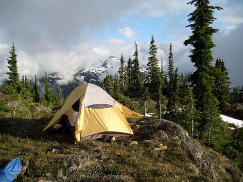
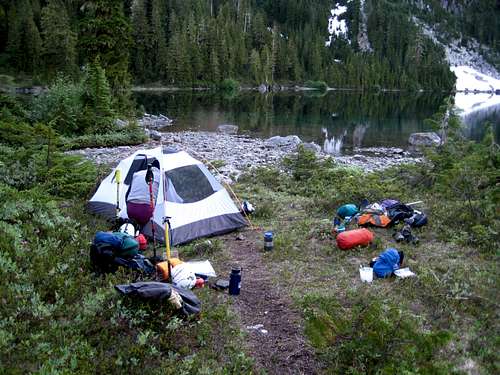
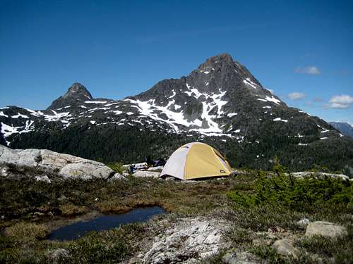
![Camp on Mt Burman]() Camp 3 on Mt Burman
Camp 3 on Mt Burman
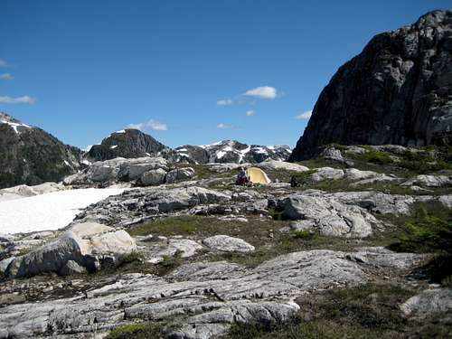
| ![Camp on Mt Burman]() Camp 3 on Mt Burman II
Camp 3 on Mt Burman II
| ![Sunset from Camp on Mt Burman]() Sunset from Camp on Mt Burman
Sunset from Camp on Mt Burman |
After lunch in the lovely meadows at the outflow of the lake, we completed the short day by taking the excellent trail up to Mt Burman’s north ridge to a point at about 1,600 metres elevation immediately below some obvious bluffs. We put in a lovely camp at this spot at about 2pm. The views were as expected, stupendous. Phillips Ridge stretched off to the south, countless lakes shimmered far below and, of course, the Hinde now stared us right in the face and said “come and get me boys”.
We spent a truly wonderful afternoon in such a magnificent spot. The time just flew by. Hours memorable enough to last a lifetime.
![Upper Phillips Ridge and Schjelderup Lake]() Phillips Ridge from Mt Burman
Phillips Ridge from Mt Burman
All too soon, however, the need to prepare ourselves for the rigours of the next day became all too apparent and we were early to bed.
Friday, August 24; summit day
No getting up late on this morning. We were up before the sun and away down at just after 6.30. It’s not too often you get to start summit day with a 450 metres descent. Nevertheless, down the north ridge of Burman we went, gently at first before plummeting down the vertical mud and the tree root “ladder” the last 100 metres into the chasm at the foot of the ridge. Just prior to this, I had a lucky escape.
![The snag that nearly killed me]() The snag that nearly did me in! The snag that nearly did me in! | ![The Burman Chasm]() In the Burman chasm In the Burman chasm | ![Hinde South Bowl]() South bowl & tarn South bowl & tarn | ![Golden Hinde lower south face]() Hinde S face Hinde S face |
There was no way to see this one coming. The merest touch on a snag on the uphill side of the route sent it hurtling down on me. It must have been in the most precarious of equilibriums. I literally threw myself ahead of it down slope and to one side. It brushed my legs as it went by before coming to rest a few metres downhill. Pure instinct on my part and a good job too. Without it this trip was over and maybe a lot worse.
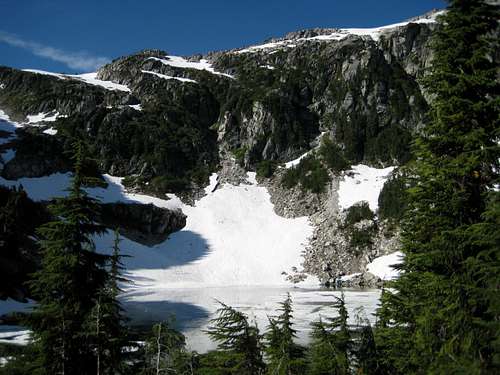
In any event, we took this in our stride, as one must, carried on down the chasm, up the other side, which is much less steep, and out onto the open ridge coming off the south side of the Hinde. Easy walking with a couple of nice breaks got us to the (frozen) tarn in the bowl under the south face of the mountain at 9.20am.
Up the lower south face we went, on scree at first and then soft snow, aiming for the exit gully at the top right hand corner of the lower face before it goes vertical.
![Climbing the South Bowl]() Climbing the lower south face Climbing the lower south face | ![Golden Hinde SE Face]() Traversing under the SE face Traversing under the SE face | ![Climbing the SE Gullies]() Climbing the SE gullies Climbing the SE gullies | ![Approaching the Summit]() Approaching the summit Approaching the summit |
We found the gully with no problem, climbed it and crossed the shoulder onto the southeast face. We then made a rising traverse east across the face, again partly on scree and partly on snow and arrived at the bottom of the SE gullies at 10.40.
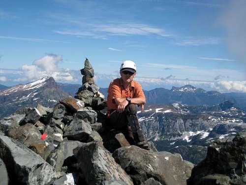
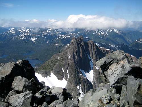
We took the second gully. It was partly snow filled. The bottom snow section looked steep, narrow and rotten. So we stayed well away from that on rock to climber’s right. The upper section, which ran up almost to the snow saddle between the west and main summits looked much more user friendly but ran out to into its steep, narrow and rotten cousin below. So, not having brought rope or pro, we avoided that too and continued on rock to the right. Difficulties were no more than easy 4th Class and soon brought us to a point just below the crest of the snow saddle. Here I advocated a near horizontal traverse to the right behind an obvious sub-summit and from the end of this traverse, we could see the main summit above and back left. A few minutes on the final boulder field and it was done. My altimeter showed 2,205 metres. The true altitude is anywhere from 2195 to 2200, depending on your source, but at least we knew the pressure was remaining constant. High fives and hugs and a well earned rest.
Superlative views! What an understatement! The Golden Hinde lies right in the centre of Strathcona – in fact right in the centre of Vancouver Island – it’s the highest point, so of course the views are superlative and of course they’re 360°. Cloud to the north unfortunately obscured about 60° of arc (which included
Victoria and Warden Peaks) but all the peaks that, over the years, have become as familiar as old friends were well and truly there. Mt Colonel Foster,
Elkhorn,
Alexandra Peak,
Mt Albert Edward, the peaks around
the Comox Glacier, Septimus, Myra, Big Interior,
Tom Taylor, Thelwood and on and on and on - including our whole line of march over the last three days.
![On The Summit]() On the summit of the Hinde
On the summit of the Hinde
| ![The Behinde]() The Behinde from the summit
The Behinde from the summit
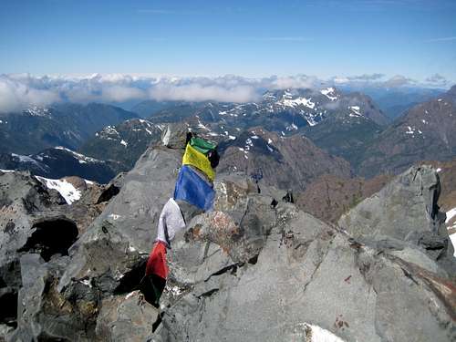
| ![Summit prayer flags]() Summit prayer flags
Summit prayer flags |
Far below us, on the slopes of Mt Burman, our tent reflected the afternoon sun and looked a long long way away!
On the summit we found the original second survey plate from 1937, a host of prayer flags, a new summit register and the inevitable and illegal memorial plaque to some poor soul who had died in the mountains. Unlike the ones on Victoria Peak and Elkhorn, this one is actually bolted in place. Now I applaud the sentiment that put this there. This guy loved the mountains and now he’s amongst them forever. But do we have to tell the world about it? What if we all did it? Especially as the second and subsequent plaques would just have to be bigger than the first. And what gives one family the right to “bag” the Hinde over another? Parks’ policy in banning such items is hard but fair. Knowing our government, I can see the day when they’ll sell summit space for this purpose but, in the meantime, let’s just leave our summits as pristine as they were meant to be shall we? And that includes no prayer flags I’m afraid.
Off in the distance to the east we could see the ski runs on Mt Washington. There’s a cellular repeater tower up there and sure enough and for the only time on the trip, we had a signal. Calls to the wives let them know of our success and assured them we were fine but also brought the news that the weather was changing for the worse.
We were running behind schedule if we were to get back to the food cache at Carter Lake that night but how often do you get to visit such a place? So we lingered over lunch and lingered some more and then, just for a change, lingered over taking photos. So, all in all, we didn’t start down until almost 2pm.
![Below the SE Gullies]() Descending below the SE Gullies
Descending below the SE Gullies
| ![Traversing the S Face]() Traversing the S Face
Traversing the S Face
| ![Climbing out of the Burman chasm]() Climbing out of the Burman chasm
Climbing out of the Burman chasm |
The descent was problem free. The gullies have lots of loose rock but it can be managed if one is careful. We were out and onto the SE face at 2.55 and at the bottom of the south face by 3.50. Down into the chasm right at the mosquito witching-hour of 4.30 and then a slow plod back up the ridge to the tent just before 6. It was quite obvious at this point, as it had been for a while really, that we were going no further that night. Better a safe and hungry night than the alternative of traversing Schjelderup Lake in the dark.
So we pooled what we had. One cup-a-soup, one bar of chocolate, one quarter bagel saved from lunch, a bit of salami, 3 dried bananas and some energy bars. The recipe: make up cup-a-soup with 2 cups of water, divide into 2. Add one eighth of a bagel, some chopped salami, stir well and enjoy. Pretend that it’s a) good (actually it was) and b) enough. Let your partner eat his chocolate first, and then offer to exchange your half for a half share in his house. Only narrowly fail to sell him on the concept. The bananas and bars we saved for breakfast. Just to compound the discomfort, the weather changed rapidly for the worse. From shirt sleeves on the summit at 1pm we were reduced to wearing every stitch we had by 7. We finished “dinner” just as the first rain squalls blew through and were in the tent well before 8. We were hungry but we were safe and who needs food when you can feast on success?
![Enlarge]() The view from the summit of the Golden Hinde. Roughly from the northeast to the west. Cloud obstructed the view to the north. The view from the summit of the Golden Hinde. Roughly from the northeast to the west. Cloud obstructed the view to the north. |
Saturday, August 25
We awoke at 5.45 on our 4th morning to heavy cloud and the makings of a wet west coast day. No point in lingering over breakfast since there wasn’t any to speak of. But we did take the time to make lots of hot drinks before packing up and heading down into the gathering storm. My altimeter has gained almost 100 metres during the night, so we knew we were in for a good soaking.
On the way down Graham decided that we were going to make a start on a higher route around Schjelderup and headed into the bush about 100 metres from the lake outflow and 50 metres above it. Naturally he chose the day it poured down to do this. After half an hour of thrashing about in or clinging for dear life to sopping wet slide alder, huckleberry and pack grabbing undergrowth – in other words, a typical Vancouver Island backcountry moment - we were forced, suitably chastened, down to the lake but at least south of the big bluff that had so irked us on the way in.
The rest of the traverse around the lake was as painful as it was 2 days before but at last it was over and we were headed over to Carter and food.
The rain stopped briefly while breakfast/lunch/dinner was cooking and I got the tent out to dry off a bit but it soon returned and we ate in a downpour.
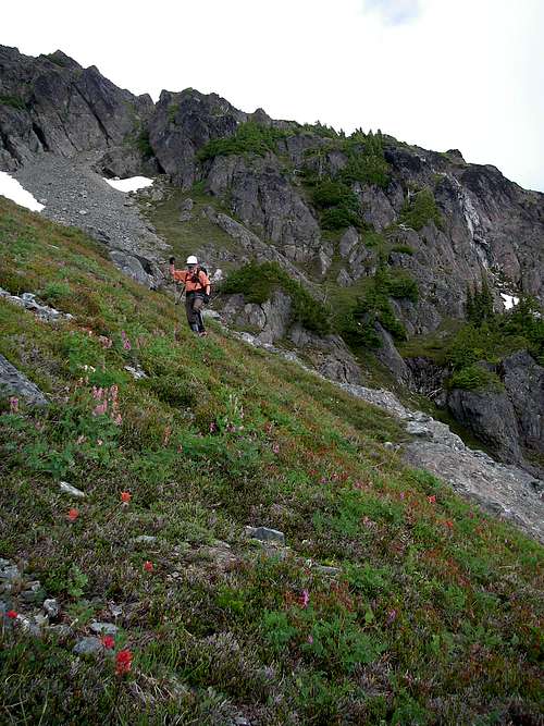
Off again at 12.30 and this time no diversions were permitted as we slid down to the river crossing, across and began the slow plod back up to Phillips Ridge. The lack of food now began to tell as I found the final steep bit up the gully particularly trying. We arrived in the saddle at 2.30pm precisely.
All that was now left to do was see how far we could travel south along Phillips Ridge before we became too tired to go any further. The answer for me came at about 6pm when I simply had nothing left to give. The last bump had been a particular chore as we attempted to avoid going right over the top and ended up on a hairy, exposed traverse on loose, sharp limestone. We’d certainly reversed at least 3 sub-summits on the ridge but since we were in heavy cloud and couldn’t be bothered getting the GPS out, we weren’t sure how many more there were to go. I really didn’t care. I wanted my dinner and my sleeping bag very soon thereafter. We found a spot with good water but not too flat. It would have to do. We were in the tent and finally getting warm by 8pm as ever thicker clag rolled in.
Sunday, August 26
A restless night as we slid repeatedly down to the bottom of the tent on our sloping site. It rained most of the night but we got up at 6 to a few signs of clearing and the cheering observation that there was ice on everything we’d left outside the tent or in the vestibule. If it’s that cold the pressure’s sure to be rising.
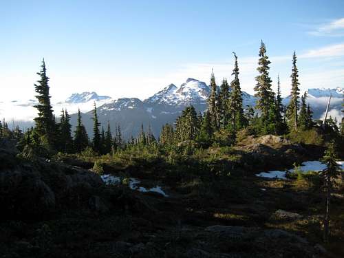
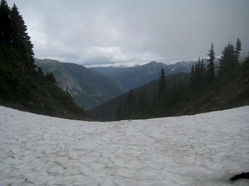
![Phillips Ridge]() Descending Phillips Ridge
Descending Phillips Ridge
The best news of all, however, once the cloud thinned sufficiently, was that just a few hundred metres travel away was the bump where we’d eaten lunch 4 days before and where Phillips Ridge begins to turn east. And, yes, just across the way was our old friend 1732. We’d come a lot further along the ridge than I thought yesterday afternoon. Today was going to be a doddle.
And so it proved. Food had finally found its way into all the right gaps and I felt strong again. We were away by 8.15 and reached the base of 1732 an hour later. This time we found the correct path that contours the high point to the south. The crampons came out for the only time on the trip as we were faced with some early morning northwest facing snow. At about this point we began to run into people for the first time in 5 days. Naturally, everyone wanted beta and we were delighted to give it. We could probably have walked out from 1732 in 4 or 5 hours. Instead we spent nearly 7 hours on the process; chat a bit, walk a bit and repeat. You get the picture. With the weather improving by the minute I think that keeping the trip alive as long as possible was also uppermost in our minds.
However, all good things must end and we finally committed to the switchbacks down from Arnica Lake and arrived at the car at 4.10pm. My altimeter read 380 metres, almost exactly what it had 5 days before. Perhaps we had imagined all that bad weather?
Two hours later and it was end-of-trip-celebratory-meal-time. My choice this trip and it was DQ burgers and ice cream. Without any doubt the finest meal I’ve ever had in my entire life – until the next time we hit the hills of course.
Epilogue
After we got back from the trip and the dust had settled a bit, I sat down with a map and, by counting contours, estimated how much we'd actually climbed to accomplish a net elevation gain of 1,845 metres - the difference between our starting altitude at Westmin and the summit of the Hinde. I made it about 3,400 metres. In other words, you really do almost climb the mountain twice by this route. Taking the option to the head of Phillips Ridge to "Mt Judy" and dropping to the outflow of Schjelderup Lake from there results in a gross gain of over 4,000 metres. Take all this into account when you're making your plans to approach and climb the Hinde
Page Visitors


Comments
Post a Comment