Wildcat Ridge from Mt Olympus to Gobbler's Knob
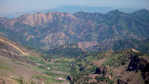
![Wildcat Ridge viewed from Mt Dromedary]() Wildcat Ridge viewed from Mt Dromedary (July 19, 2008)Mt Olympus is extreme left, Gobbler's Knob is extreme right.
Wildcat Ridge viewed from Mt Dromedary (July 19, 2008)Mt Olympus is extreme left, Gobbler's Knob is extreme right.
When I first climbed Mt Olympus over 15 years ago, I became aware of the vast green and orange wilderness stretching east from the peak. On that first climb, I ventured a small distance past the peak, to the point where I could overlook a steep, narrow chute running down into a maze of vegetation and rock to the North. The other side was even more impressively wild and treacherous: an enormous southwest-facing amphitheater (I would learn later it is called Heugh's Canyon) lined with dozens of colossal vertical rock fins, steep ramps of talus, and a jumble of boulders and trees clinging to all sides. At the head of Heugh's Canyon is a narrow strip of ridge that slims down to a knife edge, a near vertical slab sandwich that at one point in geological time was as horizontal & flat as a parking lot.
The place felt dangerous. I wanted to go further, but knew I shouldn't. Years later when I found a copy of John Veranth's
Hiking the Wasatch in my father's collection, I poured over the pages and discovered that the Mt Olympus wilderness East can be accessed via a seldom-visited route called Wildcat Ridge. Then I discovered a wealth of more detailed information (including color photos) for the Wasatch and Wildcat Ridge in Summitpost (Thanks Joseph Bullough). By mouth or in print, the ridge is invariably described in language warning the curious to either stay away or go and be prepared to hang from rocky ledges without belay, confront grumpy rattlesnakes and endure a long, hot day of butt-kicking punishment. I was hooked. I needed to get there to see it for myself.
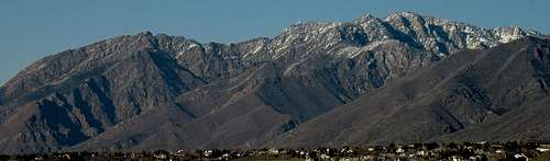
![Wildcat Ridge from Draper]() Wildcat Ridge viewed from Draper. Mt Olympus is the Mountain on the left. Photo by RockyAlps
Wildcat Ridge viewed from Draper. Mt Olympus is the Mountain on the left. Photo by RockyAlps
Two years ago a friend and I started out early on a Saturday morning intending to climb Mt Olympus, then proceed east several miles on Wildcat Ridge to Mt Raymond. We merged into the morning rush hour Olympus trail traffic and stayed in the slow lane while kids, soccer moms, dudes with dogs and old folks passed us. We made it to the summit, but one look over at the craggy ridge connecting Olympus to Triangle Peak made us both want to curl up into a fetal position. The next year, nearly to the day, I was on my way up again, my pack stocked and ready for a long day with a Wasatch Mountain Club group. We completed the entire ridge traverse to Mt Raymond in about 13 hours. I had enjoyed the route, and felt satisfied that I had reached a personal goal of endurance.
I had planned to do Wildcat Ridge again this year, so I eagerly accepted an invitation form Joe Bullough to take the route. Our initial plan was to go sometime in mid May, in spite of the heavy snowfall this past season. We each had been taking individual trips up to Olympus summit on a weekly basis, and each time we separately concluded "too much snow on the ridge, better wait a few weeks." Finally the Wasatch winter released the mountain from its grip and we settled on a Friday, which happened to be the first day of Summer. I picked up Joe at his home and we drove 5 minutes to the Olympus trailhead. Dawn was breaking and we were marching up the steep trail by 5AM.
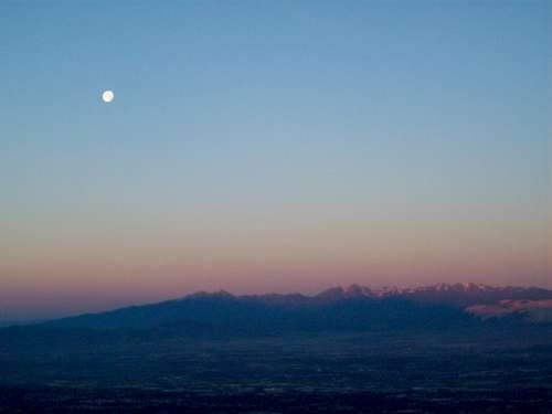
![Waning Moon at dawn]() The moon falls toward the horizon, 5:30 AM
The moon falls toward the horizon, 5:30 AM
The waning moon was still high morning sky. The day seemed to dawn quickly, as if it was dark one minute and a bright summer day the next. The hike up to the top of Olympus' South summit was expected to be approximately 2 hours, so we each settled into a comfortably brisk pace. We are both familiar with the trail, which can be boring and tedious, especially the endless stone steps section through the upper forest. I put my body on auto pilot.
![Mount Olympus South Summit]() What has 9,026 feet and flies? Mount Olympus South summit
What has 9,026 feet and flies? Mount Olympus South summit![West terminus of Wildcat Ridge]() Wildcat Ridge begins right here
Wildcat Ridge begins right here![Elusive Triangle Peak]() Triangle Peak ahead
Triangle Peak ahead
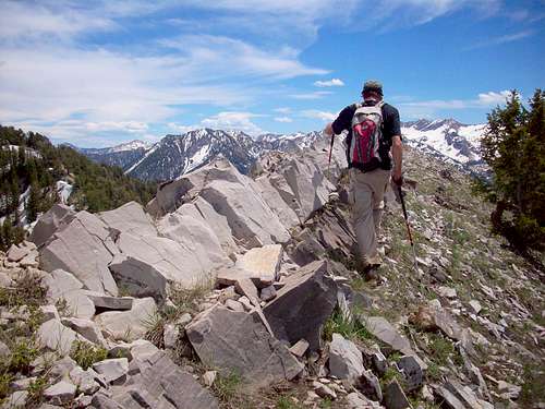
Joe and I arrived at the summit in just under two hours. We were greeted by an endless swarm of busy, hungry, biting flying insects. "Damned flies!" I had planned to have a leisurely, hobbity second breakfast on Olympus summit, but Joe said "Let's go!" and I was right behind him. (Incidentally, this was Joe's 101st summit of Olympus.) We worked our way carefully down from the summit pile and were ready to begin scrambling the ridge proper. Immediately the work involves use of hands as well as legs (and sometimes backs!) and rarely lets up until the end of the knife edge under Triangle Peak. This is fun stuff, like putting a puzzle together. It requires thinking as well as good balance. What I learned from my first journey along the ridge was to stay on top of the ridge as much as possible. One could drop down into the Heugh's side and traverse low, but miss out on all the fun.
Joe and I made steady progress along the convoluted route, squeezing past twisted trees and letting ourselves down over ledges and climbing asymetrical stone ladders. Every time I reached for a hand hold I checked to see if I would be grabbing a snake instead. Nope. But the thought remained with me most of the day that I was looking down the barrel of a loaded snake-gun whenever I became eye-level to one of the countless dark cracks in the rock. I heard a story of a climber on this very part of the ridge who had the misfortune of being struck by a long, fat rattler when he reached into a crack.
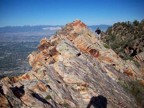
The latter half of the knife edge connecting Olympus and Triangle Peak narrows considerably, with significant exposure, reminding me of the Superior's South Ridge (above Snowbird, Utah).
I call this section the Sidewalk in the Sky. I love it. No more trees to contend with, just bright, solid rock.
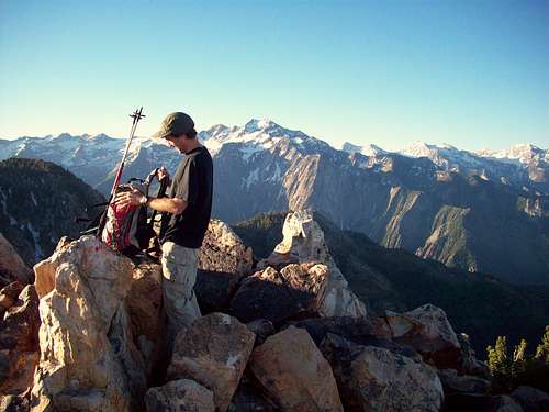
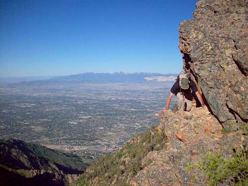
![Exposed Ledge]() A foot to Joe's right is a 200 ft drop
A foot to Joe's right is a 200 ft drop![Triangle Peak summit]() second breakfast on Triangle Peak
second breakfast on Triangle Peak
At about an hour and a half after leaving Olympus's South summit, Joe and I were finally at the base of the Triangle. Another 20 minutes would put us on top of one of the least visited peaks in the central Wasatch. The damned flies were with us the entire way, and they seemed to have called their relatives and friends to the feast. It was only after I put on my sunblock I discovered it would keep the flies from landing on me. Oh well. On Triangle Peak Joe and I had our second breakfast and made calls home. It was practically 4 hours since we started the hike and we were still in the neighborhood of Olympus.
The route ahead is as wild as its name. Not many people come through here. No noise, no crowds, no litter. The area is pristine, yet we are in view of the city virtually the entire way. I turn my back on the city and temporarily forget it. I would rather look at the wild.
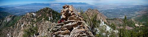
![Peak 9,587]() top of peak 9,587
top of peak 9,587
We summited the next peak East from Triangle, one I missed the year before. This peak, like the next 3 on the route, has no name, just a number indicating its elevation (9,587 ft). The hours went by as we continued climbing, sometimes in silence, sometimes in good conversation. We passed over occasional patches of snow.
At one point we found ourselves squeezing through a stone rut up the tortured face of a peak that presides over Whipple Fork to the South.
"If my wife could see me now...," I muttered. We were never in much danger, it just felt like we were a couple of ants getting folded into a pile of laundry. The work does not go unrewarded. To the South we had the constant view of the gorgeous snow-topped Cottonwood Ridge and the three lower South forks of Big cottonwood Canyon.
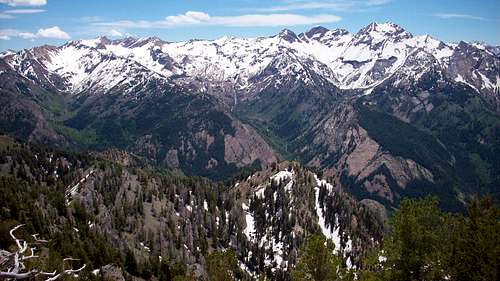
![A view of Cottonwood Ridge from Wildcat]() Cottonwood Ridge
Cottonwood RidgeI querried Joe about his favorite climb in the Wasatch and he indicated that the peaks above Broad's Fork--the Twins, Sunrise and Dromedary are his favorites. A few weeks later he went up there twice in one week.
![Down from Peak 9,587]() Mt Raymond still far away
Mt Raymond still far away
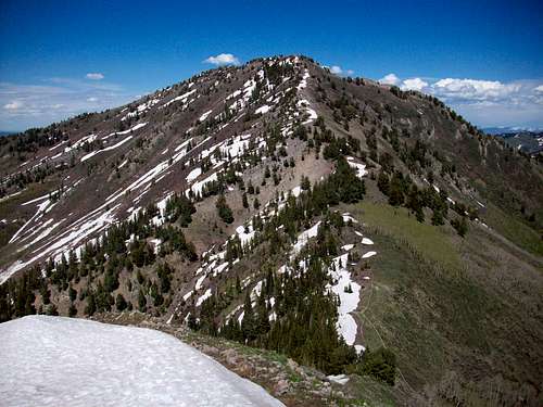
As the day wore on we encountered more forested terrain, and more patches of snow. The green Southwest face of Mt Raymond came into view to the East, still a distant goal. Raymond is the usual final peak of the route, probably because it ends the day on a high note, but I also suspect most hikers are too butt-kicked to go further.
At last we passed over the last section of scrambling and the terrain turned smooth. We climbed one last minor peak, its flanks still covered in snow, and then skated down a long slope to Neff's Pass.
There is a peak looming over and ahead of us but we elected to skip it to save energy to go all the way past Raymond to Gobbler's Knob. From Neff's Pass a trail appears, then disappears, then appears again. This is for me the least enjoyable section of the day. We guessed our way East and trudged on through more forest over a litter of a million gray shards of rock.
![Mount Raymond, West Ridge]() Mt Raymond West Ridge
Mt Raymond West Ridge
Eventually and thankfully we emerged from the trees and stood under Raymond's West Ridge. Then, it was up another 900 feet to Raymond summit. Joe took off. Lucky sucker had his wife up there waiting for him!
![Descending Mt Raymond]() Descent from Raymond
Descent from Raymond
When I finally summited the only words I could initially speak were "Hello (gasp!)." It was nice to be there. But we were not finished. Joe and I still had one more mountain in us. His wife shared some much needed water and we were off again, three of us now, heading down the ridge toward Baker Pass.
![Baker Pass & Gobbler s Knob]() Gobbler's Knob
Gobbler's Knob
Once at the pass, all three of us continued up the well defined trail toward the summit of Gobbler's. There were several false summits along the way, making this last mountain a mind challenge as well as a bodily test of endurance. I went in low gear but making steady progress. Joe was gone, like a phantom who was in view one minute but then who vanished over the horizon the next. He seemed to get stronger as we reached our 13th hour of continuous hiking.
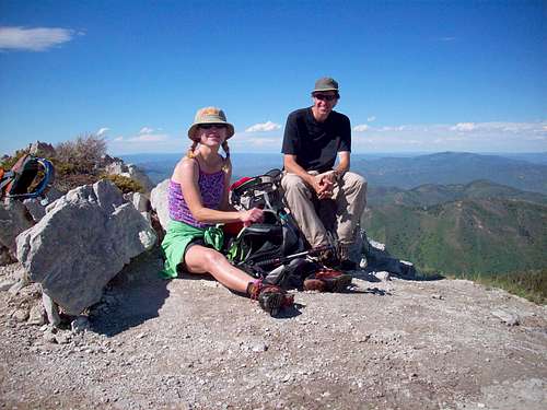
![Gristle and the CragHag]() CragHag & Gristle on Gobbler's Knob
CragHag & Gristle on Gobbler's Knob
At last all three of us sat on top of Gobbler's Knob. For the hike back down and out Butler Fork, I put on the iPod and chugged down the mountain to the beat of a 1973 Led Zeppelin bootleg. At this point I was dreaming about drinking a big ol' Coke, eating pizza, another Coke, and probably some more pizza. When I got to the bottom of the trail, Joe and Shelly were in their truck with a nice cold one waiting for me. We drove down the canyon and finished our 14 hour day with one of the finest pizzas I had ever tasted.
![Snow on Gobbler s Knob, June 2008]() Going home
Going home


Comments
Post a Comment