
|
|
Mountain/Rock |
|---|---|
|
|
34.30179°N / 117.90343°W |
|
|
6151 ft / 1875 m |
|
|
Overview - Crown Jewel of the San Gabriels?
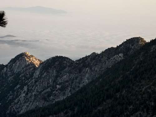
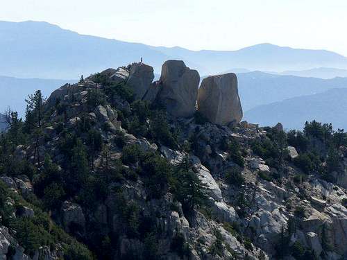
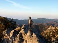
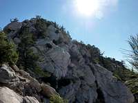
Triplet Rocks 6151' is considered the least accessible peak in the San Gabriel mountains, and lies in the San Gabriel Wilderness via a steep, rugged, and exposed ridge via Twin Peaks from the northwest.
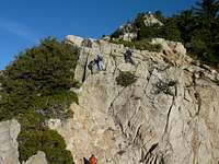
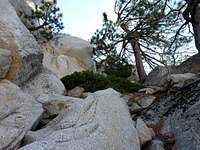
There is no maintained route to Triplet Rocks. Although there has been some mentioned of a group reaching the rocks via Bear Creek, the better known route requires hiking to the eastern bump of Twin Peaks followed by a rough ridge descent to the SE. This route requires bushwacking, navigating steep and loose slopes, and significant amounts of class 3 climbing. Class 4 / 5 climbs are available on route but avoided when trying to reach Triplets in a reasonable amount of time. This route requires 16 miles, 7500 ft elevation gain that necessitates a start in the dark and / or end in the dark to complete. There is no water on route, so be sure to carry lots and stash along the way.
 |
 |
Getting There
For the main route, one should start near the Mt Waterman trailhead near Buckhorn campground along the Angeles Crest Highway (ACH). From the west take the ACH past Mt Waterman ski area to mile marker 58 with a turnout on the left side. The trailhead starts across the road. (NOTE: Currently the lower portion of the ACH is closed. A detour is available via Big Tujunga Cyn Rd / Left on Angeles Forest Hwy / Right on Upper Tujunga Rd / Left on ACH.)
From the east, take I-15 to CA-138 to CA-2. Continue past Islip Saddle (junction with CA-39) for 6 miles.
View Larger Map
When To Climb
The steepness of the ridge as well as the north face of Twin Peaks means that snow should be avoided unless you are an experienced mountaineer on steep, brushy, & technical terrain. Snow typically falls and last from ~ Novemember to May. Summer months may be too hot. Autumn is preferred - basically a day that has cool temperatures and a good amount of daylight.
A hike to Triplet Rocks requires a long day carrying all your water. You can stash along the way, but there are no water sources along the way.
Red Tape
Taken from the Twin Peaks page: Permits are required for overnight stay, and are available at the Chilao Visitors Center in Chilao Flats on CA-2, or at the Grassy Hollow Visitors Center ~2 miles west of the Big Pines Highway.
No permits are required for day hikes.
FOREST CLOSURE: Until late 2011, Triplet Rocks and Twin Peaks are closed due to the Station Fire of 2009. The specific re-opening date is TBA, so stay tuned.
Camping
There are nice camping grounds up on Twin Peaks at either summit or in between.
I cannot think of a flat area along the ridge to Triplet Rocks suitable for camping. Of course, there is always the summit!
 |
 |
 |
 |
 |
External Links
Links to trip reports:
Erik Siering
ANF Buckhorn to Mt Waterman Description