
|
|
Mountain/Rock |
|---|---|
|
|
44.38396°N / 116.12842°W |
|
|
Valley |
|
|
Hiking |
|
|
Spring, Summer, Fall, Winter |
|
|
8082 ft / 2463 m |
|
|
Overview
Tripod Peak is a beautiful mountain located 10 miles southwest of Cascade, Idaho in the West Mountains. It is the southernmost major peak of the range and because it's summit offers such great views there is a manned fire lookout on it. The walk to the summit is one of the most pleasant hikes I've been on, covering about 3 miles of the crest of the West Mountains. There are great views on both sides, the trail is good, and the meadows and forests and beautiful. This peak is the third highest named summit in the range but there are actually a number of higher peaks along the ridge leading to it. Depending on the angle it is viewed from it can be quite impressive or barely noticeable. The best view (in my opinion)is from Smith's Ferry, Idaho along highway 55.
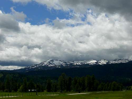
 Tripod Peak from Smith's Ferry
The views from the summit are quite expansive and include the Boise Mountains, the Sawtooth Range, the Salmon River Mountains, the Wallowas of Oregon, and the Seven Devils. It's lower slopes are heavily forested on every side while the upper reaches on the mountain are covered with rocky meadows and stunted trees. Here and there, there are solid outcroppings of Idaho Batholith granite, making for some very pleasant and beautiful scenery. There is also one decently sized alpine lake just below the ridge to the East called Blue Lake. It is clearly visible from the ridge. The area around Tripod Peak receives some of the highest annual snowfall totals in the state, so snow can linger on well into July. The weather in the summer and fall can be very nice, but just like any mountain, take precautions to avoid thunderstorms. They can and do occur.
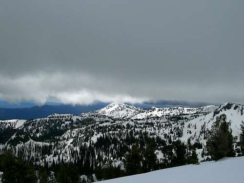 Tripod Peak in June.
Getting There
From Boise take highway 55 north towards McCall. This highway winds along the Main, and the North Fork of the Payette River and is a very scenic drive. Sections of the North Fork are known for being world class whitewater that only experts should run. The foaming rapids are easily visible from the road as you drive along. Tripod Peak first comes into view at Smith's Ferry as the large rocky peak to the Northwest. It will soon disappear behind intervening ridges and will only reappear when you reach the Round Valley South of Cascade.
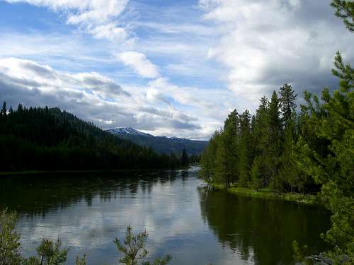
 Tripod Peak from the valley
Once out into the valley continue to follow the highway until you come to the small Clear Creek store/restaraunt. Here, take a left, off of the highway and onto Cabarton Road. This road is paved and in good condition. You will soon cross the North Fork Payette again and shortly thereafter the pavement will end near a barn. Here take another left onto the Snowbank Road.
 The Snowbank Road in June.
This road leads to the summit of Snowbank Mountain, the range's highest at 8,322 ft. and provides quick access to the high country. Follow the road until you reach the ridge top and park off the side of the road. There is a good trail along the top of the ridge all the way South to Tripod.
 Tripod Peak from the Trail.
It is about 3 miles from the road to the peak but it is not hard and the scenery is outstanding. When the trail reaches the base of of the peak it leaves the ridge and gradually moves off to the West side, eventually making in necessary to leave the trail and follow the ridge to the top. Even without a trail it is not difficult. On the top there is a manned lookout and when I was there the ranger was very. They had me sign their guestbook and told all about the equipment in the lookout and how it worked. This is not the only way to approach Tripod but is is a very fun and scenic route. It is also not difficult, and fairly close to Boise making it an attractive hike for a quick getaway.
 View North from Tripod.
Red Tape
The Snowbank Mountain Road is an excellent road, passable by even passenger cars, but it is only open to the public from May 31, to November 1 each year. The rest of the year it is still maintained but is closed to everyone but people needing to access the FAA communications equipment on the summit of Snowbank Mountain.
This area of the West Mountains is administered by the Boise National Forest.

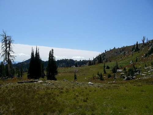 Meadows
Camping
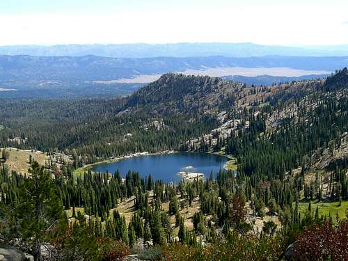 Blue Lake
External Links
Here is a link to the Emmett Ranger District of the Boise National Forest. The Idaho Outdoors Forum where you can talk to people about Idaho's Mountains. Idaho: a Climbing Guide. the link to the webpage for Tom Lopez's guidebook.
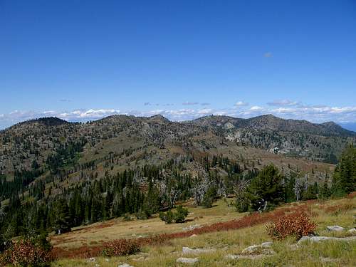
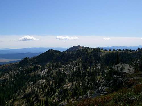 The Southern West Mountains.