
|
|
Mountain/Rock |
|---|---|
|
|
33.68051°N / 112.04463°W |
|
|
Maricopa |
|
|
Hiking, Scrambling |
|
|
Spring, Fall, Winter |
|
|
2075 ft / 632 m |
|
|
Overview
Union Mine Peak is a small mountain in North Phoenix. At 2,075’, it does not dominate any skyline. However, it is very accessible due to the fact that it is right north of the 101 Freeway.
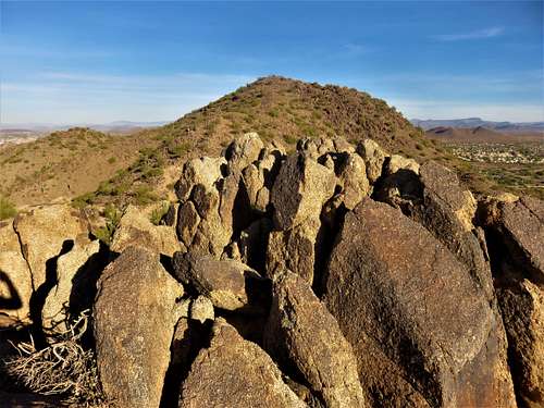 View of Union Mine Peak from the south summit
The Union Mine is located on the north side of the mountain, and there isn’t much activity or scarring.
Trails lead up to the summit from all sides. The trails vary in width, but some of them aren’t well maintained. Union Mine Peak is best hiked between November and March. It is rocky and during warmer weather, snakes and other critters may be present.
There are two summits on the mountain. The lower south summit is Point 1871. It has nice views towards the higher summit and looking south. It is also easy to get to, and is reached first from the southern approach.
Getting There
Union Mine Peak is reached from off the 101 Highway. The first three approaches are best reached from Cave Creek Road.
For the eastern approach, take Cave Creek Road for a third of a mile north to Rose Garden Lane. Turn left and drive to the end. There are a few parking spots at a circle. There is open desert for the first quarter mile of the hike. It doesn’t really matter if you stay on the trail. Just walk towards the obvious trail on the mountainside. It heads up towards the saddle between Point 1871 and Union Mine Peak. If doing Point 1871 first, it adds about a quarter mile, making it a total of about a mile to reach Union Mine Peak, gaining a total of 620'. If just doing Union Mine Peak, it is a little less than ¾ of a mile; gaining about 520’. You can also approach from the east by driving to the end of Lone Cactus Drive (0.6 miles up Cave Creek Road), with similar hiking distances. There is also a loop that can be done by descending at the saddle and winding around to the northern end of the mountain and back up and over. That is about 2 1/2 miles with an elevation gain over 750'.
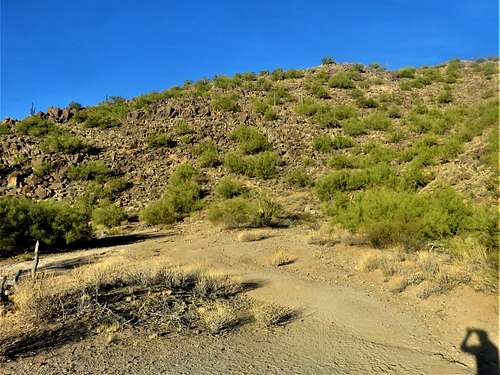 View of the east side trail up the mountainside
For the northern approach, take Cave Creek Road north to Deer Valley Drive, take a left and continue for a mile until 16th Street. Take a quick left and park. There is a trail on the right. The trail heads up to the summit in a little under ¾ of a mile, gaining about 550’.
For the southern approach, don’t get on Cave Creek Road. Stay straight from the exit ramp and get on Beardsley Road. Stay on it for ¾ of a mile, and there is a dirt road on the south end of the mountain next to N. 17th Place. The road turns into a trail at the base of Point 1871. It reaches the summit of Point 1871 in about a half a mile. Continue to Union Mine Peak, which is reached in about 0.9 miles from the start of the road, gaining 620’.
For the western approach, take the 101 to the 16th Street exit. Head north. Before 16th Street ends, take a quick right, and then a quick left, which puts you on 16th Place. Take a right on E. Beaubien Drive and park on the street somewhere near the end. From there, head up the dirt road to the saddle. You can reach the summit in about 2/3rds of a mile, gaining about 520’.
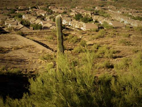 View down the west side
Red Tape
There is parking from any of the approaches. Just make sure you park legally, since parking is next to houses.