


-
 1873 Hits
-
 78.27% Score
-
 9 Votes
|
|
Area/Range |
|---|---|
|
|
45.77250°N / 7.23504°E |
|
|
Hiking |
|
|
Spring, Summer, Fall, Winter |
|
|
8996 ft / 2742 m |
|
|
Note
La montagna chiama i suoi figli, ed essi rispondono fedelmente al suo appello… Osvaldo Cardellina, Diario alpinistico, 1964-65 Page texts: @ OsvaldoCardellina "Osva", passed away on May 2, 2022. Page owners: Christian Cardellina e Osvaldo Cardellina. Any updates from September 12, 2022: Antonio Giani, page administrator, friend and climbing companion. Testi della pagina: @ OsvaldoCardellina "Osva", scomparso il 2 maggio 2022. Proprietari pagina: Christian Cardellina e Osvaldo Cardellina. Eventuali aggiornamenti dal 12 settembre 2022: Antonio Giani, amministratore della pagina, amico e compagno di salite. |
Buthier Overview Torrential
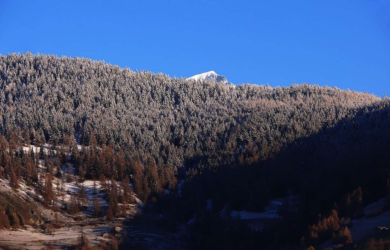
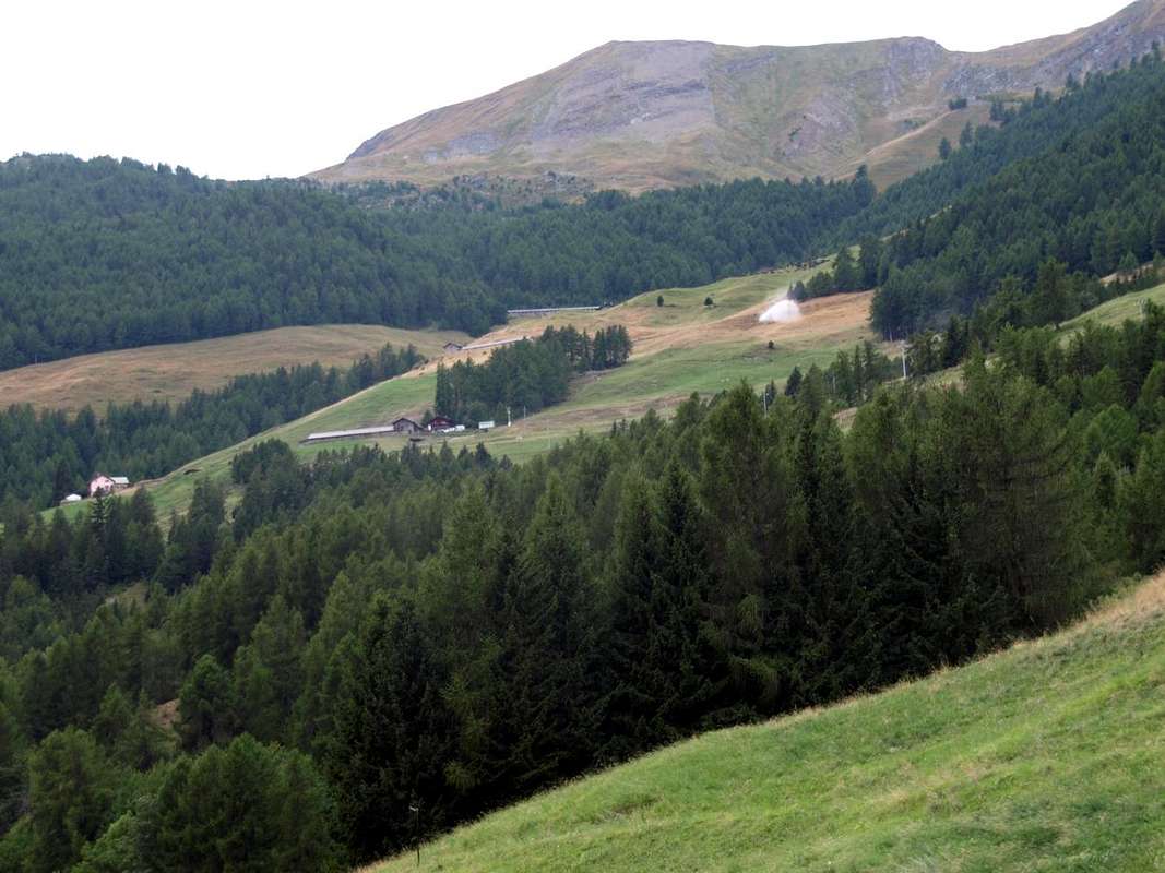
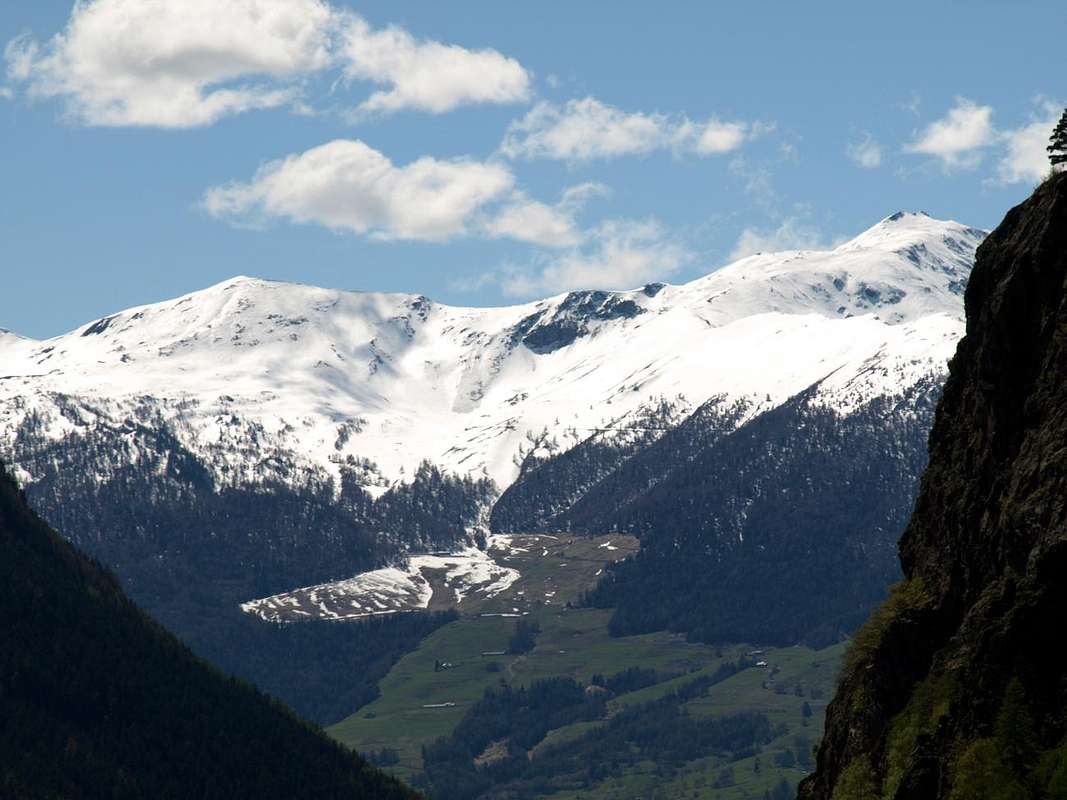
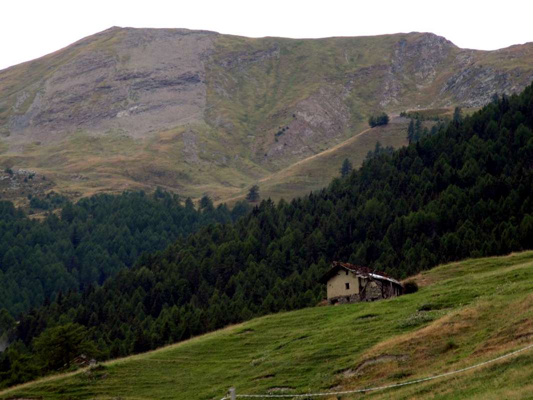
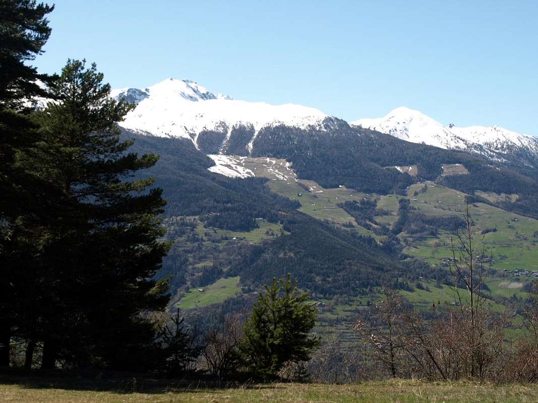
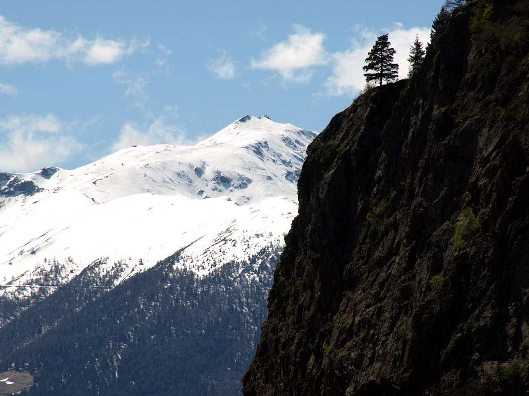
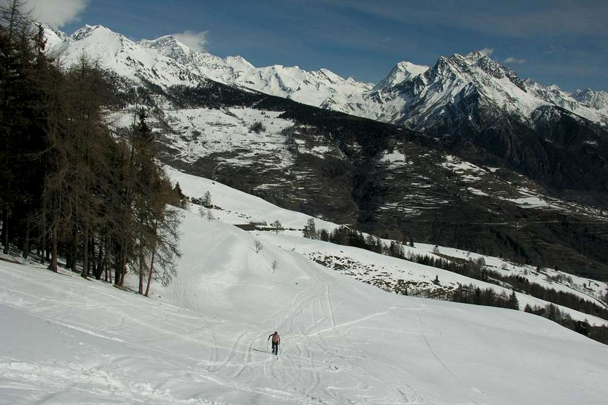
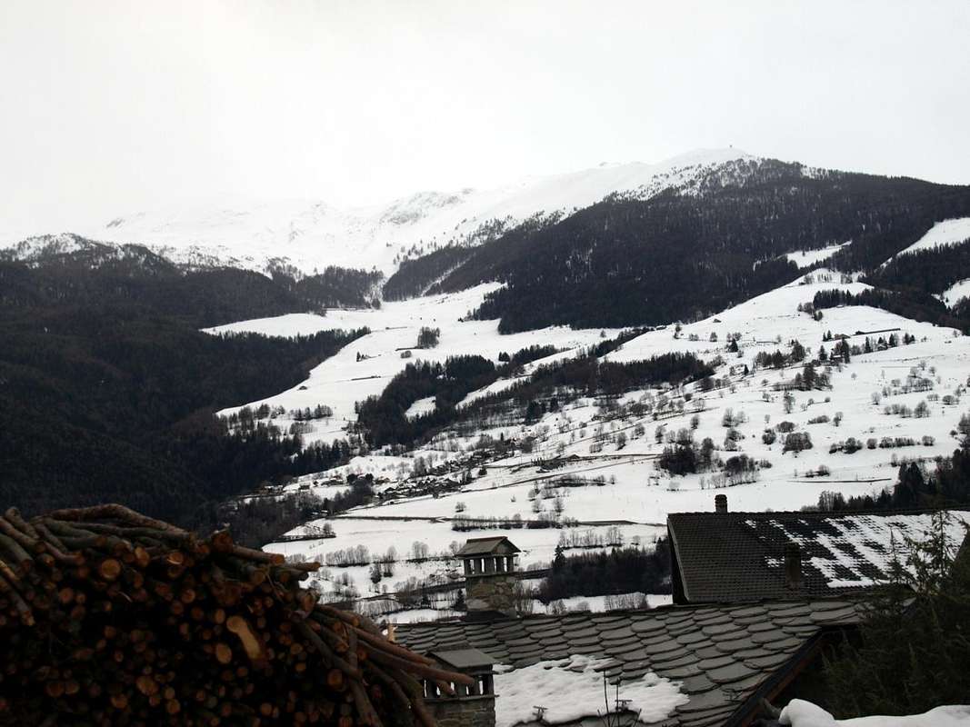
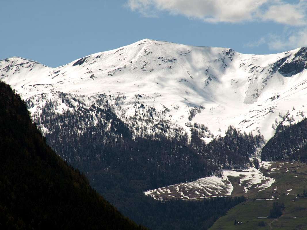
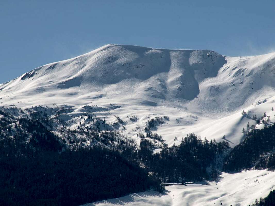
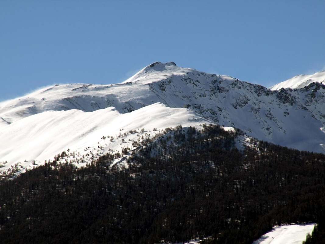
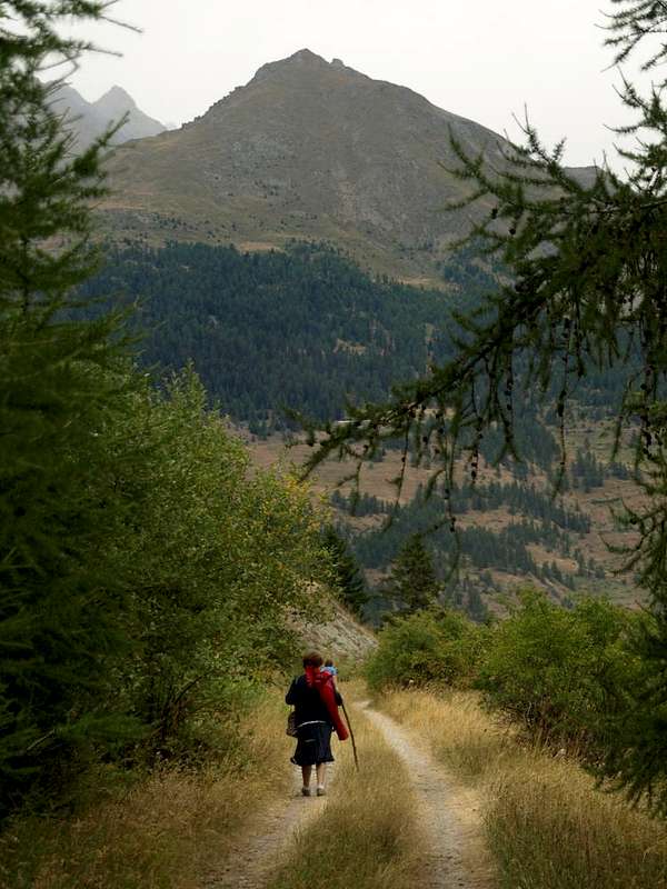
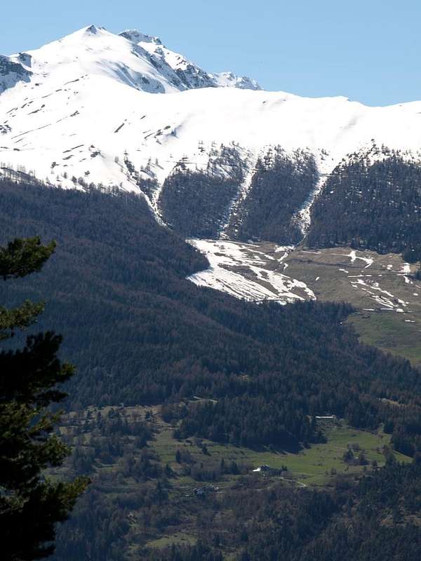
This valley marks Southeast border of vallon collocated between Gignod Etroubles, now in Gr. St. Bernard Valley. After having, starting from the homonym shelter, climbed the Pointe Chaligne (2.608m), descend to Colle and the Crest or Coast Tardiva (2.410m, 2.418m) from which quickly reach Rifugio Chaligne (1.936m), in the uppermost part of the Torrent Val Buthier in the Municipality of Gignod. The most widely used route, however, especially after the construction of the shelter, consists precisely in the fact to going up and the eventual crossing proper from this side starting at the junction on Highway at the Condemine Fraction. A third approach, but certainly a lot less frequented, is that with the departure by Etroubles then up almost along all the adjacent Valley of Ars or Arsy, at the foot of the wide Northern Slope of Fallère. Three different ways to accomplish the same whereas in the former case the route happens from South to North and possible return through the saddle 2.126 meters to Checottayes above Aosta. While the reverse happens in the next two and in this last, you can make some connections between the Vallon Arsy or Artanavaz Torrent and adjacent Val Buthier. Starting from Condemine locality at the entrance on the same, and continuing to the South progressively reach the small Hamlets of Grand and Petit Buthier. From here beautiful Excursions to different locations, but the factor that differentiates these trips more results from the fact that while the first (Tardiva) and last (La Tsa) are directed almost exclusively to the Hiking, the middle is almost a requirement for the Ski-Mountaineering. Including all highlights the practice by Snowshoeing, always good aid for the presence of deep snow. Can do is arm yourself with good will always paying attention to the danger of snowslides and avalanches, which have already caused some fatal accidents. As a counterpart a splendid Nature still lush and well-preserved and beautiful views by Aosta to the Great St. Bernard Valley "flying" above nearby Val Pelline. A series of valleys marked by the name Buthier like Buthier de Bosse better known as Rio Artanavaz or Buthier of Ollomont and that of the same Valpelline. They gather at the small Villages of Rhins and Moulin that downs to the unique Buthier that flows into the Dora Baltea near the City of Aosta. But the only valley that brings in a specific way this place name is only the small and "hidden" Val Buthier, which descends in silence towards the Northeast between the Pointe Chaligne and the valley floor ...
Il vallone segna il confine Sudorientale della piccola valle sita tra il Comune di Gignod e quello di Etroubles, ormai nell'attigua Valle del Gran San Bernardo.
Dopo aver scavalcato Punta Chaligne (2.608 m), si scende al Colle ed alla Cresta Tardiva (2.410 m, 2.418 m) dalla quale in breve tempo si raggiunge il Rifugio Chaligne (1.936 m), collocato nella parte più elevata del Torrent Val Buthier nel Comune di Gignod. Il percorso più utilizzato però, soprattutto dopo la costruzione del rifugio, consiste proprio nel fatto d'effettuare la salita e l'eventuale traversata proprio da questo versante con partenza al bivio sulla Statale presso Condemine. Un terzo approccio, ma sicuramente molto meno frequentato, risulta quello con partenza da Etroubles risalendo poi quasi tutto l'adiacente Vallone d'Arsy, posto ai piedi del largo Versante Settentrionale del Fallère. Modalità differenti per compierla considerando che nel primo caso la stessa avviene da Sud a Nord e con eventuale rientro tramite la selletta 2.126 metri verso Checottayes sopra Aosta, mentre nei successivi due avviene l'inverso ed in quest'ultimo si possono effettuare alcuni collegamenti tra l'Arsy o del Torrent Artanavaz e la Val Buthier. Iniziando dalla località di Condemine all'ingresso del medesimo, e continuando verso Sud progressivamente si raggiungono i Villaggetti di Grand e Petit Buthier. Partendo da queste località é possibile effettuare diverse belle Escursioni, ma il fattore che diversifica maggiormente queste gite risulta dal fatto che, mentre la prima al Colle ed all'appena soprastante Costa Tardiva (2.410/18 m) e l'ultima al Mont de la Tsa (2.742 m) sono rivolte quasi esclusivamente all'Escursionismo, quella intermedia é quasi di obbligo per lo Sci-Alpinismo. Tra tutte si evidenzia la pratica delle Racchette da neve, sempre di ottimo ausilio in presenza di neve alta. Non rimane che armarsi di buona volontà facendo sempre attenzione al pericolo di slavine e valanghe, che qui han già provocato alcuni incidenti mortali. Come controparte una veramente splendida Natura ancora rigogliosa e completamente ben conservata, nonché splendide vedute dalla sottostante Città d'Aosta fino al Gran San Bernardo "volando" al di sopra della viciniora Valpelline. Tutta una serie di vallate contrassegnate dal nome Buthier, come il Buthier de Bosse meglio conosciuto come Rio Artanavaz, oppure il Buthier di Ollomont e quello della stessa Valpelline. Si riuniscono presso le località di Rhins e Moulin originando lo unico Buthier che confluisce nella Dora Baltea presso la Città di Aosta. Ma l'unica valle che riporta in modo specifico questo toponimo risulta esclusivamente la piccola e "nascosta" Val Buthier, che scende in silenzio verso Nordest tra la Pointe Chaligne ed il fondovalle ...
 |
 |
 |
 |
 |
Getting There
BY CAR:
- From TORINO, MILANO, etc: Motorway A5. Exit at IVREA or Quincinetto (PIEDMONT) From IVREA: in West towards Pont St. Martin, Donnas, Bard, St. Vincent, Chatillon, Nus, Quart, St. Christophe, Aosta (in West) and Roisan, Gignod (North) Municipalities. From Courmayeur Resort: in East to Pré St. Didier, Morgex, La Salle, Saint Pierre, Villeneuve, Sarre, Aosta and in North towards Gignod Municipalities.
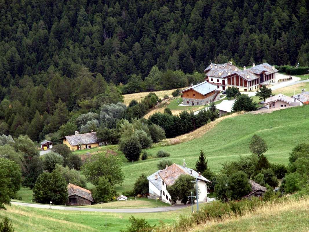
- From Aosta City towards Gignod Municipality in Great St. Bernard Valley From Aosta North Town or by St. Christophe with Main Route towards Gignod Commune (988m) or Roisan (843m) with Great St. Bernard SS.27 to alternative nearby Condemine Hamlet (1.137m). Leaving left through Municipal Road to Grand Petit Buthier Villages (1.302m, 1.439m) in Chaligne Comba. From this last, with private dirt farms roads and through Mendey, Roncaille, Rombason Pastures up to the Chaligne Shelter (1.936m), below Costa Tardiva (2.380m), Tardiva Hill (2.410m) and neighboring of Punta Chaligne (2.608m) and Mont de la La Tsa (2.742m).
- From FRANCE: through the Mont Blanc Tunnel to Entrèves-crossroads to Vény/Ferret Valleys - Mountain Guides of Courmayeur - La Saxe Rock Gym - Courmayeur. By Little Saint Bernard Pass, closed since November until half May to La Thuile Valley - Pré Saint Didier - Courmayeur. It is not necessary to take Motorway A5: you can drive on SS.26, in the direction of AOSTA - IVREA - TURIN.
BY PLANE:
- Aeroporto “Corrado Gex" Saint Christophe (Aosta).
On foot or by Ski Some Hikes even with Snowshoing
1) - from Condemine alternative on State Road towards the above Villages of Grand Buthier (1.302m), Petit Buthier (1.439m) and Roncailles, Rombason, Crossroads 1854 metres through the path n° 3A/2A or concomitant with the dirt road, always n° 3A/2A and subsequent crossing from fork 2.150 meters on watershed North/South of Costa Tardiva (2.418m, 2.394m) to Tardiva Hill (2.410 m) with path n° 3 (E/F; 3h'00/3h'15).
2) - Or by Chaligne Shelter (1.936m; new since years 2000) to Tardiva Hill, through unnumbered trail in Northwest on Southeast Slope (E/F; 0h'45/1h'00).
3) - Also by refuge, through small path n° 2 in South, towards the small saddle (2.405m) on Eastern Crest of Punta Chaligne and traverse with short and easy descent to Met Alpage (2.261m; E/F; 1h'00/1h'15), into the Southern Vallon below Eastern slopes of Met Summit and Hill (2.553m, 2.485m).
4) - And again by refuge through the small saddle 2.342 meters to the Punta Chaligne through final part of Eastern Crest (E/F+; more or less same difficulties and time).
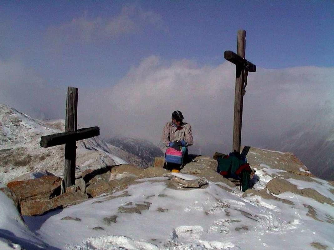
5) - Otherwise by the new Chaligne Shelter (1.936m), reached before with road in asphalt by Grand and Petit Buthier (1.302m, 1.439m) and after through the farms dirt road, continue towards the North by the latter, concomitant with the path n° 2A/3A, arriving at Tardiva Pass (2.410m) at the Southern end of the Costa Tardiva. More precisely, from the refuge continue South through the forest path n° 2A/2B until you reach the above small pass 2.126 meters; leaving to the left the path that goes back to the South at the Plan de Debat, in the Eastern Slope of pointe de Chaligne, cross to the West instead coming up with a small path not numbered towards the Tsa de Metz (2.251m). This briefly with the path n° 6/7B to Colle di Met and North Crest in final part (E/F; 1h'10/1h'25). From the hill overlooking the Valley of the Arsy of Ars back toward the Southwest on the watershed with the small path n° 2A/3 bypassing the altitude of 2.484 meters in the direction of the wide saddle (2.518m) with the Pointe de Chaligne (2.608m). From this, or just before turning right (Northwest) continue always easily along the ridge with scattered traces, easily exceeded the quota (2.535m), with around a semicircular ridge on the East-Southeast division between the Vallons of Chiusella (in South) and Arsy (North) easily to the Summit (E/F; 0h'50/1h'10 from Passo Tardiva; 2h'40/3h'00 in total).
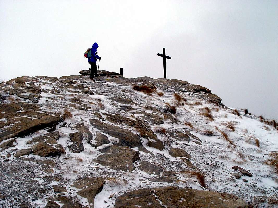
Important Remark: must be avoided both the ascent and the descent through the inviting especially the Northeast Slope; have already occurred on the same misfortunes mortal avalanche while backcountry Skiing Excursions. Always in the same season even the Northern Ridge, which sends a branch to the Hill Tardiva and another to La Tsa (2.742m), it is very dangerous; it should always be the first amongst the routes, that takes place inside the forest, and then it is certainly somewhat more safe and secure. Otherwise you must jump over the saddle, losing a little altitude, climb to the Col de Met (2.608m; E/F; 1h'45/2h'15).
 |
 |
 |
 |
 |
Avvicinamento dalla Statale n°27 del Gran San Bernardo presso il bivio per Condemine con diverse varianti e possibilità d'uso delle Racchette da neve:
1) - dal bivio sulla Strada Statale per il Villaggetto di Condemine verso i Villaggi soprastanti di Grand Buthier (1.302 m), Petit Buthier (1.439 m) e gli Alpeggi di Roncailles, Rombason e bivio 1.854 metri tramite il sentiero n° 3A/2A od il concomitante con la poderale sempre n° 3A/2A con susseguente e relativa traversata dal bivio 2.105 metri Nord/Sud sullo spartiacque della Costa Tardiva (2.418 m, 2.394 m) insino al Passo Tardiva (2.410 m) con sentiero n° 3 (E/F; 3h'00/3h'15).
2) - Dal Rifugio Chaligne (1.936 m; costruzione degli anni 2000) al Passo Tardiva tramite sentierino non numerato a Nordovest sul Versante Sudest (E/F; 0h'45/1h'00).
3) - Inoltre dal rifugio, con sentierino n° 2 a Sud dapprima dentro la foresta, verso la selletta (2.405 m) sulla Cresta Est della Chaligne e corta facile traversata con discesina all'Alpe di Met (2.261 m; E/F; 1h'00/1h'15), dentro il Vallone Meridionale al di sotto il Versante Orientale del Colle e Punta di Met (2.485 m, 2.553m) con salita ad entrambi.
4) - Ed ancora e sempre dal rifugio alla selletta 2.342 metri ed alla Punta Chaligne tramite la parte finale della Cresta Est (E/F+; più o meno stesse difficoltà e tempo).
5) - Oppure dal nuovo Rifugio Chaligne (1.936 m), raggiunto dapprima con strada in asfalto da Petit Buthier e poi poderale, continuare verso Settentrione tramite quest'ultima, concomitante al sentiero n° 2A/3A, arrivando al Passo Tardiva. Più precisamente, dal rifugio proseguire a Sud nella foresta tramite il sentiero n° 2A/2B fino a raggiungere la soprastante piccola sella 2.126 metri; lasciato a sinistra il sentiero che risale verso Ovest al Plan de Debat, sotto il Versante Orientale della Chaligne, attraversare invece ad Occidente arrivando con un piccolo sentiero non numerato alla Tsa de Metz (2.251 m). Da questa in breve col sentiero n° 6/7B al Passo Tardiva (E/F; 1h'10/1h'25). Dal colle con il Vallone di Arsy od Ars risalire verso Sudovest sullo spartiacque con il sentierino n° 2A/3 scavalcando l'altitudine 2.484 metri in direzione della larga sella (2.518 m) con la Pointe de Chaligne. Da questa oppure svoltando appena prima a destra (Nordovest) proseguire lungo tracce sparse sul crinale ed, oltrepassata facilmente la quota (2.535 m), con giro semicircolare sulla Cresta Est-sudest divisoria i Valloni di Chiusella (a Sud) ed Arsy (Nord) facilmente alla Cima (E/F; 0h'50/1h'10 dal passo; 2h'40/3h'00 in tutto).
Nota Importante: in inverno devon esser evitate sia la salita che la discesa soprattutto attraverso il Versante Nordest; sullo stesso si sono già verificate varie disgrazie mortali per valanga durante l'escursioni di Sci-Alpinismo. Sempre nella medesima stagione pur la Cresta Nord, inviante una ramificazione verso il Passo Tardiva ed un'altra verso la Cima de La Tsa (2.742 m), risulta alquanto pericolosa; in siffatte condizioni meglio il primo degli itinerari che si svolge all'interno della foresta, risulta certamente più sicuro e protetto. In caso contrario, é meglio e consigliabile scavalcare la selletta, perdendo un po'di quota, e risalire sull'opposto versante tramite il Col de Met (2.608 m; E/F; 1h'45/2h'15).
 |
 |
 |
 |
 |
Mountain Conditions
- Meteo: you can find all the needed informations at the official site of the Valle d'Aosta Region:
- Valle d'Aosta Meteo
Books and maps
BOOKS:
- "Guida dei Monti d'Italia-Alpi Pennine" (Vol.I°) di Gino Buscaini-Club Alpino Italiano/Turing Club Italiano, Luglio 1971.
MAPS:
- Kompass "Monte Bianco Valle d'Aosta Sentieri e Rifugi" Carta turistica 1:50.000.
- Kompass "Gran Paradiso Valle d'Aosta Sentieri e Rifugi" Carta Turistica 1:50.000.
- I.G.C. Istituto Geografico Centrale Torino "Massiccio del Monte Bianco" (n° 4), Torino, 1998 1:50.000.
- Studio F.M.B. "Monte Bianco-Mont Blanc", Bologna 1988 1:50.000.
- I.G.C. Istituto Geografico Centrale "Carta dei sentieri e dei rifugi" 1:25.000.
- I.G.M. Istituto Geografico Militare 1:25.000.
Important Information
- REGIONE AUTONOMA VALLE D'AOSTA the official site.
- FONDAZIONE MONTAGNA SICURA Villa Cameron, località Villard de la Palud n° 1 Courmayeur (AO) Tel: 39 0165 897602 - Fax: 39 0165 897647.
- A.I.NE.VA. (Associazione Interregionale Neve e Valanghe).
 |
 |
 |
 |
 |
 |
Useful numbers
- Protezione Civile Valdostana località Aeroporto n° 7/A Saint Christophe (Ao) Tel. 0165-238222.
- Bollettino Meteo (weather info) Tel. 0165-44113.
- Unità Operativa di Soccorso Sanitario Tel. 118.