Toggle navigation
Mountains
Routes
Images
Trip Reports
Forum
What's New
People
Areas & Ranges
Articles
Trailheads
Canyons
Huts & Campgrounds
Albums
Logistical Centers
Fact Sheets
Lists
Custom Objects
Gear
Plans & Partners
WELCOME TO SUMMITPOST
SIGN IN
REGISTER
Vasquez Peak
Additional Parents
Image
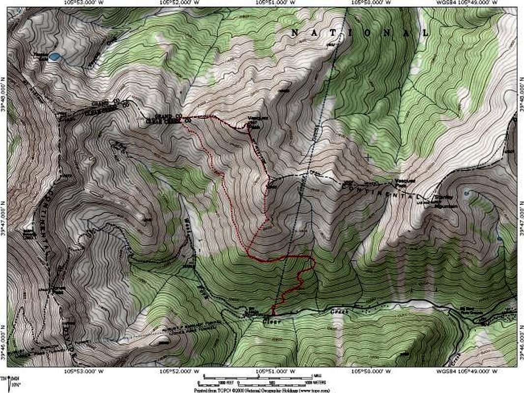
Vasquez Peak Topo Map: The...
View High-Resolution Image
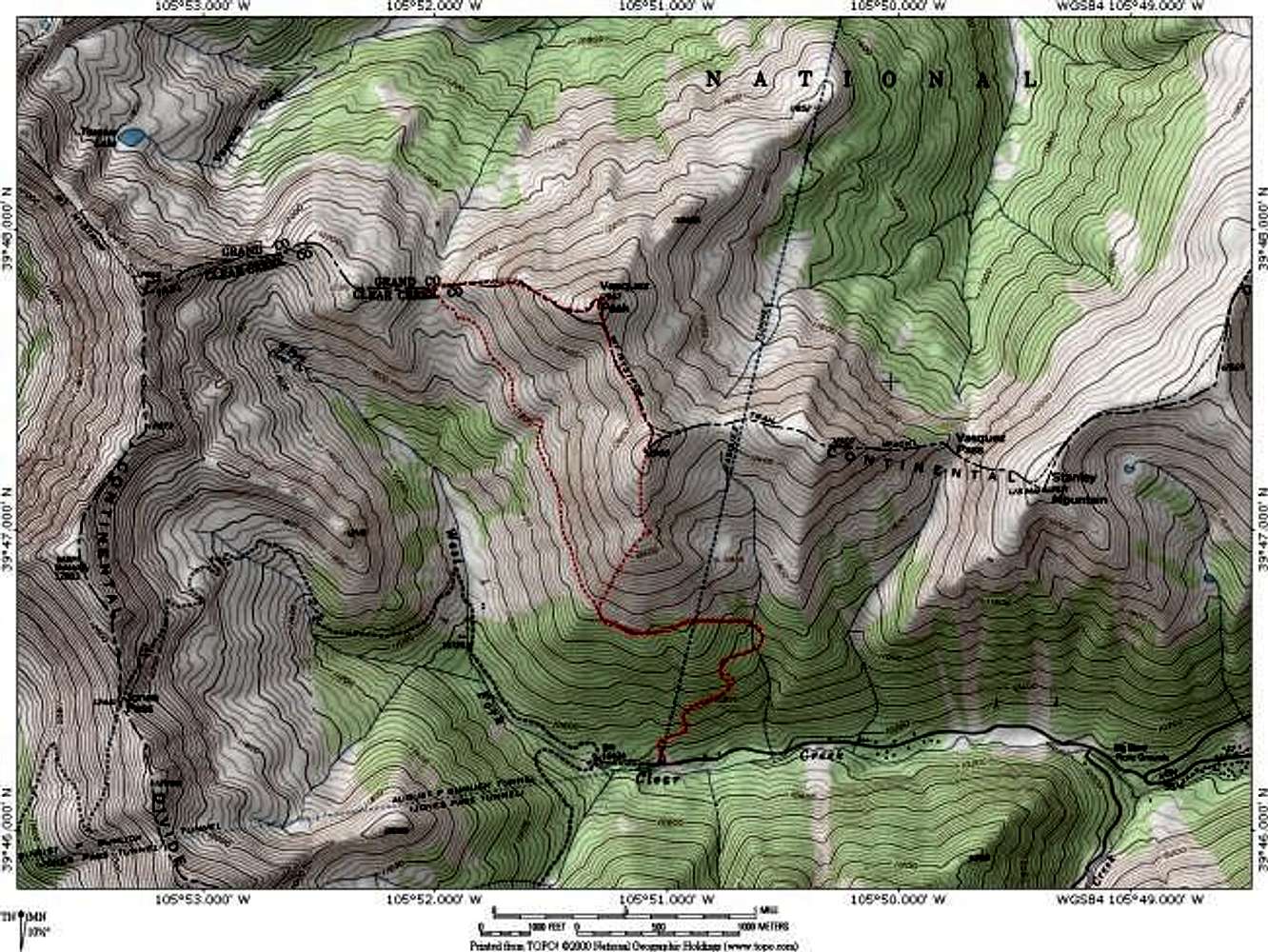
Vasquez Peak Topo Map: The...
Vasquez Peak Topo Map: The dashed red line depicts the 6.6 mile loop that utilizes part of the Continental Divide Trail (not shown). Map created with National Geographics Topo! Jon Bradford
« PREV
NEXT »
JonBradford
on
Feb 10, 2004 10:58 pm
Comments & voting
Other parents
Lat/Lon:
39.79600°N / 105.854°W
Image ID:
41485
8473 Hits
78.27
% Score
9
Votes
Log in to vote
Comments
No comments posted yet.
to post!
Don't have an account?
Vasquez Peak
(Mountain/Rock)
« PREV
Viewing
#10 of 53
GALLERY
NEXT »
JonBradford's Image Gallery
« PREV
Viewing
#175 of 1444
GALLERY
NEXT »
×
You need to login in order to vote!
User Name
Password
Remember me
Forgot your password?
Log me out when I close my browser.
Keep me logged in all the time.
sign in as a user
Don't have an account?
Register now for FREE
Rating available
Suggested routes for you
People who climb the same things as you
Comments Available
Create Albums
Register Here


