Approach
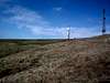
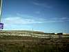
If you are coming from Highway 50, Carpenter Hill can easily be reached by way of Iron Point Road. It is a shorter hike than the north approach, and is closer to the freeway. Exit East Bidewell, travel north to the first light. This is already Iron Point Road. Make a right and drive up the hill. Carpenter Hill is easily seen with the radio towers. The road will skirt the south side of the summit. You can park as the road starts to go down and begin the very short hike.
Route Description
From Iron Point Road, head north, directly towards the highpoint. You'll ascend a semi-steep grassy slope and this will put you at the summit in about 3 minutes since when you left your car. Exhilarating....
Essential Gear
Make it interesting, and do it naked.
Miscellaneous Info
If you have information about this route that doesn't pertain to any of the other sections, please add it here.

 4145 Hits
 74.91% Score
 5 Votes