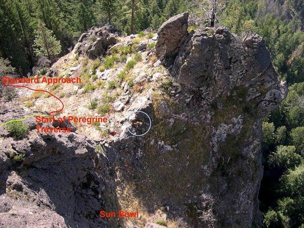
View down from top of P2 of
Peregrine Traverse . Part of standard approach shown with red line; beginning P1 of
Peregrine Traverse shown in yellow. Sun Bowl is a large ledge c. 50 feet below the start of the route (many bolted, one-pitch routes can be found here). Our 70-lbs dog can be seen in the blue circle and provides a sense of scale (October 1, 2004).


