Welcome to SP!  -

View from Four Mile Trail

 
[ Sizes: Orig | Large | Med | Small | Thumb ]
View from Four Mile Trail

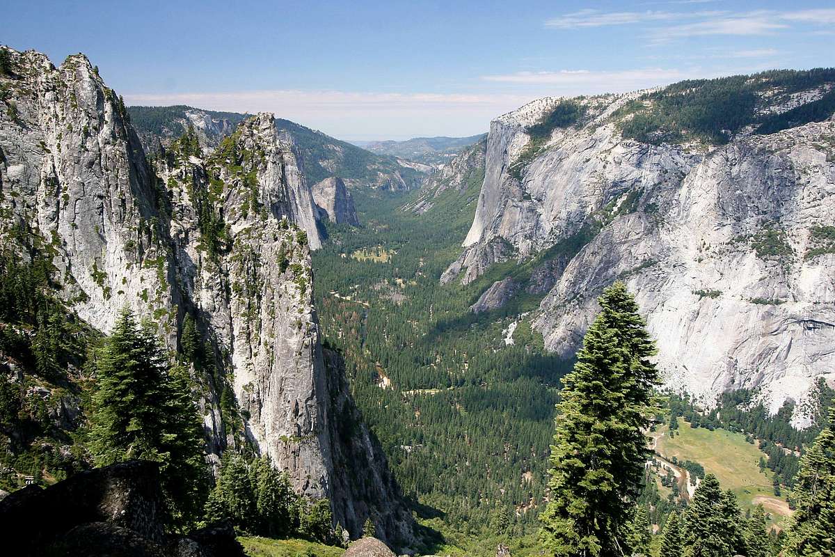
Dramatic view of Yosemite Valley, CA during the hike up Four Mile Trail. Four Mile trail is a 3220-foot, 4.6-mile ascent from the valley floor to Glacier Point. Sentinel Rock (left) and El Capitan (right) are prominent in the image. Imaged in July 2007.

Comments

No comments posted yet.


Rate This Image
Current Score: 87.31

Log In To Vote
 Yosemite National Park (Area/Range)

Lost Arrow and Yosemite Point
« PREV

Viewing
#50 of 527
GALLERY
The Mighty El Capitan
NEXT »

 Mark Doiron's Image Gallery

Black and Yellow Argiope (<i>Argiope Aurantia</i>)
« PREV

Viewing
#45 of 548
GALLERY
Lake Latonka
NEXT »


 Glacier Point (Mountain/Rock)


 If Disney Made a National Park (Trip Report)


Image Data
Mark DoironSubmitted by Mark Doiron
on Sep 10, 2007 6:33 pm

Image ID: 335511
Hits: 2530 
Lat/Lon: 37.73353°N / 119.58549°W

Image Type(s): Hiking, Scenery