


imontop - Nov 24, 2008 8:49 pm - Voted 10/10
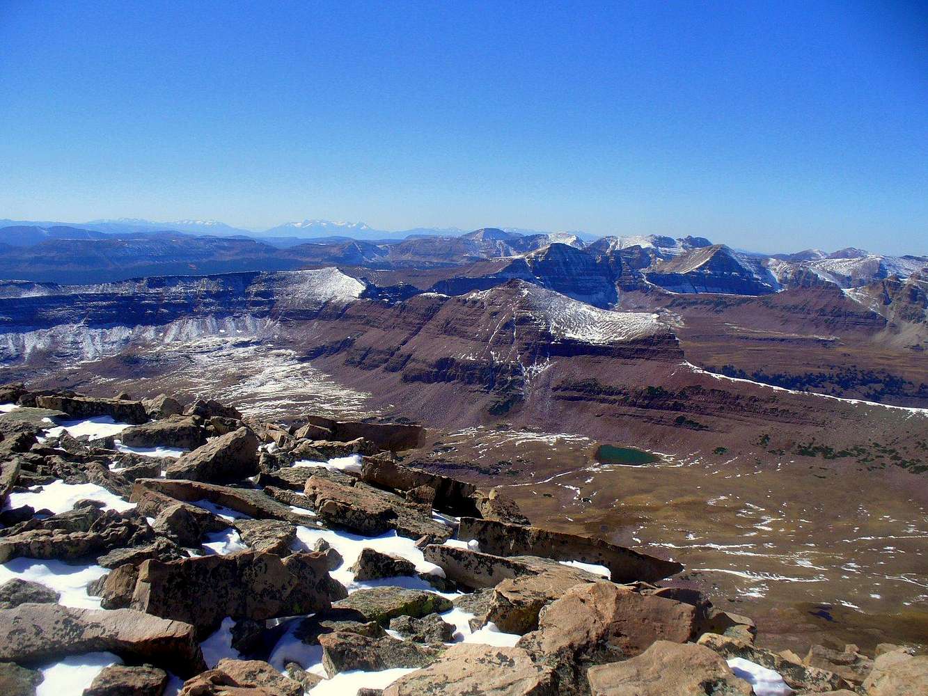
What a place huh?I love the Lovenia area! The Lake Fork and Deadhorse area is probably the most remote area in the Uintas. And your picture definately demonstrates that.

Dmitry Pruss - Nov 24, 2008 10:04 pm - Hasn't voted
Re: What a place huh?I think mid-section of KE Ridge is a good deal more remote. Lovenias are a passable day trip but later in October I hiked through Atwood Basin and it was a toughie mileage-wise. But South Side basins like Lake Fork may be darn hard to reach too!
imontop - Nov 24, 2008 11:58 pm - Voted 10/10
Re: What a place huh?Good point. South of Kings toward Emmons is remote. That would be a hell of a pull up Lake Fork toward Lovenia.

yatsek - Nov 25, 2008 2:16 am - Voted 10/10
Typical Utah huh?I'd love to visit; too few trees for me again though, another E Altaj - just cover it with snow - does it get enough for cross-country skiing?
Dmitry Pruss - Nov 25, 2008 1:23 pm - Hasn't voted
Re: Typical Utah?No it isn't a prarie-to-tundra tree-less range, not at all. The Uintas are set in the heart of more than 50 x 100 miles swath of timber country. So much forest that backpackers often complain of not seeing much for like days (check Scott's description of Yellowstone River Trail for example).
And it gets plenty of snow, often skiable November through June. The problem with xc ski access in the middle of the winter is not with the amount of snow. The problem is with the closed roads and winter trailheads which are typically very very far from the mountains.
yatsek - Nov 27, 2008 6:39 am - Voted 10/10
Re: Typical Utah?I see, so it wouldn't be so bad for me although I'd be tempted to move a bit north anyway. When it comes to very very far - no good for, say, little dogs but this is something just right for aliens like MOCKBA, isn't it?
Dmitry Pruss - Nov 27, 2008 1:40 pm - Hasn't voted
Skiing you say? Preaching to the choirLOL this year was my first year of serious hiking in the High Uintas, but I've been skiing there since mid-90s, and all of my High Uintas trip reports on SP are for ski tours.
There is a caveat though. All of these trips were day trips (sometimes with car camp or off a yurt). But Lovenia area isn't doable in one day on skis. When the snow is good, it's over 50 miles round trip, and by the time the summer trailheads open up, the snow ain't good any more.


Comments
Post a Comment