

-
 20988 Hits
-
 84.95% Score
-
 24 Votes
|
|
Mountain/Rock |
|---|---|
|
|
39.84258°N / 2.92571°E |
|
|
Download GPX » View Route on Map |
|
|
Hiking, Mountaineering, Scrambling |
|
|
Spring, Summer, Fall, Winter |
|
|
3622 ft / 1104 m |
|
|
Overview
 Puig Tomir summit seen across the karst near its top Puig Tomir summit seen across the karst near its top |
After Puig de Massanella, Puig Tomir is the most important mountaineering objective in Mallorca's Serra de Tramuntana. At little more than 1100m it does not compare with the mountains in the centre of the range but its ascent is arguably the most difficult undertaking on the island. While short when done from the closest trailhead it has everything that you'd rather expect from much higher mountains e.g. in the Dolomites or Julian Alps: tricky traverses of moving scree slopes, chimney climbs with fixed protecttion and a large karst plateau which can turn nasty in foggy conditions.
Puig Tomir is located in the north-east of Serra de Tramuntana, separated from the central part of the range by the valley in which you find Lluc Monastery. It is by far the highest mountain in this area, thus offering excellent views towards the north coast, the island's fertile plains in the west and the high summits of Serra de Tramuntana in the south. Capes Formentor and Alcudia draw most attention from its summit.
 |  |  |
Like the remainder of the island, Puig Tomir is made up from brittle limestone. While its eastern side is one giant karrst slope, to the north and east massive walls drop to the valleys underneath. The karst while seemingly a giant flat plain, is deeply structured with giant ruts and crevices. Negotiating this plateau is far from simple, especially if you lose sight of the many cairns that lead you to the summit along the normal route.
 |  |  |
In an ironic twist this normal route forces its way up one of the more difficult sections of the mountain. From the karst summit plateau a gully develops in the south-west, which soon widens into a scree couloir. Negotiating the scree - while not overly difficult - is rather dangerous during descent, thanks to the coonstantly moving rubble, which tends to drag you into near vertical gullies.
 |  |  |
Last but not least: one of the approaches to Puig Tomir from Lluc Monastery leads through an area of bizzarre limestone formations, which were washed out of the bedrock bycenturies of heavy winter rains. A mythical area, which prolongs the otherwise short ascent into a day tour.
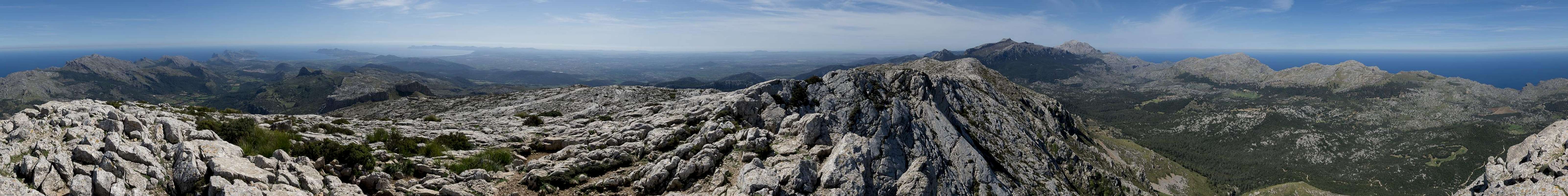
360° Summit Panorama
  |
Routes
 Rock tower near the normal route
There are two routes onto Puig Tomir, one through the south-west couloir, the other along the east ridge. The trailheads for both are pretty much the same ones, access routes are different. Descriptions start at Lluc Monastery.
- South-west couloir via Coll de sa Font
This is the normal route to Puig Tomir. Starting from Lluc head west on / beside Ma-2140 past Refugi Son Amer. Head up GR221 which passes Coll de sa Font, Coll Pelot and Coll des Pedregaret.
Here turn right, heading up the mountain first along a stone wall, later into the developping south-west Couloir. Stay above the large scree field, heading towards a cut at its top. Here the couloir proper starts, taking you do a pronounced saddle. Turn right, ascending a uncomfortabbly steep scree chute, which heads toward the crux of the route, a chimney, which is secured by chains. Above the crux the path winds across the karst landscape, heading onto the summit plateau. Turn left towards the summit of Puig Tomir.
- South-west couloir via es Pixarells
Very scenic hike, which heads through an area of bizarre karst formations. From Lluc head out on Ma-2410 until you reach the abandoned sports field. Cross the sports field after which you turn left, steeply ascending to the karst plateau. The famous camel formation (Es Camell) can be visited to the right. Follow the path which heads towards a saddle after which it winds through a valley of rock formations towards the picnic area es Pixarells. Here cross MA-10, heading up a dirt road which leads to Binifaldo and Coll des Pedregaret. The remainder as above.
- East ridge via Coll de l'Arena
Very remote route, which starts at Lluc, heading west on Ma-2410 passing Refugi son Amer and heading to Coll de sa Font. Here turn right onto a dirt road which takes you to Autanella. Right before you reach the farm, at s'Enrocador des Bocs turn left (north-west) to Coll de l'Arena. In the saddle turn north, passing Cava dels Morts and heading up to Coll del Fartaritx. Now up the eastern karst slope towards the summit of Puig Tomir.
Getting There
 Lluc Monastery among the mountains of the northern Serra de Tramuntana
A typical tourist location, the island Mallorca can be best reached by plane. There are flights from virtually every European international airport to Palma de Mallorca. From the island capital the following itinerary leads to the most common trailheads:
- Take motorway Ma-13 from Palma north-east to Inca.
- Switch to Ma-2130, direction Lluc Monastery
- At the intersection between Ma-2130 and Ma-10 to Polenca turn right onto Ma-10.
- The first trailhead is at Lluc Monastery, which you reach from the intersection by following Ma-10 eastwards and later Ma-2140 to the monastery.
- For the second trailhead leave Ma-10 at km 17,4 onto a side road, which leads to Menut and Binifaldo
- If this road is closed, there is a picnic area some 500m north of the Menut road. From there a hiking path leads to Binifaldo.
Red Tape
 Karst view towards Alcudia Peninsula
No permits required.
When To Climb
You can climb Puig Tomir all year round, however September through May is the best time. Avoid the hot summer months.Accommodation
 Northern Serra de Tramuntana
Generallly, there are lot of accommodation options on Mallorca, which you can find on the usual portals. Prices, however, are quite high.
Camping is generally not allowed, the land is privately owned. In the vicinity of Puig Tomir there is a campground near Lluc Monastery and a mountain hut, Refugi son Amer close by. The sanctuary itself also provides small rooms ("pilgrim cells") for overnight stay at a moderate price.
Weather Conditions
The right clothing provided, the mountain can be accessed in any weather condition. However, orientation in fog can become very difficult on the karst plateau on top or on the east ridge route.
Maps & Books
There are many publications about hiking on Mallorca. I include the ones which I have used myself as well as recommendations by other SPers. The book by Rolf Götz, which is available in four languages has a good choice of routes, two thirds of them in Serra de Tramuntana. Two routes are dedicated to Massanella.In particular I want to recommend the book by Marc Schichter & Kirsten Elsner, even though it is only available in German. It comes with an excellent map of Serra de Tramuntana (probably the best available) and lots of routes which can be connected at will.
Maps
- Mallorca
4 map box set
Kompass Verlag
1:35000
ISBN: 978-3-99044-062-9
- Walk Mallorca
Discovery Walking Guides
1:40000
ISBN: 978-3-99044-062-9
Books
- Mallorca
Rolf Götz
Rother Verlag
ISBN: 978-3-7633-4805-3 (English)
ISBN: 978-3-7633-4122-1 (German)
ISBN: 978-3-7633-4923-4 (French)
ISBN: 978-3-7633-4701-8 (Spanish)
- Wandern auf Mallorca
Marc Schichter & Kirsten Elsner
Reise Know-How
ISBN: 978-3-89662-289-1
- Walking in Mallorca: Classic Mountain Walks in Mallorca
June Parker
Cicerone Press
ISBN: 978-1852844882
FallingUp - Oct 13, 2017 3:33 am - Hasn't voted
A few updates October 2017I have climbed Tomir about a dozen times over the least 5 years. Here are a few additions and corrections based on my observations. First and most critically - while most people probably do Tomir as a round trip from Lluc, a small percentage do it as part of a Lluc/Pollensa traverse in either direction. You may have seen something written about traversing (from Pollensa to Lluc) Fartarix, Ca, and then Tomir in that order. This is effectively no longer possible as an essentially impassible fence has been put up in a critical section between Fartarix and Ca (actually between the Moleta sub peak and Ca). What this means is that if you summit Tomir from Lluc (via either route listed in the article), what you need to do to get to Pollensa effectively is to go down the Pollensa side of Tomir to the col between Tomir and Ca. On the left (GR221) side of the Col, you need to find the trail marked with cairns and red dots that will take you 'under' Ca to the summer pasture/farm that is below Fartarix. From there, Fartarix is a possible side trip of about 1.5 hours. It is very difficult but not impossible to find the start of that cairn/red dot path if you are coming down from tomir - be ready for this and if possible get its coordinates on your satnav before you go. Fartarix now becomes a side round trip under this arrangement, but is worth it if you can spare about 1.5 hours. Some maps show a path from the trail i describe to a "pass de l'all" just below fartarix. I have tried to find this pass from the top but looked down from where it must have started from and found the descent suicidally steep looking. Maybe it wasn't (if i had the ability to see from the bottom it might look more benign), but I also suggest that unless somebody else weighs in with more definite information that the path from the bottom to the "pass" de l'all might not actually exist or might be a grade 2/3 scrambling route unsuitable for nearly all hikers. at the very least, if there is a route there, it must be on a very steep cliff face. Finally, the second thing I want to add, and maybe I've just climbed it too many times, but I was a bit suprised to find terms like "chimney" and "alpine style" describing the normal climb up to Tomir from the Lluc side. Maybe I've just forgotten what its like to be relatively inexperienced, but this in my view is a relatively straightforward walk-up with only a bit of hands a feet scrambling required at points. That said, yes, the loose rock underfoot at times probably is a bit tricky in places, but this has been made substantially easier in recent years by the establishment of parallel / alternate paths in some formerly slightly tricky areas and by the fact that in many places the deep scree (loose rock) has simply been pushed away by hikers. Always be fully prepared for the worst in any mountain you climb. While I noted that to me Tomir seems a bit easier than described here, this only applies to people with substantial climbing experience. Whoever you are, take plenty of water, use caution as there are plenty of fall and trip hazards, and always be prepared to turn back, especially if there is moisture on the rocks due to snow/rain/cloud as that can make things very difficult indeed.
Gangolf Haub - Oct 22, 2017 8:05 am - Hasn't voted
Re: A few updates October 2017Thanks to you additions - I really appreciate them. Asfor the use of the word "chimney" - I know what you mean. But being German I wasn't able to find a better suiting word than "Kamin", which I litterally translated. On the other hand - what would be the correct English word? And luckily - I can't be blamed for using "alpine" - I think people want to express their surprise at the ruggedness of Serra de Tramuntana, which you really wouldn't expect at that height.
bannus1967 - Jan 29, 2019 9:59 pm - Hasn't voted
Video impression of the climbVery nice and scenic climb, find a video impression here: https://youtu.be/D3h6028Dczs