
-
 14372 Hits
-
 76.48% Score
-
 7 Votes
|
|
Mountain/Rock |
|---|---|
|
|
47.39695°N / 11.22219°E |
|
|
7204 ft / 2196 m |
|
|
Overview
 Leutascher Dreitorspitze
Because of its location the summit offers great views towards the Karwendel as well as to the western parts of the Wetterstein Gebirge. But that' s not all. Besides the impressive views down into both valleys the mountain is a great lockout across the Bavarian Prealps to the north. Those gentle mountains provide a great contrast to the Stubai Alps visible in the south. All in all it is a fine place to stay and enjoy the day.
Unfortunately the mountain is no insider and so it is visited frequently. Most people ascent Große Arnspitze from Scharnitz and therefore the longer route starting at Mittenwald is quite lonely. Additionally this route isn' t as steep and strenorous as the "direct" routes from Scharnitz. A more interresting route is the traverse of the Arnspitzstock which includes some easier exposed climbing.
Today the summit marks the border between Austria and Germany. But even in earlier times the mountain played a quite important role in history. The ruins of Porta Claudia on the slopes of Große Arnspitze tell an interresting story about the wars in that area.
Porta Claudia
| Porta Claudia was a huge fortress named after princess Claudia de' Medici (1604-1648). During the Thirty Years' War (1618-1648) it was getting more and more necessary to protect the important border between Bavaria and Tyrol since the war was getting closer. Finally the fortress was built from 1632 to 1634. There are only a very few images on the web and reality but I found this one showing the fortress from the north under attack. It was constructed in the valley of Scharnitz close to today' s border between Austria and Germany. Together with a wall at the Leutasch valley the fortress was a great effort to protect Tyrol from attacks from the north. After being completed it wasn' t attacked during the rest of the Thirty Years' War. Nevertheless it was expanded in 1670. After some minor battles at that place it was attacked in 1805 by the French army lead by Napoleon coming from the north. Firstly Porta Claudia was defended successfully by less than 1000 men against several thousands French soldiers. Finally the fortress was conquered by Napoleon with the help of local hunters and foresters. They showed them a hidden trail around the walls of the fortress. Today this trail is called "Franzosensteig" (French trail) and is marked on several maps. After that battle the fortress was owned by Bavarians, French and Tyrolese. Finally it was blown up by the Bavarians since it wasn' t needed anymore (Tyrol was part of Bavaria in those days). Today only some ruins and images of the huge fortress are left. But their walls can be visited on the slopes of Große Arnspitze. |  Ruins of Porta Claudia Ruins of Porta Claudia Franzosensteig Franzosensteig |
Maps And Routes Overview
Maps:
Routes:
| 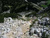 Final part Final part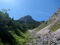 Haselrinne Haselrinne |
Mountain Conditions
 Große Arnspitze in winter
Weather:
- www.wetter.com
Long term, but sometimes inaccurate weather forecast for the city of Scharnitz. - ZAMG
Not as detailed as the link above, but quite accurate forecasts. - OEAV weather forecast
Weather forecast especially for mountaineering porpuses. Unfortunately this page is available in german only. - Avalanche report (Tyrol/Austria)
Current avalanche report for Tyrol. This page is in german only but there is a link to an english pdf-file on the left side.
Webcams:
- http://waldhotel-seefeld.at/Webcam/webcam.html
Webcam at Seefeld looking up to Ross-hut (1751m/5745ft).
Getting There
Except of the routes starting from Leutasch all trail heads are easily reachable by car and public transportation. There are busses driving into the Leutasch valley but I don' t know how often they drive. So if you intend to start at Leutasch I recommend to get there by car. The road through the Leutasch valley connects Mittenwald with Seefeld. Reaching both cities by car and train is described below.| By car: | Road 177 and B2 which connects Innsbruck (Austria) and Garmisch-Partenkirchen (Germany) runs through Scharnitz, Seefeld and Mittenwald. From Garmisch-Partenkirchen you have a highway connection to Munich and Innsbruck provides a conenction to Italy (Brenner) and Switzerland. |
| By train: | About every hour the train from Garmisch-Partenkirchen (Germany) to Innsburck (Austria) stops at Mittenwald and Scharnitz. From Garmisch-Partenkirchen you have access to the trains to Munich, Ehrwald (Austria) and Rheutte (Austria). Innsbruck is the gateway to Italy (Bozen/Bolzano, Verona). For more information visit the homepage of Deutsche Bahn for german and ÖBB for austrian train connections. |
Red Tape
There are no permits, fees or seasonal closures.There are several parking lots at Leutasch, Scharnitz and Mittenwald. The parking lots are marked within the KOMPASS maps.
When To Climb
Große Arnspitze is frequently climbed from spring to early winter. Because of its steep slopes summiting in winter is very dangerous and not done very often. Because of the steep slopes I don' t think that the summit is visited during the winter months except there wasn' t heavy snow fall yet.
Camping
| The hole area around Scharnitz is very touristic both in winter and summer. So you find a lot of hotels and places to stay. For more information visit the multilangual homepage of the area. For a stay on the mountain you have the choice between a tent and the Arnspitzhut. This little self-supplier hut is a bit below the summit of Große Arnspitze. It belongs to the DAV (section Hochland) and is a self supplier hut which is open the hole year. For more information contact:
|

External Links
- http://www.dav-huettensuche.de/index.php?pagedef=details&huetten_id=222490
Information about the Arnspitzhut of the DAV. - http://www.seefeld.at/en/index.php
Multilangual homepage of the area around Scharnitz - Steinmandl.de
Route description with pictures in German
- Mittenwald - oberes Isartal
Lots of information on the area, more mountains, huts, accomodation...
- Bergsteigen Arnspitze - via-ferrata.de
Via-Ferrata.de - Klettersteigportal - Over 100 fixed rope routes. Moreover detailed information over climbing, alps, hiking and other outdoor activities.