
-
 28344 Hits
-
 93.81% Score
-
 44 Votes
|
|
Mountain/Rock |
|---|---|
|
|
36.78390°N / 103.968°W |
|
|
Hiking |
|
|
Spring, Summer, Fall, Winter |
|
|
8182 ft / 2494 m |
|
|
Overview
| "… a striking example of recent extinct volcanoes … which … is of great scientific and especially geologic interest…" |
| – President Woodrow Wilson's Proclamation No. 1340 declaring Capulin Volcano to be a national monument, August 9, 1916 |
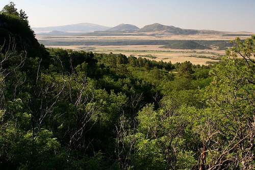
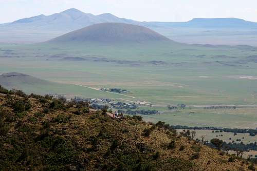
Capulin Volcano, located in northeastern New Mexico, is a long extinct cindercone volcano. At four miles around and 8182-feet in elevation, it is one of the most well preserved cindercone volcanoes in the world. It is the site of a national monument that was created in 1916, and includes a visitor center, road to the crater rim, and several designated hiking trails. Some of the trails are paved, and some have interpretive placards. The surrounding area includes many other volcanic features, so the drive there can be quite interesting and scenic.
Getting There
Capulin Volcano National Monument is located 33 miles east of I-25 near Raton, NM. It is accessed via U.S. Highway 64/87. The park entrance is on NM Highway 325, three miles north of the town of Capulin. It may also be reached from the southeast via U.S. Highway 87 through Clayton, NM, or from the east via the very scenic Dry Cimarron Scenic By Way (see map). This latter route provides access to Black Mesa Nature Preserve, the location of the Oklahoma state high point.
Red Tape
Capulin Volcano National Monument charges a fee for a seven-day pass (Visit here for current fees: https://www.nps.gov/cavo/planyourvisit/fees.htm). There are a few days a year when the fee is waived. Educational groups may also be able to secure a fee waiver. Those arriving in large vehicles (26 feet in length or 8 feet in width) will require an escort to drive on the Volcano Road to near the top of the mountain. Arrangements should be made in advance for large vehicles. Trailers and towed vehicles are prohibited. There is parking at the bottom where one may leave anything being towed.
Most days the park is staffed from 8:00 a.m. to 4:00 p.m. Driving the two mile road to the volcano rim is only allowed when the park is staffed. During other hours visitors may hike or bike the road to the rim. If the road is open to vehicles, then hiking or biking along it is not allowed.
Pets and bicycles are not allowed on any hiking trails.
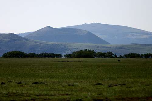 View from Johnson Mesa.
Camping and Lodging
There is no camping at the park. Raton offers both camping and hotels. Sugarite Canyon State Park is near by and offers primitive and RV campsites year round.
Hiking
The monument offers nearly five miles of hiking trails. These include a one mile trail around the crater rim, as well as a short spur into the center of the crater. Other trails around the base offer opportunities to explore the other features of this fascinating landscape.
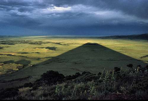 Capulin's shadow as seen from the Crater Rim Trail. Image by Slowbutsteady.
Crater Rim Trail: A paved, one-mile loop around the top of the volcano. There are exhibits along the trail that explain the features of the Raton-Clayton Volcanic Field.
 Crater Rim Trail as seen from the southwest side.
Crater Vent Trail: A 0.2 mile (one-way) trail leading to the crater bottom. It is paved and has an elevation change of 100 feet.
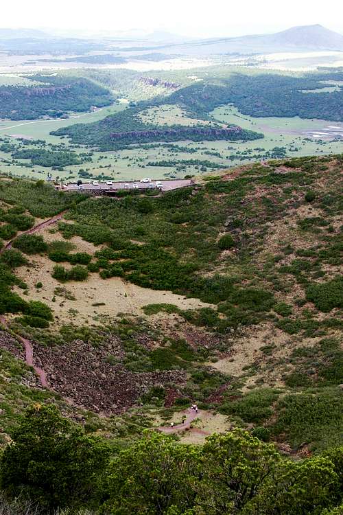 Crater Vent Trail.
Lava Flow Trail: A one mile loop at the base of the volcano that crosses one of the volcano's lava flows.
Nature Trail: Adjacent to the visitor center, this figure eight sidewalk trail is handicap accessible. Interpretive signs along the way describe the flora, fauna and geology of the region.
Boca Trail: An unimproved, two mile loop through the boca area at the base of the volcano from which the lava flows originated. The trail provides close up views of numerous geologic features.
Contact Info
You may contact the park at:
Capulin Volcano National Monument
P.O. Box 40
Des Moines, NM 88418
Visitor Information Phone Number
(575) 278-2201
Fax Number
575-278-2211
External Links
The park website is located at http://home.nps.gov/cavo/index.htm.
Wikipedia article on Capulin Volcano National Monument is located at http://en.wikipedia.org/wiki/Capulin_Volcano_National_Monument.
Libre Map Project USGS Folsom Quad Topo (includes Capulin Mountain).
Scott - Jan 24, 2024 11:05 pm - Voted 10/10
FeeFee is now $25
Mark Doiron - Jan 25, 2024 4:52 am - Voted 10/10
Re: FeeThanks, Scott. I'll fix later today when I get home. Might be best to put link to webpage listing fees.
Mark Doiron - Jan 25, 2024 7:32 am - Voted 10/10
Re: FeeIt's fixed with just the link (which now says it's $20). Thanks for the correction!