
-
 11075 Hits
-
 85.36% Score
-
 20 Votes
|
|
Mountain/Rock |
|---|---|
|
|
46.84900°N / 12.42150°E |
|
|
9681 ft / 2951 m |
|
|
Overview
Geographical Classification: Eastern Alps > Hohe Tauern > Villgraten Group > Hochgrabe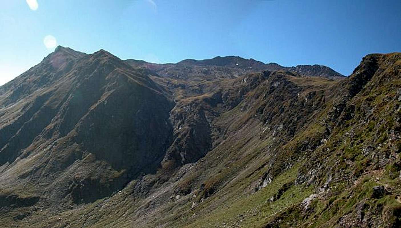
OK, the attractiveness of this mountain is just a bit below the highest rank, I guess
This is a comment I received on one of my mountain pages recently and I had to agree that this was right. But what is it, which makes a mountain attractive?
I must concede that the summit, I'm writing about now, almost falls into the same category. Hochgrabe is a mountain in the south of the Villgraten Group of the Hohe Tauern Range. There are two moderately difficult ascent trails the challenges of which are elevation gain and length rather than exposure or steepness. If you wanted to find climbing sections on it you would have to search a long time.
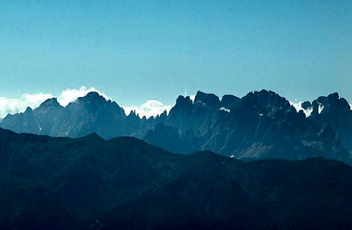
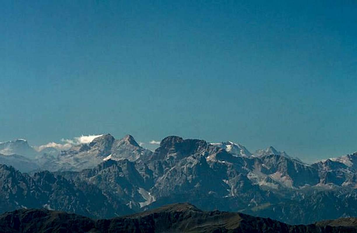
Still Hochgrabe is one of a handful of mountains in the Villgraten Group which top 2900m but just don't reach 3000m.In fact it is the southernmost one standing solitarily north of the Pustertal Valley. And this is what is definitely unique to the mountain: a gorgeous 360° view of all mountains in a circle with 150 km diameter. The whole Dolomites can be seen to the south-west - and this certainly is a large mountain group. To the south-east it is the 140km Carnic Alps Main Ridge and the northern 180° show the whole Hohe Tauern Range.
A mountain to see from - not one to be seen. One of the ascent trails - the northern one leads across Schrentebachboden. A German name if there ever was one. But in contrast to its ugly pronunciation this is one of the most beautiful high valleys I have seen. Of course it helped that the weather was perfect but here in this shallow cirque a lot of creeks meet to meander towards a small waterfall which tosses into the Winkeltal Valley. Idyllic could be the correct word.
 |  |  |  |  |
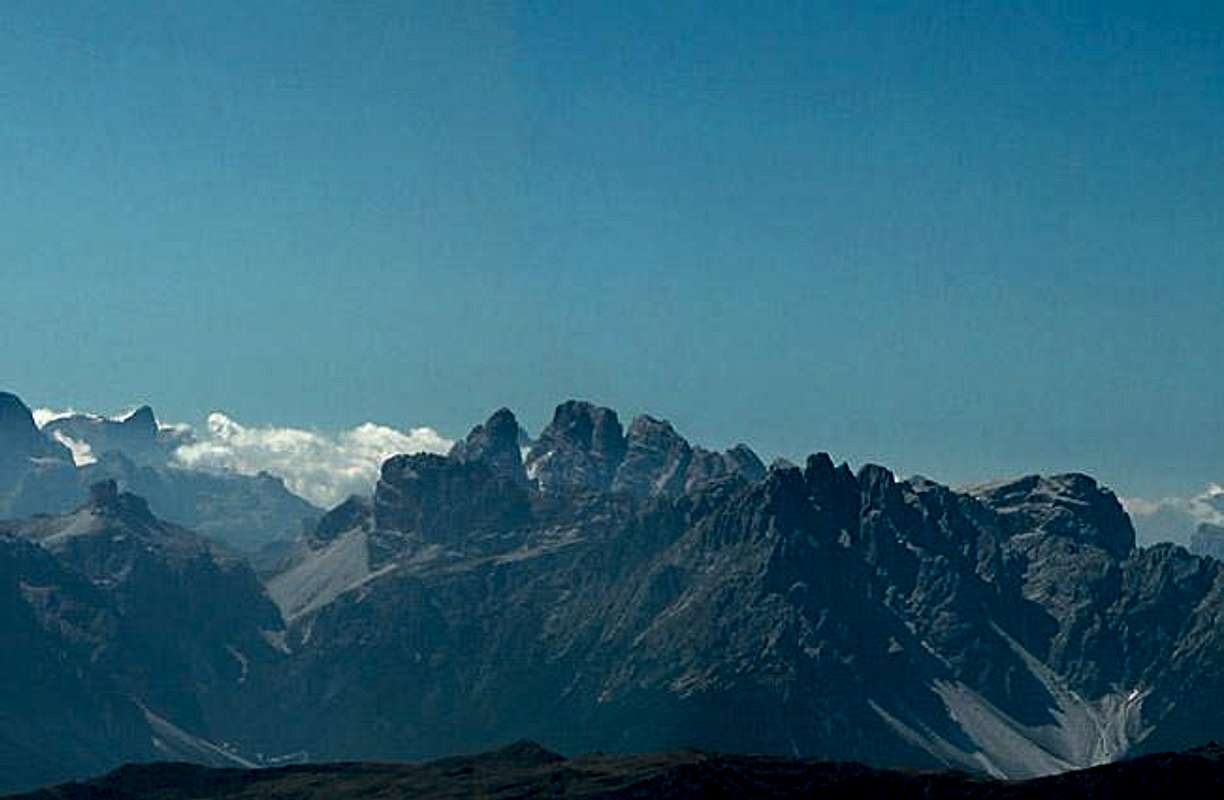
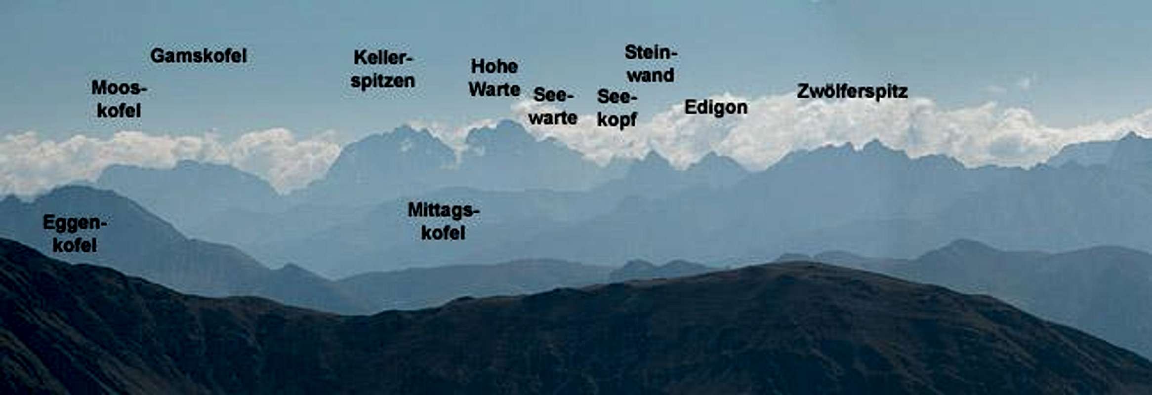
The Dolomites Panorama
Croda da CampoCima BagniCampanili PopèraCima PopèraMonte GiralbaPala di PopèraCroda Rossa di SestoCima UndiciCroda dei ToniCima UnaAntelaoMonte PaternoCima GrandeLastron dei ScarperiPunta dei Tre ScarperiSorapisPelmoTorre dei ScarperiCroda dei RondoiPiz PopenaMonte CristalloRocca dei BaranciCima Piatta AltaCivettaTofana di MezzoTofana di DentroMonti SpeciePicco di VallandroCroda RossaCime di SestoMarmoladaGran VernelPiccola Croda RossaCunturinesLa VarellaPiz BoèCr. del BeccoC. PiscaduC. NoveC. DieciSassolungoS. CiampacP. PuezDantersassLe OdleC. Colli AltiM. MuroP. Tre DitaSass de PutiaM. RovinaPlan de CoronesPloseOrtles/Cevedale Group
Croda da CampoCima BagniCampanili PopèraCima PopèraMonte GiralbaNeunerSextener RotwandElferZwölferEinserAntelaoPaternkofelGroße ZinneSchusterplatteDreischusterspitzeSorapisPelmoSchwabenalpenkopfSchwalbenkofelPiz PopenaMonte CristalloHaunoldHochebenkofelCivettaTofana di MezzoTofana di DentroStrudelköpfeDürrensteinHohe GaisslGsellknotenMarmoladaGran VernelKleine GaisslCunturinesLa VarellaPiz BoèSeekofelC. PiscaduNeunerZehnerLangkofelS. CiampacPuezspitzenZwischenkofelGeislergruppeHochalpenkopfMaurerkopfDreifingerspitzePeitlerkofelAferer GeisselnKronplatzPloseOrtler/Cevedale Group
 | 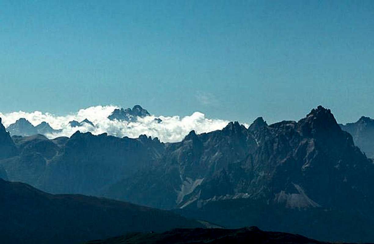 |  |  | 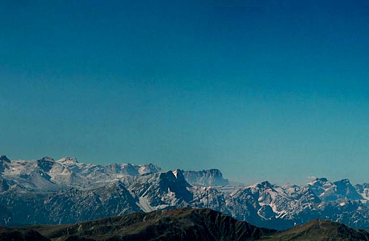 |  |
The Carnic Alps Panorama
 |  |  |
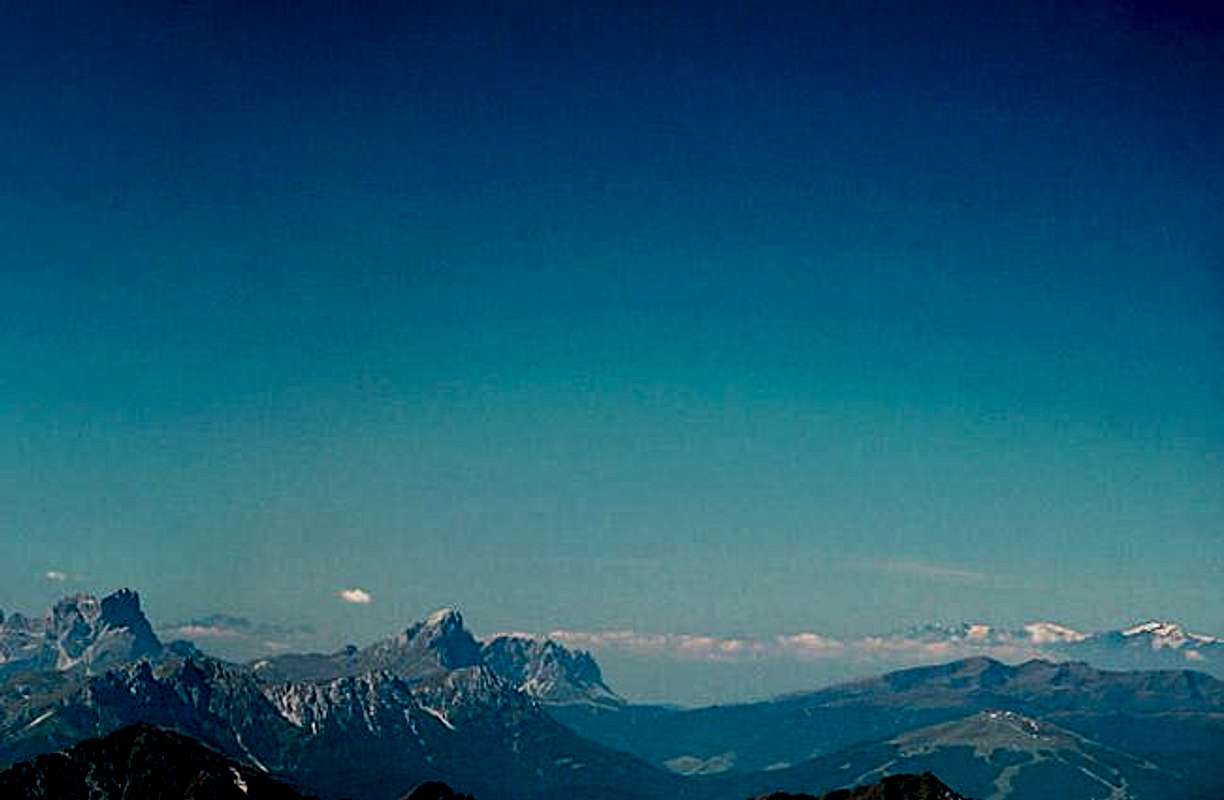
The Hohe Tauern Panorama
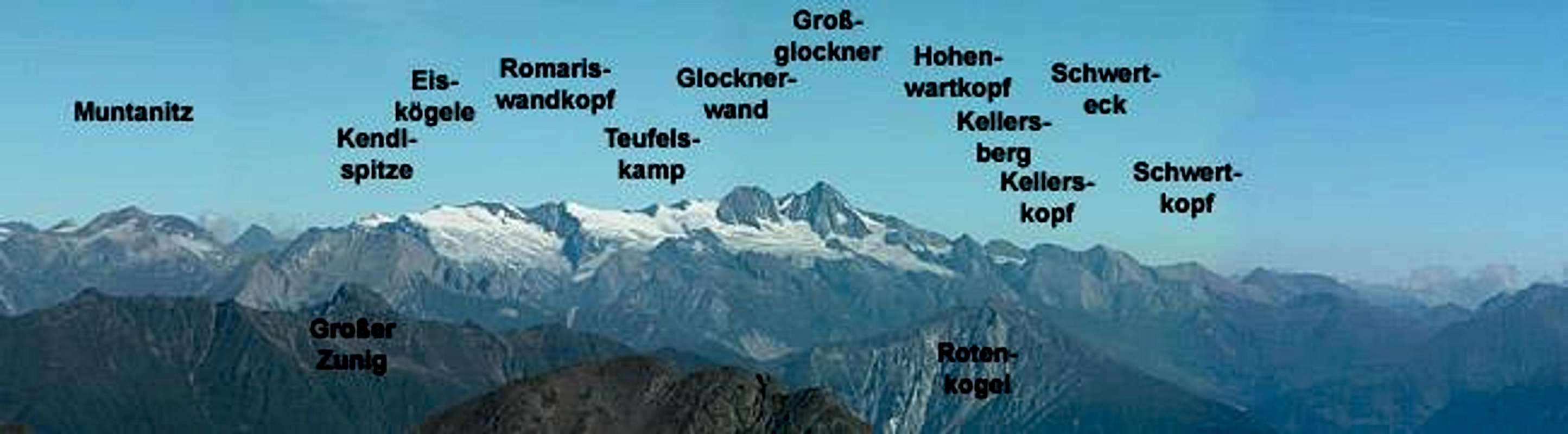
Unfortunately I goofed here. Forgot to take a shot so a part is missing. Thanks to Mathias Zehring for the annotations!!!
 |  |  |  |  |  |
Getting There
The best starting points for an ascent of Hochgrabe are Innervillgraten to the south and Volkzeiner Hütte to the north of the mountain. Both trailheads are located to the north of the Pustertal Valley.From the West (Brenner Motorway A22)
Leave the Brenner Motorway near Brixen / Bressanone and follow SS49 to the east through Pustertal / Val Pusteria. To the east of Innichen / San Candido you cross the Austrian-Italian border and follow the road (now B100) to Sillian. Here turn north in towards Außervillgraten. for the southern trailhead go on to Innervillgraten, where the ascent starts. For the northern trailhead turn right in Außervillgraten into Winkeltal Valley which you drive through to its end at Volkzeiner Hütte
From the North
There are two possible roads:
- From Kitzbühel over B108 through the Felbertauern Tunnel to Lienz, then southeast to Oberdrauburg (B110), where you turn on to B100 west into Pustertal. Go through the city of Lienz until you get to Sillian, there turn north to Außervillgraten. Follow the directions as given above depending on your preferred trailhead.
- From Salzburg along motorway A10 to Spittal. Turn west on B100 to Oberdrauburg, Lienz and Sillian.
 |  |  |  |
Red Tape
There's no red tape here. |  |
When To Climb
The mountain can be climbed all year round. The hiking season is between late May and late September but winter ascents with touring skis are also possible on both routes. I doubt, however that the northern trailhead can be reached by car in winter making this route very lengthy.Accommodation
For accommodation follow one of the following links:- Hochpustertal official site
- Anras official site
- Sillian official site (click on the "Live Bilder" link for livecams and weather info).
- Außervillgraten official site
- Hochpustertal lodging (tiscover.at)
The nearest hut is Volkzeiner Hut (formerly Silianer Hut) at the northern trailhead. It also serves as trailhead for the ascent of Großes Degenhorn. The hut is privately owned.
Weather Conditions
In general the weather here is better than in the rest of Austria because the Villgraten Group is located to the south of the Alpine Main Ridge. Look at the following websites for weather information.- Tyrol weather
- Sillian official site (click on the "Live Bilder" link for livecams and weather info).
- Lienz City official site / weather
Maps 'n' Books
MapsI have been using a map by Kompass Verlag, which is very good for the hiking trails though it does not show ALL the relevant summits of the area.
- Lienzer Dolomiten / Lesachtal
1:50000
Kompass Map WK47
Kompass Verlag
ISBN: 3-85491-053-3
Books
You’ll probably not be able to find anything on the Villgraten Group in a language other than German. The book I used is
- Hiking and Trekking
Osttirol Süd
W. Mair
Rother Verlag
ISBN: 3-7633-4132-3
Good descriptions with maps covering: Defregger Berge, Villgrater Berge, Carnic Alps, Lienz Dolomites
Mathias Zehring - Nov 11, 2004 5:46 pm - Voted 10/10
Untitled Commentwhen I was there on a March 7th we could drive until Niederbruggeralm pasture (1597 m). From there it was 75 min to Volkzeiner hut. So it was a long but possible daytrip