
-
 9785 Hits
-
 84.82% Score
-
 19 Votes
|
|
Mountain/Rock |
|---|---|
|
|
46.76000°N / 12.79000°E |
|
|
8572 ft / 2613 m |
|
|
Overview
Geographical Classification: Eastern Alps > Gailtal Alps > Lienz Dolomites > Teplitzer Spitze
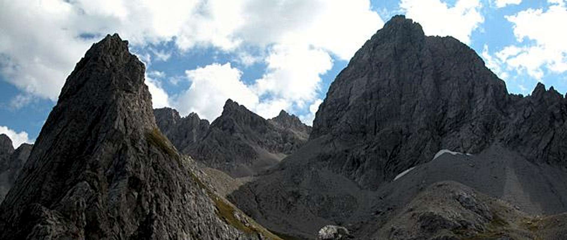
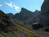
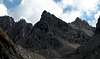
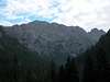
Teplitzer Spitze might be considered one of the minor summits of the Lienz Dolomites. When seen from afar, especially from the south it just appears to be a little peak dwarfed by neighbouring Simonskopf and Seekofel. When looking at it from the north, however you will see a beautiful almost vertical north face which drops down to Laserz Lake at 2261m and thus offers 400m of climbing possibilities. The situation is not unlike the one at Kleine Gamswiesenspitze, where you also find an easy class I normal ascent, with an important climbing route. There are two routes through the north face (see following section) which are among the best known and most climbed ones of the Lienz Dolomites. The proximity to Karlsbader Hütte helps, of course. You need 30min from the hut to reach the entry points.
The normal route(s), which start from the south, is relatively easy to get at. There are two steep trails leading to Ödkarscharte Pass, where the final ascent starts (see routes in the sidebar). Both are covered with scree and I would consider both as rather dangerous. Ödkarscharte already is located at 2596m so the final ascent, which is a UIAA grad I exposed scramble covers only 20m of elevation gain (Literature has it that the scramble is for 50m of elevation gain. Actually the pass is located some 30 - 40m lower than the highest point, which you need to traverse if you want to connect the two ascent trails to a loop and I suspect that my map considers this highpoint to be the pass - therefore the mark of 2596m).
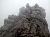
When we climbed to Teplitzer Spitze along the ascent trails (one up, one down) all the Lienz Dolomites were covered in fog so no feelings of acrophobia could develop. Unfortunately nothing could be seen. We had hoped to top the clouds on Teplitzer Spitze but only got som 15min of pale sunshine while we were having our lunch up there. Needless to say that we met nobody up there - except for a young tomcat who had followed us all the way from Karlsbader Hütte. I hope he found his return route...
 |  |  |  |  |
Route Overview Teplitzer Spitze
When preparing this page I was astonished that my Google research came up with several pages about the climbing routes on Teplitzer Spitze. In the dismal weather in which I climbed the normal route I couldn't have anticipated that there might have been different routes. SP-member kletterwebbi has published a (German) report on his home page so I'm hoping that we might get some route info and more pictures in the future.
The best overview about the two routes is given on a page by the German Alpine Club, section Karlsbad. The short sketches given here are compiled from their page.
Routes
- Normal Route
Rated: UIAA I
Elevation Gain: 400m (from Karlsbader Hütte), 700m along the Kerschbaumer Törl Route
Time: 1h 30min
- North Face Eller
Rated: UIAA III+
Elevation Gain: 250m
Times: 30min to the entry point, 2h 30min climb
- Haspingerweg
Rated: UIAA IV-
Elevation Gain: 300m
Times: 30min to the entry point, 1h 30min climb

Getting There
There are two trailheads to the north of the Lienz Dolomites, Lienzer Dolomitenhütte and Klammbrückl. Both are quite near to each other but separated by an elevation difference of 500m The higher and thus easier starting point is Lienzer Dolomitenhütte.
From the West (Brenner Motorway A22)
Leave the Brenner Motorway near Brixen / Bressanone and follow SS49 to the east through Pustertal / Val Pusteria. To the east of Innichen / San Candido you cross the Austrian - Italian border and follow the road (now B100) to Burgfrieden. For Klammbrückl turn right (east) here onto a side road, which you follow to its end at the Klammbrückl parking lot. For Lienz and the trailhead at Lienzer Dolomiten Hütte remain on B100 until you reach the city. Here turn right, direction Tristach and cross the Drau River to its southern side. From Tristach the "Dolomitenstrasse" the road into the Lienz Dolomites, is marked by signposts. Follow this road (toll!!) until you reach Lienzer Dolomitenhütte.
From the North
There are two possible roads:
- From Kitzbühel over B108 through the Felbertauern Tunnel to Lienz, then southwest to Burgfrieden and left onto the side road to Klammbrückl (Klammbrückl trailhead) or south to Tristach and "Dolomitenstrasse" as described above (Lienz trailhead)
- From Salzburg along motorway A10 to Spittal. Turn west on B100 to Görtschach, where you turn south towards Lavant and on to Tristach (Lienz trailhead) or go on to Burgfrieden and the sideroad (see above) (Klammbrückl trailhead).
From the South (Udine)
Take Motorway A23 to the exit Camia Tolmezzo. Follow SS52 north to Tolmezzo where you turn onto SS52 bis. This leads to Plöckenpass, where it crosses the Austrian-Italian border. In Austria the road turns into B100 and at Oberdrauburg turn west (still B100) to Görtschach etc.
 |  |  |  |
Red Tape
As stated elsewhere there are no restrictions in the Lienz Dolomites. You have to pay a toll of 7€ when using "Dolomitenstrasse", the road to Dolomitenhütte. Also, you find signs asking you to keep dogs on leash because of grazing sheep.
 |  |  |
When To Climb
Climbing and hiking season in the Lienz Dolomites is May through September. The ascent trails will be very tricky in winter conditions with snow above an unsure layer of scree. Ski tours will be difficult as well due to the sheer steepness of some of the passages.
Accommodation
Free camping in the group is discouraged in the Lienz Dolomites. There are quite a number of refuges all over the Lienz Dolomites (see the Mountain Huts and Refuges Section on the Lienz Dolomites Page) so it should be not neccesary to pitch a tent. Karlsbaser Hütte is only half an hour from the entry points to the climbs and 1h 30min away from Ödkarscharte. If you are looking for hotel rooms or apartments follow one of the links below
Weather Conditions
The Lienz Dolomites are located directly on the border between the two Austrian states Carinthia and East Tyrol Teplitzer Spitze belongs to East Tyrol), so for a weather report look at one of the pages below:
Maps 'n' Books
Maps
I have been using a map by Kompass Verlag, which is very good for the hiking trails though it does not show ALL the relevant summits of the area.
- Lienzer Dolomiten / Lesachtal
1:50000
Kompass Map WK47
Kompass Verlag
ISBN: 3-85491-053-3
Books
You’ll probably not be able to find anything on the Lienz Dolomites in a language other than German. The books I used are (none of them deal with Kleine Gamswiesenspitze):
Hiking and Trekking
- Osttirol Süd
W. Mair
Rother Verlag
ISBN: 3-7633-4132-3 - German
ISBN: 3-7633-4307-5 - Italian
Good descriptions with maps covering: Defregger Berge, Villgrater Berge, Carnic Alps, Lienz Dolomites
- Gailtal – Lesachtal – Karnischer Höhenweg
Kompass Wanderbuch 982
Kompass Verlag
ISBN: 3-85491-500-4
Good Descriptions with maps and elevation profiles covering: Carnic Alps, Southern Lienz Dolomites, Gailtal Alps
External Links
- Austrian Map online
Online digital maps of Austria (OEK 50, OEK 200 and OEK 500) by the BEV (Bundesamt für Eich- und Vermessungswesen) - in German