

-
 11092 Hits
-
 86.85% Score
-
 23 Votes
|
|
Mountain/Rock |
|---|---|
|
|
46.86528°N / 12.17880°E |
|
|
Hiking, Mountaineering, Scrambling, Skiing |
|
|
Spring, Summer, Fall |
|
|
9245 ft / 2818 m |
|
|
Overview
Geographical Classification: Eastern Alps > Hohe Tauern > Villgraten Group > Rot Wand
Antholzer Rotwand / Croda Rossa di Anterselva 2818 m
This mountain has two names: Croda Rossa di Anterselva, the italian name, and Rotwand (meaning Red Wall) the original tyrolese place-name, as all the mountains in the region South Tyrol/Bolzano Alto Adige. Not to be confused with other mountains called Croda Rossa, such as the Croda Rossa / Rotwand in the Sesto Valley. For this reason the most correct name is Croda Rossa di Anterselva/Antholzer Rotwand
.
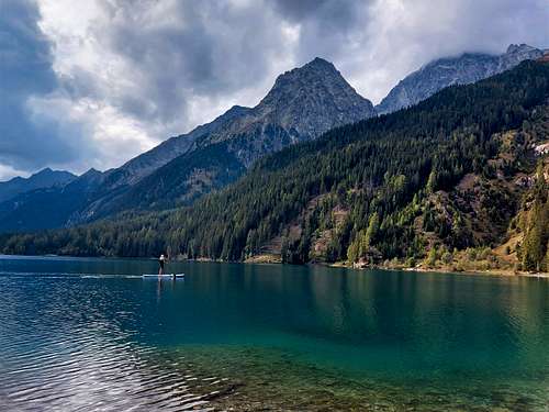
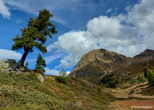
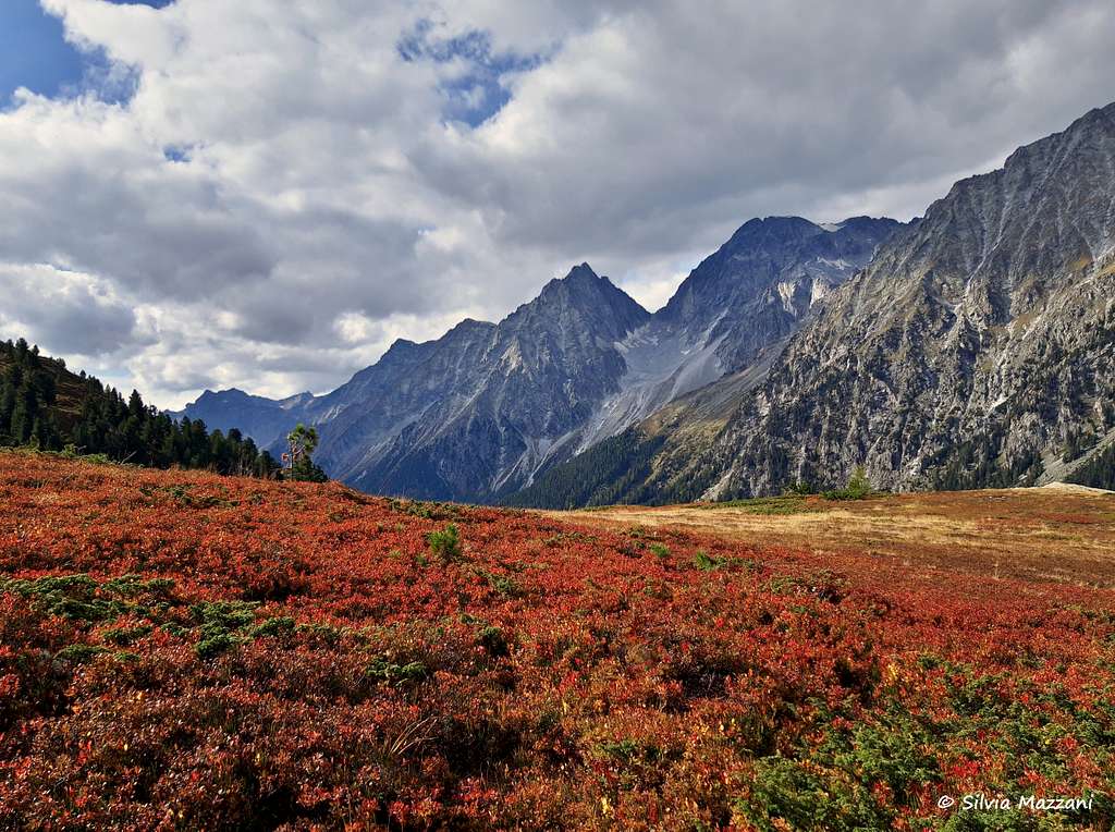
The origin of the name Croda Rossa / Rotwand ("rosso" in Italian and "rot" in German mean "red") refers to the particular reddish color of the rocks. It is an attractive rocky pyramid 2818 m high, located between the Hexenspitze to the SE and the Pietra Forata/Hollensteinspitze to the SW in the group of Monti di Casìes/Gsieser Berge, which forms the Southernmost part of the Alpi Pusteresi. In the Tyrolean partition, which is very different from the Italian one, the mountain instread belongs to the North-Westernmost end of the Villgraten Group in Hohe Tauern. It is an excellent and spectacular viewpoint. It is located in one of the long Southern side ridges and fittingly is the highest summit of its ridge. It towers above Lake Antholz/Lago di Anterselva but is dwarfed by its direct neighbour across the valley, Hochgal / Collalto.
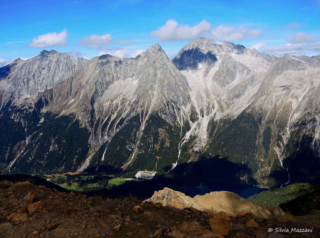
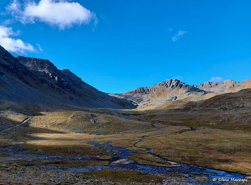
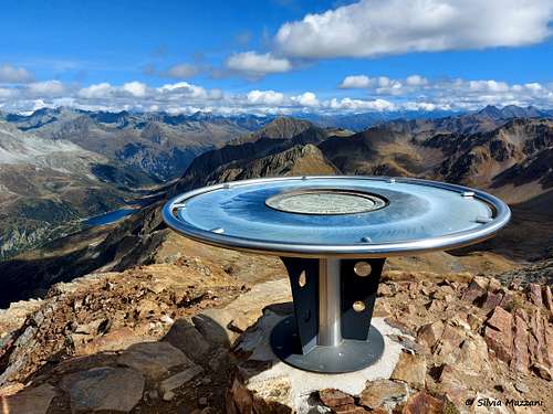
Croda Rossa di Anterselva is very popular among hikers, though three of the four ascent routes to its summit are far from easy. The shortest approach is from Stallersattel, a road pass between the Italian Antholzer Tal / Valle di Anterselva and the Austrian Defereggental. The pass is located at an elevation of 2052 m which makes the ascent a moderate day tour. This itinerary is rather easy, it presents only a short stretch of scrambling on the easy rocks of the short final ridge. The summit panorama is very broad. In addition to the cross, it has been placed a magnificent orientation table that allows to identify all the surrounding peaks at 360 degrees. Like all of the mountains in this area, Croda Rossa di Anterselva is on helluva lookout summit. Besides the direct close-up view of Hochgall you can see the whole Dolomite Panorama stretching from the Sexten / Sesto Dolomites in the East to Peitlerkofel / Sass da Putia in the West. To the North you have a good view on Großglockner and the surrounding Glockner Group.
The three other routes start at the valley floors of Valle di Anterselva (1400 - 1630m) and Gsieser Tal/Valle di Casies (1600m) and require some endurance. Moreover they either cross long and steep scree fields or run along the exposed Southern side ridge (Knebelstein - Hellensteinspitze - Rote Wand).
Like the majority of the mountains in this area, Rote Wand is a highly panoramic summit. Besides the direct close-up view of Hochgall you can see the whole Dolomite Panorama stretching from the Sexten / Sesto Dolomites to the East to Peitlerkofel / Sass da Putia to the West. To the North you have a good view on Großglockner and the surrounding Glockner Group.
Getting There
Croda Rossa di Anterselva is most easily reached from the South, from Pustertal/Val Pusteria. The Antholz/Anterselva and Gsies/Casies Valleys all run North from Pustertal and lead to the mountain which is located at the end of and between both valleys. The Derfereggen Valley in the North also leads to Passo Stalle/Stallersattel and thus into the Antholz /Anterselva Valley and thus qualifies as itinerary for the three Antholz trailheads.
Western Approach
Take the Brenner / Brennero Motorway A22 from Innsbruck (north) or Verona (South). Exit Bressanone/Brixen and turn onto the SS49 into Pustertal / Val Pusteria/Pustertal road. Along the state road that runs through the valley, between the towns of Valdaora and Monguelfo, there is first a well-indicated junction to Anterselva and Passo Stalle, then near Monguelfo a second junction to Valle di Casies. Here you leave the Val Pusteria state road and turn to the preferred valley.
Northern Approach
Take B161, Felbertauern Road, from Kitzbühel south. After passing Felbertauern Tunnel you reach Matrei, where you can turn into Derfereggental Valley. If you go on, you'll reach Lienz, where you can turn west into Pustertal Valley.
Eastern Approach
Take Motorway A2 from Klagenfurt to Villach. There turn onto A10 north which leads you to Spittal. A little north of Spittal turn west onto B100, which follows the Drau River Valley to Lienz and on into Pustertal Valley. For Derfereggen Valley turn north at Lienz onto B161, which you leave at Huben.
Southern Approach
Take motorway A27 from Venezia north to Belluno. At the end of the motorway take SS51 north to Cortina d'Ampezzo an on to Toblach/Dobbiaco. Here you are already in Pustertal Valley. Go west and turn north at Welsberg / Monguelfo or Olang / Valdaora.
Routes Overview
|
There are four routes up onto Rote Wand, none of which is really difficult. Three routes will include serious scrambling and large elevation differences, while the route from Stallersattel is shorter and easy.
|
To zoom-in and zoom-out you can also use the small mini-map in the bottom-right corner. |
 |
 |
 |
 |
 |
 |
 |
 |
Red Tape
No red tape can be found anywhere in this mountain group. Anyhow, if you want to reach Passo Stalle/Stallersattel from the South (Anterselva), be aware that this road is operated as a one way road for either direction twice an hour. In fact the last 4 km of the road are very narrow and transit is one-way for 15 minutes every hour. A traffic light system consisting of two red/green traffic lights (one upstream, at the border, and one downstream, near the lake) regulates access to this stretch of road. Precisely, in the first quarter of every hour (from 00 to 15 minutes) access to the south is allowed (from the Austrian border to the Italian valley floor), while in the third quarter (from 30 to 45 minutes) access to the north is allowed ( from the Italian valley floor to the Austrian border). Access to the road is not allowed during the intervals between the two transits, to allow traffic to clear (crossing the one-way alternating section takes about 10 minutes).
The pass is open from 6.00 to 22.15; in particular, it is open from 6.00 to 21.15 in the south direction (from Austria to Italy) and from 6.30 to 21.45 in the north direction (from Italy to Austria). During the winter the pass is always closed.
When To Climb
Rotwand is an all year climbing destination. The route from Stallersattel is a popular ski tour in winter and spring and only the summit will be tricky in winter conditions. The hiking season is from June through late September with October hikes possible depending on the weather.
Accommodation
The Anterselva valley with its hamlets of Anterselva di Sotto, Anterselva di Mezzo and Anterselva di Sopra offers various possibilities of accomodation -
For other accommodation follow one of the following links:
Meteo
Guidebooks and maps
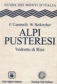
"Alpi Pusteresi - Vedrette di Ries" - F. Cammelli, W. Beikircher - Collana Guide dei Monti d'Italia CAI/TCI
Maps
- Defereggental-Lasörlinggruppe 1:50000 Kompass Map WK45 Kompass Verlag ISBN: 3-85491-051-7
- - Taufers - Ahrntal / Tures - Valle Aurina 1:50000 Kompass Map WK82 Kompass Verlag ISBN: 3-87051-091-9
Books
An excellent hiking book is (in German)
- Pustertal, Tauferer Tal Ahrntal Kompass Wanderbuch 955 Kompass Verlag ISBN: 3-87051-408-6