
-
 19256 Hits
-
 85.36% Score
-
 20 Votes
|
|
Mountain/Rock |
|---|---|
|
|
38.81400°N / 104.9712°W |
|
|
El Paso |
|
|
Hiking, Mountaineering, Trad Climbing, Toprope, Bouldering, Scrambling |
|
|
Spring, Summer, Fall, Winter |
|
|
10820 ft / 3298 m |
|
|
Overview
"Tuckaway Mountain" is seldom visited, although it is visible from many summits in the Colorado Springs region. If you have ever been to the summit of Pikes Peak, Almagre Mountain, Mt. Rosa, Mt. Arthur, Mt. Garfield, or Cameron Cone, you have seen Tuckaway's long and flat summit.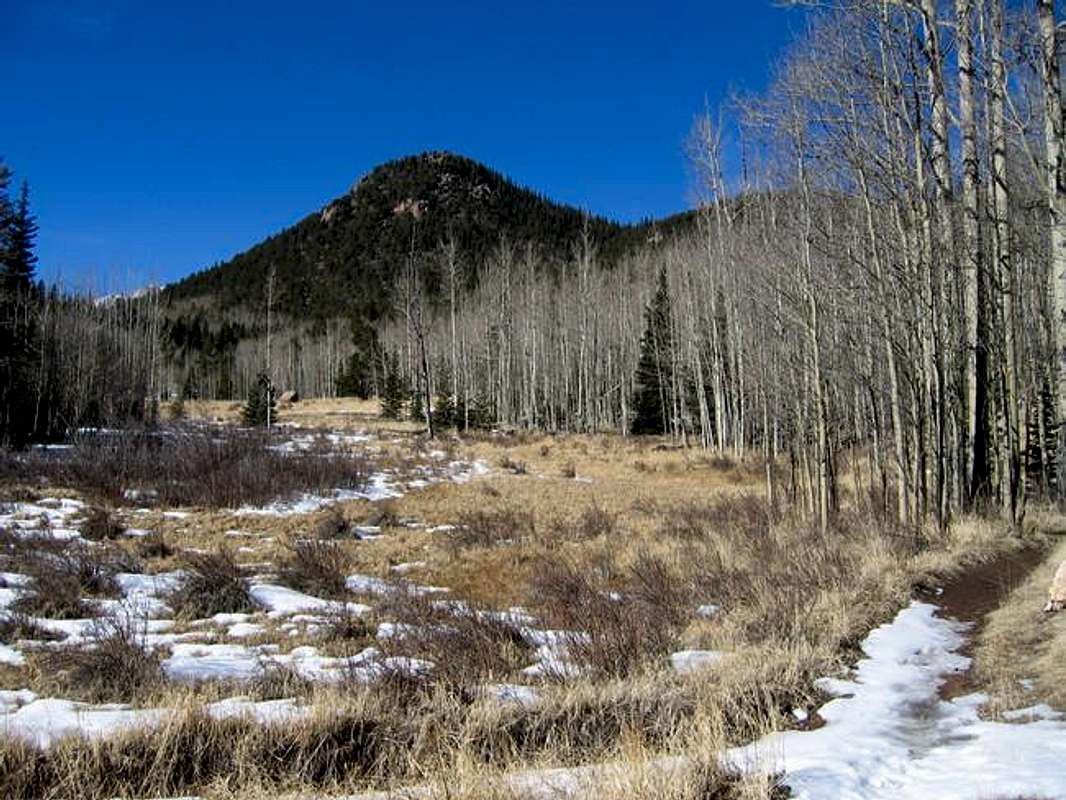
"Tuckaway Mountain" from Jones Park Trail
There are a few factors that make Tuckaway's summit a place where you will find solitude. It is surrounded by other, higher and more well-known peaks. Unlike its neighbors, you can't even see Tuckaway from most of Colorado Springs. And although a well-used trail passes the base of Tuckaway, it is not a short hike, and there is no trail or established route to the summit.
The true summit of "Tuckaway Mountain" is located within the west end of the summit contour, west of where the register placed my Mike Garratt lies. The summit boulder is about 10 feet high and requires 5.3 climbing to reach the top. The relative height of the summit boulder compared to the eastern summit area was determined by sight level, hand level and GPS.
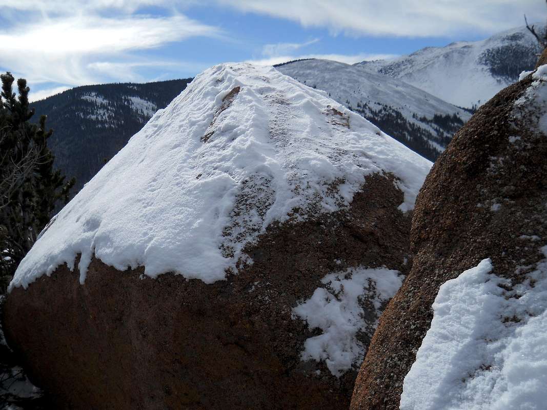
"Tuckaway Mountain" 5.3 Summit Boulder
Getting There
Tuckaway can be approached from a few trailheads, I will describe two of them here.Option 1: Seven Bridges (from Gold Camp / High Drive.) Trailhead elevation: About 7500'. From US 24 in Colorado Springs, go southwest on 26th Street. Follow this til it dead ends at High Drive, and turn left up Gold Camp Road. Gold Camp turns into a 2WD dirt road and is a fun drive. Take this road to a large parking lot at High Drive. If you reach pavement on Gold Camp Road, you went too far.
Option 2: Trail 701. Trailhead elevation: About 10,200'. From the Broadmoor area, find Old Stage Road and head up into the mountains. This is a 2WD dirt road and eventually merges into Gold Camp Road. This is a beautiful drive, but it is about an hour drive to the trailhead from Colorado Springs. Stay on Gold Camp Road until you find Forest Road 379. If you have 4WD you can drive up 379, otherwise you'll have to hike. Park at the Trail 701 Trailhead.
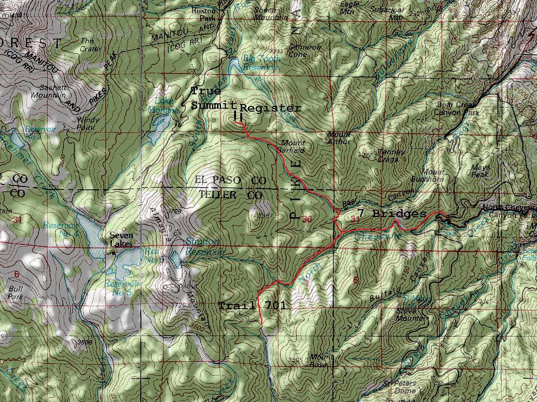
"Tuckaway Mountain" southeast slopes route from Trail 701 and the Seven Bridges Trail, Colorado
Red Tape
"Tuckaway Mountain" is in the Pike National Forest. No permits or fees are required to park, hike, or climb in the area.When To Climb
"Tuckaway Mountain" can be climbed year round.Camping
There are plenty of good areas to camp in the area, along Bear Creek, Cheyenne Creek, or just about anywhere in the forest. There are no campgrounds at the trailheads, however.Mountain Conditions
Contact the Pikes Peak Ranger District for current conditions.Pikes Peak Ranger District
(719) 636-1602
Here's a site for Teller County/Rampart Range above 7500 Ft/Pikes Peak Between 7500 And 11000 Ft.
And here's Colorado Springs weather:
