The page was successfully edited.

-
 10145 Hits
-
 70.36% Score
-
 1 Votes
|
|
Route |
|---|---|
|
|
37.79910°N / 107.8284°W |
|
|
Hiking, Mountaineering, Scrambling, Skiing |
|
|
Spring, Summer, Fall, Winter |
|
|
A long day |
|
|
Class 3 |
|
|
Approach
The approach for this route starts at the South Mineral Creek Trailhead which is accessed from Silverton, Colorado. Take US Highway 550 north towards Red Mountain Pass from from the US 550-110 intersection. After only 2 miles, you will take the turnoff for the South Mineral Campground on the left side of the road. Follow this good quality dirt road for 3.5 miles until you arrive at the South Mineral Campground where you can park on the right side of the road. The approach hike can be shortened by taking a right off of the South Mineral Road towards Clear Lake and park at the first switchback (room for only a few cars). A very short unmarked trail goes west to intersect the Ice Lakes Trail passing right through a small waterfall which is quite exposed and may be difficult at times. This approach shaves 1.8 miles and 540 vertical feet off the round-trip distance and elevation gain. When dry, this shortcut can be accessed with tough passenger cars with decent ground clearance. Whichever starting point you choose, hike the scenic trail into Ice Lakes Basin to about 12,600 feet at Fuller Lake. There is an old mining shed here and this is where the climb begins. Although this approach is pretty short, it is a great place to spend the night as it is perhaps one of the most beautiful alpine basins in Colorado.
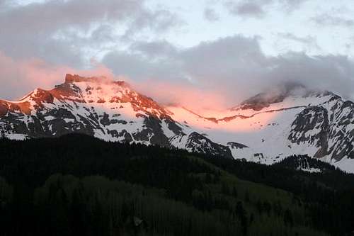 Vermilion Peak (right) and Pilot Knob | 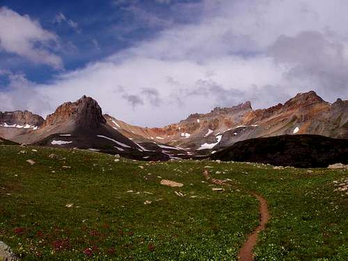 The trail into Ice Lake Basin | 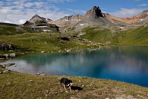 Ice Lake |
Route Description
From 12,600 feet at Fuller Lake, hike southwest towards the east face of Vermilion Peak and up the high basin above the lake. The prominent couloir in the east face is the Vermilion Dollar Couloir and you reach its base at 13,000 feet. The steep section at the base of the climb can be climbed via some class 3 scrambling to the right or straight up if the snow is solid. Climb the nice couloir for 800 feet to a notch southeast of the summit. From the notch, climb up the same loosy gully as per the standard southeast ridge route and finish the ascent on some class 2+ scrambling to the narrow and exposed summit area. It is recommended to descend the Southeast ridge. When the couloir is free of snow as it is typically by August, it's best to avoid this route as the couloir would be a bowling alley of loose rocks some of which may be in the looming, barely there killer block type!
RT Distance:
From lower trailhead at the South Mineral Campground - 10 miles
From the upper trailhead - 8.25 miles
RT Elevation Gain:
From lower trailhead at the South Mineral Campground - 4,100 feet
From the upper trailhead - 3,500 feet
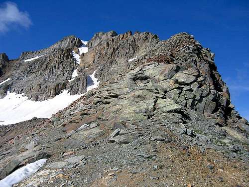 The Silver Dollar Couloir with less snow | 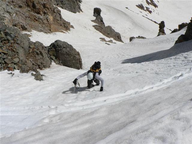 Climbing the Vermilion Dollar Couloir | Approaching the couloir |
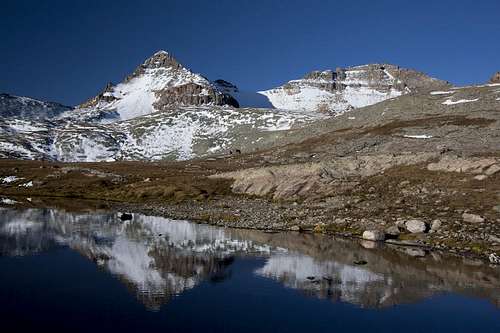
View of Fuller Peak and Vermilion from the lake next to the old cabin
Essential Gear
An ice axe, crampons and a helmet are all highly recommended due to the nature of this climb. Also have a sturdy pair of boots and waterproof clothing.
Map
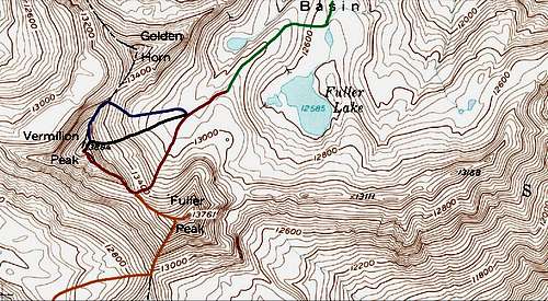
Map provided by Brian Kalet
RED: Vermilion Peak SE ridge - Class 2+
PURPLE: Vermilion Peak NE ridge - Class 2+
YELLOW: Fuller Peak NW Ridge - Class 2
BLACK: Vermilion Dollar Couloir - Class 2+ and Steep Snow
External Links
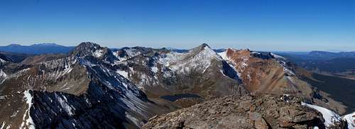
Vermilion Peak summit panorama
Great Trip Report of the Couloir
More Ice Lakes Basin Info
Silverton Chamber of Commerce
Town of Silverton
South Mineral Campground
San Juan National Forest Campgrounds