

-
 252721 Hits
-
 99.72% Score
-
 131 Votes
|
|
List |
|---|---|
|
|
Overview
From the top of North America to the top of a trailer park in suburban Delaware, this collection of 50 mountains and otherwise obscure places quite possibly ranks as America's most unique peakbagging list. Unlike most lists of mountains that fall within the natural boundaries of geologic formations, United States highpoints are both a testament to man's need to draw his own geographic boundaries and a celebration of some of the most beautiful places on the North American continent. The names Denali, Rainier, Hood, Gannett and Granite are enough to make nearly any mountaineer drool. But Ebright Azimuth? Jerimoth Hill? Britton Hill? Panorama Point? Mount Sunflower? Surely you must be kidding! But in the world of state highpointing, all of these places share equal footing. And perhaps for the thousands of Americans who pursue the hobby at least casually, the journey that is highpointing is more important than the final destinations. There may in fact be no more enjoyable way to see America. Per the Highpointers Club through Q2 2016, there are 273 recorded completers of all 50 highpoints and a total of 522 recorded completers of the lower 48 highpoints. It is a worthy goal to attempt such a feat, and a remarkable accomplishment for those who reach it. However, it is a wonderful experience just to visit as many as possible, whether it be 20, 30, 40, or all 50. It has been a long-standing tradition of the Highpointers Club to allow ascent of these high points by any means - including motor vehicles. However, the pages of Summit Post tend to focus more on hiking and mountaineering routes than the easiest way available. Drive up Mount Mitchell, North Carolina or Mount Washington, New Hampshire if you wish but a review of the 50 pages of this mountain group offers the traveler many more intriguing ways to visit the zeniths of the states. Of course, it should also be said that no matter how hard you try, you will never be able to make mountains out of some of these molehills. Move the state lines of Kansas or Nebraska a few miles to the east and Mount Sunflower and Panorama Point become utterly insignificant. In fact, of the 50 highpoints, probably only 32 of them could be considered actual mountains whether or not the trail starts at or near the summit, and another 9 of them hills, with 9 of them essential flat plateaus with no real noticeable rise beyond a gradual slope. It is the goal of this group page to simply provide an overview of the highpoints and a few words about the Highpointers Club and its history. For the main course, take a look at the individual pages, many of which are simply outstanding on every level. The contributors to this website have spent many hours of time preparing these mountain pages and the results speak for themselves.
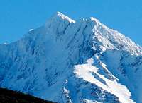
 Mount Whitney, California
West Region
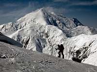
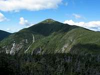
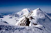
Denali, the Athabascan name meaning "The Great One." At 20,320 feet, Denali is the highest peak in North American and the focus of many climbers' goals. The standard route up the mountain is the West Buttress, and from May until July the route is a crowded series of camps from 7,800 feet until the high camp at just over 17,000 feet. Most climbers fly in from Talkeetna, a small town almost completely centered around the climbing of Denali. While on the mountain, you're likely to see climbing teams from many different nations. As one of the seven summits, Denali attracts a lot of attention from the international climbing community. Besides the exquisite beauty and grandeur of the mountain, one of the best experiences can be the camaraderie between climbing groups from the different nations. The subtlety in climbing styles, attitude toward the mountain, and usage of gear is a fascinating study.
The 14,000 foot camp on Denali is the largest on the mountain and has been described as a "beach," "tent city," and even "the parking lot of a Grateful Dead show." Over 100 tents are typically set uphere including the National Park Service. The camp's southern facing exposure along with the fact that it's located in a sheltered bowl, often make for pleasant and warm conditions. This is definitely not a typical wilderness experience, and it is not uncommon for individuals to have no intention of going further than 14,000 feet. Up to 14,000 feet, it requires nothing more than glacier travel and hard work. Conversely, the 17,000 foot camp is typically a place where you want to spend as little time as possible. After a short acclimation here, most parties attempt to summit from this camp. High winds and extreme cold can pin down parties between 17,000 and the summit for days on end. Injury and even death is common above the 14,000 footcamp and a typical day during peak season has several rescue operations or body recoveries. The "thwock" of the NPS rescue helicopter can be a common sound from 14-17,000 feet. The sheer number and varying ability of climbers contributes to this occurrence.
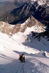
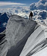 Denali Summit Ridge
The most important elements for success on Denali include preparation, teamwork, and conditioning. For the typical highpointer, the biggest technical challenges will be the rigging of sleds, the use of cramp-ons and ice-axe, the proficiency in a rope rescue system, and use of a mechanical ascender. For more experienced parties the biggest challenges will be the weather conditions, the effects of altitude on the body, and cooperation amongst teammates. Those seeking a more challenging, yet far less crowded route up the mountain may wish to try the Muldrow Glacier, the West Rib, the Cassin Ridge, or the South Buttress.
Click here for a detailed, day by day trip report.
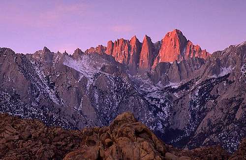
 Whitney Sunrise
Considered by many to be over crowded, easy, and over managed, Mount Whitney is a spectacular peak and the highest point in the lower 48 states at 14,505'. The most popular route up the high point of California is the Whitney Trail with its 99 switchbacks and Class 1 rating. It is not uncommon to see trail runners and streams of hikers on the route. The 22-mile round trip trail is typically done in a day and includes some dramatic views once you crest. At this point, you are officially in Sequoia National Park and the views of the backcountry are exceptional.
The Mountaineer's Route was first climbed by the legendary John Muir in 1873 and along with the East Face provide excellent alternatives to the Whitney Trail. Another great alternative approach would be a multi-day trip through Sequoia National Park starting from the west side of the park. Because of the high levels of usage, overnight and day hiking quotas are in effect from May to November.
One of the great aspects of Mt. Whitney for climbers is its year-round access. The peak sits relatively south in the Sierras and there are many sunny winter days that give great off season opportunities. Still, heavy snow and cold temperatures occur during the winter, but compared to some areas, it's a relatively mild region. Winter ascents more often require overnight stays.
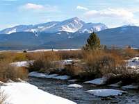 Elbert from Near Leadville
Despite being the 2nd highest peak in the lower 48 states, Mt. Elbert isn't the discussion piece that it could be given its great beauty, easy access, and importance to Highpointers and Colorado 14ers. The peak does see a good amount of ascents, and its 9.2-plus mile roundtrip hike to the summit is an attainable goal for most. Winter ascents are possible, which offer another dimension to the possibilities. The views from the summit are intense with the Sawatch, Elk, Sangre de Cristo, and Mosquito Ranges all encompassing. The nearby town of Leadville has a rich mining history and has hosted such western legends as Doc Holliday, Kit Carson, and Buffalo Bill Cody.
Click Here for a Trip Report from a State High Pointer
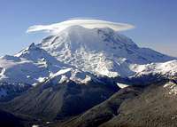 Rainier with Lenticular
The sparks from crampons on the exposed Disappointment Clever rocks in apre-dawn start, the audible groans and startling cracks from the active glaciers, the continuous barrage of brilliant green meteors entering the atmosphere in the dark night, and the sudden emergence of 25 guided climbers from an underground bunker at 10,000 feet. These are a few of the unique sensory experiences that are common on Mt. Rainier. With collapsing snow bridges, avalanches, route finding problem, and sudden severe weather during peak-climbing season, Rainier is a serious mountain that has deaths, injuries, and rescues each year.
With its close proximity to Seattle, and the fact that Rainier is a huge mountain with 20 plus routes, this high point sees a large number of climbers each year. It is considered by many to be the best training ground in the lower 48 for Denali and other larger mountains with glacier travel and steep snow. The Disappointment Clever Route is one of the most common routes, yet each year the various routes slightly change due to the active glaciers. Serious climbers seeking a great challenge should consider the Liberty Ridge Route, perhaps the best snow/ice test piece in the lower 48. Liberty Ridge involves steep, direct climbing, no margin of error, and a level of commitment where you're forced to continue up and over a daunting dilemma during inclement weather.
Expect winter time conditions year round, with sudden, wet and snowy storms common in July and August, followed by clear and sub-freezing weather. Often, Rainier will sit above the clouds and you'll travel from rainy conditions in Seattle to rainy or snowy conditions at Paradise, and emerge above the weather.
For Statistical Climbing Success Rates Click Here
In 2010, 10,643 people attempted to climb Mount Rainier; 4,920 of them actually reached the summit.
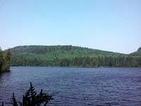
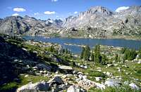 Island Lake on Gannett Approach
The most remote state high point requires a long (40-50 miles) round-trip hike and climb to reach its summit. Unlike the rival Teton Range, The Wind River Range doesn't reveal its beauty until your hiking into its backcountry. The Winds hold numerous backcountry lakes, glaciers, and rocky summits.
The standard route from the Pole Creek Trailhead involves a potential camp at the north end of the glacially carved Titcomb Basin and a snow climb up and over Dinwoody Pass (Bonney Pass) at 13,000 feet, before the true summit is climbed up via the Gooseneck Ridge. On the descent, a 1,200 foot climb back upand over Bonney Pass is required. A common perception on a Gannett trip is that the approach is as beautiful, if not more so, than the summit.
Along with good conditioning, Gannett typically requires proficient usage of ice-axe, cramp-ons, and a rope. It's debatable, but Gannett is often considered the 2nd to 4th hardest state high point.
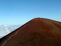 Summit Trail
Yes, snow falls on the top of this 13,796 foot Hawaiian volcano. Mauna Kea means "white mountain" in Hawaiian, and from the depths of the nearby ocean floor to the summit is 33,000 feet. A road leads to the top, and the summit is filled with large, white domed observatories - the largest collection of astronomical telescopes on the planet.
The Mauna Kea trail starts at the visitor center, climbs 4,576 feet in six miles, and provides a good way to the summit. Another interesting option is the utilization of a mountain bike for a portion of the climb.
 Summit Trail
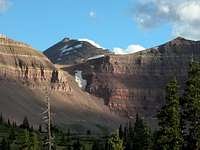
The seventh highest State High Point is situated in the High Uinta Wilderness Area of north-central Utah. The Henry's Fork approach is the standard route and it is typically done in two days, although the strongest could do this in a long day. Moose are often seen along the approach and altitude sickness is a common complaint. Nearby South Kings Peak was thought of as the state high point as late as the 1960s. Elbert, Kings, Gannett, Granite, and Black Elk peaks would make a good highpoints swing trip for visitors from other areas.
 Wheeler & Walter
The highest peak in "The Land of Enchantment" lies in the Sangre de Cristo mountain range of New Mexico and Colorado. The most common hiking options include the Bull-of-the-Woods Trail which goes 16 miles round trip and is quite scenic, or the Williams Lake Trail which is just six miles round trip but less scenic. Wheeler Peak is a good candidate for a Fall ascent, as the days are often warm and clear with the nights cold. Typical climbing season is May to November, with winter ascents a possibility.
 Boundary Peak
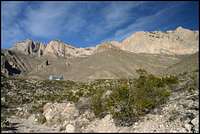
At the northern end of the White Mountains, lies Boundary Peak, the highest point in Nevada at 13,140 feet. Within this range, which spans Nevada and California, are some higher peaks. White Mountain is the highest in this range and the third highest in California. Nearby Montgomery Peak (13,441) is taller and craggier than Boundary and is visible from the summit ridge. Many plan to do Boundary and some of these other peaks in one outing. The nature of the climb up the Trail Canyon Route is scree with some minor scrambling nearthe top. Solitude can be easily found here as the general climbing season is long with year-round climbing being possible. Like most other larger peaks, Boundary receives snow and frequent high winds.
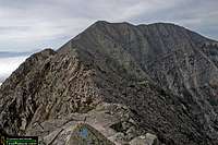
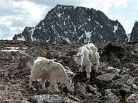 Granite Goats
Granite has the distinction of being the only U.S. State Highpoint that requires climbing vertical rock to reach the summit. Granite is known for a little of everything: rock climbing, long hiking, scrambling, snow climbing, route finding, exposed camping, sudden severe thunderstorms, deep August snow, and most often a truly rewarding summit. Granite is typically done in two or three days. The aptly named Froze-to-Death Plateau is a unique cross country hiking experience. It involves hiking on a rolling, very rocky plateau, with no defined trail. The best navigational method involves following large, easily sighted cairns, across the terrain. Camp spots are typically in rock built shelters and water sources are hit and miss.
Summit day involves mostly class 2-3 scrambling, crossing a snow bridge and 4th class to easy 5th Class climbing. The South Face Route requires careful route finding to keep the climbing level at the easiest. It's possible to accidentally get onto 5.7-5.10 rock, but those comfortable with exposure will often climb up the rock sections rope-less. A rope is handy for a quick rappel, or if the vertical terrain becomes covered in snow or rain.
Expect the unexpected on Granite. In August of 2005 an early snowstorm brought 10 inches of heavy wet snow. Night-time temperatures were 10-20 degrees. The next day most of the snow melted in 60 degree temperatures, although the gulleys remained clogged with snow. On the South Face, a nearby party got off route into 5.8 land and dropped their rope. On the descent there were eight climbers using the same rappel station.
The last of the U.S. State Highpoints to be climbed, Granite is a rewarding experience, in part due to its difficulty, remote location, and breathtaking views. On clear days, the Grand Teton is visible in the distance from thesummit.
 Borah
BorahIdaho's tallest peak at 12,662 feet is situated at the northern part of the Lost River Range. The range is host to seven of the nine tallest peaks in the state of Idaho. The Lost River Range is known for its large, hulking, non-technical summits. This sparsely populated valley is a paradise forthose seeking solitude. A typical summer day will see some hikers on Borah, but on the edges of the season or during the off season, it's easy to have the peak to yourself.
Borah's Chicken-Out-Ridge Route gains 5,260 feet of elevation in just 3.6 miles. At about 7,200 feet, the route starts out as an old Jeep road, then becomes a feint climber's trail, then crosses an exposed ridge of rock, followed by a seasonal snow bridge crossing, until the summit is finally reached. The continuously steep route has few switchbacks and offers a good aerobic test. The route is typically done in 3-10 hours, roundtrip. Recently, this route has become the affection of speed climbers.
 Borah- North Face
A more challenging route exists on the reclusive North Face of Borah. 5-7 pitches of 45 degree snow and ice gives way to a 55 degree couloir and a 5.0-5.7 rock climbing section. Depending on the time of year, you may need to fight your way through a cornice to reach the summit ridge. The descent is most often the Chicken-Out-Ridge route and the entire north face can be scouted from near Challis, Idaho (just north of Borah on 93). The North Face involves over 2,000 feet of climbing and was probably first done in 1971.
In 1983 a magnitude 7.3 earthquake rocked this region and left a large visible scar on the plateau at the base of the peak. One wonders whether the earthquake has affected the official summit elevation, and when the last survey/ telemetry measurement was. The USGS 1:24000 Quad for the area is dated 1967. Besides the earthquake damage and the consequent nearby deaths, this relatively benign peak has seen deaths by lightning, avalanche, and fall.
As late as the 1920's most believed that Hyndman Peak was Idaho's largest peak. Even after T.M. Bannon's 1912 first ascent of Borah Peak, the Idaho Statesman Newspaper ran an article defending Hyndman as the highest in the state. It wouldn't be until 1928, that Borah was declared highest. Borah is named for Senator William Borah, who served for34 years.
 Humphreys Aspen
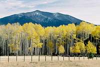
At 12,633 feet, Humphreys Peak defies the typical Arizona stereotype that the state is mostly a warm desert region. From the depths of the nearby Grand Canyon to the often snowy and windy summit ridge, this region is one of the most diverse in the nation. The lower west slopes of Humphreys contain some beautiful Aspen groves, while the east side of the peak is in a rain shadow and contains Sunset Crater. The standard route heads up the Humphreys Peak Trail from the Snow Bowl ski area. The nature of the ski area, and all that goes with it, detracts from the wilderness experience for the purist. Still, once you're away from the trail-head and up onto the ridge, the peak has a beautiful, wild feeling to it. For added challenges, ascend the peak in winter or utilize the Weatherford Trail. Nearby Agassiz Peak appears as the tallest peak from the Flagstaff area, and makes a good added excursion. (see restrictions)
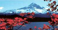 Lost Lake Hood
The sulphuric and steamy vents near the Devils Kitchen is a reminder that Mount Hood is a dormant volcano. Like most of the Cascade Volcanoes, this peak strikes up and away from its surrounding terrain with much prominence. The mountain is well used, given its proximity to the Willamette Valley, the ski area, and the resort lodge.
The popular south side approach starts at Timberline Lodge and climbs Class 2 terrain to the summit. Conditions may vary and cramp-ons, ice-axe, and helmet may be required. At just eight miles round-trip and 5,300 feet of vertical gain, this approach provides a straight-forward route to the summit. It is best climbed early, given the chance of collapsing snow bridges on the glacier and the hazard of rock fall. Another really good option for highpointers is the Cooper Spur Class 2 route. While the South Side route offers easier access and nearly year-round opportunities, the Cooper Spur approaches may offer more solitude.
Northeast Region
 Katadhin
From the Appalachians to the Adirondacks and the Allegheny Plateau, a tour of the 12 Northeast highpoints offers the traveler a glimpse into this geologically complex region of the country.
Without question, the Northeast quadrant is dominated by the mountains of the northern Appalachians. The famed Appalachian Trail (A.T.) passes over or comes within two miles of five of these highpoints, including the northern terminus of the A.T. and the gem of the Northeast - Katahdin, Maine. At 5,267 feet, Katahdin sharply rises some 4,000 feet above the surrounding landscape and its impressive profile have led some to call it the only western peak east of the Mississippi. Though it is a state highpoint, Katahdin is probably best known as the finish line to the A.T. for approximately 300 folks who annually complete the nearly 2,200 mile trek from Springer Mountain, Georgia.
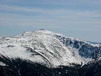 Mount Washington
This, of course, is not meant to diminish the importance of the equally renowned Mount Washington, New Hampshire ... often described as the world's most dangerous small mountain. At 6,288 feet, Mount Washington's brutal weather (highest surface wind speed ever recorded) and relatively easy accessability (2-3 hours from downtown Boston) have proved a lethal combination far too often. Yet for those fortunate enough to visit her summit in clear skies, views not only encompass the surrounding White Mountains but extend westward across Vermont's Green Mountains to the Adirondacks of New York. Other Appalachian Trail highpoints include Mount Greylock, Massachusetts and High Point, New Jersey. The A.T. also passes less than two miles east of Mount Frissell, Connecticut. All of these mountains offer many hiking options while Katahdin and Washington offer mountaineering routes as well.
 Mount Marcy
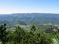 Spruce Knob
Keeping with the geology theme, it should be said that the three state highpoints in the Allegheny Plateau region are more closely related to the southern Appalachians than to the mountains of the Northeast. But the relative geographic smallness of the Northeast has led to the inclusion of Mount Davis, Pennsylvania, Backbone Mountain, Maryland and Spruce Knob, West Virginia in this region. These three highpoints are all located within about 120 miles of each other and many complete this trifecta on the same trip. While the 3,000-foot plus elevations of Backbone Mountain and Mount Davis are impressive enough for the Northeast, one must keep in mind that much of this "unglaciated" part of the plateau sits above 2,000 feet. In terms of prominence, the lower Pocono Mountains of eastern Pennsylvania offer more net gain than does the highpoint of the Keystone State.
Spruce Knob, however, is quite a treat. Rising some 3,000 feet from its base, this 4,861-foot mountain is the very definition of the backwoods of West Virginia. For those looking to hike this mountain, the most common approach is a long one. The Horton-Seneca Creek-Huckleberry Trail route is a 19-mile round trip so many choose to utilize the dirt summit road in at least some form. If you enjoy mountain biking, this is a great way to go. And for those with a taste for rock climbing, nearby Seneca Rocks offers many great choices.
The remaining two highpoints in the region - Jerimoth Hill, Rhode Island, and Ebright Azimuth, Delaware - aren't exactly lofty goals but Summit Post maintains pages with quality information nonetheless.
South Region
The Southern Appalachians
(Georgia, Kentucky, North Carolina, South Carolina, Tennessee, and Virginia)
 Brasstown Bald stands high above the Georgia valley
Mount Mitchell is the highest point East of the Mississippi River in the United States at 6,684 feet. It is almost 400’ higher than Mount Washington. While you can drive to the summit, several trails can take you to there, including the Mount Mitchell Trail. The Mount Mitchell Trail is a convenient day hike through thick forest. It offers several nice viewpoints. A distinctive characteristic of the summit is the thick and smoky clouds on the lower peaks. Like the Smoky Mountains, over 65 miles away, it is the Black Mountains that truly personify the “smoky” appearance of the high Southern Appalachians. Because so many people drive to the summit, the Mount Mitchell Trail is not overly crowded. However, if you want a longer adventure try the Black Mountain Crest Trail. This trail requires a one or two day loop hike that takes you to the summit of several of the highest peaks in North Carolina.
High up in the forests of Tennessee looms a series of 6,000 foot mountains that make up Smoky Mountain National Park. The highest summit of the Smoky Mountains in Tennessee is Clingman’s Dome at 6643’. The views from Clingman’s summit are tremendous, and you can usually find snow on this peak through early April. Unfortunately, Clingman’s Dome has few day-hiking options. The summit road leads you a half-mile to the summit, and the Appalachian Trail parallels the summit road for nearly 8 miles. Other approach routes are over 20 miles round trip, and require over a day to hike. Clingman’s Dome can become pretty crowded during the warmer months and unfortunately, the summit road is generally not open in the wintertime when solitude is more likely assured. Hiking in winter is very feasible, but requires that the main park roads are open. In fact, the best hike in the area is really Mount Leconte, less than 10 miles from Clingman’s Dome. While 50 feet shorter than the Dome, the hike boasts a solid day hike. Along the way you will encounter an 80 foot tall cliff face that overhangs the trail, housing massive icicles in the winter months. Also along the trail are plenty of viewpoints, and a long ridge-like summit with views in all directions.
Mount Rogers is part of the large Grayson Highlands area that towers above any other mountain range in the Commonwealth of Virginia. The best part of the mountain is the open meadow of Wilburn Ridge, which is about 5,000 feet above sea level, and not too far from the summit. Wilburn Ridge is a natural playground, with expansive views, flowers, boulders, and even wild ponies. The Appalachian Trail ends about one-half mile from the summit, at an open space overlooking Wilburn Ridge, and providing expansive views of the Blue Ridge Mountains. Whitetail deer frequent the area, and the rustic final trail to the summit is in deep woods.
Brasstown Bald offers a variety of hiking trails, a well-maintained summit, and some of the best evening views you will ever see. This is a highpoint worth climbing during the day and during the night where a clear day provides views of lush forests and valleys, and a clear night provides a wondrous view of the stars, casting shadows on the surrounding mountains. You can hike Brasstown Bald from 1/2 mile away from the summit, or via one of several day-hiking trails of varying lengths.
Black Mountain is the least preserved highpoint in this region. While standing an impressive 4,145 feet, trails are limited, and access to the highpoint restricted unless you sign a waiver form protecting the mining community that owns the summit area. The road to the top (Route 160) is quite pretty. Coming from Virginia, you climb over 2,500 feet along sharp curves around the mountain. When I hiked Black Mountain, I parked at the entry to the access road, and hiked 1.5 miles to the actual summit. The views at the summit were limited, and the development at the top removed any natural beauty from the summit area. This is a highpoint with great potential, but valuable energy resources prevent the State of Kentucky from celebrating their highpoint as much as they do in the surrounding states.
Sassafras Mountain is far shorter than its northern counterparts, and the lowest highpoint in the Southern Appalachian region. It is most certainly a mountain, rising far above the Western South Carolina valleys, but seems insignificant due to the 6,000-foot peaks of North Carolina, just 20 miles away in Pisgah National Forest. There are several day-hiking opportunities, and from the summit you will have some nice views of the high peaks of North Carolina. There are some excellent hiking trails and summits in South Carolina nearby Sassafras, including Table Rock Mountain.
The Ozarks and Southern lowlands
(Alabama, Arkansas, Florida, Louisiana, and Mississippi)
 Cliffs on Mount Magazine - Arkansas
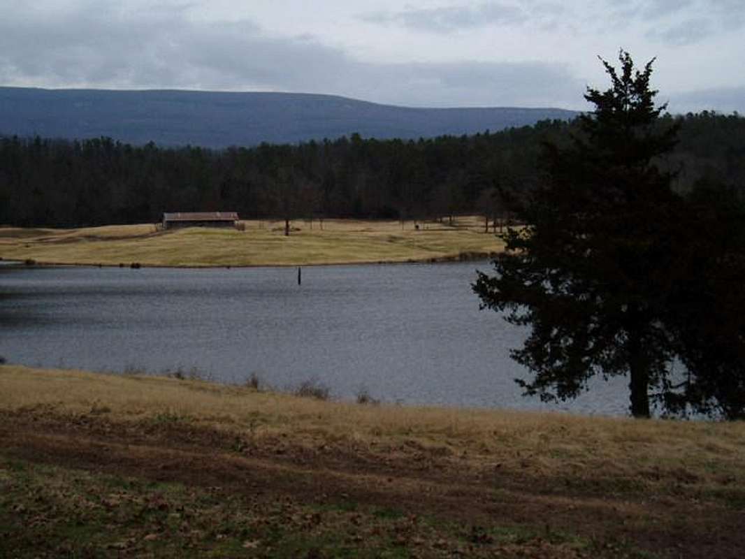
Signal Hill is the highest point of a long wide ridge-top called Mount Magazine. Along the ridge are rock cliffs, where you can go rappelling and hang gliding. There is 1,500-foot prominence over the surrounding valley, and several hiking trails of varying lengths to the summit. Arkansas celebrates their highest mountain, and created Mount Magazine State Park as a cleverly-developed tourist getaway.
Cheaha Mountain dominates the skyline of nearby towns in Eastern Alabama. It stands only 2,407’ high, but stands 1,500’ above the surrounding plains. Thick forests cover the mountain, while providing various hiking trails and rock climbing areas such as the Rock Garden, Pulpit Rock, and Bald Rock. Northeast Alabama actually contains some of the Appalachian Mountains, but Cheaha Mountain itself is disconnected from the Appalachian chain by nearly 100 miles.
Woodall Mountain in Mississippi is a large hill rising about 300 feet above the surrounding forests. You can hike a small trail from an unmarked trailhead at the North side of Woodall Mountain called the North Ridge Trail. This will put you on a narrow road that leads to the summit. You could drive up the road to the top, but hiking to the summit is a lot more fun. Woodall Mountain unfortunately has an electric tower on top, but at least the summit is preserved for people to visit. Despite being one of the lowest elevated highpoints in the United States, Woodall Mountain stands out because there aren’t any other significant hills in the area.
On the road off of I-20 going south to the Louisiana highpoint, a sign says: “Welcome to Louisiana Hill Country”. The highest of these “hills” is Driskill Mountain, which rises 150’ up from its trailhead in front of a small church. The trail meanders for about a mile up to the wooded summit.
Britton Hill is the lowest state high point in the United States at 345 feet. A forest lies behind the highpoint marker offering a short trail through the woods to get you back to nature. It is a far cry from the Appalachians to the North, but it is probably the only high point endangered by hurricanes every year. In fact, when I visited Britton Hill, I drove through a mild, class 1 hurricane to get there.
The Southern Prairie
(Texas and Oklahoma)
 The Majestic Guadalupe Peak stands high above the Texas desert
Guadalupe Peak is many miles from the other Southern highpoints, but then again, Texas is a really big state. Guadalupe Peak is unlike any other state highpoint. Standing at only 8,749', it is a certainly not alpine, and due to its southern latitude, it is without snow for most of the year. However, it is high enough to provide rich pine forests, topped by large rock cliffs that tower above the desert plain. You can spend days in the Guadalupe Mountains exploring new territory, hiking up various trails, and always finding something interesting. The best time to hike is in the colder months. From the summit you can look down at the desolate Southwest Texas desert, 4,500 feet below.
The climate around Black Mesa is rugged, scenic, and dry. At no point during a trek up the Mesa are you in thick forest, so you have a full view of the surrounding mesas for the entire hike. Getting to and from the summit requires a few hours, and lots of water. The highpoint area is well preserved, and devoid of development, providing a rather bucolic experience. While the top of the Mesa is rather flat, there is plenty of elevation gain, and pretty views from the summit and from the cliff edges not far from the summit. Black Mesa is not the highest mountain (from base to top) in Oklahoma. The Wichita Mountains, Southwest of Oklahoma City, offer nearly 1,000 foot elevation gains and Class 5 rock walls. Not to say Black Mesa is not itself an excellent hiking spot, but don’t ignore the rest of the Sooner State if traveling West through Oklahoma City to get to the Mesa.
Midwest Region
There are many great things about the American midwest. There are Great Lakes and Great Plains. Few would argue that its farming culture is among the greatest on earth. Yet, for all of this, there are most definitely not many great mountains. Perhaps more than any other region, highpointing in the midwest requires an appreciation for points that are ... well, not high. So resist the urge to make this region the butte-end of bad jokes and avert your eyes downward for a brief tour of the 12 midwestern highpoints.
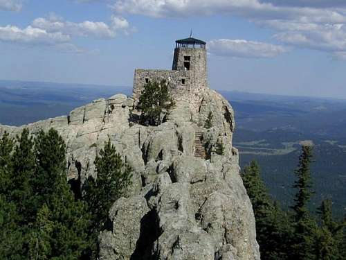 Black Elk Peak, South Dakota (fmr. Harney Peak)
GREAT PLAINS - Without a doubt, the most interesting highpoints and the only true mountains to be found in this grouping lie in the northern Great Plains states of North and South Dakota. The Dakotas are truly a wonder. It was in South Dakota that the faces of great former Presidents were carved on Mount Rushmore. Just a few miles behind these famous faces is Black Elk Peak (previously known as Harney Peak), the king of the Black Hills, and the highest rock tower in the vast pine forests of western South Dakota. South Dakota's highest point is the steepest of any midwestern highpoint, standing about 1,500 feet above its base (the only highpoint in the region rising more than 1,000 feet). White Butte, North Dakota stands only a few hundred feet from its base but commands attention with a striking white hue as a result of bentonite in its rock and soil. In keeping with the Presidential theme, it should be noted that Theodore Roosevelt National Park is only about 30 miles north of White Butte. The hiking at this relatively uncrowded National Park is good enough to have been featured in the December 2005 issue of Backpacker magazine.Geologically speaking, the Great Plains rise significantly from the eastern part of each state to the western part of each state. Elevations in each of the four states start at near 1,000 feet but end up anywhere from 3,500 feet to over 7,200 feet in South Dakota's Black Hills. While Nebraska has some interesting rock formations and buttes within the state, the highpoint lies in a high plateau. Just 10 miles away, across the Wyoming border, the Pine Bluffs rise several hundred feet above the town, making it seem as though Nebraska is as flat as a pancake, when really, Panorama Point is very close to being a very interesting highpoint. Kansas, on the other hand, is just flat. A small rise in elevation in lonely farmland is home to Mount Sunflower (the "Mount" being a misnomer).
 Eagle Mountain
GREAT LAKES - Moving eastward, the northern Great Lakes region that contains the highpoints of Minnesota, Michigan and Wisconsin is a land of austere and breathtaking natural beauty. It almost goes without saying that the highpointer will leave the region with vivid memories of long meandering drives along the flanks of Lake Superior and the northern shore of Lake Michigan.Of the three Great Lakes highpoints, Minnesota's Eagle Mountain is the greatest treat. Located miles from nowhere, the summit of Eagle Mountain is typically attained after a 3.5 mile one-way hike through a mature hardwood forest dominated by towering pine trees. This gentle hike wraps around the quaint Whale Lake and saves much of the net elevation gain of about 600 feet for the final mile. While Eagle Mountain offers the best hiking, Michigan's quiet and wooded Mount Arvon will certainly challenge your route-finding abilities. The zenith of Michigan is reached at the end of a maze of dirt and logging roads that begins about 16 miles northeast of L'Anse and ends at a well-marked clearing 11 confusing miles later. This leaves the Wisconsin state highpoint - Timms Hill - which is interestingly located in a county park. While there is nothing particularly mountainous about Timms Hill, this very pleasant area of small lakes, rolling hills and forest can be appreciated atop the summit firetower, which is just a short uphill walk from the main parking lot. Unlike the other Great Lakes highpoints, Timms Hill is straight-forward and easily accessible.
 View near Taum Sauk
Red Tape
 Gated entrance to Charles Mound
While many of the highpoints have minor access issues involved with their ascents, three states have significant restrictions.Charles Mound, Illinois is located on the privately owned farm of Jean and Wayne Wuebbels and the Wuebbels only allow visitation on the first weekends in June, July, August and September. In 2014, the access days will be on June 7/8, July 5/6, August 2/3, September 6/7. Daylight hours only. Special requests on non-access days will be denied no matter how much you beg.
After a few rounds of land ownership changes and significant work by the Highpointers Club in recent years, Jerimoth Hill, Rhode Island is now far more accessible than in the days when it was only open to the public five time per year. In December 2011, the State of Rhode Island purcahsed the actual summit of Jerimoth Hill from Brown University. Combined with a December 2008 purchase of the land adjacent to the highpoint, all relevant land is now in the hands of the State of Rhode Island. Read about it here. The daily visiting hours of 8 AM to 4 PM established while Jeff and Deb Mosley owned the property near the 812-foot highpoint remain in effect. Visitors are asked to stay on the main trail.
Finally, Penn-Virginia Resources requires Black Mountain, Kentucky visitors to sign a summit waiver and only allows you to walk or drive the summit road. Though coal giant Penn-Virginia no longer owns mineral rights above 3,500 feet on the Kentucky side of the Black Mountain massif, it still owns surface rights and as such can enforce “No trespassing” regulations in the upper reaches of Black Mountain. Further information on the waiver is available on the Black Mountain Summit Post page. The actual waiver is downloadable here. This downloadable waiver includes the new mailing address as of May 2010.
Highpointers
 Atop Mount Mitchell
Founded in 1987 by Jack Longacre, the Highpointers Club has grown into a well-organized group of about 2,300 members complete with a high quality quarterly newsletter, Apex to Zenith, and an annual convention. The 2013 Konvention (as it is known to members) was held on July 19 and 20th in Millinocket, Maine with activities and hikes in Baxter State Park, where Maine highpoint Katahdin rises 4,000 feet above the valley. For 2014, Clingman's Dome and nearby Gatlinburg, Tennessee have been selected as the focal point of activites on July 25 and 26. Full information and a schedule of activities can be found here.
Though the Club was founded in 1987, the idea of highpointing had been previously hatched before there were even 50 states in the Union. Arthur Marshall became the first man to climb to the summits of the 48 continguous states in July 1936 while well-known climber Vin Hoeman became the first to top out in all 50 U.S. states in July 1966. To date, there have been 253 people documented to have ascended all 50 highpoints and an additional 220 who have climbed the lower 48, making it one of the more exclusive climbing clubs in the United States. The list of completers maintained by the Highpointers Club also includes four non-US citizens, showing that this list has gained at least some international recognition. Popularity of this list appears to at an all-time high. While it took 34 years (1966-2000) between the 1st and 100th completer, there was only a nine-year span (2000-2009) between the 100th and 200th finisher. Any bets on when the 300th finisher will be recorded?In recent years, a "can you top that" kind of competitive spirit has crept into the world of state highpointing. In 2005, Ben Jones set a speed record for climbing the 50 highpoints, doing so in 50 days while Dave Johnston (of Minus 148 fame) owns the distinction of being the first man to climb all 50 highpoints in winter, finishing in March 2005. Ben Jones' speed record was topped in the summer of 2008 by Mike Haugen and Zach Price, who with the aid of a support team and corporate sponsorship, touched all 50 highpoints in 45 days, 19 hours and 2 minutes. Not to be outdone, the bar was set out of reach for most normal human beings of normal means and ability when - in the summer of 2010 - a 12-year-old by the name of Matt Moniz teamed up with his Dad (Mike Moniz) and Mountain Hardware to bag all 50 highpoints in a time of 43 days, three hours and 51 minutes. Read more about this young adventurer and his new record here. The speed record was broken yet again in August of 2016 by 21 year old Maddie Miller in 41 days, 16 hours, and 10 minutes.
But not everyone who highpoints is focused on setting records or even finishing the list. Many enjoy taking family trips to remote parts of the country and concentrate on only the "friendly" highpoints while more hard-core climbers often set their sites on just the "tough ones." It is an activity and a Club that brings together people from all walks of life, making it quite an interesting group.And if you're a member of Summit Post, be sure to check out the STATE HIGHPOINT CLIMBERS thread for fun, casual and informative interaction with other highpointers.
Difficulty Essay
A Discussion on the Difficulty Ratings of U.S. State High Points
The subjectivity of how difficult the various U.S. State High Points are, is an open ended topic with no definitive answers. It's easy to classify the High Points based on generally accepted statistics: total elevation gain and/or total distance round trip. Thomas P. Martin has come up with the "Martin Classification of Difficulty for U.S. State Highpoints.". It's a combination of elevation gain and distance on the easiest "standard" route. His system assigns a "difficulty rating" to each High Point, from 1 (easiest) to 10 (most difficult). This system provides a base calculation and classification on the peaks, but is less effective on some of the harder State High Points and a few of the peaks in the East are assumed that you drive to the top. It should be noted, that both North Carolina and New Hampshire would be rated a 5 if hiked via standard routes, and Massachusetts would be ranked a 4. Martin acknowledges the various other factors that can cause subjectivity.
Weather- besides ability, perhaps the leading cause of failed attempts, epic long days (and nights), injury, and even death. If the weather is marginal and one still succeeds in reaching the summit (or not), it may increase the perception of the difficulty of the mountain. Conversely, a pleasant, windless day on many peaks could decrease the difficulty perception.
Ability- a person's ability to manage the risk and discomfort of inclement weather in relation to that person's physical abilities is a big factor. Those in the best physical shape are able to overcome these difficulties without losing clarity, balance, and judgment. Those with superior mental clarity and confidence can also persevere in adverse conditions. From my experiences, the number one factor involved in backcountry or vertical wall injury is being tired. Many stumbles occur on the descent and the publication "Accidents in North American Mountaineering" (published annually) chronicles that at least 50% of accidents are on the down climb.
Proximity of Training Area to High Point- those that live and train near a specific High Point can have a distinct advantage over those that must travel long distances. Besides the elevation differences that can cause altitude sickness, those that train in terrain that is similar to the High Point have a better understanding of what to expect, how their body reacts to the environment, and what is the best gear for the outing. There are, of course, exceptions and those that are great at preparation and cross training can overcome some disadvantages. Many consider Mt.Hood in Oregon the 5th hardest U.S. High Point. With only 8 miles roundtrip and 5300 feet elevation gain, those comfortable with cramp-on work, snow climbs, and glacier travel may find this peak relatively easy. Those living near the Cascades or the Wind Rivers may deem Mt. Whitney in CA or Kings Peak, UT a more challenging outing. Whitney is usually done in a long day and involves over 21 miles and 6750 feet. Kings Peak involves an even longer climb and usually requires an overnight outing. Another factor in living close to a peak is you always have the option of going back without the monetary and time commitment that someone from another area must invest. Living near a peak, you also receive information about the peak from friends, climbing shops etc., further adding to the comfort level. In other words, there can be more pressure to summit a High Point if your traveling from another area and /or on a tight schedule involving multiple ascents.
It is widely accepted that Denali in Alaska is the hardest U.S. State High Point. The mountain involves a high level of preparation- carrying 3 weeks of food, equipment, clothing, and shelter is something that can be easily mismanaged. Often, the thought process is that bigger, warmer, more calories etc. is the proper method of being safe. The NPS, Guide Outfits, and some equipment manufacturers help to instill this attitude. If you have a big, heavy, but warm tent, lots of high calorie food items, a beefy ice-ax, and a sled full of emergency equipment, you'll be safe. Well yes and no. You'll be safe on the lower portion of the Kahiltna Glacier, and if you get tired from all the excess weight, your in a relatively safe area on the mountain. Many people are absolutely wasted by the time they reach the 14,000 camp (you start around 7,500) from hauling sleds weighing 80+ pounds plus the pack. Your safe up to 14,000 and amongst many, many climbers. The tired and injured can easily turn around in relative safety. I've seen kegs of wine, small weather stations, and solar panel charging kits for laptops, make it to 14,000 feet. But what was the cost? In our group it was 2 injuries and heavy fatigue on several others. One of the biggest lesson learned was that "light is right" Completely dried food, lightweight tents (you can always wear your clothes inside), and lightweight hardware were the best. The other big factor, of course, was conditioning and age. Those that trained and had a high level of aerobic capacity made it to the summit. Those with relatively low body fat were the most successful. Those that had regular training experiences, were the least prone to injury on the mountain.
Extra Credit
Well, they're not really states and not required for recognition as a 50-state completer, but the highpoints of Washington DC and Puerto Rico are each pursued by many highpointers for entirely different reasons.
 Fort Reno
At 429-feet above sea level and located in the far Northwest quadrant of Washington DC, Fort Reno is the highest natural point in the District of Columbia ... a city whose license plates now lament "Taxation Without Representation." Of course, residents do get electoral votes in Presidential elections and some would like to see it become a state, but the dubious status of the District makes it an interesting highpointing goal if not a legitimate mountaineering objective. And, hey, if you're the type to "climb" to places like Britton Hill, Florida and Ebright Azimuth, Delaware, are you really the type to look down on DC's highest point? Fort Reno is probably best known as the site of the only Civil War battle fought within the District of Columbia. Summit Post has a rudimentary page on Fort Reno. Notably, in 2007 a 409-foot USGS benchmark was placed in the Fort Reno park, marking the highest natural point of land in DC. This is 20 feet lower than the artificial highpoint created with landscaping around the reservoir in the Park. This project was done in cooperation with the Highpointers Club. The benchmark is located just southeast of the Reno Reservoir.
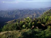 From atop Cerro de Punta
osatrik - Jul 11, 2009 3:04 pm - Hasn't voted
Magazine Mountain - NOT Mount MagazineA check of the official geographic names index (GNIS) of the USGS reveals that the name of the high point in Arkansas is "Magazine Mountain", not "Mount Magazine". Although not a hard and fast rule, generally "Mount Xxxxx" is used for a peak, and "Xxxx Mountain" is more frequently used for ridges, which better describes this feature. Magazine Mountian appears in the GNIS as a ridge, and Signal Hill as its summit. "Mount Magazine" is the name used by the Arkansas State Park, but it not the officially accepted name. All four of the guidebooks published to date on state highpoints have used the correct nomenclature, and I believe entries in Summitpost.org should do the same.
hgrapid - Jul 11, 2009 3:16 pm - Hasn't voted
I disagree that this needs to be changedPretty much most references in the local area (of Arkansas) call this area Mount Magazine. Signal Hill is the official summit. I don't see any reason to change based on the USGS official names, when the whole area is called Mount Magazine State Park.
caverpilot - Apr 5, 2016 6:25 pm - Hasn't voted
Re: I disagree that this needs to be changedI'm entertained by this response as the Highpointer's Club website specifically states that the official source for highpoints is the USGS. If we can't rely on the official source, what's the point? (And yes, I see the area is called Mount Magazine State Park). lol
nick06 - Oct 17, 2009 2:33 am - Hasn't voted
Most Glaciated RangeArticle says the Wind Rivers are the most heavily glaciated range in the lower 48. Most glaciated is by far the North Cascades of Washington.
SawtoothSean - Oct 17, 2009 2:05 pm - Hasn't voted
Re: Most Glaciated RangeThe original source of information about this, I believe, was the Winds guide book. I'll take the USGS source of information as a better more reliable source of information with data figures, so I will change this statement in the article.
WingLady - May 22, 2010 4:39 pm - Voted 10/10
Update forThe link in the note "Various Guidebooks can be obtained through the Highpointers Club" no longer functions. New, autographed copies of "Highpoint Adventures" (1st Edition only) is available from: The Winger Bookstore
Alpinist - Feb 25, 2012 2:48 pm - Voted 10/10
Embedded images are offFYI - your embedded thumbnail images for Humphreys, Hood, Katahdin, etc., are not lined up with their associated descriptions. The second paragraph of text for Borah has thrown them out of sync...
Richard Flinn - Sep 5, 2013 7:39 pm - Hasn't voted
Mt. MagazineI wanted to let you'll know, that the prominence of Mount Magazine is 2,435 ft above sea level. Almost all of the web hits you'll get say, it is 2,133ft. This is a widespread mistake. Also Magazine it is not part of the Ozarks, it is in the Ouachita range.
Richard Flinn - Sep 5, 2013 7:48 pm - Hasn't voted
Mt.MagazineMt. Magazine prominence = 2,435ft. Mt. Magazine/signal hill rises to a total of 2,753ft above sea level.
distressbark - Mar 8, 2014 7:00 pm - Hasn't voted
not Eagle MountainThe photo you provide of Minnesota's Eagle Mountain is in fact not Eagle Mountain. The view is across Whale Lake to a nearby highpoint but Eagle Mountain is actually out of frame and to the left. Would be nice to see an accurate photo of Minnesota's highest point. Thanks.
hgrapid - Mar 10, 2014 12:04 pm - Hasn't voted
Re: not Eagle MountainChanged to show correct view of Eagle Mountain
distressbark - Mar 21, 2014 10:27 pm - Hasn't voted
Re: not Eagle MountainRad, thanks!
caverpilot - Apr 5, 2016 6:20 pm - Hasn't voted
not Mt. McKinleyThe author of the Denali page has updated to reflect the official name, however the name of the AK highpoint is still listed as "Mount McKinley." Please update, thanks!!