-
 13866 Hits
-
 77.32% Score
-
 8 Votes
|
|
Mountain/Rock |
|---|---|
|
|
42.37903°N / 8.91103°E |
|
|
Mountaineering |
|
|
Summer |
|
|
8386 ft / 2556 m |
|
|
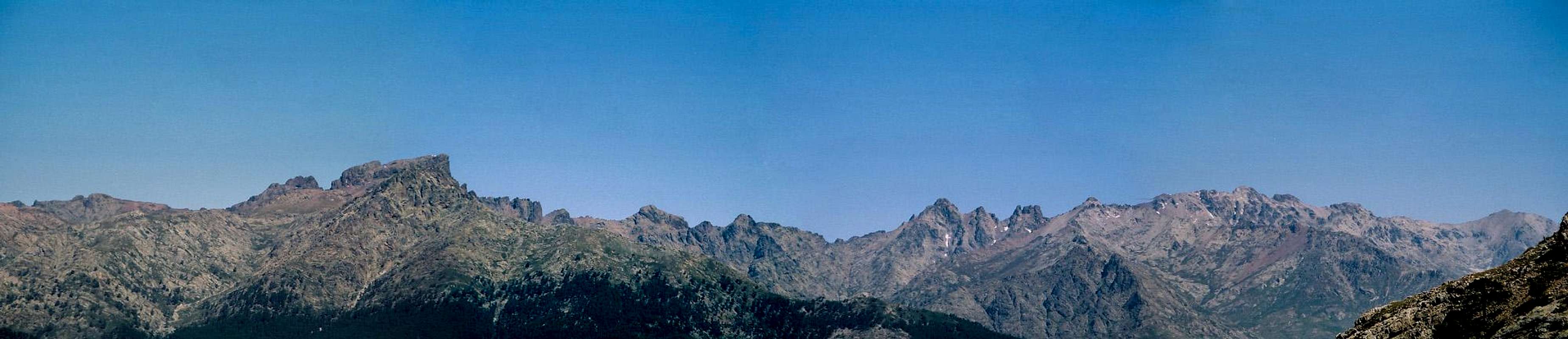
Overview
Punta Minuta is situated next to the "Grande Barriere", the backbone of Corsica, i.e. the crestline between monte cinto and paglia orba. It borders to the valleys of Filosorma (Cavicchia / Fango river), Asco (Stranciacone) and Niolo Basin (Golo).The GR20 contours through its western wall (Cirque de Solitudine between Bocca Minuta and Col Perdu), which marks the crux of the whole fortnight trail.
There are various possibilities up to this impressive peak, from scrambling at the two normal routes (I named them "Northern normal" and "sourthern normal" route)
to arrete climbing in western alpine format.
Getting There
Public transport for north as well as south side of punta minuta is non-existent.For the northern normal route trailhead is at Haute-Asco (1422m), reached by car through D147. The junction of this department road and the RN 193 Ajaccio - Bastia is a little north of Ponte Leccia. Before the little town of Asco the narrow road follows the deep-cut Asco george. At the trailhead some kms further on there is a hotel and a GR20 refuge as well as some skiing & lifts in winter season.
South route starts behind Calsima, Corsicas highest village. Again use RN 193 and at Francardo turn into the Golo valley using D84. The first part of the drive takes you through the gorge "Scala di Sta Regina"; at Albertacce turn into the D318 to Calasima; the tar road continues for 2km to a parkground (about ten places), altitude 1061m.
Red Tape
None. Several rules from the parc-naturel are not more than self-evident (no open fire etc.).Accomodation / Camping
There is a campground in the upper Stranciacone valley. Next to the GR20 hut at Haut-Asco basic camping is also possible.On the south side additionally the Bergerie Ballone (1.5h from trailhead) and the Refuge Tighiettu (after 2-2.5h) provide shelter and food (in season). At the way to the Bergerie you pass the famous "Grotte des Anges" bivy shelter, a big rock sleeping about four persons.
External Links
For Weather information for Corsica lookup theMeteo Corse page.
When To Climb
The southern side is snow-free about May to June up to September. Northern route remains snowy / icy the whole summer season and therefore certainly is also a target for skialpinism in april or may. In high winter avalanche risk has to be taken into consideration.Maps and Books
IGN OT4250 "Monte Cinto" 1:25.000 LinkCorse du Nord, 1:50 000, Ed. Didier Richard, map no. 20
Korsika für Bergsteiger und Kletterer from Hans Schymik (1987, in german and unfortunately sold out). ISBN: 3980042901.
Panoramas
 Summit view
 Cirque de Trimbolaccio
 Right below Tighiettu hut
The panorama from Gangolf Haub also is worth a look.