
|
|
Mountain/Rock |
|---|---|
|
|
40.75265°N / 105.6955°W |
|
|
Larimer |
|
|
Hiking |
|
|
Spring, Summer, Fall, Winter |
|
|
11003 ft / 3354 m |
|
|
Overview
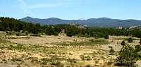
This is the tallest of the Three Bald Mountains and also the named summit in the Laramie Range. (However, the highest point in the Laramie Range is located on top of a broad ridge in the midst of the forest about a half mile to the northwest of Middle Bald Mountain. Thanks to Ryan Schilling for this information that he got from Bob Martin, who verified this with a hand-level.)From the summit you have great views in all directions: to the south you can see the Mummy Range; to the southeast is the Never Summer Range, as well as the upper Poudre Canyon; to the west are the Medicine Bow Mountains; to the northwest is the Park Range; to the north you can see flatter areas in Wyoming; and to the east are the lower foothills. From the summit you can also see nearby North and Middle Bald Mountains, as well as a couple of other unnamed "bald" peaks.
The two other named Bald Mountains (Middle and North) are the second and third tallest named peaks in the Laramie Range. Middle Bald Mountain is the most bald, while North Bald Mountain is not bald at all. This is just supposition, but I wonder if the people who originally created the topographic map of the area mislabelled the peaks, assuming them to be the three highest? Unnamed peak (10,884) is a more prominent and balder peak than North Bald Mountain (see the photo below of all four of the tallest peaks). I wonder if this originally may have been called South Bald, South Bald called Middle Bald, and Middle Bald called North Bald?
Getting There
There are numerous ways of getting here, so I will just describe the way I used, and list a few other ways, as well.
Take 287 northwest from Fort Collins to Livermore. Turn left at Livermore onto Red Feather Lakes Road (CR 74E) and drive west 24 miles to Manhattan Road (CR 162). Turn left on Manhattan Road and drive south 3.3 miles to NF 171. Turn right onto NF 171 and drive 1.6 miles past numerous intersections with smaller roads. There are no official parking lots along the road, so you must park on gravelly areas just off the road (that are often used by campers.) When the road splits into 171 and 171C, take 171C. Drive down 171C as far as you’re willing to go with your vehicle, as the road becomes more and more rugged, the further you go. Continue down 171C by whichever mode of transportation you are using (e.g., hiking, jeep) to the beginning of the Swamp Creek Cutoff Trail (marked by a brown post with the numbers 871.) If you are able, you can drive another 0.8 miles down the trail to a fence, beyond which only non-motorized vehicles and motorcycles are permitted. From here, you can take a number of routes to South Bald Mountain. My favorite is to cut straight uphill to the west-northwest (290°), which takes you up to the same ridge of South Bald Mountain and the first of the unnamed bald mountains (10,546 feet.) From here you can follow the ridge up and down two more unnamed bald mountains (10,884 feet and 10,775 feet.) The next peak on the ridge is South Bald Mountain. If you don't feel like going up and down several other smaller peaks first, you can also follow the Swamp Creek Cutoff Trail further to where it gets the closest to the summit, then head steeply uphill.

You can also get near the base of the peak by taking the very rugged Elkhorn Baldy Road (NF 517).
Red Tape
You can get near the base of the mountain by hiking, horseback, bicycle, motorcycle, ATV, or snowmobile. For more information check with the US Forest Service.Camping
The peak is in multi-use national forest. Contact the US Forest Service for any information on camping regulations.External Links
Swamp Creek Cutoff Trail and South Bald Mountain Photo AlbumWant to Contribute?
Anyone is welcome to contribute. Just let me know what you want added to the description, and I will likely add it for you. Thanks!Seasonal Information
Possible Forest Service access roads in the area are:Deadman Road as far as Pearl Beaver Road
Killpecker Road (NF 300)
Bald Mountain Road (NF 517)
For the most up-to-date information on road openings and closures, visit the US Forest Service Road Conditions Website.