The page was successfully edited.


|
|
Area/Range |
|---|---|
|
|
49.51094°N / 18.21533°E |
|
|
5653 ft / 1723 m |
|
|
Overview
What we call the Beskids (in Polish Beskidy, Slovak Beskydy, Ukrainian Бескиди) covers a huge mountainous area of low rounded mountains, which forms the outside part of the northern Carpathians.The Beskids are usually divided into several sub-regions detailed below. Since many of them are already introduced as areas, and given the fact that this page, initially meant to cover the whole Beskids, focused mostly on the western regions, this page was renamed "Western Beskids".
Here is a map that shows roughly the area that the "Western Beskids" are meant to cover, let's understand the Moravian, Silesian, Żywiec and Small Beskids, around the convergence of the three borders of Poland, Slovakia and Czech Republic :
View Beskids in a larger map
Definition of the Beskids in the wide sense
The Beskids are a mountain range of the Outer Carpathians, which stretches from the Bečva River (Moravian Gate, Czech republic) on the west to the Čeremoš River (Ukraine) on the east.According several definitions, the Beskydy are either 50-70 km width and 600 km long, or according to other geographers "only" 320 km. It all depends on what we do consider as the end of this range :
- The sources of Tisza River, or
- The Usok pass at the Polish-Ukrainian border
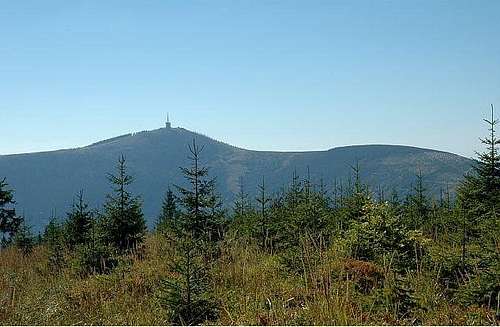
Given this fact, the identity of the highest mountain depends on this definition too. The highest peak of the western part of the Beskids, then the area here introduced, is Babia Góra (1725 m). If we go ahead the Polish-Slovak border, we get Hoverla (2061 m) in Ukraine's Chornohora.
However, most of the Beskids are a part of this Outer Western Carpathians. The Lesser Beskids (Slovak: Nízke Beskydy, Polish: Beskid Niski) and the Bieszczady situated to the east of them are part of the Eastern Carpathians. The Dunajec River usually defines the limit of the western section. However, this page does not take Gorce into account as an area has been made for it.
Rich in coal and once having large deposits of iron ore, the Beskids became an iron and steel center in the 18th century; the largest plants are now located at Ostrava and Třinec, in the Czech Republic.
The name of the mountains probably comes from a Thracian or Illyrian origin.
In these whole range of the Beskids, one can find 11 national parks - 4 in Poland, 1 in Slovakia and 6 in Ukraine and a lot of protected areas. However only one of them, Babia Góra, lies into the Western part.
 |
 |
The general division of Beskids is as follows :
Western Beskydy:
- Moravsko-Slezské Beskydy (Moravian Beskids, CZ)
Slezské Beskydy / Beskid Śląski Silesian Beskids, PL&CZ)
- Beskid Mały – mountain range in Poland. Its borders are: north-Pogórze Śląskie; east-Skawa River; south-a road nr. 946 Żywiec-Sucha Beskidzka and Pasmo Pewelskie; west-Brama Wilkowicka and the Biała River. The Soła River divides this range into two parts: western, called Pasmo Czupla and Magurki, and eastern, called Beskid Andrychowski. Highest points: Czupel (933m), Madohora (922 m), Leskowiec (922 m), Magurka Wilkowicka (909 m), Jaworzyna (890 m)
- Beskid Żywiecki – second highest mountain range in Poland. On the west, this range is divided by the valley of Sola River from Beskid Śląski, and on the east by the valley of Koszarawa from Beskid Mały. Beskid Żywiecki forms a watershed between the Baltic Sea and the Black Sea basins. Highest points: Babia Góra (1725 m), Pilsko (1557 m), Mała Babia Góra (1515 m), Romanka (1336 m), Hala Lipowska (1324 m), Hala Rysianka (1322 m), Wielka Racza (1236 m), Wielka Rycerzowa (1227 m). Babia Góra National Park : Area: 33.92 km2. In 1933 was established Babia Gora Reserve(Rezerwat na Babiej Górze) with an area of 650 ha, and then in 1954 a National Park, and protected area was extended to 1704 ha. This National Park is since 1977 a part of UNESCO-MAB Biosphere Reserve. This reserve was extended in year 2000 (11 829 ha). It includes a state forest oriented to near-natural forest management, as well as inhabited areas.
- Beskid Makowski – between the rivers of Koszarawa and Krzeczówka. Divided into three subgroups: Pasmo Pewelsko-Ślemienskie, Pasmo Koskowej Góry, Pasmo Lubomira and Łysiny. Highest points:Jałowiec (1111 m) - sometimes considered as a part of Beskid Żywiecki, Lubomir (904 m), Koskowa Góra (874 m), Bakow (871 m), Koton (868 m)
- Beskid Wyspowy – It is located between Skawa River and the Kotlina Sądecka basin. This is a mountain range created by isolated peaks. Highest points: Mogielica (1170 m), Cwilin (1072 m), Jasień (1062 m), Kutrzyca (1051 m), Modyn (1029 m)
- Gorce – Highest points: Turbacz (1310 m), Jaworzyna Kamienicka (1288 m), Kiczora (1282 m), Kudloń (1276 m), Czoło Turbacza (1259 m). National Park Gorce - the first Nature Reserve - Rezerwat Orkana, was established in 1927 (114 ha; extended in 1964 to 319 ha). In the 50´s was created another one - Gorczański Rezerwat Żubra (100 ha). In 1979, in the surroundings of Turbacz, there was established a big reserve with an area of 2500 ha. National Park was established in 1980 - 5908 ha.
Central Beskydy:
- Beskid Sądecki – Area: 670 km2. Borders:to the west : Dunajec River, to the east : Kamienica Valley, Mochnaczka Valley and Tylicka pass, to the south : Grajcarek River and Rozdziela pass. Highest points: Radziejowa (1262 m), Złomisty Wierch (1226 m), Wielki Rogacz (1182 m), Skałka (1163 m), Jaworzyna Krynicka (1114 m)
- Beskid Niski album by Henryk – Beskid Niski is divided into several subgroups:Beskid Dukielski - central-eastern part of Beskid Niski; highest points: Baranie(754 m), Piotruś (728 m), Cergowa (716 m); western part of this subgroup is a part of Magurski National Park (created in 1995). Pasmo graniczne - eastern part - located between two passes: Beskid nad Czeremcha pass (581 m) on the west and Łupkowska pass (640 m) on the east. The highest point - Kamień nad Jaśliskami (857 m) is a part of a Nature Reserve Kamień. Pasmo Bukowicy - north-eastern part of Beskid Niski. Highest points: Skibce (778 m), Tokarnia (778 m), Rzepedka (708 m). In the north-western part, there is a Forest Reserve Bukowica. Beskid Rymanowski - highest points: Kopa (640 m), Kopiec (634 m), Przymiarki (628 m), Sucha Góra (611 m). Góry Hanczowskie - here are located all the highest points in Beskid Niski: Lackowa (997 m), Ostry Wierch (930 m), Bušov (1002 m, already in Slovakia).Pasmo Magurskie - Pasmo Magurskie is created by two ridges: Magura Malastowska (813 m) and Magura Watkowska (20 km long; highest points: Watkowa (846m), Kornuty (830 m), Świerzowa (801 m)). Dorzecze górnej Wisloki - the lowest part of Beskid Niski. Highest points: Kamienny Wierch (710 m), Uherec (706 m). Eastern and northern part of this subgroup is a part of a Magurski National Park. Góry Grybowskie -highest point: Chełm nad Grybowem (779 m).
- Ondavské hory - Slovakian part of Beskid Niski. Highest points: Bušov (1002 m), Javorina (881 m), Smilnianský vrch (750 m), Filipovský vrch (705 m). A small part of this group, along the Polish-Slovakian border is a part of Protected Landscape Area Východné Karpaty. Other National Nature Reserves: Zborovský hradný vrch (1926), Becherovská tisina (1954), Magura (1964), Regetovské rašelinisko (1979), Humenská (1980), Humenský Sokol (1980), Ilovnica (1980).
Eastern Beskydy
- Beskidy Lesiste
- Góry Sanocko-Turczanskie - Magura Łomnianska (1024 m)
- Bieszczady Zachodnie (in Slovakia Bukovské vrchy) album by Henryk - Tarnica (1346 m)
- Bieszczady Wschodnie (Ukraine) - Pikuj (1405 m)
- Beskidy Brzezne (Ukraine)
- Gorgany (Ukraine) - Sivula (1836 m)
- Beskidy Pokucko-Bukowinskie (Ukraine, Romania) - Hordje (1473 m)
- Poloninski gory/Beskidy Poloninskie (Ukraine, Romania)
- Polonina Rivna - Rivna (1482 m)
- Polonina Boržava - Stoj (1677 m)
- Polonina Krasna - Sihljanskij (1563 m)
- Svidovec - Bliznica (1883 m)
- Cornogora - Hoverla(2061 m)
- Hrinjevskij chrebet - Baba Ljudova (1590 m)
Moravian-Silesian Beskydy
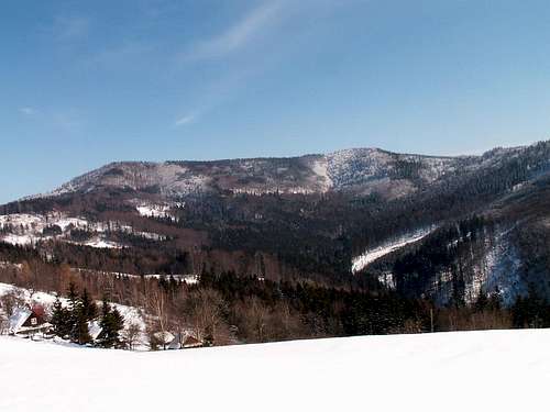
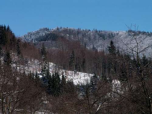
Beskydy are too large to describe them in one section. So, I decided to describe only this part, where I live = Czech part, and anyone other can do the rest :)The Moravia-Silesian Beskydy Mountains are situated in the eastern part of the Czech Republic in northern Moravia. The area shares borders with Poland to the north and with the Slovak Republic to the east. The Beskydy Mountains are part of a frontier mountain range that runs from north to south, with the highest points over 1000 m above sea level. Its landscape of long, rolling hillsides is covered with forests and pastures. An exceptional value of this region’s natural and cultural wealth has lead to the fact that this area had been declared the nature reserve in 1973. The highest peak of Beskydy Mountains is “Lysá hora” (Bald Mountain) – (1324 meters).

The round ridges of Beskydy Mountains are gradually declining into the gentle upland. The pine forests dominate the area. The Bečva and Ostravice Rivers head here. Due to their extent, the Beskydy Mountains are divided into the following parts: Moravskoslezské Beskydy, Vsetínské vrchy, and the Moravian part of Javorníky Mountains.
Highest points:
Lysá hora (1324 m)

Smrk (1276 m)

Smrk is a typical massif of Moravian-Silesian Beskydy with several tops (Malý Smrk, Smrček, Malý Smrček, Skalka, Šance, Samorostlý, Trojačka). It is not possible to get any refreshment on the top and there is no hut.
There is a Nature preserve Smrk. It is the highest in the Rožnovská hornatina upland. The top is separated from the Lysohorská hornatina upland by the Ostravice river and from the massif Kněhyně by the valley Čeladenka.
Railway station Ostravice - red marked trail - Smrk, saddle - Smrk - Polana - Čeladná, chapel. Length 21 km.
Kněhyně (1257 m)

The Kněhyně mountain is a significant peak in this area with many rocks formations and beautiful views. There is a 250 meters long cave nearby the peak, a protected place of pseudo-karst in Beskydy, which is closed for public.
Čertův mlýn (1205 m)
Significant hill (1207m) in the Radhošťské Beskydy mountains. According to a legend, the hill has name after a mill, which should have been built by devil close to the fifty meters long dry valley. This nature interest is an exhibit of movement of limestone blocks. There is the
Beskydy’s natural reservation with vertical forest growth of spruce with a segment of rowans nearby. The reservation goes from the Čertův mlýn hill to the Kněhyně mountain.
Trávný (1203 m)

It stands upon the valley Morávka and Mohelnice. It is often called Velký Trávný as well. The top is covered with rare mountain growth which allows only fragmentary views of surroundings.
Radhošť (1129 m)

During the time of Slovan antiquity a sacred ceremony, which rejoiced the god of Radegast, took place here. The characteristic shape is seen far and away, even though the mountain is not the highest in its surroundings. There is a pilgrimage chapel of Cyril and Metoděj from 1898 with the copy of the Valašská Madona painting by A. Liebscher and the crucifix with Cyril and Metoděj statuary by A. Polášek from 1931 on the top. The mountain is whole screwed with passages and caves. The most widely known is Volárka, which lies approximately 200 meters eastward of the peak. Radhošť is linked to ancient Slavic traditions. The Rožnov burgher Janík erected a stone cross in 1805 on the location where there was allegedly a pagan place of worship. The Cyril and Methodius Chapel in the Byzantine style was consecrated in 1898. This chapel was originally built out of unsuitable sandstone. In 1926 it was restored and covered with shingles. A belfry was added onto the chapel on the Greco-Roman Catholic side at the same time. In 1931, a group statue of Cyril and Methodius, made by Albín Polášek was erected in the vicinity of the chapel.

CHKO Beskydy -(Protected Landscape Area) Beskydy of the area of 1 160 km2 is situated at the height from 350 to 1 328 m above the sea level and includes the territory of the Moravian-Silesian Beskydy, Vsetínské vrchy and the Moravian part of the Javorníky. This is the largest Protected Landscape Area in the Czech republic.
Area: 1160 km2
Location: 49° 11´- 49° 39´ N, 18° 03´ -18° 44´E
Altitude: 350 - 1328 m
Date of creation: 5.3.1973
Protected areas:
- 7 National nature reserves
- 1 National nature monument
- 20 Nature reserves
- 22 Nature monuments
Čantoria national nature reserve (lying outside the PLA) is also administered by the Administration of Beskydy PLA.
Beskydy PLA was designated for its unique natural treasures, especially indigenous primeval forests with rare Carpathian fauna and flora, rich diversity of meadow coenosis, unique surface and also underground pseudokarstic phenomena and exceptional aesthetic qualities and diversity of rare landscape type shaped by man in coexistence with nature. The importance of Beskydy PLA is underlined by 42 small-scale protected areas designated on its territory, by an extensive conservation area of natural water accumulation and last but not least by its supraregional recreational significance.
Contact:
Správa CHKO Beskydy
(Administration of Beskydy PLA)
Nádražní 36
756 61 Rožnov pod Radhoštěm
Phone: +420 571 654 293
Fax: +420 571 657 407
Email: beskydy@schkocr.cz
www.beskydy.ochranaprirody.cz


Silesian Beskydy
Silesian BeskydyArea: 700 km2
This range is a part of Western Beskydy. It stretches on the right shore of Olše/Olza River, at the Czech-Polish border, and it is adjoining to Moravian-Silesian Beskydy.
The borders of Slezske Beskydy/Beskid Slaski:
- on the west: Jablunkovská brázda (valley of Olza river)
- on the east: Kotlina Żywiecka (basin, rivel Soła).
- on the south: Przełęcz Koniakowska saddle
- on the north: Pogórze Śląskie (upland)
The larger part is situated already in Poland. There are two outstanding ridges: massif of Čantoryje/Czantoria and Stožek and behind Wisła valley - the massif of Barania Góra. Average annual temperature is 6-7 C.
Highest points:
Skrzyczne (1257 m)

Barania Góra (1220 m)

Second highest mountain in Silesian Beskidy. Location and height difference cause one heaviest rain in Poland (1300 mm). That creates great conditions for springs of Vistula river (Wisła)- the longest river in Poland (1047 km). One of the streams creates few small waterfalls called "Kaskady Rodła"- reachable by blue marks from Wisła Fojtula.
Natural reserve "Baraniogórski rezerwat" (383,04 ha)- established in 1953, named after K. Buzek.
Under the top (at Przysłop Meadow)- mountain hut (PTTK).
Wielka Czantoria/ Velká Čantoryje (995 m)

The difference between top of the mountains and valleys below them is 700 m.
Čantoryje/Czantoria massif
This range separate from Barania Góra massif in Kubalonka Pass (761 m). It creates a watershed between the rivers of Olše/Olza and Wisła. The main ridge of this range stretches from north to south; from Tuł (621 m) - Wielka Czantoria/ Velká Čantoryje (995 m) - Soszów (884 m) - Cieślar (923 m) - Malý Stožek (843 m) - Velký Stožek/Stożek Wielki (987 m) to Kyčera/Kiczory (990 m), and here it turns toward east to Przełęcz Kubalonka pass (761 m).
The most important pommels are:
- from Kiczory goes to the southeast and ends in Młoda Góra (838 m)
- towards the river Wisła valley go little ridges, which separate minor valleys: Poniwca, Gahury, Jawornika, Dziechcinki and Łabajowa
- to the Czech side, towards the river Olše valley, goes from Malá Čantoryje border ridge with a mountains of Ostrý (722 m) and Wróżna (514 m)
- from Stožek goes to the southwest a long ridge, which ends in Loučka (835 m)
Barania Góra massif
This is massif is often called Pasmo Wiślanskie, and it stretches from north to south. It creates a watershed between the rivers of Wisła and Soła.
Mountains from south to north:
Tyniok (891 m)-Gańczorka (901 m)-Karolówka (930 m)-Barania Góra (1220 m)-Magurka Wiślańska (1129 m)-Zielony Kopiec (1140 m) and Malinowska Skała (1150 m).
From Malinowska Skała this range continues to the northwest: Malinów (1095 m)-Grabowa (905 m)-Kotarz (965 m)-Beskid Węgierski (914 m)-Beskidek (850 m).
From Malinowska Skała to the northeast goes another ridge to Małe Skrzyczne (1201 m) and Skrzyczne (1257 m).
Routes
Here are only a very little part of all possible routes:Lysá hora
a) Frýdlant nad Ostravicí (370m), blue marked trail - Nová Ves (390 m)-Malenovice (460 m) - Hradová (790m)- Ivančena (925 m)- Ivančena, monument (920 m), red marked trail - Malchor, crossroad (1205m), blue marked trail - Gabrielka (1250 m)- Lysá hora (1324 m) 2 3/4 h

b) Ostravice (422 m), red marked trail - Butořanka (730 m)-Lukšinec (950 m)- Lysá hora (1324 m), 2 h

Trávný
Krásná (510 m), yellow marked trail - Hájenka (680 m), blue marked trail - Trávný (1203 m), 2 h

Kněhyně
Horní Čeladná,chapel (514 m), red marked trail - Malá Stolová (970 m)- Kněhyně, sedlo (1150 m)- Kněhyně (1257 m) 2 h

Smrk
Horní Čeladná, chapel, red marked trail - Polana, crossroad (892 m)- Smrk (1276 m) 2 1/2 h

Kunčice pod Ondřejníkem - Rožnov pod Radhoštěm
Kunčice p. Ondřejníkem, chapel (473 m), blue marked trail - Malá Stolová (970 m) 65 min, yellow marked trail - Kněhyně, sedlo (1150 m), red marked trail - Kněhyně (1257 m)- Kněhyně sedlo - Čertův mlýn (1205 m)- Tanečnice, sedlo (1005 m), green marked trail - Pustevny (1020 m), blue marked trail - Radegast, statue (1105 m)- Radhošť (1129 m)- Černá hora (885 m), red marked trail - Rožnov pod RadhoštĚm (370 m), 6 1/2 h

Ostrý
Dolní Lomná (510 m), blue marked trail, Sedlo pod Malou Kykulou (755 m), green marked trail - Kozubová, fold (925 m) - Kozubová (982 m), yellow marked trail - Kamenitý (810 m), green marked trail - Pod Babím vrchem (860 m)- Babí vrch (920 m), red marked trail - Kalužný (960 m), blue marked trail - U Kalužného (930 m) - Ostrý, hut (954 m), 3 1/4 h
Malý Polom
Horní Lomná (570 m), blue marked trail - Kyčmol (650 m) - Pod Malým Polomem, saddle (950 m) - Pod Malým Polomem (1010 m), red marked trail -Čubonov (1000 m)- Pod Burkovým vrchem (970 m)- Muřinkový vrch (940 m), yellow marked trail - Přelač (680 m)- Horní Lomná (570 m), 3 1/2 h
Velký Polom
Dolní Lomná (510 m), blue marked trail - Kostelky (930 m), red marked trail - Hotel Tetřev (950 m) - Velký Polom (1067 m), 2 1/4 h

Stožek
Návsí (390 m), yellow marked trail - Filipka (761 m), red marked trail - hamlet Zimný (695 m), yellow marked trail - Velký Stožek (987 m)
Bahenec
Jablunkov (380 m), green marked trail - Jablunkov, crossroad (390 m), yellow marked trail - Groníček, saddle (824 m), red marked trail - Bahenec (770 m), 2 1/4 h

Girová
Jablunkov, green marked trail - Polanka (540 m) - Čertí mlýny (740 m) - Girová (775 m), 2 h
Kozubová
Košařiska, Milíř (520 m), green marked trail - Pod Babím vrchem (860 m), yellow marked trail - Kamenitý (810 m) - Kozubová (982 m), 2 1/2 h

Čantoryje
Nýdek (420 m), red marked trail - Pod chatou Čantoryje (850 m) - Chata Čantoryje (950 m) - Velká Čantoryje (992 m), 1 1/4 h

Velký Sošov
Nýdek (420 m), green marked trail - Střelma (475 m)- Beskydské sedlo (660 m), blue marked trail - Velký Sošov (886 m), 2 h
Getting There
Many European metropoles around this region can be reached by plane :- Cracow
- Ostrava
- Poprad
- Brno
- Katowice
As for closer access, a "star map" will better describe all possibilities than a long chapter... Just be aware that the deepest you go in mountains, the tiniest are the roads... Medium sized towns are usually served by bus or train.
On popular destinations, you'll often find paying car park. Usually it's not too expensive. Just take them, your car will just be safer than left in a remote place of the country, where unfriendly locals could be interested in opening a foreign car to see what's in it...
View Larger Map
Accomodation & tips
The Beskids are highly touristic areas in all three countries they belong to. Since the sea is too remote, herds of tourist, both from Southern Poland or Central Europe rush to the green during sunny green week ends, or to the snowy ski resorts in winter.Consequently, the tourist will be embarassed with choice concerning accomodations.
Areas located near ski resorts usually have a lot of modern accomodations in the valleys. As for more remote places, the density is lower, but one will find more genuine accomodations locally known as "agrotouristic" (green B&B's).
A lot of portals summarize all accomodations on internet, but unfortunately rarely in English or foreign languages. Since an inventary of all of them would be too much work, and the data is changing constantly, here are only a couple of tips to help to sort it out.
Let's start with a small lexicon:
- Accomodation = Noclegi (PL), Ubytovanie (CZ/SK)
- Hotel = Hotel/Hotel. "Hostels" often designate Youth hostels or motels.
- Green lodge = Agroturystyka (PL), Agroturistika (CZ/SK)
- Guesthouse = Pokoje gościnne (PL), Penzión (CZ/SK)
- Summer residence = Dom letniskowe (PL), Chalupa (CZ/SK)
- Flat for rent = Kwatery (PL), Privat (CZ/SK)
- Mountain hut = Schronisko (PL), Chata/Horsky Hotel (CZ/SK)
- Tavern = Chata (PL) => not to mix with the Czech homonym
- Restoracja (PL), Restaurace (CZ/SK)
- Campsite = Kemping (PL), or Kemp/Tábořiště/ATM (CZ/SK)
(however campsites are rare in these regions)
Some portals:
* Poland:
- www.turystyka.beskidy.pl
- www.beskidy24.pl
- www.spanie.pl
* Czech Republic:
- www.beskydy.cz
- www.ubytovanivbeskydech.cz
* Slovakia
- www.beskydy.sk
visentin - Jul 6, 2010 5:32 am - Voted 10/10
perhapsA page for the whole Beskides is too much. Half of the Carpathians... Your page is obviously very focused on the Czech Beskides, plus the SW Polish, with very good information on these areas. But too much contrast with other areas not or poorly described. Considering that Gorce, Pieniny, Bieszczady already exist as areas, that perhaps Henryk could turn Niski & Sadecki albums as areas, and that the creation of a parent page for Ukrainian mountains is currently discussed, wouldn't it be wise to rename this page as "Western Beskides", encapsulating : Moravské/Slezské/?ywiecki/Makowski ? The main section about the global term Beskydy/Beskidy could be kept, just as an informative chapter, but I think "Western Beskides" would be more coherent like this. What's your opinion about it ? Thanks Eric (currently building the Radhost page...)
yatsek - Jul 6, 2010 6:17 am - Hasn't voted
Re: perhapsIMO The most practical thing would be trimming this page to "Western Besky(i)ds" leaving out the Low Beskid/Ondavske Vrchy and anything farther east. Such a solution would go very well with the NE Carpathians chapter on the Carpathians page.
Gorzi - Jul 6, 2010 8:04 am - Hasn't voted
Re: perhapsThis page was renamed to Western Beskides. Thank You both for Your opinions. It's really a better solution. Cheers, David.
visentin - Jul 6, 2010 9:34 am - Voted 10/10
Re: perhapsThanks David. It would now seem appropriate to detach the Pieniny and Bieszczady. Thanks ! The Carpathian structure takes form ;
yatsek - Jul 6, 2010 6:07 pm - Hasn't voted
Re: perhapsDiky David. BTW Those two theories about where the Beskids end result from the political map being different before and after the 2nd World War II. Ukrainian people don't seem to use the word "Beskydy" for any mountains east of the Bieszczady. Cheers, Jacek