Thanks to
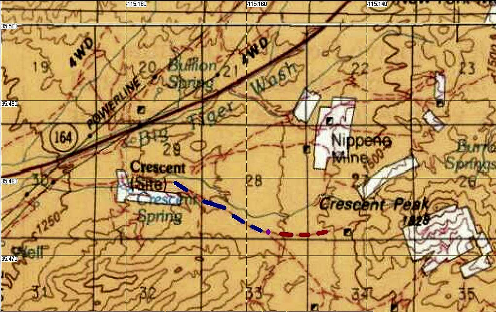
MoapaPk, here is an image of BLM land around Crescent Peak. The tan in the attached jpeg is BLM land. The white sections are either private land or township land. The blue dashes are the Crescent Peak Rd. Though the good paved road formally continues to the SE, it's actually called something else after the fork (magenta dot).


