
|
|
Route |
|---|---|
|
|
46.44110°N / 13.84660°E |
|
|
Hiking, Mountaineering, Scrambling |
|
|
Summer, Fall |
|
|
A long day |
|
|
Easy scarmbling and easy climbing UIAA I below the summit. |
|
|
Getting There
 Dovski kriz and two routes. Through the valley Na Brinju is on the right of the route from the south.
The valley Vrata is accessible by car from Mojstrana village (12km), which is placed in the upper Savska Dolina valley at the end of Vrata valley (71km to Ljubljana, 13 to Kranjska Gora). You exit from the main road following the signs either to 'Mojstrana' or 'Vrata'. If you are using public transport you will have to walk up the Vrata valley from Mojstrana (2.30h).
From Mojstrana you drive (or walk) into the beautiful Vrata valley. Half way into the valley there's Koca pri Pericniku (mountain hut) and on the right side of the road Pericnik waterfall itself (10 minutes walk). You drive all the way over the macadam road. The trailhead starts in Vrata valley, on the meadow, called Poldov rovt (941m) where you park a vehicle.
Route Description
 The SP members descending from Dovski Kriz.
 On the upper parts of ascent on Dovski Kriz.
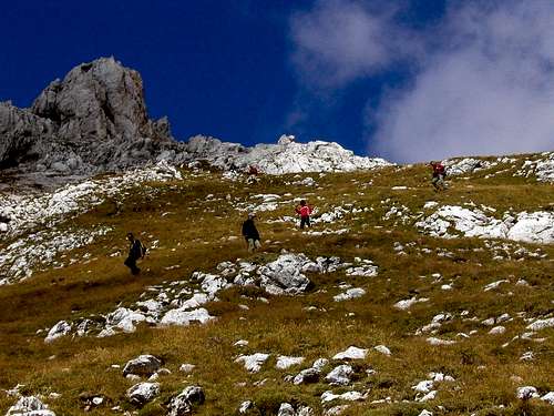
From Poldov rovt you take the west direction. Soon behind the meadow you will find a good hunters path, ascending through woods a bit more than 100 meters. You follow this path and in some switchbacks through the nice forest you reach a small ridge in the forest where this route crosses to the ravine and then continue directly up to the bivouac II.
On this ridge you see a steep route which goes directly up. You follow it and on the next crossing you go directly up (the second route goes to the right to Skrnatarica or Kukova spica). The steep route which goes in nice switchbacks comes over some small rocks to the summit called Brinova glava, 1571m. From this summit you follow the not very godd visible route some meters up and then you cross the steep grassy slopes and soon you come to the valley Na Brinju between the ridge of Splevta, 2272m (on the left) and the ridge of Kopica, 2202m (on the right). You walk through the valley over some grassy slopes and higher up also over some small screes. The route comes on the pass between Splevta and Dovski Kriz, 2542m.
From here the direction to the summit is north.
First rocks above the saddle are a bit more steep (easy climbing, I.), you cross them a bit towards right. There you reach steep grassy slopes and proceed directly upwards and at the end cross to the right again a little on the saddle between Dovski Kriz and the side ridge of Kopice. Now you are some 100 meters below the summit. From this grassy saddle you will probably need some orientation skills, if lucky, you will find also stone marks.
First you climb up, but soon you take a ledge to the right, which brings you in the notch below the summit (UIAA I). From this notch you proceed either directly by the main ridge or keep a little (but not too much) towards right. Carefully you scramble to the summit.
You descend by the same route to the saddle below and then you descend by the route by bivouac II. Check the description also.