

-
 31661 Hits
-
 75.81% Score
-
 6 Votes
|
|
Mountain/Rock |
|---|---|
|
|
36.68892°N / 118.39052°W |
|
|
Tulare |
|
|
Hiking, Mountaineering, Scrambling |
|
|
Spring, Summer, Fall, Winter |
|
|
13802 ft / 4207 m |
|
|
Overview
Perched on the Kings-Kern Divide, Caltech dominates the skyline near Forrester Pass along with the likes of Mt Keith, Junction Peak, and Ericsson Peak. This peak, the 21st highest in California, is the newest addition by Sierra Peaks Section of the Sierra Club Angeles Chapter, as the 248th peak (listed at index 8.12, 13,832', class 2) in the SPS Peaks List.Like other peaks in the area, i.e. Trojan (USC), Mt Stanford, and University (UC Berkeley), this name follows a collegiate theme. Being the highest unnamed point in the area, it was chosen in 1961 by Rick Jali (later the 1967 SPS chair), Jim Eder, and Ted Mathes to be climbed and named as "Caltech Peak". They made the 3rd recorded ascent in June 1961 and obtained approval of the Caltech name from the US Dept. of the Interior. The name became official on the 14th of December 1961. The first East Ridge ascent was by Smatko, Erb, Ross, and MacLeod, who comprised 4 of the 5 first SPS list finishers. It was voted down by the SPS for addition to the SPS Peaks List in 1979 and 1997, but passed in 2008 by a vote of 47 to 34.
First ascent by Norman Clyde, June 22 1926.

North Ridge & West Face from Mt Ericsson (photo by Bob Burd)
Getting There
Caltech can be approached from a number of different directions depending on the itinerary. The closest trail head approach is via the Shepherd Pass trail but easiest access is available to those hiking the John Muir Trail. Entry into this region is also available from the west, albeit a bit longer. Finally, a couple of more obscure routes are available to the more adventurous.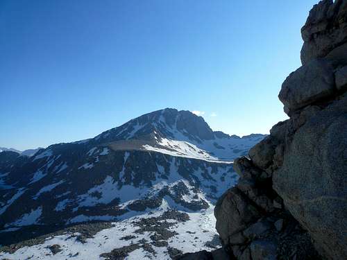 Caltech's NE Ridge from Forester Pass (Jul 09)
Routes
With the exception of the North Ridge, all routes on Caltech are Class 3 or easier. Some of the routes include: Looking down at the NE Ridge and the cirque below the north face (Jul 09)
Red Tape, Camping, and Conditions
Being in Sequoia National Park, Caltech Pk. is subject to the usual SEKI National Park regulations, requiring advance camping permits, protection of food from bears, low impact camping, etc. - see the SEKI Red Tape section.For entry from the east side, everything you need to know about permits, regulations, and driving directions can be found on the Eastern Sierra - Logistical Center page. While overnight hikes require a wilderness permit, day hikes can be done without red tape.
Climbing can be done in almost any season but May through October are the most popular times. In heavy snow years, the chutes and slopes may hold residual snow. This is also true for any of the routes over the Sierra Crest. Check for current weather.

East slope from Diamond Mesa (photo by Bob Burd)
External Links
Christopher Brennen's trip report with some interesting historical background2009 Sierra Challenge Day 9
Caltech, University, and Stanford trip report
Center Basin trip photos including Caltech