

Tbacon251 - Aug 25, 2005 6:21 am - Hasn't voted
HelpI am planning a trip for this October and have never climbed on H.C.
Are all of the diff. trail options marked or will I have to navigate them myself?
Thanks,
Troy

Andy - Aug 25, 2005 9:35 am - Hasn't voted
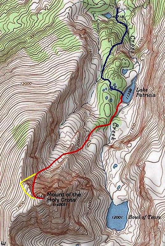
Re: HelpThis map shows a non-standard route that require some off-trail navigation. If you find the correct trail from the maintained Half Moon Pass Trail up to Lake Patricia it's not too bad. But if you don't get on the faint trail then the navigation can be a bit difficult and the terrain rugged. From Lake Patricia to the summit the navigation is pretty straight forward.
The north ridge is considered the standard route and I believe it is fairly obvious (though I haven't done it). I think the big challenge there is on the way down you need to make sure you head east at the correct point so that you get into the East Cross Creek drainage. It seems like several parties every year wander down into the Cross Creek drainage, get lost, and have to be rescued. Click here for such a story. Click here for a description of the North Ridge Route.


Comments
Post a Comment