
Viewing: 1-4 of 4

Dean - Feb 24, 2004 8:50 pm - Voted 10/10
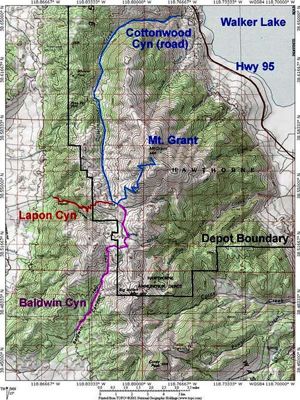
Great map![]()
drm519 - Feb 28, 2004 6:32 am - Voted 10/10
Re: Great mapIs it possible to climb right up from the road on the east? I realize there is a lot of elevation involved, but could you park the car, jump a fence and make way up one of those two creek canyons? Just wondering.

ScottyS - Feb 28, 2004 5:50 pm - Hasn't voted
Re: Great mapTheoretically, you could climb it from roads on either side that way. Of course, most people just prefer to drive....;-)
A long time ago, I walked most of the way up the Cottonwood Creek road --- boring.
Going up a canyon without a road in Nevada is almost always a horrific bushwack. Stay to ridges on the desert peaks --- that's what I say.
gonewest - Aug 14, 2008 5:42 pm - Hasn't voted
cottonwood cyn road closureThere's a great 4wd road from Cottonwood Cyn that goes fairly close to the summit. Even though it's on the other side of the mtn from the ammo dump it's closed at the entrance. go figure.
Viewing: 1-4 of 4


Comments
Post a Comment