
-
 4808 Hits
-
 74.01% Score
-
 4 Votes
|
|
Route |
|---|---|
|
|
46.95053°N / 10.30960°E |
|
|
Hiking, Skiing |
|
|
Half a day |
|
|
Hike |
|
|
Overview
 Looking towards Vesilspitze during the ascent Looking towards Vesilspitze during the ascent |
As detailed on the main page, Palinkopf is not the most beautiful mountain to climb. Most routes wouldn't deserve a description but there is one which is worthwhile since it reserves the ski run experience for the last 20 or 30 minutes. It is the route through Val Musauna to the Zeblasjoch saddle and from there across the ridge towards Palinkopf.
Most of the route runs along dirt roads, only the ridge traverse from Zeblasjoch to the base of Palinkopf runs along a hiking path. Still - and even though the higher part of the route crosses and follows ski-runs - the route has some beauty, mainly because of the brightly green pastures out of which impressive limestone faces rise. The most impressive one is Vesilspitze or Piz Rot, which is located directly above the Zeblasjoch saddle.
Getting There
The main page already describes ow to get to Samnaun. There are a lot of parking lots but none of them in the village, rather stay at the eastern outskirts.Route Description
 The end of Val Musauna
- Start altitude: 1800m
- Summit altitude: 2864m
- Prevailing exposure: W
- Type: Hike
- Protection: None
From the centre of Samnaun follow the signs to Zeblasjoch. The road runs through the western outskirts of the village and soon heads out into Val Musauna, the valley which directly runs in the direction of the saddle. After a sort while (15 min) the normal route to Samnaun's highest mountain, Muttler, turns off to the left into Val Chamins. The road turns into a gravel road, which heads out at the bottom of the valley directly for Vesilspitze in the west. It winds to the base of a big step in the terrain, across which a waterfall tumbles.
 Val Musauna Val Musauna |  Leaping creek Leaping creek |  Piz Chamins Piz Chamins |
The route heads on to the rigt of the waterfall, climbing the step in several switchbacks and quickly gaining height. After another 30 minutes the road reaches a large sloped plateau, across which it winds towards Zeblasjoch. The meadows on the plateau are the most beautiful part of the Palinkopf ascent and they stretch on for about 45 minutes. Finally a large bend leads you underneath the Vesilspitze north face towards the Zeblasjoch saddle.
 Val Chamins Val Chamins |  Vesilspitze Vesilspitze |
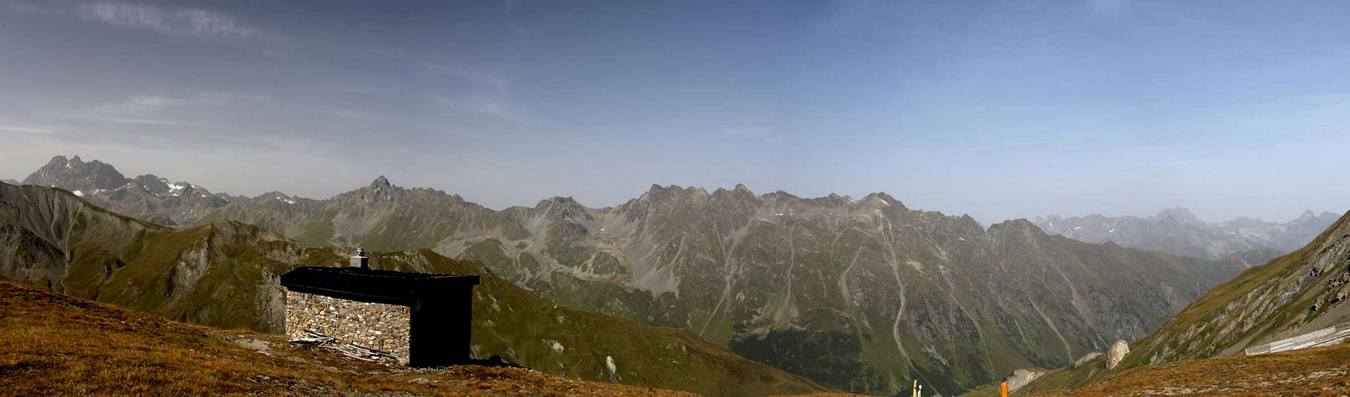
There are two possible routes to Palinkopf from the saddle. One - about 600m to the east of Zeblasjoch - follows another road towards the east face of the mountain, where it joins the eastern ski runs. The other more recommendable one head up on the ridge between the saddle and Palinkopf. At the highpoint of the ridge you'll find a customs-hut, form which you have a wonderful view of the eastern Silvretta Group.
  |
The remainder of the climb is barely worthwhile describing. From the hut you descend to another saddle from which you have the choice between two ski runs, one in the west, one in the east of the mountain. The western one has the better views, the eastern one is more open and thus less depressing.