
-
 8804 Hits
-
 79.04% Score
-
 10 Votes
|
|
Mountain/Rock |
|---|---|
|
|
46.70267°N / 12.19311°E |
|
|
Hiking |
|
|
Summer, Fall |
|
|
7808 ft / 2380 m |
|
|
Overview
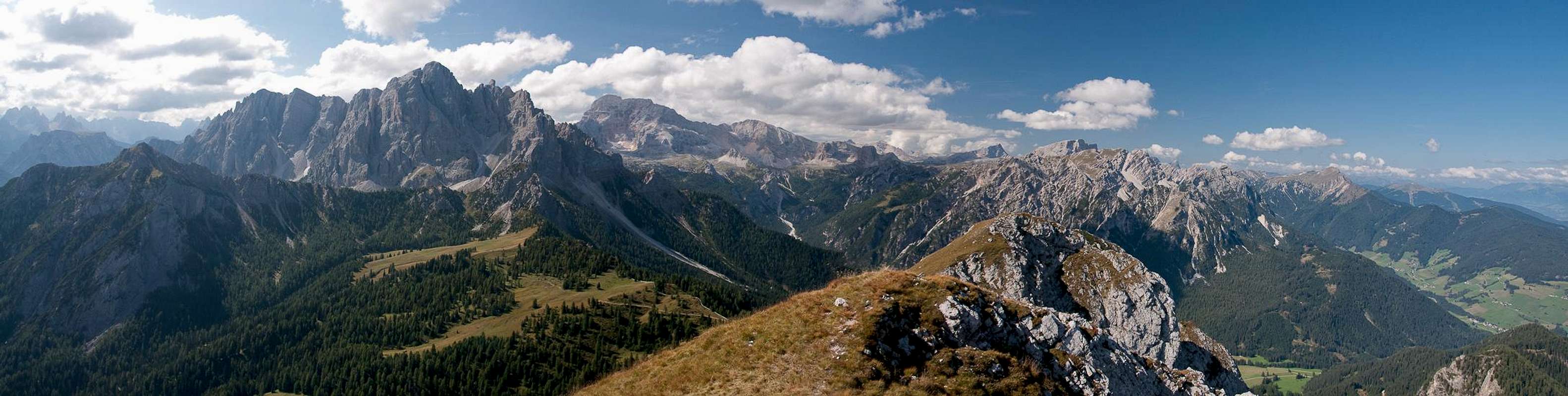
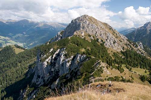 Sarlkofel / Monte Serla as seen from Lungkofel / Monte Lungo Sarlkofel / Monte Serla as seen from Lungkofel / Monte Lungo |
If you compare the Prags / Braies Dolomites with the neighbouring Dolomite mountain groups you will notice a great difference. While the Sexten / Sesto Dolomites on the other side of Höhlensteintal /Val Landro lure visitors with hundreds of towers, spires and pinnacles, the Prags / Braies Dolomites are much quieter with huge pastures and only occasional mountains raising their heads in between. It is telling that the most important attractions are Pragser Wildsee / Lago di Braies and Plätzwiese / Prato Piatta, a lake and a meadow. Nevertheless there are some important (and even impressive) mountain, not least among them Dürrenstein / Picco di Vallandro.
To the north of this mountain, the Prags / Braies Plateau quickly drops towards Pustertal / Val Pusteria, but before it does it leaves a region of lower summits popping out of its slopes. Of these the most important are Sarlkofel / Monte Serla and its siamese twin, Lungkofel / Monte Lungo, two mountains, which are connected by a short but wide ridge. Both summits stand out over the surroundings and depending on your viewpoint can appear much more intimidating than they actually are.
 |  | 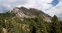 |
Sarlkofel / Monte Serla is the eastern of the two mountains. Like Dürrenstein / Picco di Vallandro it rises out of the gorge-like Höhlensteintal / Val Landro and like its big brother it does so with vertical walls. In Sarlkofels case these walls are about 800m high and form a veritable barrier or portal to the narrow valley. When seen from the outside, from Toblach / Dobbiaco in Pustertal / Val Pusteria the mountain is like a broad pyramid in appearance.
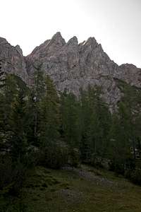
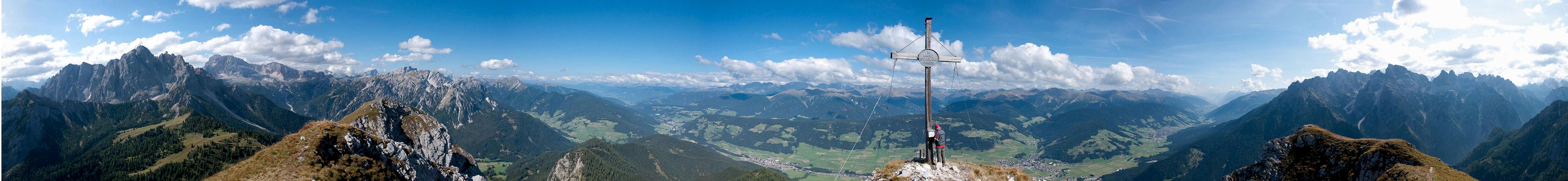
However, when seen up close you'll realise that Sarlkofel's summit is split in three with the eastern summit being the highest at 2380m. There are two regular hiking routes to the mountain, both starting at Bad Altprags / Bagni di Braies and both joining forces in Sarlsattel, the saddle, which separates the mountain from its lower neighbour Lungkofel. Thanks to its exposed location, Sarlkofel is an excellent lookout peak, offering good views towards the Sexten / Sesto and Prags / Braies Dolomites as well as the Hohe Tauern Group in the north.
360° Summit Panorama
  |
Getting There
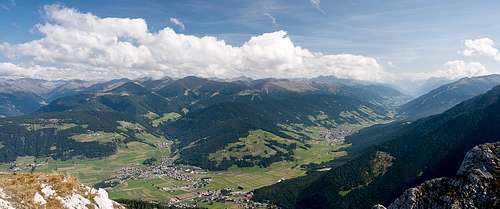 Pustertal / Val Pusteria as seen from Sarlkofel / Monte Serla
From The North
- Take A22 Brenner Motorway to exit Brixen / Bressanone
- Turn off onto SS49 east to Bruneck / Brunico or Toblach / Dobbiaco
From Austria (East)
- Take A12 Inntalautobahn to exit Kufstein.
- Turn onto B178, later B161 south in direction Kitzbühel.
- At Mittersill B161 turns into B108 which heads through Felbertauern Tunnel.
- Take B108 until Lienz were you turn right (west) onto E66 which on the border crossing turns into SS49 to Toblach / Dobbiaco and Bruneck / Brunico.
From Udine
- Take A23 north to exit Carnia.
- Turn off onto SS52 which leads through several detours to Innichen / San Candido
- Turn east on SS49 to Toblach / Dobbiaco and Bruneck / Brunico.
From Venezia
- Take motorway S27 north towards its end near Belluno.
- Turn onto SS51 towards Cortina d’Ampezzo and on to Toblach / Dobbiaco.
Red Tape
 |
In 1980 an area of 25680ha has been set aside for the natural Park Fanes Sennes - Prags. You are required to treat the Natural Park with care: leave animals and plants in their place, use trails (especially when mountain biking), and take the official open roads with your car.
For more information you can look at the parks official website
Accommodation
For hotels and apartments have a look at the websites of the towns and cities of the area:Weather Conditions
 |
Maps & Books
Books
The Prags Dolomites / Dolomiti de Braies are not as well covered in terms of Guidebooks. The list below offers the German books I know of dealing with the area but there certainly are more, especially Italian ones.
- Dolomiten 5 - Sexten - Toblach - Prags
F. Hauleitner
Rother Verlag
ISBN: 3 7633 4199 4
- Dolomiten
P. Fleischmann
Kompass Verlag
ISBN: 3 8705 1409 4
Sextener Dolomiten extrem - Alpenvereinsführer
R. Goedeke
Rother Verlag
ISBN: 3 7633 1255 2
Maps
The most commonly used maps are the ones by Kompass and by Tabacco. The Kompass one is good as an overview map while the Tabacco one offers more details.
- Bruneck - Toblach / Brunico Dobbiaco
Kompass Map WK 57
ISBN: 3 85491 064 9
Scale: 1:50000
- Dolomiti di Braies / Pragser Dolomiten / Marebbe / Enneberg / Plan de Corones / Kronplatz
Tabacco Map 031
Scale: 1:25000