Overview
![Tellerjochspitze / Montello]() Tellerjochspitze / Montello as seen from the west above Tellerjoch Saddle Tellerjochspitze / Montello as seen from the west above Tellerjoch Saddle |
The village of
Durnholz / Valdurna is located at the dead end of one of the major valleys of the
Sarntal Alps / Monti Sarentini. Though it is surrounded by mountains, all over 1000m higher than the village, one mountain dominates:
Tellerjochspitze / Montello. It rises at the eastern end of
Durnholzer See / Lago Valdurna, a nice mountain lake, together with which it is the main attraction from the village or the lake promenade. A closer look reveals, however, that the mountain is connected on its eastern side with the west ridge of
Jakobsspitze / Cima San Giacomo, the highest mountain of the western half of the
Sarntal Alps. The separating saddle,
Tellerjoch, gave rise to the mountain's name.
Tellerjochspitze / Montello rises very steeply from the surrounding valleys. While its base is covered with forests, its mid-slopes are covered with pastures and the top is considerably rocky. Though it doesn't rise much above the
Tellerjoch Saddle, its summit crest is long rather than wide and it possesses two summits at 2508m and 2563m. The lower summit carries the cross and is the one visible from the village of
Durnholz / Valdurna below.
There are two routes to the mountain, both of which head for
Tellerjoch. The saddle is located on the
Sarner Hufeisentour trekking trail, a multiday trail which follows the horseshoe-shaped
Sarntal Alps Range. The routes pass by the mountains on either the northern or southern sides, before a slope traverse leads back to the saddle. The trail passes about 200m to the east of the saddle. To climb the mountain, try to reach the saddle from its northern side from where a short scramble of little exposure takes you to the summit. Views are open to the north, south and west only, as
Jakobspitze / Cima San Giacomo obstructs views in the east.
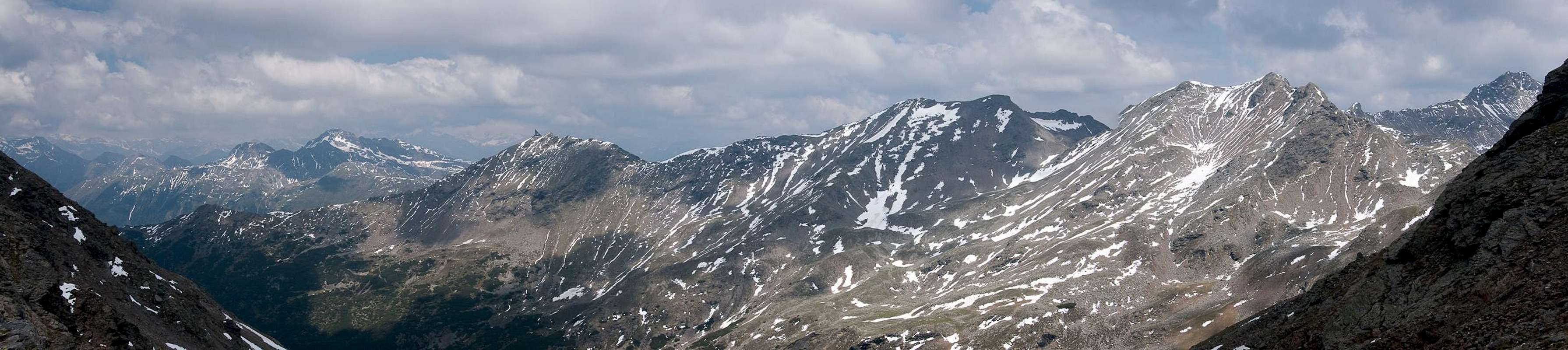
Tellerjochspitze / Montello is a good vantage point to see the whole
Gentersbergkamm Ridge, which can be seen in the north-west, just across Durnholz / Valdurna.
Panoramic View
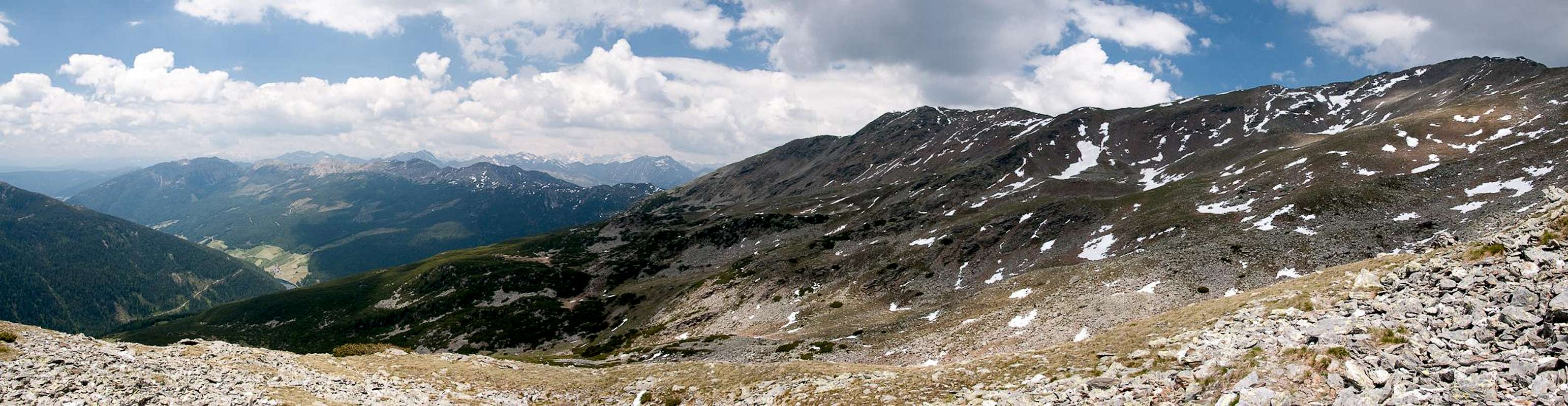
Tellerjochspitze and Jakobspitze as seen from the south. Gentersbergkamm to the left |
Getting There
![Tellerjochspitze / Montello]() Tellerjochspitze / Montello
Tellerjochspitze / Montello
There is only one reasonable trailhead for
Tellerjochspitze / Montello, at the village of
Durnholz / Valdurna in
Sarntal / Val Sarentino.
- Durnholz / Valdurna trailhead
- Take Brenner Motorway A22 to Bozen / Bolzano
- Drive through the city, following signs to Sarntal / Val Sarentino on SS508
- At Astfeld / Campolasta turn off onto SP137, direction Durnholz / Valdurna. You have to park outside the village and will be charged a fee of 3€.
- You can also reach the village from Sterzing / Vipiteno across Penser Joch / Passo di Penes (also SS508). Again you have to torn onto SP137 at Astfeld / Campolasta.
Red Tape
Sarner Weißhorn, Hohe Scheibe, Mutnelle, Hörtlahner Spitze, Tagewaldhorn |
There is no red tape in this area. Except for a few sheep and goats the area is not used for farming. In
Durnholz / Valdurna you will have to pay a fee of 3€ for parking.
Accommodation
Eisacktal / Valle Isarco
Bozen / Bolzano
Weather Conditions
Maps & Books
Maps
- Digital Maps
- Regular Maps
- Sarntal/Val Sarentino
Kompass Map WK 056
1:35.000
ISBN: 3-85491-340-0
- Brixen / Bressanone
Kompass Map WK 56
1:50.000
ISBN: 3-85491-063-0
- Bozen / Bolzano
Kompass Map WK 54
1:50.000
ISBN: 3-85491-061-4
- BOLZANO-RENON / BOZEN-RITTEN-TSCHÖGGLBERG
Tabacco Map 034
1:25.000
- MONTE SARENTINI / SARNTALER ALPEN
Tabacco Map 040
1:25.000
Books
- Bozen-Salten-Schlern
Kompass Guidebook WF953
Kompass Verlag
ISBN: 3-85491-406-7
- Rund um Bozen
Helmut Dumler
Rother Verlag
ISBN: 3-7633-4267-2

 3828 Hits
 79.78% Score
 11 Votes
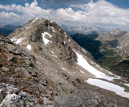 Tellerjochspitze / Montello as seen from the west above Tellerjoch Saddle


 Tellerjochspitze / Montello