Rising just east of the Făgăraş and Iezer mountains, the Piatra Craiului is usually regarded as the east end of the Făgăraş Group (part of the South Carpathians) and has always been regarded highly, which is reflected in the name of the mountains that translates as the Royal Rock, or King's Stone.
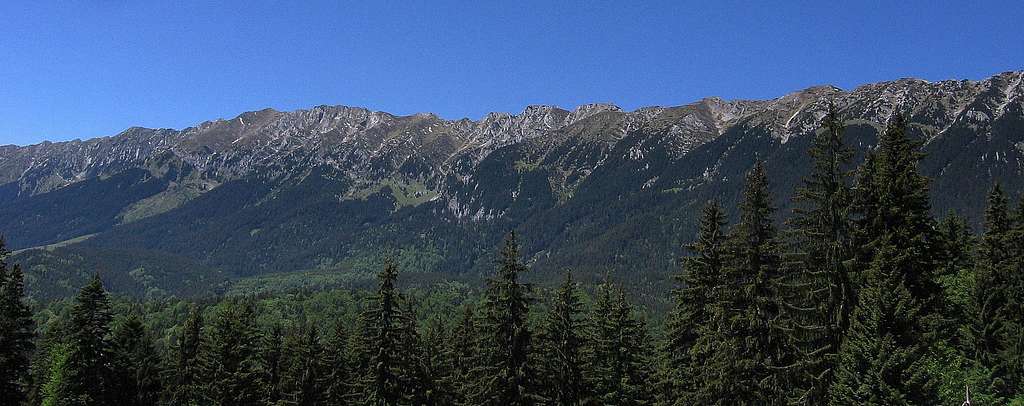
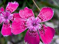
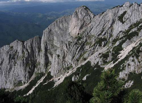
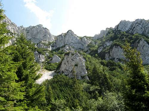
The Piatra Craiului is - in a nutshell - about a dozen kilometers long, narrow ridge of Jurassic limestone, which runs NNE to S like a stately sawtooth spine of a gigantic dragon. These limestone mountains – thanks to their jaggedness – have remained fairly untouched by the pastoral economy that has shaped the landscapes of most Carpathian ranges for centuries, if not millennia. No wonder the Piatra Craiului is home to many a bear, wolf and lynx as well as endemic flower species, such as the pink named Dianthus callizonus.
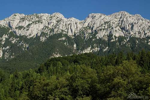
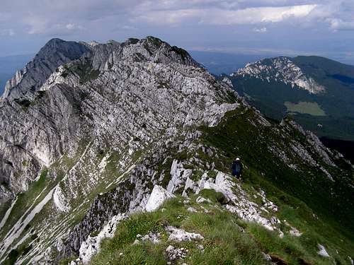
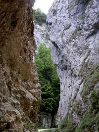
Ţimbalele from Plaiul Foii, Ţimbalul Mare left of centre - by Tomek Lodowy
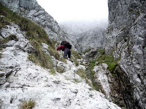
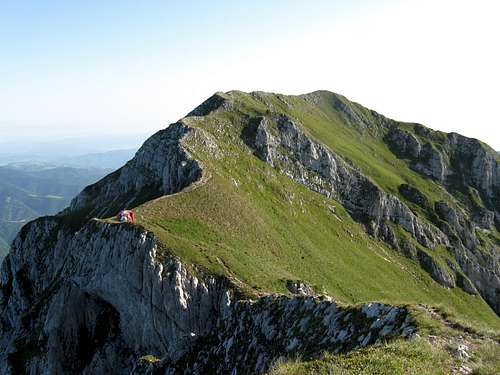
The range is every Carpathian scrambler's dream. Those who prefer technical climbing also frequently scale its sheer limestone walls and towers, although the Bucegi Mountains, which sit about 20km to the south-east, are much more popular with rock climbers. The Piatra Craiului is a compact mountain range, perfect for day hikes or climbs. Weather permitting, you can hike along a waymarked trail from a hut at the foot of the mountains at about 800m up onto the crest, which reaches a peak in La Om or Piscul Baciului (Pásztor-csúcs/Hirtenspitze/Shepherd's Peak) at 2239m (878m of prominence), and come back down within one long summer day. The main ridge trail, without an ascent and descent and without a heavy backpack, can be hiked in about six hours. What is meant by the main ridge trail here extends between the passes of Crăpăturii in the north and Funduri in the south. Its length is about ten kilometres. However, the actual length of the whole main ridge, including the southernmost section, is nearly 25km – more than twice as much as the length of the main ridge trail as defined above. As for rock difficulty, the main ridge trail is occasionally YDS class 3 (whereas the most difficult waymarked trail climbing the northwestern side of the mountains is class 4). NB There is virtually no water anywhere near the crest.
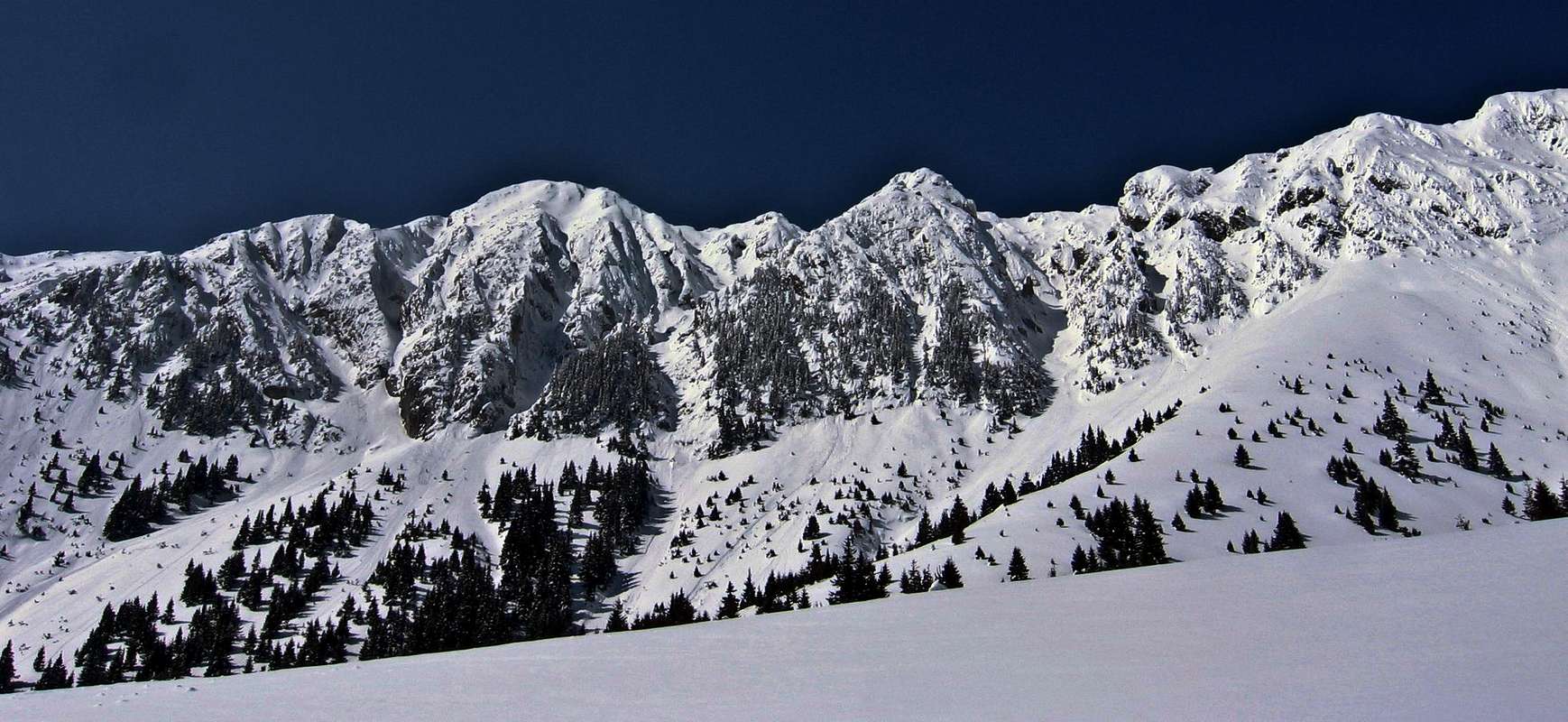
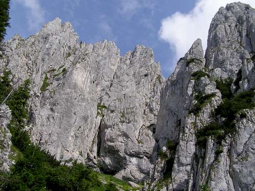
The part of the main ridge which extends north from La Om (or rather north from Şaua Grindului (Grind Saddle), which is just south of La Om) is understandably called Creasta Nordică (North Ridge), whereas in the opposite direction stretches Creasta Sudică. The second highest and the most prominent peak on the North Ridge except La Om is Ţimbalul Mic (Little Dulcimer in English) at 2231m, with a prominence of almost 120m. But the most impressive in the Ţimbalele group, which lies halfway along the North Ridge, seems to be Ţimbalul Mare (Great Dulcimer) at 2177m, over 90m of prominence. The highest summit on the South Ridge is Umerilor at 2209m (over 60 m of prominence) facing La Om over Şaua Grindului.
The main ridge trail is intersected by waymarked paths at the following points:
Vf. Turnu (vf. = short for vârful = peak) at 1911m at the north end of the main ridge
Şaua Padinei Închise (şaua = pass) at 1936m or nearby Vf. Padina Popii at 2018m on the trail from Plaiul Foii to Cabana Curmătura (please see chapter 6) via Padina Popii
Vf. Ascuţit at 2150m on the Plaiul Foii-Cabana Curmătura trail whose eastern part running up Brâul Ciorânga Mare was opened to the public in 2010s
Şaua Grindului at 2200m/Vf. La Om, on the trail from Plaiul Foii to Refugiul Grind (the western part of this trail, named Drumul lui Deubel (Deubel's Route), also known as La Lanţuri, i.e. Chains, is YDS class 4 in a couple of places)
Şaua Funduri at 1889m, at the south end of the main ridge trail
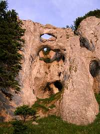
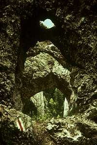
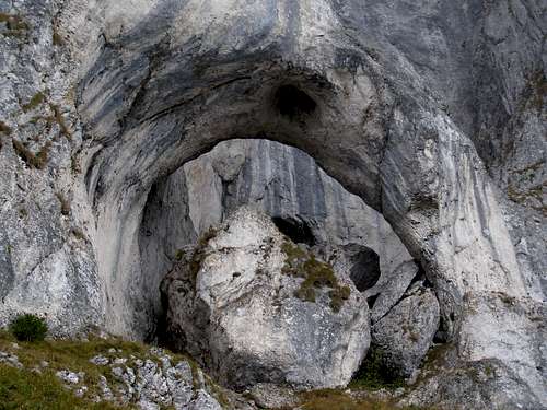
The western face of the Piatra Craiului is an imposing wall whose highest parts are virtually inaccessible to non-technical climbers, except the few routes listed above (whose hardest bits are secured with metal cables) and a couple of unmarked paths reaching UIAA grade II, that is to say more or less YDS 5.2 in terms of technical difficulty. This western flank of the mountains is cut by steep ravines, called padinas in these mountains, which are lined by and elaborately decorated with thousands of limestone walls and spires, among which you can get lost easily. The La Lanţuri route, which is part of the line dividing the North Ridge from the South Ridge, passes by some beautiful limestone arches at a spot called La Zaplaz, which used to be known as Deubel Holes. Talking of karst arches, the largest and most magnificent is Cerdacul Stanciului at the western base of the South Ridge.
The eastern face of the Piatra Craiului is much gentler except for a couple of places, such as the northernmost section of the South Ridge. The northeast edge of the mountains is several hundred meters lower (1816m) and much shorter, but not much different in shape from what runs to the south-west from it. It is named Piatra Mică, i.e. Little Rock, and towers right over the town of Zărneşti.
The mountains have been designated a National Park so you are only allowed to camp at the campsites by the huts. If you get caught off the waymarked trail, you are likely to incur a fine of several hundred euros! Here's more about the Park rules
A few kilometres north-east of the town of Zărnești the Libearty Sanctuary has been set up. Several dozen bears, mostly Romanian, are enjoying a new life there.
When To Go
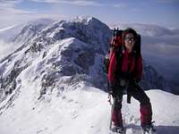
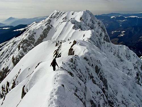
January, behind Andreea is Ţimbalul Mic
In wintertime relatively few people go climbing in the Piatra Craiului, on the other hand, among those few people the percentage of SP members seems to be a little higher. :) In June there can still be plenty of snow in the couloirs and ravines. In July and August, the trails can get crowded in places. July can be rainy, depending on the year. Late summer and the first half of autumn seem to offer the best chance of your enjoying whatever snowless fun you have come for.
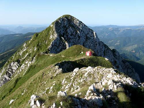
Refuge Lehmann on Vf. Ascuţit (Sharp Peak), 2150m, N part of N Ridge
In summertime, finding accommodation at the foot of the Piatra Craiului is not difficult. There are several huts (in winter they are usually packed with people), often with an adjacent camping ground, around the mountains. The town of Zărneşti offers a range of guesthouses. The mountains are dotted with characteristic shelters (refugiul's), most of which look like halved soccer balls. These refuges are rudimentary, but unlocked and offering shelter if the weather gets foul or if it's getting dark. Two of them are located on the main ridge, both at above 2100m. The first huts and shelters in Piatra Craiului were built toward the end of the 19th century by the Siebenbürgischer Karpatenverein. (Transylvania used to be much more multi-ethnic - more info in this SP article.)
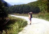
The most convenient base for the North Ridge area is a place called Plaiul Foii, where a hut has stood for over a century and where today there are several facilities in which rooms/beds can be rented, plus a campground where one can pitch the tent (do not count on peace and quiet). For the South Ridge area, Cabana Garofiţa Pietrei Craiului (cabana = hut) can be a nice place to stay. The most convenient hut for Piatra Mică is no doubt Cabana Curmătura at 1470m, the only problem being the quality of service and cleanliness, of which there have been some not very enthusiastic opinions in recent decades, so to some a cozy guesthouse in Zărneşti may be a more appealing option.
Foot of the west wall down below; Plaiul Foii on the left
Getting There
Access to the mountains is pretty good. Apart from the road, there are good railway connections from Bucharest, the capital city of Romania, to the city of Braşov, where - if going by train - you have to change and get on the train for the town of Zărneşti (the journey takes just about half an hour) at the very foot of the Piatra Craiului.
Children refers to the set of objects that logically fall under a given object. For example, the
Aconcagua mountain page is a child of the 'Aconcagua Group' and the 'Seven Summits.' The
Aconcagua mountain itself has many routes, photos, and trip reports as children.
Parents refers to a larger category under which an object falls. For example, theAconcagua mountain page has the 'Aconcagua Group' and the 'Seven Summits' asparents and is a parent itself to many routes, photos, and Trip Reports.


 37144 Hits
 97.79% Score
 73 Votes


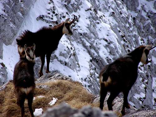 The chamois - photo by CiprianLolu
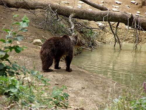 Bear sanctuary - photo by CiprianLolu
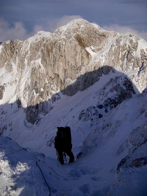 January, behind Andreea is Ţimbalul Mic
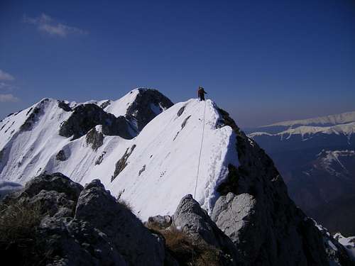 On the South Ridge in April - photo by gabriela
 In spring, climbing up Padina lui Călineţ - photo by cernomor
 The summer rain's over - photo by mibu
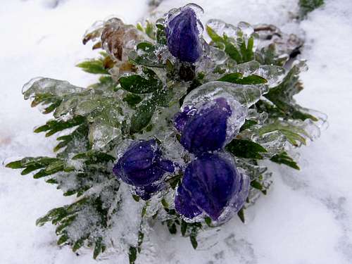 Freezing in a September
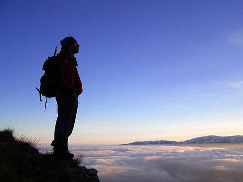 A rescuer in his home - photo by CiprianLolu
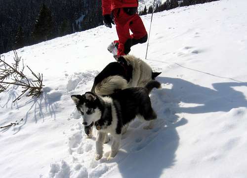 A rescue team member's huskies
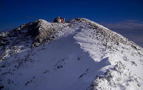 Refuge Lehmann on Vf. Ascuţit (Sharp Peak), 2150m, N part of N Ridge
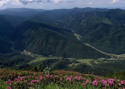 Foot of the west wall down below; Plaiul Foii on the left
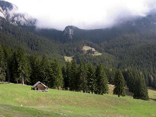

 The very top of La Om a.k.a. Piscul Baciului, 2239m
 Piatra Craiului from Bucegi
 Le Slaubeause