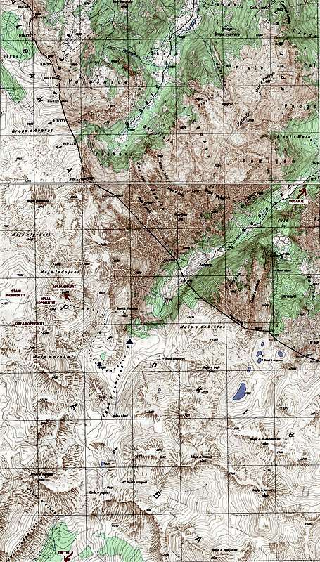
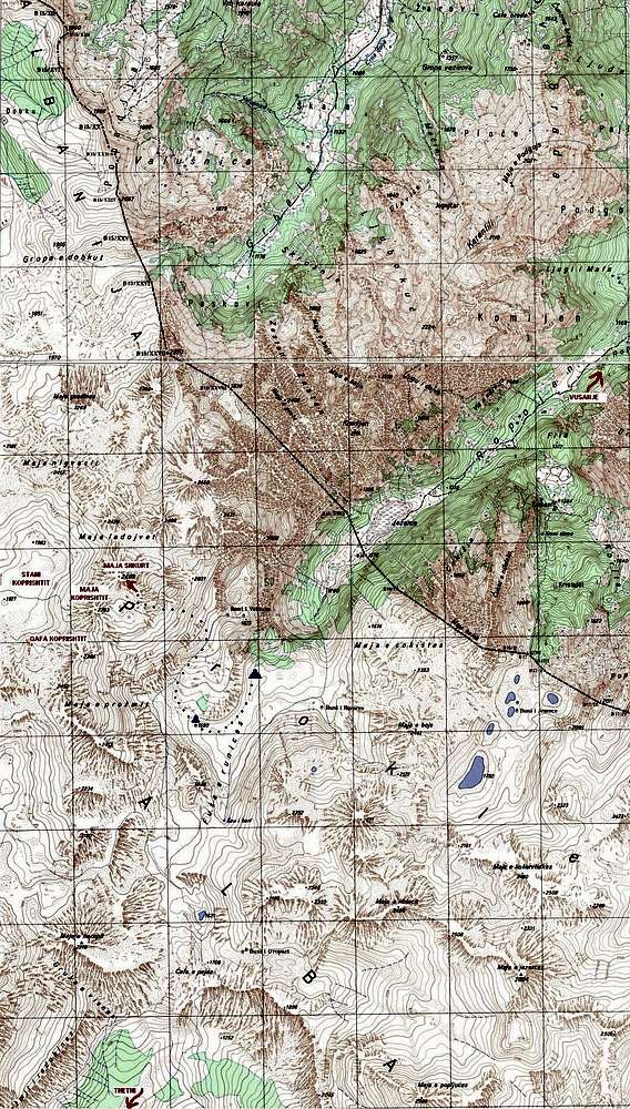
Old Yugoslavian military map with marked approach to Maja Shkurt from Ropojana valley (dotted blue) and the climbing route Peacehammer (red arrow). Directions to Vusanje in Montenegro and Thethi in Albania are shown with arrows to north and south, respectively. Shepherds' summer settlements (katuns) are shown with blue triangles - Fusha Runices (lower) and Buni Vukoces (higher). In summer 2011 only the former was used by shepherds.


