
|
|
Mountain/Rock |
|---|---|
|
|
46.96230°N / 10.93860°E |
|
|
Hiking, Skiing |
|
|
Spring, Summer, Fall, Winter |
|
|
9895 ft / 3016 m |
|
|
Overview
A few German words
| Ferner, Gletscher | Glacier |
| Kamm | Ridge |
| Kogel (plural: Kögel, also Koegel) | Mountain top |
| Schwarz | Black |
| See | Lake |
| Straße (also Strasse) | Road |
| Tal | Valley |
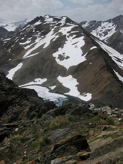
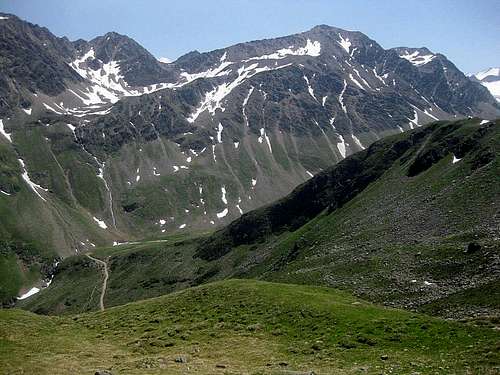
Schwarzkogel from Rotkogel
Between Polleskamm and Geigenkamm lies the very quiet Pollestal. In stark contrast, on the southeastern side of the Polleskamm you'll find the busy Rettenbachtal. In winter, this is the heart of the Söldener ski area. The Schwarzkogel lies at its very edge, and one of the ski lifts goes almost to the top. Even in cumbersome ski boots, I estimate that it would take no more than 10 minutes to walk up the last part. Although the ski developments take away a little bit from the summer experience, the views from the top are still great.
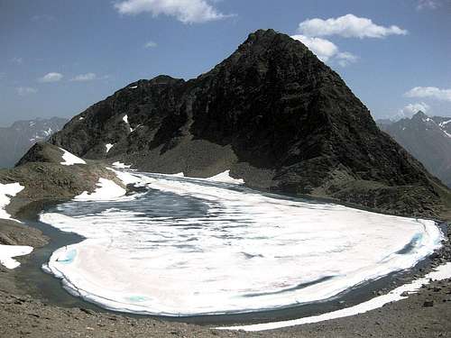
Ice and snow on the Schwarzsee, with the Rotkogel on the other side, seen from the upper slopes of the Schwarzkogel
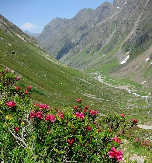
Alpine rose in the Pollestal
The easiest way to get to the Schwarzkogel is by the Gletscherstraße. The shortest route in distance starts at Gasthof Falkner (2145m), the shortest in time at the junction with the dirt road at around 2500m. Alternatively, from Sölden you can take the Giggijochbahn, one of the few lifts in the area that operate in summer to quickly transport hikers up into the mountains. Or you can simply walk up from Sölden.
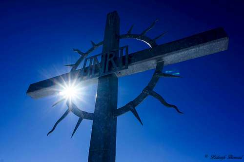
Summit Cross

Getting There
There are ski resorts all over the long Ötztal valley, but the nearby village of Sölden is arguably the most important one. It's easy to get there by car or by public transport, but being such a popular place, in winter it's not as easy to get a bed if you just walk in without a reservation.In summer, there are far less tourists and that makes it a very different place. Most visitors come for hiking, mountain biking, cycling and sight seeing; a small minority come for other activities, such as climbing the big glaciated peaks in the southern Ötztal area. All in all, while Sölden is far from crowded in summer, it's not deserted either. Some restaurants are closed, but there are still plenty open for business. At first glance, all the ski outlets seem to have turned into specialist outdoor stores - and the staff really know what they are talking about. Public transport is excellent, and if you arrive unannounced, you'll quite likely have no trouble finding accommodation - unless you happen to stumble in during one of the special summer events, especially the Ötztal cycling marathon. All this make it an excellent base for exploring the area.
Sölden can be reached from only two directions, north or south.
The northern entrance to the Ötztal lies at the small village of Ötztal Bahnhof, and can easily be reached by train or car from east, west or north. The city of Innsbruck lies just east of there. It has a small international airport, but further north, Munich is still close and it has much better connections, and you can take a train from there.
From Italy in the south, you can drive over the very scenic Timmelsjoch, a high mountain pass. It's closed in winter and when there is too much snow. In that case the alternative route from the south is over the Brenner pass, via Innsbruck.
Approach
Either on the ascent, on the descent or both, you are very likely to pass the Rotkogelhütte (2660m). There are many ways to get there from Sölden. A selection (the times given are only for getting to the Rotkogelhütte):- Hike all the way from Sölden (1368m).There are several possible trails, some of which occasionally cross or even follow the Gletscherstraße. The steepest and therefore shortest route basically follows the Rettenbach from Sölden all the way to Gasthof Falkner (2145m) at the side of the road. From there, a steep zig zag trail leads to the hut. A slightly longer alternative would be to hike via Hochsölden (2050m). Either way, the lower half of the route steeply ascends through woodlands, then higher up it's grassy slopes.
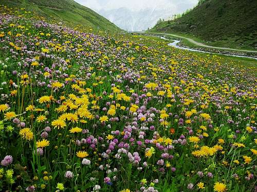
![Flowers early summer in the Rettenbachtal]()
Flowers early summer in the Rettenbachtal
The woods are pleasant enough for hiking, and once above the tree line the views are great, but the necessary elevation gain makes for a long day. Some specially constructed mountain bike trails run down through the woods, clearly marked and with signs declaring them off limits for hikers, but unavoidably the hiking and cycling trails cross sometimes, and occasionally they even follow the same course for a short while, so be aware that something fast can suddenly come descending towards you on those stretches.
- Ride the Giggijochbahn (cable car) from Sölden up to 2284m, a bit above the tiny village of Hochsölden, then hike west along a winding and gradually ascending trail (1 hour).
- Use either your own transport or the bus to Gasthof Falkner (2145m) along the Gletscherstraße (toll road), then hike up a steep zig zag trail (1¼ hours).
- The easiest but also the least scenic route starts just above 2500m on the Gletscherstraße, where there is a turnoff with a dirt road heading northeast (46.9530°W / 10.9454°W) to the ski area. This is the most convenient trailhead for the route from the southeast - see below. To get to the Rotkogelhütte, follow the gently rising dirt road for half an hour. Occasionally there is a trail running parallel to the road, hugging the slopes above it.
With a bicycle, it's possible to ride up the Gletscherstraße and then take this turnoff to get to the Rotkogelhütte. It doesn't even need to be a mountain bike, but to have one would make for a very fast and exhilarating descent down to Sölden, using the special mountain bike trails in the woods lower down.
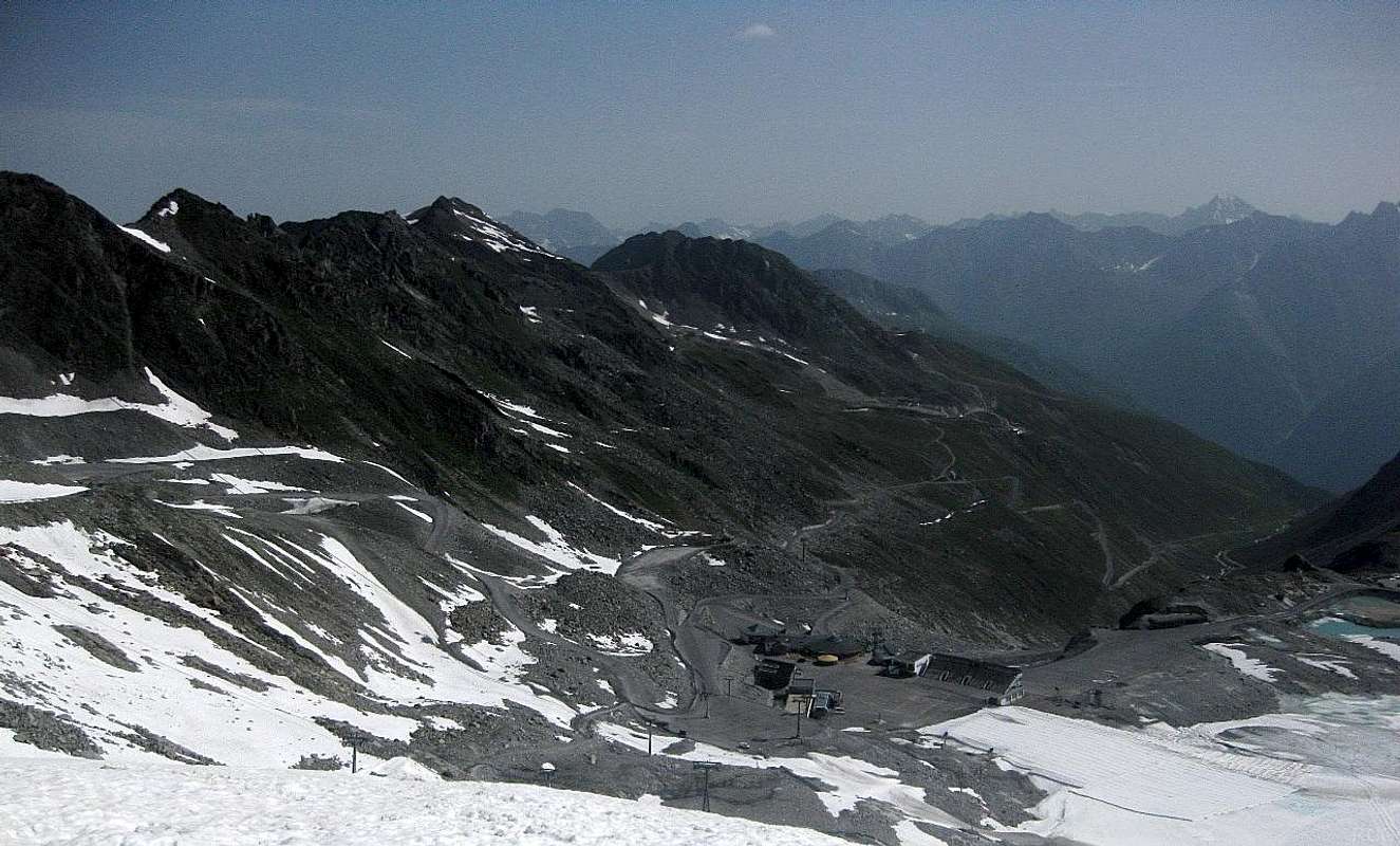
Looking down the Rettenbachtal from the Rettenbachferner. The large and unattractive parking lot is just below, and the Gletscherstraße is clear to see. Both are testament to times gone by, when summer skiing was still going strong. The Schwarzseekogel is the broad summit in the center, the one just to the left of it, with the double top, is the Schwarzkogel. From here, the shortest way to the Schwarzkogel is the SE route: go down along the road to around 2500 and take the dirt road to the left (you can see the junction in the photo), and soon after that , even before passing the Schwarzseekogel, turn left and go up the ski slopes, where you can still a little bit of snow.
Routes
Open Source Map of Schwarzkogel, including the northeast route - not all trails are shown on this map
On the left is the Schwarzseekogel, the slopes on the right belong to the Rotkogel. The trail leads to the saddle between the two, past the Schwarzsee and further to the Schwarzkogel, the deceptively small peak in the distance.
From the northeast
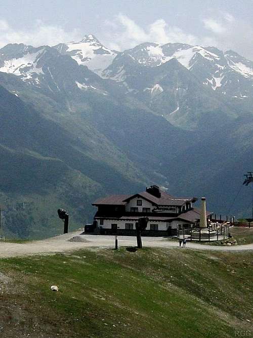
There is no overnight accommodation at the Rotkogelhütte, but the food isn't too bad, and the views are outstanding!
About 5 minutes from the top, where the route passes the summit station of a ski lift, it turns south for the home stretch.
From the southeast
Rotkogel and Schwarzkogel from the Pollestal
See also the large photo at the end of the previous chapter.
From the north
Much, much longer is the route from the north, from the Pollestal, a quiet glacier carved valley running parallel to the Polleskamm. It also joins the northeastern route very close to the ski lift station. The northern route leaves the Pollestal valley floor at around 2300m, but what makes it so long is that it takes a couple of hours to even get there: from the road in the Ötztal valley, the shortest routes start at the villages of Im Brand (1260m), Bruggen (1238m) and the southern tip of Huben (1199m), all near the entrance of the Pollestal.Red Tape
Apart from the toll road, none.When to Climb
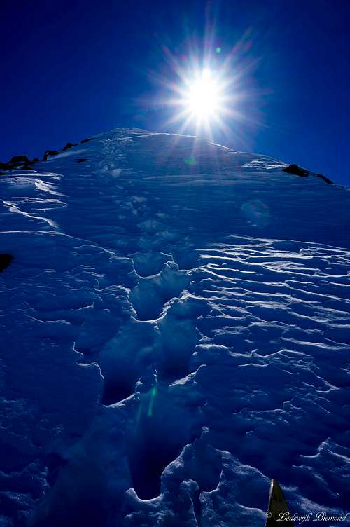
A winter ascent: a steep(ish) part
Camping
Although the name may suggest otherwise, the Rotkogelhütte offers food, but no overnight accommodation. The nearest place to stay is the tiny tourist village of Hochsölden (2050m), but there is much more choice in Sölden itself.Wild camping is not allowed.
External Links
SöldenRotkogelhütte
Oebb is the site of the "Österreichische Bahn" - the Austrian rail company - but it goes further than that. The travel planner includes buses and international trains, such as from Munich.