
-
 18601 Hits
-
 86.85% Score
-
 23 Votes
|
|
Mountain/Rock |
|---|---|
|
|
37.97025°N / 107.5883°W |
|
|
Hinsdale&Ouray |
|
|
Hiking, Mountaineering, Scrambling |
|
|
Spring, Summer, Fall, Winter |
|
|
13218 ft / 4029 m |
|
|
Overview
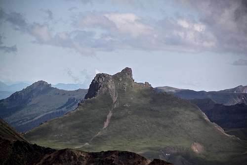
To make things confusing there are two Engineer Mountains in the San Juan Mountains. This one - Engineer Mountain “A” - is a thirteener, easy accessible from the Engineer Pass rough 4WD road. The other Engineer Mountain is located just a few miles south and is accessible from Coal Bank Pass (off Highway 550). This 2nd Engineer Mountain is a prominent landmark seen from Hwy 550, and offers a more challenging climb (class 4) with a beautiful ridge summit. It is sometimes marked as Engineer Mountain “B” since its altitude is lower.
Engineer Mountain “A” 13,218 feet (4029 meters), prominence 418 feet (128 meters), Colorado Rank 469
Engineer Mountain “B” 12,968 feet (= 3953 meters), prominence 1408 feet (430 meters), Colorado Rank 655
Closest Mountains: Seigal Mountain 1.62 miles away, Darley Mountain 0.86 miles away
Parent Lineage: Darley Mountain
Class: 1
 Engineer Mountain "A" Engineer Mountain "A" | 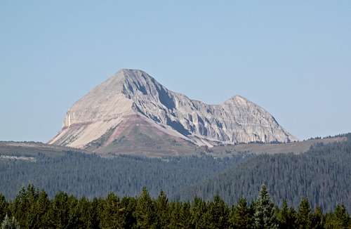 Engineer Mountain "B" Engineer Mountain "B" |
Getting There
Bear Creek Trail - detailed description on SP click here. Briefly: From Ouray, drive 2.3 miles south on US Highway 550 (=Million Dollar Highway) to where the road passes through a small tunnel. The trailhead is on the right (=west) side of the road immediately beyond the tunnel. It is well marked.There is a small parking lot on the west side of the road, and a larger parking lot on the right side of the road. Follow this trail for 7.1 miles to Engineer Pass.
Engineer Pass 4WD Scenic Trail - this is a very popular jeeping destination, part of the historic Alpine Loop (see many links below in External Links section).
History of this road: Six years before building the Million Dollar Highway between Ouray and Silverton, Otto Mears extended his toll road from Saguache to Lake City and through to Animas Forks, via Engineer Pass. Mears network of toll roads continued south to Eureka and Silverton and north to Mineral Point, Poughkeepsie, and Ouray. From its completion in August 1877, this road was an important stagecoach route and the principal freight route for the wagons and mule trains that hauled supplies and ore between all the main mining camps in the area and Saguache, which was the closest major supply center. Within three years, the route had daily stages run by the Rocky Mountain Stage and Express Company.
Engineer Road Description: The route commences south of Ouray on the Million Dollar Highway, US 550. If you wish to avoid the hardest section of the Engineer Pass Trail (some rental companies warn you not to use this approach), the route can be commenced at Silverton via Animas Forks ghost town.
The turnoff from US 550 onto Engineer Pass Trail is well marked. This 4 WD road gets straight down to business. The first five miles are the hardest of the entire trip (I have memories of cursing on this road many years ago when got stuck behind super slow drivers). The road is narrow and steep, rough and has sheer drop-offs. It is very popular and can be very busy during the summer (Leave early). In the winter time it is popular with snowshoers.
At 1.6 mile point, you pass the Mickey Breene Mine, which was discovered in 1890. The mine yielded high grade ore and produced copper and silver.
About 2.5 miles from US 550, the road intersects with Poughkeepsie 4WD road (really rough one). From the Mineral Point turnoff, the terrain starts to clear, with numerous open meadows. The road continues up to Engineer Pass at 12,800 feet.
From the top of the pass, the road descends into American Flats and past the site of Engineer City. From this point, the road follows the path of Henson Creek all the way to Lake City.
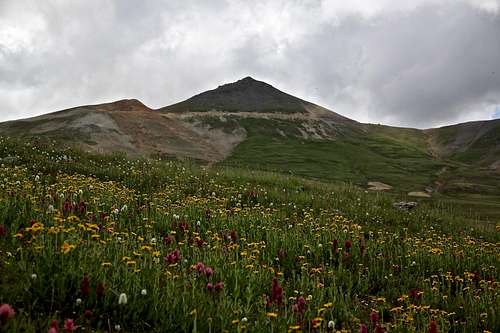
 Upper Bear Creek trail Upper Bear Creek trail |  Lower Bear Creek trail Lower Bear Creek trail |  View of mountains View of mountains |  Wildflowers Wildflowers |  Lower Bear Creek Trail Lower Bear Creek Trail |
 Engineer Road - checking ice Engineer Road - checking ice |  Engineer Road - winter evening Engineer Road - winter evening |  Engineer Road - start Engineer Road - start |  Engineer Road - scenery Engineer Road - scenery |  Engineer Road - winter trail Engineer Road - winter trail |
Route
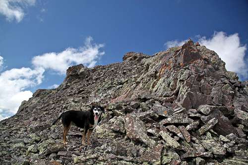
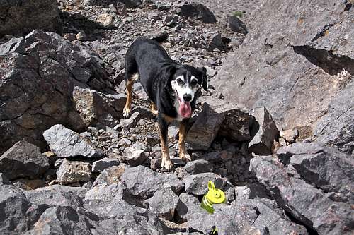
Duchess just below the summit
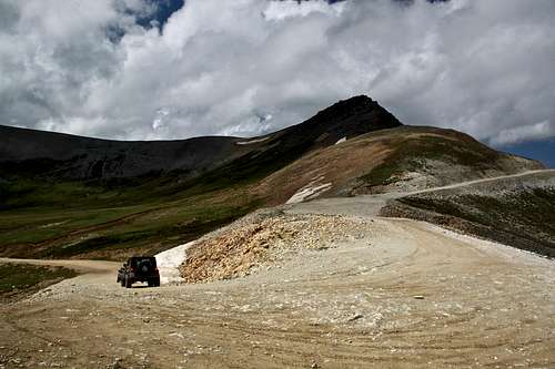
Almost boring looking summit of Engineer Mountain "A" from the Engineer Pass
The distance is less than 0.5 miles from the Engineer Pass Sign, and the elevation gain is less than 500 feet. The views from the summit are spectacular.
Lazy hiker - can drive up all the way to the top of Engineer Pass and reach the altitude of 12,800 feet in his/her vehicle. The hike towards the summit should take less than 20-30 minutes, difficulty class 1-2. And as mentioned above, it involves less than 0.5 mile distance, and less than 500 feet elevation gain.
Slightly more ambitious hiker - can park anywhere below the Engineer Pass summit, and hike initially on 4WD road, then up the east ridge of the mountain. Distance would obviously depend how far do you choose to drive up.
Ambitious hiker - can choose very scenic Bear Creek Trail approach. The difficulty is very easy, nice trail all the way, class 1, and a short section of class 2 below the summit. The trail is incredible scenic, listed as National Recreation Trail, well signed. The round trip distance would be slightly over 15 miles (16.5 miles if combined with Darley Mountain).
Detailed description of Bear Creek trail is available here. (highly recommended).
Very ambitious hiker - can choose to do this hike off season, and hike, snowshoe, ski up Engineer Pass road from Hwy 550. This will be nearly 20 mile round trip distance. Please be aware of avalanche danger during the winter months. The initial section of Engineer Pass road is a popular ice climbing destination, and there are several famous ice climbs in the area. I will mention just a few: Gravity Rainbow, and Kennedy Gully (the YouTube video of this ice climb made it around the world with a nearly fatal accident when a large chunk of melting ice slid away above the climber). The Engineer Pass road can be also mountain biked during the summer months, but please be aware that the road is narrow and there will be a lot of slow jeep traffic along there. Some cars move super slowly, and can take hours to reach the top of the pass. There is also rock climbing at the turn off from Hwy 550 towards the Engineer Pass, e.g. Lightline.
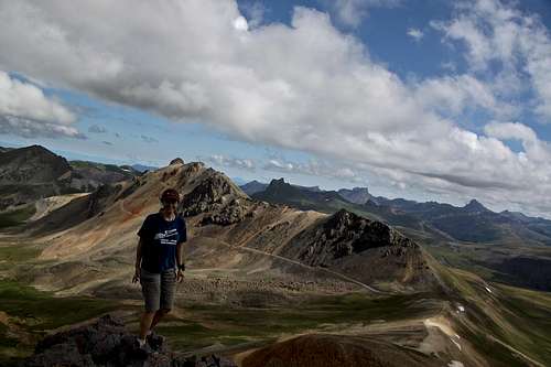
Summit views
 Duchess on the summit Duchess on the summit | 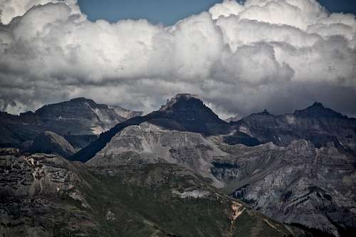 View into Yankee Boy View into Yankee Boy | |
 Darley in the background Darley in the background | 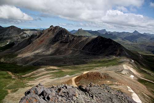 Nice combo with Darley Nice combo with Darley | |
 Wildhorse Peak 13,266 ft Wildhorse Peak 13,266 ft | 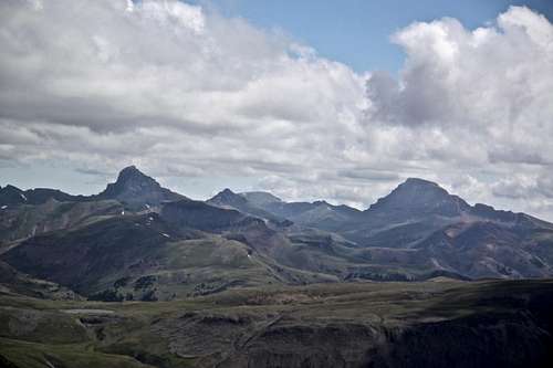 Wetterhorn and Uncompahgre Wetterhorn and Uncompahgre | |
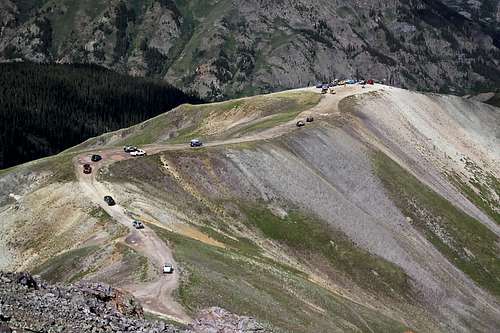 Busy traffic Busy traffic | 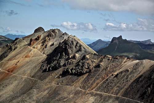 Darley detail Darley detail |
Red Tape
There are no fees to hike up Bear Creek Trail. There is no fee to drive up along the Alpine scenic road.When to Climb
Most hikers will summit during the summer months when the Engineer Pass road opens up. There is a snow typically till June. If you choose to venture to this area during the winter time always check for avalanche conditions. I would recommend for winter access the Engineer Pass 4WD road, and definitively not the Bear Creek trail. The Bear Creek trail is very narrow at places and completely filled with the snow - impassable, unless you are ready to bring a shovel and remove tons of snow to create a passage. Avalance danger could be high here.
Camping
Multiple primitive camping spots along the upper section of Bear Creek trail and also along the 4WD Engineer Pass road. There are no fees if camping on your own, but this also means no facilities.External Links
- Engineer Mountain "A" on 13ers.org
- Engineer Mountain on List of John
- Alpine Loop Scenic Byway
- BLM Alpine Loop Backcountry Byway
- And more information on Alpine Loop
- You tube clip to see what to expect if driving
- Rock climbing off Engineer Pass Road - I have climbed only Lightline.
- Ice climbing at Engineer Pass Road: Gravity Rainbow and Kennedy Gully among a few.