August 10 - 13
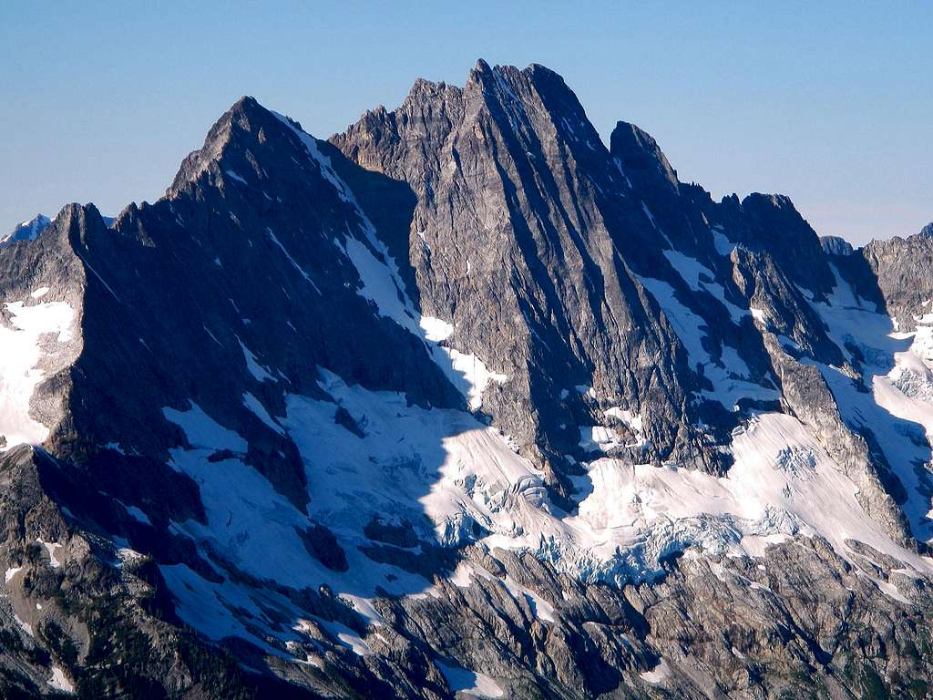
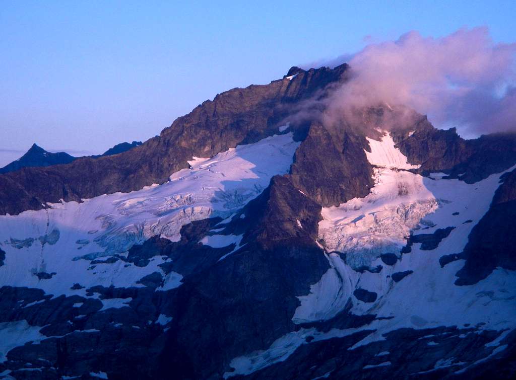
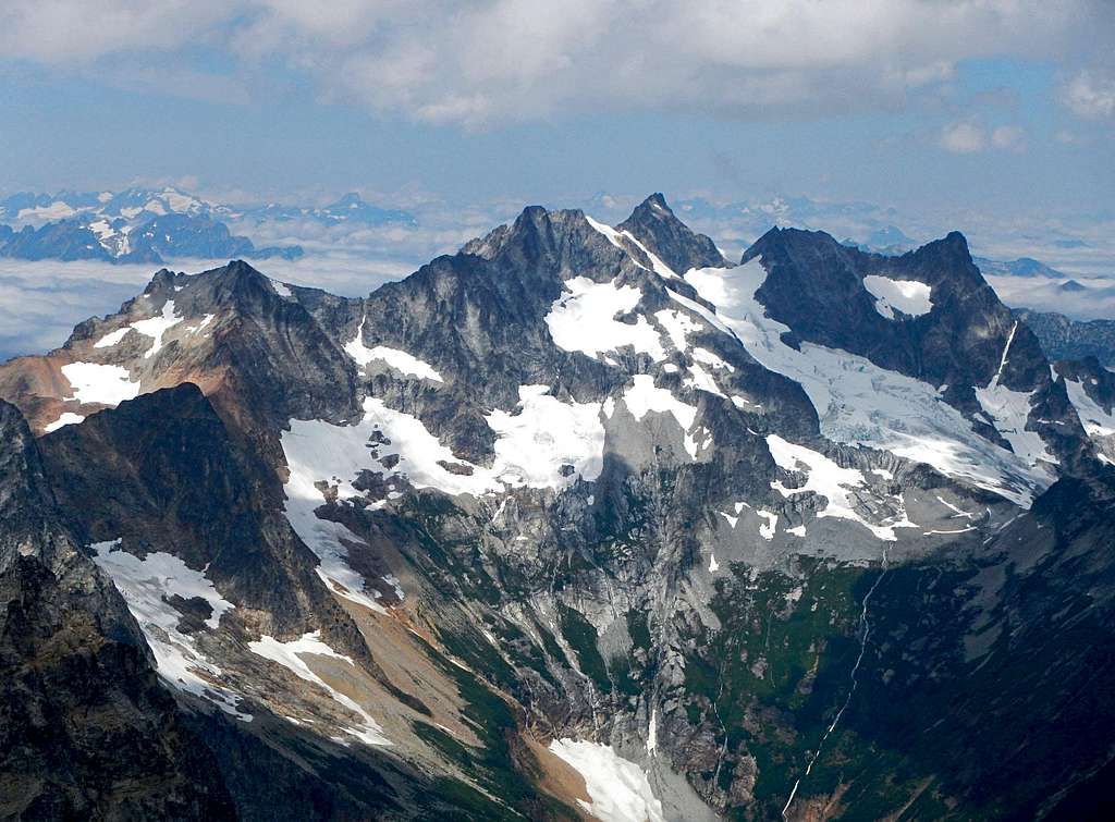
![Goode Mountain]() The northeast face, September 2011
The northeast face, September 2011
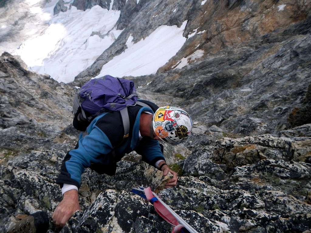
At 9200 feet, Goode Mountain is the 9th highest peak in Washington state. There is no easy way to reach the top of this remote mountain. All routes have hideously long approaches, a matter of several days, and each one involves some degree of technical climbing. Putting four men at the top would take a group effort, expedition style. We decided to attempt the SW couloir route which finishes with a few pitches at the top of the northeast buttress.
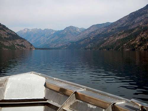
![Stehekin Ferry]() Nearing the north end of Lake Chelan
Nearing the north end of Lake Chelan
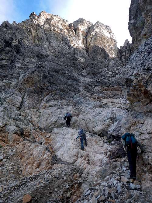
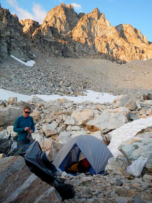
We took the fast ferry to Stehekin Saturday, a town which is not accessible by road. From there we hiked as far as we could before we were hit by storms. We had planned to stay in 5-mile-camp which was supposed to be very nice, but we ran out of time for that. Instead we pitched our tents off-trail down by the river, just before the rain started. We nicknamed this spot Swamp Camp. Thunder storms continued throughout the night, but I slept soundly with my earplugs in. The next morning it was clear again, so Greg and I hiked from the park creek trail up along a climbers boot path to the climbers camp at 7390 feet. It took us 2 hours and 45 minutes. We were rushing ahead of Edward and Dave because we wanted to have a shot at climbing Storm King, a neighboring peak. The boot path up to the climbers camp is hard to find at first but easy to follow most of the way.
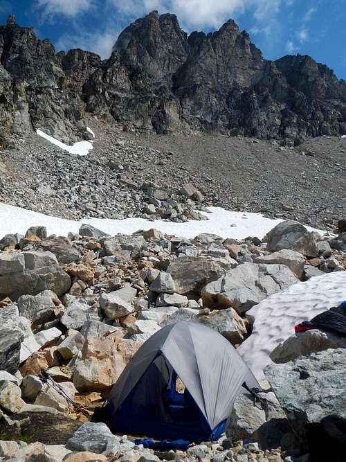
![Goode Camp]() Climbers Camp Below Goode Mountain
Climbers Camp Below Goode MountainAfter pitching our tent at 7380 feet we made the traverse on snow and loose rock over to Storm King. We ascended loose talus/scree and then tricky slabs covered in loose scree. We reached the base of the nasty loose rotten gully at 8250 feet. We scrambled up another 15 feet. Then a crack of thunder boomed. Greg and I looked at each other. F**k! The rain started immediately. We retreated to the base of the gully over loose wet rock and waited in a semi-sheltered moat to see what would happen next.
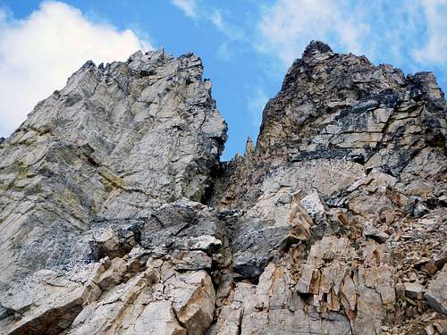
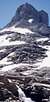
![Storm King Gully and Notch]() The Loose Rotten Gully (Storm King summit at left)
The Loose Rotten Gully (Storm King summit at left)![Storm King Notch]() Greg below the notch
Greg below the notchDiscussing our options, we decided to wait awhile longer and watch the weather. Our hopes were that it would improve. The sky didn't look that bad, just some light clouds and one dark one passing overhead toward the east. After 15 minutes, the storm seemed to have passed and the sky looked promising again. We started back up the gully until the scrambling became more intimidating. I then belayed Greg while he place a few pieces and climbed up to the col. When he got there I heard him say “Oh F**k!” He later explained that he mantled up and came face to face with the abyss which is the northeast face. The notch itself was only a foot wide.
![Wall of Water]() The Wall of Water
The Wall of Water
At this point I heard more thunder. I turned around and saw that the sky had darkened. Then I noticed a wall of falling water coming our way. It was infuriatingly cliche, but we were getting stormed-off Storm King. I told Greg that I thought it would be better for him to rap down and clean the route rather than for me to come up to him. It was time for us to leave and that's what we did.
![Hell Storm]() The sky turned dark (rain drop on lens)
The sky turned dark (rain drop on lens)
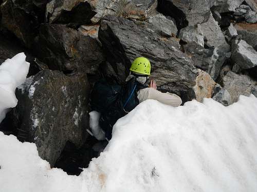
We did our best to get back to camp before getting slammed by the storm. There was heavy rain and then hail. While crossing a moat at the edge of a snowfield, Greg fell 5 feet when the snow collapsed underneath him, softened by the heavy rain. He cut his hand very deeply and there was blood everywhere, on the rocks, and all over his shirt. The gash was half an inched deep and his skin had separated. There was a lot of soft-tissue exposed. I bandage him up with a wad of gauge and some duct tape. I had to use a lot of tape because the rain was so heavy in that moment. He tied a bandanna over the whole mess and we kept moving.
![Moat Injury]() I took this photo before I realized Greg was injured
I took this photo before I realized Greg was injured
We got back to camp completely drenched and demoralized and spent the rest of the day in our tents hiding from the rain.
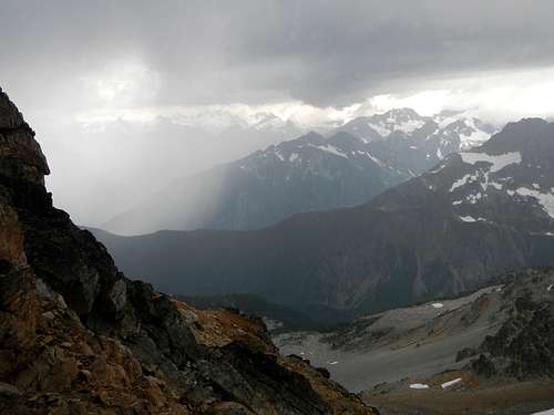
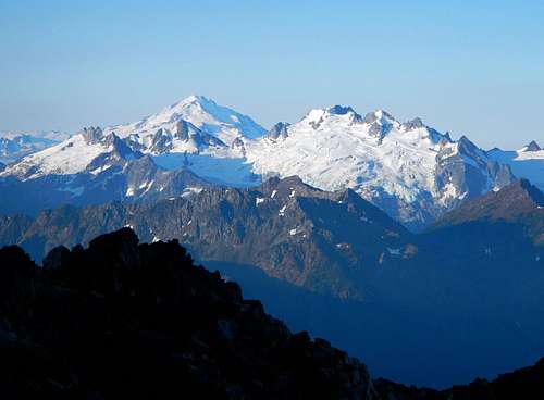
![Buckner Glaciers]() Alpenglow on Mount Buckner
Alpenglow on Mount Buckner
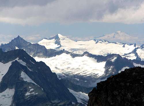
![Gunsight, Sinister, Glacier, Dome]() Gunsight Peak, Sinister Peak, Glacier Peak and Dome Peak
Gunsight Peak, Sinister Peak, Glacier Peak and Dome Peak
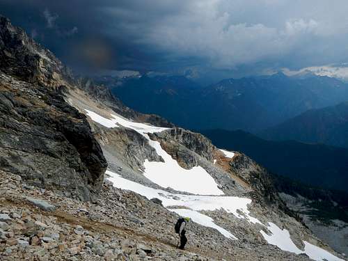
The next day we we were up and moving by 6:15am. Greg said he wasn't even going to think about the pain in his hand during the climb. I wondered to myself how he was going to deal with it. One thing was for sure, he would lead none of the pitches.
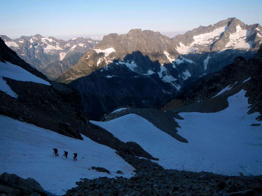
![Alpine Environs]() Climbing above the glacier remnant
Climbing above the glacier remnant![Below The Southwest Couloir]() Scrambling up talus on the ridge below the couloir
Scrambling up talus on the ridge below the couloir
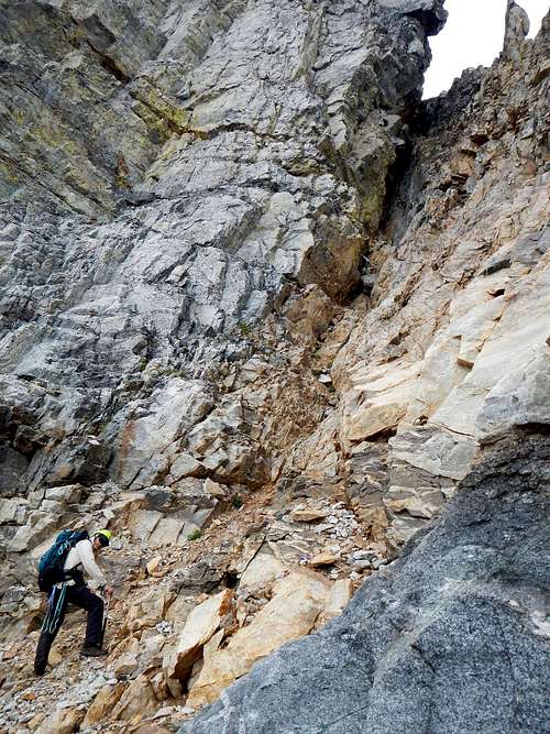
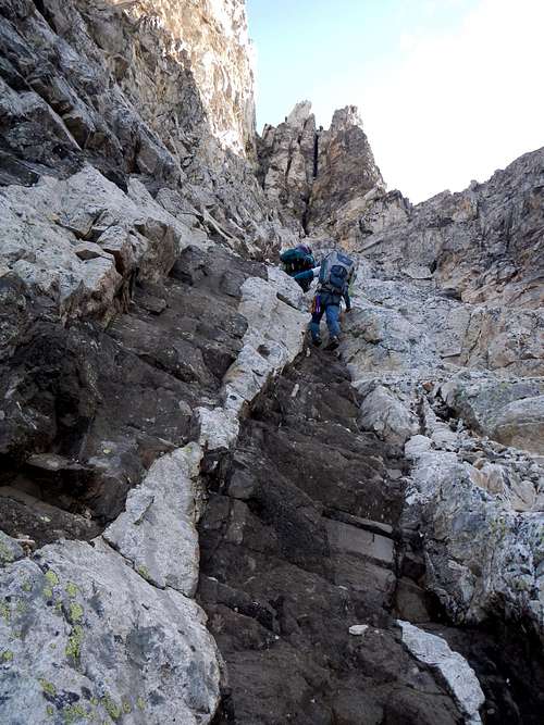
We scrambled up the moraine and crossed the glacier remnant to reach the small rotten ridge below the southwest couloir. A lot of rocks moved around as we were climbing up to reach the crest of the ridge. We scrambled up along the crest until we could see the couloir above us. We found one of two exposed ramps through the cliffs which allow access into the base of the couloir. The couloir was broad and the scrambling easy. Along the left side we found the mythical “black stairs”, a vein of darker solid rock with step formations which make for easy scrambling.
![Entering The Couloir]() Entering the southwest couloir
Entering the southwest couloir
| ![The Black Stairs]() Climbing the "black stairs"
Climbing the "black stairs" |
We continued to follow the black staircase to within 50 vertical feet of the apparent chimney at climbers left. Here we roped up and Dave led a horizontal slab pitch to reach a hidden gully on the right side of the couloir. Half way across the ledge he kicked loose a rock which went flying down the couloir (see the video).
![Ledge Traverse]() The slab ledge traverse
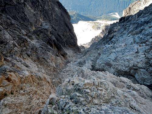
The slab ledge traverse![Looking Down The Southwest Couloir]() Looking back down the couloir
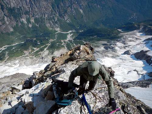
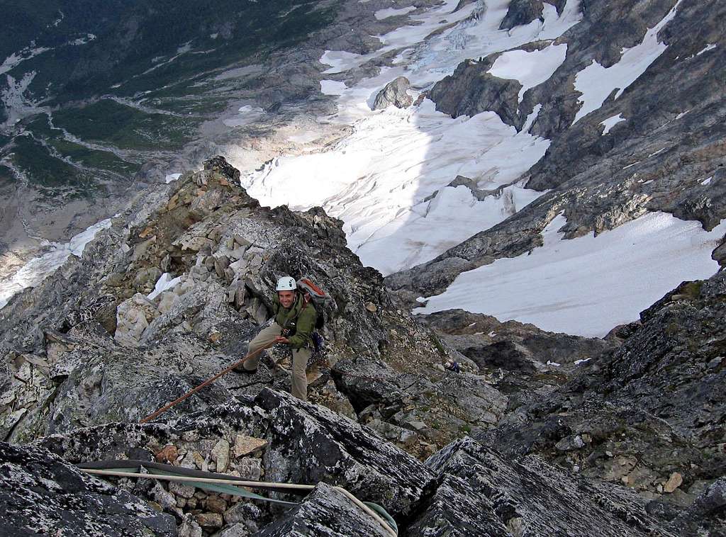
Looking back down the couloirFrom the top of the hidden gully, we scrambled a few more feet up to "black tooth notch". Whoa! Suddenly we were high on the northeast face of Goode, with thousands of feet of exposure below us. We followed a broad sandy ledge north for 30 feet and then rappelled down 20 feet to another ledge. We followed the second ledge north and then scramble-traversed on 4th class rock over to the famed northeast buttress.
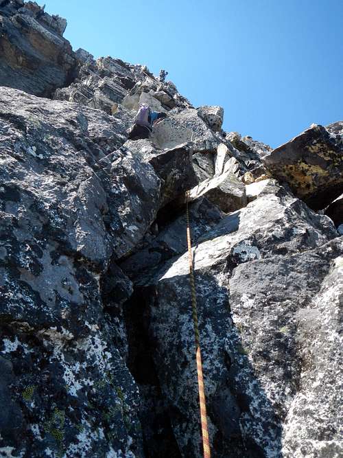
![Class 4 Traverse]() The class 4 traverse
The class 4 traverse![Climbing the Northeast Buttress]() On the northeast buttress
On the northeast buttress
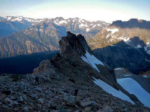
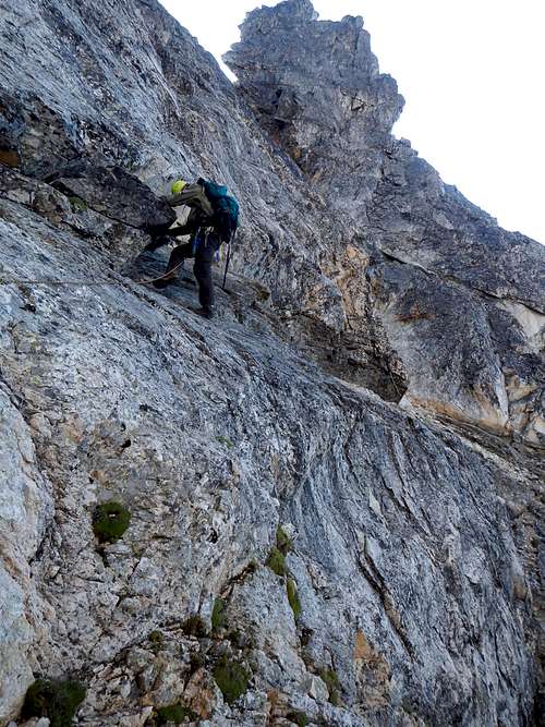
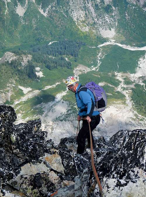
On the buttress we roped up again and Edward led a long pitch up to a higher notch at the very top of the buttress. We secured both ends of the rope so that Dave and I could climb simultaneously using
prusiks. That was our strategy for saving time. Ideally, rock climbing is done in pairs but since there were four of us we had to do it differently. The rock itself was easy, low to mid fifth class, but there were a lot of small blocks balanced precariously and it took care not to send these down on each other. After Dave and I reached Edward, Greg followed at the end of the rope with a belay. One thing was on all of our minds. Was this good weather going to hold for us? That was the big question. After the major storm of the previous day, we were all a little jumpy.
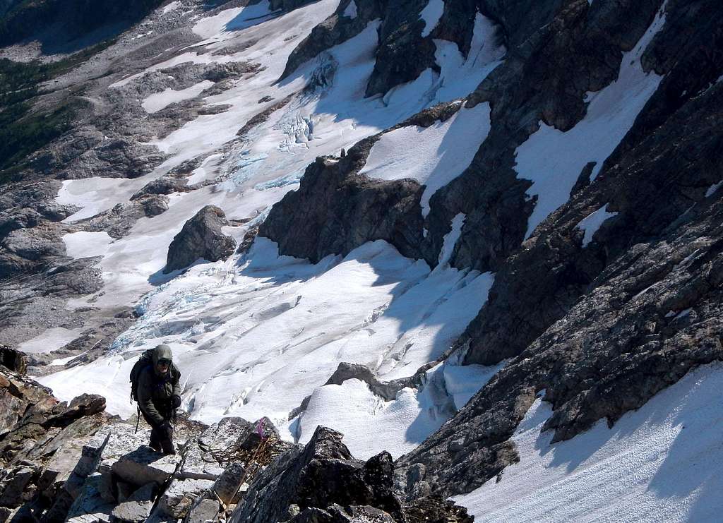
![Goode Glaciers]() Above the glaciers on the northeast buttress
Above the glaciers on the northeast buttress
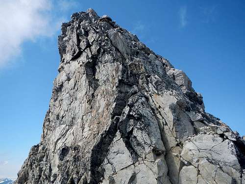
![Goode Summit Block]() The summit seen from the wrong notch
The summit seen from the wrong notch
Something didn't seem right. The little notch we had climbed into was terribly exposed and what stood in front of us looked harder than it should be. Apparently we were slightly off route. Edward set a sling around what looked like a horn and Dave belayed Greg and Edward as they climbed down to a ledge about 20 feet below. He then prepared to rappel down to the ledge. I told him to wait a second because I didn't trust the look of the horn the sling was around. I looked behind it and squatted down to see it from below. Then I pushed on it and the whole thing moved. Dave and I exchanged a knowing look. I might have just saved his life. Always check your horns! I made a mental note to talk to Edward about it after the climb.
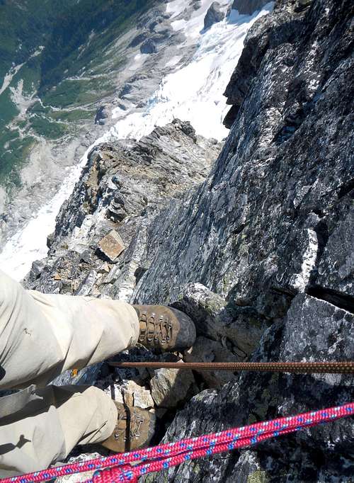
![Near The Top]() Enjoyable climbing
Enjoyable climbing
| ![Goode Exposure]() With Exposure
With Exposure
|
Edward led the last long pitch straight up to the summit. Now above the buttress, we climbed up more of a flat face. There were a lot of features and it was nice enjoyable climbing with mad exposure! Dave and I did used prusiks again and Greg followed with a belay at the end of the rope. I was happy to see
the bivy spots on the summit, which I had previously heard about. There was a register from 2011 left by Franklin B and Andy D. This was certainly one of the best views in Washington! I could even
see Johannesburg.
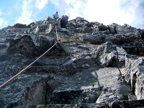
![Final Pitch]() The last 30 feet
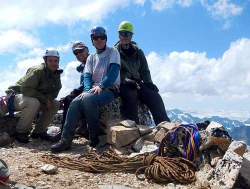
The last 30 feet![Goode Summit]() On the summit of Goode Mountain
On the summit of Goode Mountain
We reversed the route using both our 60 meters ropes for longer rappels. After the first rap, the rope got stuck. It would not budge. I tied one end of it to my harness to act as a counter-weight while Greg prusiked up the other side to fix the problem.
![Mount Logan]() Mount Logan seen from the summit
Mount Logan seen from the summit![Forbidden, Eldorado, Baker]() Forbidden Peak, Eldorado Peak, and Mount Baker seen from the summit
Forbidden Peak, Eldorado Peak, and Mount Baker seen from the summitThere was one sketchy class 4 traverse near the top of Black Tooth Notch. A sling had been left there as a psychological belay. I added another sling to it ant then checked to make sure that the knots in the original sling were snug and trustworthy. To my dismay I found that one of the tails of the knot in the original sling had slipped back inside the knot. Tails on this type of know should be at least two inches long. I took the time to take it apart and re-tie it, all the while holding onto the class 4 rock in such a precarious spot. Honestly, this whole episode scared the crap out of me.
![First Rappel]() The first rappel
The first rappel![2nd Rappel]() Greg took this shot of me on the second rappel
Greg took this shot of me on the second rappel
We spent a second night at high camp and hiked out the following day. Back near Coon Lake, we encountered thousands of tiny toads on the ground. It was difficult to avoid stepping on them but I did my best.
![Back At Camp]()
Back at camp
Tuesday evening we stayed with our friends Trapper and Roxanne at their cabin in Stehekin. They cooked us pizza from scratch and offered us clean beds and showers. What a treat! I could tell they were living vicariously through our photos and stories of the climb.


Comments
Post a Comment