(If you are only interested in the only way to start a new year, simply fast forward to the Jan 1st entry in this diary.)Introduction
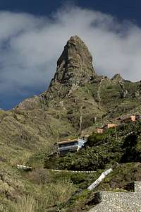
![Pan de Azucar]() Pan de Azucar, Teide's summit cone Pan de Azucar, Teide's summit cone |
It has become custom (habit?) for us to spend the winter holidays in the sun, hiking and exploring the
Canary Islands off the Moroccan Coast. We’ve been to all the islands except
El Hierro at least once, several of them twice. So when this winter’s vacation came up again we explored the ways to get to the smallest island. However, we had to realize again, that
El Hierro is too hard to reach (we would lose two days travelling). Thus we browsed the archipelago for another destination. The selection soon closed down on either
La Gomera or
Tenerife and good memories finally decided us on the latter. We’d been to the island twice already, a foggy May visit in 2001 and a dry but hazy winter stay in 2006 / 2007. We’d been all over the island but some places you need to visit more than once. Moreover, we realized that the new edition of our favourite guidebook now comes with 70 instead of fifty tours so that we guessed some new hikes would be possible as well as repetitions of the ones we did in 2001.
However, the best thing was something quite different. You need a permit to climb to Spain’s highest mountain,
Teide, and during our former visits we didn’t want to take the hassle to apply for it in some office in downtown
Santa Cruz. Thus twice we had turned around some 150m shy of the summit, turned back by rangers guarding the
Telesforo Bravo Trail to the top. In the guidebook, however, now we found an internet address, an online link for registration and quickly we were registered for the first of January. From that moment on our prayers went out for dry weather to avoid snowy and icy slopes on the way up.
However, some two weeks before Christmas, a storm shook the
Canaries and severe flooding and power outages were reported. The webcam at the
Izaña observatories showed a snow-capped
Teide and our goal seemed to slip away from us. But with a little luck just enough snow might melt to finally allow us to stand on top of the
Atlantic Ocean. No more precipitation was reported and our hopes started to rise.
But now for the diary, which starts at Christmas Eve 2013.
Dec 24th 2013 – an Untypical Christmas Eve
Christmas Eve – usually we are already on vacation and we should have been on
Tenerife this year as well but our families have kept us here. I will visit my old mum and Judith will celebrate with her family. In between we will have to check in our luggage at
Frankfurt Airport so it will be a busy night. But now we are sitting at the breakfast table trying to plan the day. We’ll pack in the morning, then I will cook dinner for my mum and me tonight (pasta, vegetables, beef, all baked with a bit of cheese on top), Judith will go for a run in the fields. Then lunch, a brief hike through the vineyards, check-in, Christmas Party. We discuss, when would be the best time to bring dinner to my mum and decide that we’ll go there before checking in, with me returning after I brought Judith to her family in another part of town. So far, so good.
Everything runs according to plan until we get ready for the check-in. I pack the suitcases into my car, Judith brings the dish with the dinner and off we go. My mum is happy to see us and after a little small-talk we plan further proceedings. It’s 6:30 p.m. and we plan to be at the airport at 7. Check-in and return trip shouldn’t take too long that we both suggest that my mum put dinner into the oven around 7:45. This should enable me to be just on time.
Half an hour later at the airport we realize a long queue in front of the Condor counter but there’s another one in the next building. Six counters are operated and it’s our turn after about 15 minutes. But no, we are told to line-up in the long queue because only there we can check-in the evening before the flight. Trooping back we realize the queue has gotten longer and after a while at its end we realize not much is moving here. Obviously the luggage belts are out of order today. Two dudes ship away the luggage on hand-carts – which takes forever. Moreover, the sole check-in clerk dashes across the hallway again and again to greet friends and fellow employees to wish them a merry Christmas. Steam starts building up inside of me …
As it most likely does in my mum’s oven now. It’s right before 8 p.m. and we are still waiting in line. By 8:30 we have made it to the desk and have to pay €10 (yes, waiting in line for 90 minutes still costs money at Condor). Judith tries to complain but we both know that it’s useless. So we grab our boarding cards and return to our car. Heading back I deposit Judith with her family and finally reach my mum at 9:00. This is how you should spend your Christmas Eve, isn’t it?
But the remainder of the night is much better – dinner is not burned and actually quite good. We light some candles and enjoy our time with each other. There are some presents and it is very relaxing after the time at the airport. In the end, after leaving my mum I reach Judith and her family just as they are exchanging presents. I settle down with a glass of wine and after the ceremony is over we quickly say goodbye. After all, we’ll have to get up at five tomorrow morning.
Dec 25th 2013 – Travel and Playa del Ancón
“I’m afraid I have to give you bad news. During the night the plane was tanked but now there are six tons of kerosene too many. We will have to return to the gate. We’ll be delayed by two hours, probably. I’m sorry for the inconvenience.”
We are in the bus right underneath our plane and now they tell us we’ll have to return. Wonderful! It seems to be getting one of these days. After all, we didn’t have any problems the last two years and being late for two hours won’t mean much as we expect to land around 10:45. It’s going to be noon or later now. But after having returned to the gate we are shepherded back into the buses almost immediately. There are delays on the stairs down the gate, in the bus before and after the short trip, in the cabin so that we start about 90 minutes late. “But we’ll fly faster trying to catch up some of the delay”. Please do, by all means!
“We have left our cruising altitude, please return to your seats …” Now it’s 11:30 and it has been a somewhat rocky ride. We are approaching
Tenerife and as I look out of the window I can see the eastern tip of the island across the left wing.
Gran Canaria hovers behind. Weather here in the north seems to be good, only a few small clouds over the ocean, but there is still snow on Teide. As we get closer and finally start our looping descent along the west coast we can see that even the south side of the volcano is covered in white. Again, it looks like we won’t be able to get to the top. A big disappointment, but there are so many other things you can do on
Tenerife.
We touch down and head for the gates. Getting off the plane takes a bit, the hike to the luggage belts as well but our suitcases arrive after only five minutes. I have some discussion at the car rental but all in all we are quickly out of the airport driving along
Autopista del Sur. As all shops will be closed today we grab a canister of drinking water at the closest filling station and drive onwards. Our landlady will be waiting for us from 2 p.m. onwards (my estimate) and we reach the apartment less than five minutes after.
![Huge breakers on Tenerife s north coast]() Huge breakers on Playa del Ancón
Huge breakers on Playa del Ancón
A short chat with the landlady (we were in the same place eight years ago) and we unpack inside the apartment. As always there’s too little storage room but finally we press everything into the cupboards. While I do the final pressing Judith consults the guidebook and suggests driving down to
Café Vista Paraiso and hike down to the north coast from there. And so we do. It turns out to be much steeper than we thought but after a bit more than an hour we are on
Playa del Ancón. The waves are huge and one catches me at unawares. Afterwards I have sand and saltwater in my boots. Great! But at the time we have returned to the Café I’m damp from sweat all over so I guess there’s not much difference.
![Teide in the afterglow of Dec 25th 2013]() Teide in the afterglow of Dec 25th 2013
Teide in the afterglow of Dec 25th 2013
At nightfall I take a look out of the window and see
Teide illuminated by the afterglow. Grabbing the camera I search for a good spot to snap a shot. While stumbling across the vineyards around our finca I overhear one of the other guests “… there’s ice slabs on top ... very dangerous ... closed by the park rangers.” Yes, no
Teide this year – I understand.
Dec 26th 2013 – The Desert Loop
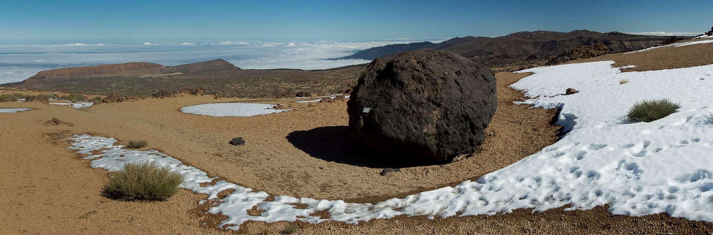
![The tuff desert]() The tuff desert inside the Cañadas del Teide
The tuff desert inside the Cañadas del Teide
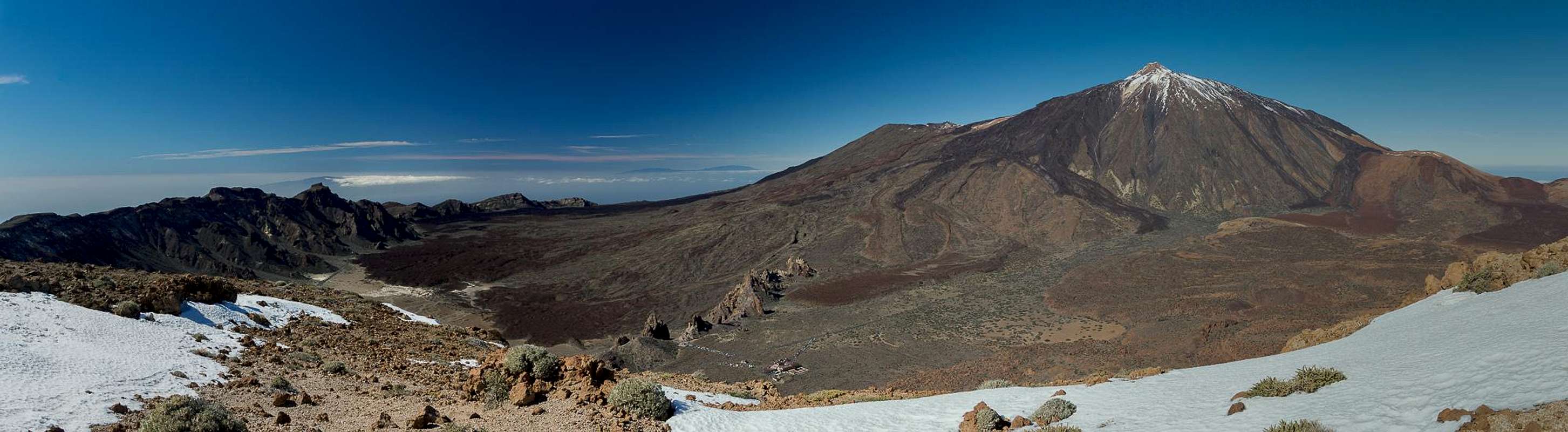
Eight years ago we discovered the
loop from El Portillo to La Fortaleza, Montaña Blanca and back. We enjoyed it so much that this morning we decide to redo it. Anyway, weather here in the north is bound to be cloudy and it’s a good idea to go to the
Cañadas del Teide which are above the clouds at almost any time. Driving through the dark I only hope that the temperature up there won’t be too low. We won’t get up there if there’s rime on the road. After all, our little rental car has only summer tires.
But I needn’t worry - we reach the headquarters of the national park before 8 a.m. Getting ourselves ready we watch the offices being opened but then quickly start out on the loop. We remember the sun setting during our last trip so we shouldn’t linger. At first it’s very cold but after about 30 minutes the sun rises above the caldera rim. To our disappointment
Teide really is covered in snow, which reaches far down the eastern slopes. We troop along the
Fortaleza Trail and quickly reach
Cañada de los Guancheros at its base. There are what looks like cattle fences on the desert plain. We later learn that they were put up after a big fire which devastated the
Fortaleza Area in summer 2007.
![Riscos de la Fortaleza]() Fortaleza Fortaleza | ![Teide]() Teide Teide | ![Summit view Fortaleza]() Summit View Fortaleza Summit View Fortaleza |
We decide on the direct trail to the saddle
Cruz de Fregel (finding there, that the other trail also has been closed by fences). A short rest with a nice view towards
Teide and then we head up for the summit. It doesn’t take long to get there and we try to scout the way ahead. We think we can glimpse the track but anyway the desert valley is obvious through which it must run. Judith proposes to hike along the edge towards the west as both our GPSs tell us there is a descent route out there.
It turns out to be a rocky scramble through one of the western gullies of the fortress. It is brittle and while descending we decide we shouldn’t return here. Whole blocks come loose as we descend and in one place we have to dance across a ledge above a precarious drop. But finally we reach the base. Here Judith suggests taking a different route - “it’s not much longer” – which runs in parallel to the intended one. Thus we pass
Montaña Negra before reaching the
Huevos del Teide, lava bombs at the base of
Montaña Blanca.
So far we haven’t seen a single person but now, as we are settling down to lunch we can observe quite many. About 200m to the south the normal route to
Teide (and
Montaña Blanca) runs along. Also, the path from
El Portillo (which we will use as return route) passes here. A German family seems to want to do the reverse route. They don’t find the intersection to the
Fortaleza Trail even though they stand only steps beside it. I try to make signs but somehow they misinterpret, scrambling up to where we are sitting. Once they are close enough I show them the path (complete with marker) and off they go.
![Montaña Rajada]() Montaña Rajada Montaña Rajada | ![Cumbre Dorsal and the Anaga Peninsula]() Eastern Cañadas Eastern Cañadas | ![Montaña de los Tomillos]() Montaña de los Tomillos Montaña de los Tomillos |
We finish our lunch and decide against
Montaña Blanca. We’d have to ascend another 270m from where we are and honestly, we’ve been there four times already. If we get a chance on
Teide, we’ll pass the summit anyway on Jan 1st. Thus, we descend in direction of
El Portillo. The desert is filled with gravelly tuff, shimmering in all shades of yellow and red. In some places there’s a slight tint of green among the orange crystals. Passing
Montaña de los Tomillos, one of the more decorative cinder cones, I turn around to look at
Teide. Definitely, there’s a lot of snow up there. Even
Montaña Blanca seems to be covered. I’m sure we’ll make an attempt but will we get higher than
Refugio Altavista (3260m)?
The shadows darken as we reach
El Portillo…
Dec 27th 2013 – The South-Western Caldera Rim
![Roque de los Almendros northern rock faces]() Roque de los Almendros northern rock faces
Roque de los Almendros northern rock faces
Last night we decided to go to
Boca de Tauce, the other portal to the
Cañadas del Teide, besides
El Portillo. The saddle is located at the south-western end of the giant crater. From here we plan to hike across
El Sombrero and
Roque de los Almendros towards
Lomo de las Mesas and
Sombrero de Chasna. However, we can’t find the trail and as this appears to turn into a pathless scree scramble we turn around and head for the regular
Sombrero de Chasna trailhead. We drive some 6km and park the car at the side of the road.
Last time
Sombrero de Chasna turned out a bit disappointing, which is why we reserve it for the return trip. We had been on
Lomo de las Mesas on the caldera rim, a long stretched back which offers exceptional views over the
Cañadas del Teide. So we decide to go for the caldera rim and end up in one of its saddles. Still curious about the path to
Roque de los Almendros and
El Sombrero we decide to turn left to search for it. At first the path turns out to wind in an absolutely stunning part of the rim with huge drops into the caldera below. There are many saddles, all of them with mighty
Teide as a backdrop. We congratulate ourselves on our choice.
![Sombrero de Chasna]() Sombrero de Chasna Sombrero de Chasna | ![Teide]() Teide Teide | ![Guajara]() Guajara Guajara |
But then we reach a plateau which abruptly ends in a vertical face. It would be possible to get down here (UIAA II+) but somehow we both don’t feel like it. After all we would have to return here after the short remaining hike to the two summits and I’m not sure I want to scramble up these rocks. They look like the gully on
Fortaleza yesterday.
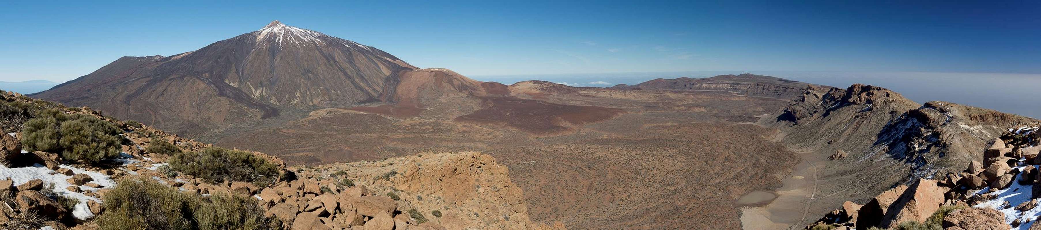
Cañadas del Teide from the caldera rim |
Thus we return along the rim, now heading for and across
Lomo de las Mesas. A closer look at
Teide reveals that there is still snow at the
Rambleta but
Pan de Azucar (the conical top) and the south face are almost snow-free. It just might be possible. After all some days are still left. And in today’s heat surely some snow will melt, won’t it? As we are getting close to
Guajara now, Judith proposes to go there as well. I tell her that from this side you have to negotiate the ledges through the north face which are still snow and ice-covered. Thus we descend towards
Degollada de Ucanca but refrain from going all the way down.
After a lunch with a view we return across
Lomo de las Mesas, taking our time. Finally on the western side of the back we take the path which leads to
Sombrero de Chasna. It heads for a chimney in the north-east face which turns out to be covered in ice. Nevertheless we manage to climb it and find ourselves on top of the circular summit plateau. Hiking to the southern end we have a good view towards the cloud covered south coast. During the break that follows I hunt lizards with my camera, quite successfully actually.
![The western caldere rim]() Sombrero and Roque de los Almendros Sombrero and Roque de los Almendros | ![Pan de Azucar]() Teide Teide | ![Gallotia galloti galloti]() Canary Lizard Canary Lizard |
We return across the plateau, descend through the slippery chimney and then head back through
Barranco de la Magdalena. The hike becomes tedious in the end but finally we reach our car. A drive across the
Cañadas and we head down to our holiday home.
Dec 28th 2013 - Part 1: The Western Rim
![Roques del Cedro, Pico Viejo and Teide]() Roques del Cedro, Pico Viejo and Teide
Roques del Cedro, Pico Viejo and Teide
Again, the weather doesn’t look too promising on the north coast so that we decide to go to the
Cañadas del Teide again. While driving through the crater we decide to climb the four mountains on its western rim. We’ve been here before twice but also got lost twice during the descent from
Montaña del Cedro. Let’s see how we’ll do today.
At
Mirador de Chio a huge raven greets us. There’s lots of rime on the slopes of
Pico Viejo but today we’ll be headed for the other direction. 500m to the south, a dirt road turns off from the
Cañadas Highway and we head for our first destination,
Roques del Cedro. The summit of these rocky outcrops is only 200m higher than the road from which we started so we quickly step upon it. The duo of
Pico Viejo and
Teide very impressively looks down on us. Across the strait
La Gomera seems to be covered in a shampoo of clouds.
![Roques del Cedro]() Roques del Cedro Roques del Cedro | ![La Gomera]() La Gomera La Gomera | ![Pico Viejo and Teide]() Pico Viejo and Teide Pico Viejo and Teide |
Heading onwards we descend into a saddle from which the path to
Montaña del Cedro starts. It avoids the steep east face by passing underneath the north face into the back of the mountain, from where a nearly pathless scramble reaches the top. Again, the view towards
Pico Viejo and it huge lava stream dominates with
Teide looking across its shoulder. Now the dreaded descent starts. But for the very last 50m, however, we manage to find the route and where we lose it we can already see the road we have to hike to. We turn left and find ourselves in the next saddle.
But now clouds start rolling into the
Cañadas. Suddenly the tops of the caldera rim mountains have vanished. As we know the slabs on the route to
Roque de Chavao are steep and slippery as well as hard to be found we decide against going there. Instead we hike the path through the lava fields underneath the east faces of
Roque de Chavao and
Montaña Gangarro to
Boca de Tauce.
![Roques de Chavao]() Roques de Chavao Roques de Chavao | ![Montaña Gangarro]() Montaña Gangarro Montaña Gangarro | ![Roques de Chavao]() Roques de Chavao Roques de Chavao |
We don’t see much of the impressive rocks of that section of the trail and in
Boca de Tauce a cold wind makes staying in one place very uncomfortable. We turn around and hike until we find a sunny spot (the clouds temporarily recede) in the lava to have our lunch. Once we have finished it starts to drizzle and we struggle to get to our car quickly.
Dec 28th 2013 – Part 2: Roques de Garcia
![Roques de Garcia]() Roques de Garcia
Roques de Garcia
It’s only 1 p.m. and we decide that we’ll have to attempt something else. I suggest the loop around the
Roques de Garcia. We’ve been there before and I must say that it is not exactly one of my favourite places. Between 2.8 and 3.6 million people visit the
Cañadas del Teide each year and all of them end up at the parking lots near
Los Roques. You will find anything there but solitude. Still I also had my share of magic moments among these impressive rocks. Twice we visited them during sunset and saw them light up brilliantly in the last rays of the sun. Even the afterglow gave wonderful impressions.
The
Roques de Garcia are located in the very midst of the
Cañadas del Teide and thus as far away as possible from the clouds which are oozing up from the coasts. Most likely it’ll be even sunny out there. But reaching the parking lot we quickly see that there is no space left. We drive over to the
Parador Hotel where the situation is similar but as we reach the dead end a car pulls out in front of us. We go to the hotel cafeteria in search of postcards (which we find) and while Judith inspects the restrooms I go outside to wait for her. There is a slight drizzle but still the sun is shining and yes, a rainbow develops at the base of
Teide. It looks unreal being as low as it is and everybody is trying to take a photograph.
![Roques de Garcia]() Roques de Garcia Roques de Garcia | ![Roques de Garcia]() Roques de Garcia Roques de Garcia | ![Roques de Garcia]() Roques de Garcia Roques de Garcia |
At the Roques parking lot we ignore the lookouts and enter the loop trail. After a few steps the crowds thin and basically we are alone. The drizzle is annoying and the clouds appear to close in. Even
Teide seems to be lost in clouds. We hike along the east of the towers until we reach the northern tip of the loop. Here a signboard tells us the path to
Pico Viejo turns off. During our
memorable Teide trip eight years ago we lost it more often than we walked on it – a horrible experience. Still, if weather allows, we plan to descend it again in four days.
![Roques de Garcia]() Roques de Garcia Roques de Garcia | ![La Catedral]() La Catedral La Catedral | ![Rainbow above the Cañadas del Teide]() Cañadas del Teide Cañadas del Teide |
We turn the last tower and start to descend down to
Llano de Ucanca, the huge plain at the base of the towers. From this side, rising out of the Llano, they appear to be huge. We are lucky to have blue skies in this place and now and then even the sun pulls through. The path runs very close to the towers and I shoot a lot of panoramas to squeeze them into single pictures later. After a small plateau we head down to the Llano for real, heading at the large rock, called
El Catedral. It is one of the best known climbing spots, thanks to the basalt blocks it is made of. There are no climbers today as we realize as we walk along its base. Now a 200m ascent leads us back to the parking lot and crowds of people – and the rainbow, which appears to have stood in place for the two hours it took us to return here.
Dec 29th 2013 – Roque del Conde, Roque Imoque, Roque de los Brezos
Los Riscos, Roque de los Brezos, Roque Imoque |
The weather forecast is still underwhelming for the north of the island so we decide to head south to
Arona, hoping to combine two routes of our guidebook. Driving to
Arona takes more than an hour since we have to circle around the
Cañadas del Teide and
Cumbre Dorsal. But finally we reach the trailhead in the village of
Vento. We’ll first climb
Roque del Conde, the main landmark of Tenerife’s south. The table-top mountain is a mere 1001m high but it towers directly above the tourist areas of the island, reportedly one of the best lookouts of the area.
The hike is rather uneventful. We have to cross two barrancos (dry creek beds) before the ascent starts for real. The first stage takes us to a shoulder on the south ridge, where we get first glimpses of
Los Cristianos,
Playa del Ingles,
Las Americas and
Adeje. Construction is booming down there. The second stage leads across ledges through the south face of
Roque del Conde, a little airy but the best part of the hike. Finally we reach the summit plateau and troop to the summit. There are good views towards our further destinations:
Roque Imoque and
Roque de los Brezos. And the
Teide Summit briefly appears through the clouds.
![High above the south-west coast]() Above Los Cristianos Above Los Cristianos | ![Roque Imoque]() Roque Imoque Roque Imoque | ![Roque del Conde]() Roque del Conde Roque del Conde |
We attempt to descend through the east face but the ground seems too slippery so we return the way we came. We head down to the shoulder, than through
Barranco del Rey, before turning north along
GR131, one of the multiday trekking trails of
Tenerife. It leads back through
Barranco del Rey, then to a saddle, separating
Roque del Conde from
Roque Imoque. First we see the rocky ridge of
Los Riscos, and then
La Gomera makes an appearance. Finally we realize that some 30 paragliders are in the air, browsing the upwinds over the rock formations.
Our path now takes us to a broad saddle, where once stood
Casa de Suárez, a farm which long since has been abandoned and fallen into ruins. Threshing place and terraces are still there, a good place for a break or a picnic. We head on, however, reaching the south and west slopes of
Roque Imoque. We head for the saddle which separates it from
Roque de los Brezos, only to find that a road leads right up there and that the place is taken by a local family.
First we turn east and hike up the ridge to the pinnacle of
Roque Imoque. At the base of the summit block we enter a chimney, which after 5m heads out onto a ledge. Turning left we head out into the east face, from where a steep scramble takes us to the top. From up there it seems that the remaining clouds are about to vanish and sure enough during descent we get a clear view towards the volcanic shield of
Teide.
![Los Riscos]() Los Riscos Los Riscos | ![Roque de los Brezos]() Roque de los Brezos Roque de los Brezos | ![Opuntia Fruit]() Opuntia Fruit Opuntia Fruit |
Back in the saddle we turn to the other side and scramble up to
Roque de los Brezos. Orientation is more difficult but finally we stand on the main summit. Judith suggests the traverse to the west summit which turns out to be the most difficult part of the day. An exposed balancing act takes us to the col between the summits from where an easy hike takes us to the western one. Here we have good views across the
Los Riscos Ridge towards
Adeje and the coast.
We cross back to the main summit, then down to the saddle from where we retrace our steps to our car in
Vento. Thanks to the finally clear sky we get some great views of the
Los Riscos / Los Brezos / Imoque Ensemble before turning the corner and heading down into
Barranco del Rey. There we observe climbers on its basalt walls who have to deal with the spikey greenery. Again, shadows are long as we return to our trailhead.
Dec 30th 2013 – Guajara and the Paisajes Lunar
Today we’re back in the south, hiking the south route to the highest rim mountain of the caldera:
Guajara (2715m). We start from
Villaflor (not quite since we take a bumpy dirt road to shorten the long ascent) and plan to visit the moonscape (
Paisaje Lunar) and its black relative (
Paisaje Lunar Negro). Not far from the trailhead we get our first glimpse of
Guajara but this view already tells us that we’ll have to go a long way, passing the mountain far to its south, then ascending a barranco to its east with the final ascent along the steep summit slopes. We better get going.
So we do and after a while we reach the intersection with the trail to
Paisaje Lunar. We turn off and descend quite some distance until we find ourselves on a lookout overlooking the moonscape. I take a quick photo but we decide not to go close – after all we have some distance to go. Back on the main trail we hike through the last of the pine forest and suddenly find ourselves on the cinder slopes south of
Montaña de las Arenas. We descend into a valley, where we get a first glimpse of
Paisaje Lunar Negro. The path leads onward, circling a cinder hill before turning north and running directly for the
Guajara South Face. Halfway up we step on the cinder summit to the left of the trail and once more get a view of
Paisaje Lunar Negro.
![Paisaje Lunar]() Paisaje Lunar Paisaje Lunar | ![A path above the clouds]() A path above the clouds A path above the clouds | ![Paisaje Lunar Negro]() Paisaje Lunar Negro Paisaje Lunar Negro |
The further we get the more we see of our surroundings.
Gran Canaria has been on the horizon for quite a while but today it is shrouded in mist. We now hike northward high above the slopes of
Barranco del Rio, which ends in
Degollada de Guajara, directly on the rim of the caldera. Before we get there we turn west onto the
Guajara Normal Route, which zigzags across the south slopes of the mountain. Though never difficult it gets surprisingly steep right before we reach the summit plateau.
There are high winds on the plateau and we quickly head for the stone circle shelters, which mark the summit of
Guajara. Hiding behind them we pull out our lunch and start munching. A couple (German) joins us, who came up across the ledges of the north face. I grab my camera to document the scenery and while I’m in the east of the plateau a second couple comes up from the north. They take their time so that I’m back in our sheltered spot before they reach us. Instantly there’s a big hallo. It turns out that both couples met each other last year on
Teide and everybody seems to be wondering about this strange accident. Both, however, speak of snow and ice on the volcano and that they wouldn’t want to risk their lives going there. But looking across the caldera I don’t see much snow anymore so where would be the risk?
The eastern Cañadas del Teide |
After a longish stay we leave, again retracing our steps. It is a very long descent and by the time we’re back at our car we’re fully exhausted. Judith falls asleep immediately after we left the bumpy dirt road and leaves it up to me to get us safely back to the apartment.
Dec 31st 2013 – Cumbre da Masca
During our last stay on the island we had climbed
Camino de los Riscos to
Baracan and to the
Tabaiba Saddle beyond. On another day we had been to
Cruz de Gala and
Pico Verde. From
Baracan I thought I had seen an opportunity for a long ridge hike connecting these three mountains and the guidebook agreed: one of the 20 new routes was dedicated to the descent from
Pico Verde to
Tabaiba Saddle. The saddle is a road pass on the way from the north coast to the village Masca, a must-go for any tourist. Thus we had encountered busloads of people there last time.
But today we are early, it is before 8 a.m. as we get out of the car. Nobody is in the mirador and even the sun hasn’t come up yet. We start with the ridge traverse to
Baracan in the north, a wonderful hike, sometimes even a bit exposed. It avoids several gendarmes on the lower ridge, then cuts across the
Baracan South-West Face. Nearly at the end of the crossing a park turns off and quickly takes us to the summit. I climb up onto the summit pillar to take my photos there. The sun has barely risen across the mountains in the south and now hovers above one of today’s destinations:
Cruz de Gala.
At 10 a.m. we’re back in the saddle but there are still no tourists. Crossing the road we head onto our ridge, which will take us the whole length of
Cumbre de Masca to
Pico Verde. Let’s go! To the west impressive ridges tower above the deep barrancos of the
Teno Mountains. The hike promises to be just as beautiful as we thought. However, the biggest summits on the ridge are passed on the northern side where the dense laurisilva stops any light. The path is slippery, the air is cold in these jungle-like sections. But as the obstacles are passed we’re back on the ridge enjoying the sunshine.
![Sunrise above Cruz de Gala]() Sunrise above Cruz de Gala Sunrise above Cruz de Gala | ![Baracan]() Baracan Baracan | ![Cumbre de Masca]() Cumbre de Masca Cumbre de Masca |
, usually a wonderful backdrop in this area, can hardly be seen in the mist over the
Atlantic Ocean but now we approach our next destination:
Pico Verde. The mountain stands sentinel above
Masca, a wonderful lookout deep inside the famous
Barranco de Masca. Getting to the top is far from easy. The topmost section is an exposed scramble across the basalt blocks of the east ridge. A huge French group is on the summit but as we approach they start leaving.
We have lunch on
Pico Verde taking in the great views. We are a bit turned off by looking at
Teide, which from this side seems to be in the firm grip of winter. The summit cone is white and only the very top appears to be snow-free. Judith suggests taking the southern approach to
Cruz de Gala which means hiking the support road for the radio towers on its top. I’m lukewarm about this but why not? It is still early.
We scramble back to the saddle between the two mountains, then turn south and descend to the ring road below. After some 2km it takes us to the paved maintenance road which we now hike up. It is hot and steep and enthusiasm is ebbing in both of us. Finally we are on the top, ignoring the radio towers and heading to the fire lookout instead. A couple of photos and we return, turning off the road into the rain forest and slipping and sliding through the dark. Eventually we make it to the ascent ridge enjoying the far better lighting conditions of the early afternoon.
![Cruz de Gala and Pico Verde]() Cruz de Gala, Pico Verde Cruz de Gala, Pico Verde | ![Summit view Pico Verde]() Barranco de Masca Barranco de Masca | ![Canary Lizard]() A lizard's victim A lizard's victim |
Shortly before we reach
Tabaiba Saddle we take a break eating our apples. I throw the core from me and while I’m waiting for Judith to finish hers lizards scramble towards it. Some lick the juice but later a lizard takes a bite gulping it down in one big swallow. Later today I’ll learn from Wikipedia that the
Canary Lizard loves fruit and is considered a pest by the local farmers. A few more steps and we are back at our car. Sure enough there are coaches and busloads of people are milling away at the mirador. We have a bit of trouble disentangling our car but then we’re on our way home.
Our landlady invites us for New Year Celebrations but we refuse. Tomorrow is going to be the big day and we’ll have to get up early…
Jan 1st 2014 – the Only Way to Start a New Year
At 5 a.m. the alarm clock goes off. We quickly grab our clothes and start preparing breakfast. The packs are packed and we’ll take two extra litres of water. We also pack all layers of clothing we have as the
Teide Summit is known for its high ice-cold winds. At 5:45 we are on the road, at 6:45 we park our car at the
Parador Nacional. It is -3°C and we quickly get going.
The first stage is the hike along the
Cañadas Highway. For the
Teide Trailhead we have to hike 7km and I calculate that it’ll take 90 minutes. Still, there is no traffic - the first car passes us after 20 minutes. Seemingly the road goes on forever but finally we pass the cable-car station and turn the corner. There it is, the trailhead. Two cars are parked and another is just about to join them. The sun has come up across the caldera rim and it is starting to get warmer.
We both get rid of one of our layers, then start hiking through the beautifully yellow tuff desert. Weather seems to be perfect, the air is crystal clear and you almost can touch
Gran Canaria with your fingertips. Underneath, small clouds fly across the
Atlantic Ocean but from here you can see as far as can be. We reach the
Huevos del Teide at the base of
Montaña Blanca and start hiking the slopes of Teide’s south-eastern satellite. The lava bombs always make for wonderful photo-ops and I take shot after shot. Finally we reach
Montaña Blanca at 2770m but only take a minute break before we start on our next stage.
![Huevos del Teide]() Huevos del Teide Huevos del Teide | ![Ice on Rambleta]() Ice on Rambleta Ice on Rambleta | ![Huevo del Teide]() Huevos del Teide Huevos del Teide |
At first there is little snow and some of the neighbouring sloes are completely free of it. However, the path winds through an only slightly pronounced valley and here spindrift as accumulated a thin layer. As we get higher the layer thickens and the closer we get to
Refugio Altavista, the icier the slopes get. Without our hiking poles we’d probably drift down the slopes every now and again. Right before we get to the refugio we meet two couples coming the other way. Two dudes on crampons and a couple in sneakers. Not really an unambiguous message, if you ask me.
Naturally we take a short break at the hut but hike on quickly. The time window of our permit is for 1 – 3 p.m. and we’d like to have our lunch first. It’s only 300m elevation gain from
Refugio Altavista to the
Rambleta but this turns out to be the most difficult part of the ascent so far. All snow is covered with a thick layer of ice and only the lava blocks remaining above the snow offer safe footing. We hop and slide along the path but finally arrive at
Mirador de la Fortaleza, the easternmost outlook from the
Rambleta.
Again I take some pictures but then we start heading for the cable-car station. Only two people are up here, it looks like the lift is closed today. The
Rambleta is covered in ice and snow and we seriously ask ourselves whether we’ll be able to get to the top without crampons. As we close in to the station we see that it really is closed today. Also, there is no ranger to validate our permit, so why did we even get it? It is 12:30 and we start eating our lunch. I scout the descent but have to observe that everything on the
Rambleta has been closed due to snow and ice. It’s probably going to be another of those epic adventures…
![Teide s crater]() Teide's crater
Teide's crater
At exactly 1 p.m. we climb across the closed gate onto the
Telesforo Bravo Trail. Here close to
Rambleta there is still a lot of snow but higher up there’s only rock to be seen. We slide across the snow and ice but suddenly come to a stop. There’s no path to be seen and so we hike out onto a moving lava slope. We try to zig-zag our way to where we think the path might be but this includes traversing a steep snow field. I try to tackle it from the top and barely make it across but Judith with her lower weight doesn’t encounter any problems. Yet we are back on
Telesforo Bravo which now turns into something like a staircase. It’s steep and we finally feel the lack of oxygen. Huffing and puffing and with heavy legs, making use of every reason for a break we can think of we finally make it to the
Teide Crater.
![Anaga Peninsula]() Anaga Peninsula Anaga Peninsula | ![Hero shot on Teide s summit]() Heros Heros | ![Gran Canaria above Cañadas del Teide]() Gran Canaria Gran Canaria |
Which comes as a bit of an anticlimax. We’ve seen many a volcanic crater but this one looks like a cauldron filled with rubble. To the east there are red basalt walls but the rest looks just like gravel. We make use of the cables to scale the basalt walls and suddenly are embedded in a cloud of sulphur smell. Warm vapor is emitted from tiny holes in the ground and the ugly smell comes at a premium. We quickly try to pass the steam but have to find that it is almost everywhere. Also, there is no wind on the summit so that we have all the time to enjoy the smell.
We meet the German couple we briefly saw on
Rambleta. They are discussing the best way to descend and while I take the obligatory summit shots we tell them about their options. Either return the way they (and we) came negotiating lots of ice without crampons or descend towards
Pico Viejo. Due to the current position of the sun in that direction there’s bound to be less ice but probably still some snow. From
Pico Viejo either to the
Parador (our descent route) or to
Boca de Tauce along the
Scree Fields of Hell (easy going down). We agree to hike together at least as far as
Pico Viejo, hoping that our GPS receivers will guide the way.
![Pico Viejo and the Canary Islands]() Pico Viejo, El Hierro, La Gomera and La Palma
Pico Viejo, El Hierro, La Gomera and La Palma
The time has come to depart (the day is short on Jan 1st) and we quickly reach
Rambleta. Back at the cable-car we climb across another gate and hike out the path to
Mirador de Pico Viejo. There we have the usual wonderful view of the giant crater but the islands
El Hierro,
La Gomera and
La Palma are shrouded in clouds. Still the view looks impressive. From the mirador we switch to the hiking trail and now the complications start. Every now and again we drift away from the path (as proven by the GPS systems) but it turns out to be real difficult to get back on track. In addition to the precarious dance across sharp edged lava rocks there’s snow everywhere and you simply have to be very careful not to slip and fall. In addition there are footsteps everywhere, some of which clearly lead in the wrong direction. I hike ahead with my eyes on the GPS but still I lose the way a handful of times. But finally the snow starts to vanish and the path to
Pico Viejo gets obvious. Soon we are on the orange tuff field to its east heading for a signboard announcing an intersection.
![Teide summit during descent]() Teide summit during descent
Teide summit during descent
We separate from the other couple – they haven’t seen the
Pico Viejo Crater before and there’s no way I’m going to let them miss it. Due to the late hour we need to speed on, however. If the descent turns out to be the horrible lava dance we had to perform eight years ago we’ll need every minute before sundown to get back to the
Parador Nacional. A short handshake and we go our separate ways.
Believe it or not: where last time we found a single cairn, today there is a well-kept trail. At least we have found the start of the route. A few hundred metres onward we have understood that this trail avoids the lava fields altogether (a good decision!) and instead negotiates a sandy valley between two of the streams. There are huge boulders everywhere around, most of them marked on my GPS! We comfortably hike towards the
Roques de Garcia and even where we have to cross a lava stream there is a plainly visible path. There’s no chance to get lost.
![Long shadows over the Cañadas del Teide]() Long shadows in the caldera
Long shadows in the caldera
Finally we get close to the
Roques de Garcia. It’s 5:30 p.m. and the sun will set at 6. Maybe – and probably – we’ll reach the rocks in time for the sunset. At 5:45 shadows indeed get very long.
Guajara seems to cast hers all over the
Cañadas while Teide’s western slopes are brightly illuminated. At 6:15 everything is dark inside the crater but the top of
Guajara shines in a brightly yellow light. At 6:20 we have reached the parking lot at the Roques. I take a last photo of
Roque Chinchado and
Teide in the last light of the day and we troop on towards our car.
![Roques de Garcia]() Roques de Garcia Roques de Garcia | ![Roque Chinchado and Teide]() Roque Chinchado and Teide Roque Chinchado and Teide | ![Last daylight on Guajara]() Guajara Guajara |
The GPS receivers tell us our statistics:
12h hiking, 26km distance, 1700m elevation gain. While we settle down in our seats Judith asks, why we are doing these kind of things. The answer quite obviously is:
what better can you do on a first of January?Jan 2nd 2014 – Punta de Hidalgo to Batan de Abajo to Chinamada and Back
After yesterday’s exertions we decide to do a short tour today. For the first time there are no clouds in the north and we decide to go to the
Anaga Peninsula in the north-east. It is the greenest part of the island with lots of deep canyons and knife-blade like ridges. Add a number of towers, former volcanic plugs, and you get the idea of the region. The hike we want to do now connects two canyons, one of which is negotiated by hiking and old irrigation channel which clings to the vertical walls above the barranco.
We park our car in
Punta de Hidalgo but then realize we have to hike the roads of the town to its southernmost part. The roads are steep – very steep indeed and we gain 300m until we leave the town behind. A few more steps and we are where the irrigation channel should start. There’s no connecting trail so we slither and slide down to it through the spikey undergrowth.
![Irrigation Channel high above Barranco Seco]() Above Barranco Seco Above Barranco Seco | ![Irrigation Channel high above Barranco Seco]() Irrigation tunnel Irrigation tunnel | ![Irrigation Channel high above Barranco Seco]() Irrigation channel Irrigation channel |
The first part of this water channel hike is the most impressive. The channel clings to the rock wall and overhangs force you to step on the outside boundary. There are tunnels - the longest about 100m long – so you better bring a flashlight. The channel runs out into a side valley, returning the other way and suddenly ends at a small dam. Here we have to wait as a huge group comes down the steep route through a rock face. When the pass us we realize that they are French and that it is the same group we met on
Pico Verde two days ago.
We climb the path through the rock face and find ourselves in the hamlet
Bejia. A long traverse takes us to a large saddle, from which we can see our destination,
Batan de Abajo. We descend towards the village and halfway before we reach it a picnic area offers its services at the right place and the right time. During lunch a multitude of
Canary Lizards visit us, the males with bright blue and green spots on their body.
Judith proposes to combine our route with another one, which heads for
Chinamada high on the other side of the Barranco. She prefers the sunny slopes to the dark bottom of the canyon and I understand. However, we’ll have to cross two barrancos and this will lead to lots of elevation gain. Didn’t we want to do a short and easy tour today?
We descend into
Barranco del Rio, through which we hike for a while. After all these days in the
Cañadas del Teide we are amazed that we can see and actually hear running water here. We leave the barranco and climb steeply to a shoulder, a ridge which separated
Barranco del Rio from a side canyon. Crossing the ridge we enter the side canyon. At its end we have to climb a sequence of slabs which certainly would be difficult in wet conditions. It is dry now - the sun is blazing onto the slabs – so that our tired legs pose the only problems.
![Barranco del Rio]() Barranco del Rio Barranco del Rio | ![Rock window]() Rock Window Rock Window | ![Punta Fajana]() Punta Fajana Punta Fajana |
A long traverse takes us to
Chinamada, another hamlet at the end of a dead-end road. Here a rock fall has barred the hiking route but a detour has been established and we circumvent the problem. Now a camino real, a paved mule trail, which connects
Chinamada with
Punta de Hidalgo, takes us back to the coast. At one point we wonder how to get to a rock window above the trail (the guidebook claims there is an easy path, which we can’t find) and in another we get a wonderful view to
Punta Fajana in front of the cliffs of the north coast. After that we struggle to get back to the town before the sun leaves
Barranco del Rio. We barely make it in time. Again we scaled more than 1200m of elevation, not exactly a short hike as we had planned.
Jan 3rd 2014 – Playa de Antequera
![Teide looking down onto Santa Cruz]() Teide looking down onto Santa Cruz
Teide looking down onto Santa Cruz
Thirteen years ago we were amazed by the hike from
Igueste to
Playa de Antequera. It ranks with us as one of the most beautiful hikes of
Tenerife and it’s supposed to be short. After we failed to do a short hike yesterday this is our next attempt of not stretching ourselves. Getting to
Igueste on the south coast of the
Anaga Peninsula requires us to drive through the capital
Santa Cruz and its huge port. Not exactly our favourite sport but we are early enough so that we reach our trailhead at 8 a.m.
We park at the upper end of the village and have to hike a long bend to get to its centre. Our trail starts near the village church and quickly gains elevation. After an hour on the path we are high enough to get a wonderful view of
Santa Cruz with mighty
Teide looking down on it from above. We then take the intersecting trail to the
Semaforo where in former times the ships entering
Santa Cruz Harbour got their signals. It lies on a balcony above the south coast, quite naturally with wonderful views.
Our next stop is
Atalaya de los Ingleses, another lookout above the coast. From here you can see both the south and east coasts of the peninsula across the ridges of the
Anaga Mountains. We head down into a barranco which leads to
Playa Zapata but before we reach the coast we head out of it on its eastern side. The path now clings to the cliffs high above the coast, sometimes brittle but never really difficult. At 12:30 we are down on
Playa de Antequera and start enjoying our lunch.
![Semaforo de Igueste]() Semaforo Semaforo | ![Punta de Anaga]() Coastal Trail Coastal Trail | ![Coastal trail to Playa de Antequera]() Punta de Anaga Punta de Anaga |
Before we head back through another barranco (
Barranco de Antequera) we head up to a saddle overlooking the east coast. Above colourful red rocks we catch a glimpse of Tenerife’s easternmost cape,
Punta de Anaga. We return and quite uneventfully hike out
Barranco de Antequera until we reach
Degollada Pasito de Corcho. From there a long descent takes us back to
Igueste. Elevation gain: again 1270m!
Jan 4th 2014 – The volcanoes above the Teno Range
But today we’ll do a short tour. Definitely. We need to go to the grocery store afterwards anyway so it’s got to be short. Our idea is to go to
Los Pajares above
Barranco de Masca but when we reach
Garachio we realize that the
Teno Range is shrouded in clouds. Maybe we can go to the south? Or up to
Las Arenas Negras? The picnic area should be above the clouds by our estimates.
![Volcan Chinyero]() Volcan Chinyero
Volcan Chinyero
It turns out we are correct. There’s no fog at
Las Arenas Negras as we start to hike a volcano round tour.
Volcan Garachio lies to our right, a beautiful black cinder cone. Its summit is closed to hiking for environmental reasons so we forgo it. Instead we extend the loop to encompass
Volcan Chinyero as well. From the east
Chinyero also looks black but as we slowly turn to the south more and more of it turns red. There is a large malpais, a lava flow around the volcano and we’ll have to find ways to cross it.
![Volcano alignment]() Aligned volcanoes Aligned volcanoes | ![La Gomera]() La Gomera La Gomera | ![Fig trees]() Fig Trees Fig Trees |
and
Pico Viejo loom above the lava as we get to the path which crosses the lava field. Judith proposes to extend the loop a bit to the west so we stay on the south side of the malpais and descend towards the west coast. Here some pioneer vegetation has taken root and everything looks a bit more natural. We cross the lava flow with a good view towards
La Gomera and reach a set of perfectly aligned cinder cones. There are huge fig trees growing right out of the lava and farmers have put up fences around some of them. As we eat our lunch, clouds start rising from the north coast and soon we are enveloped in dense and wet fog. The remainder of the loop leads us through the pine forest back to
Volcan Garachio and
Las Arenas Negras and as we reach the picnic area it starts to drizzle. Perfect timing and we have more than enough time to buy some groceries.
Jan 5th 2014 – Afur to Taganana and Back
![Taganana]() Roque de las Animas and Roque de Enmedio above Taganana
Roque de las Animas and Roque de Enmedio above Taganana
We are back on the
Anaga Peninsula, back in its north. Starting from the hamlet
Afur we hike down to
Playa de Tamadite, a rocky beach on the north coast of
Anaga. It is still early and
Barranco de Tamadite lies in deep shadows. The sun is shining only onto the tops of the ridges to the sides of the barranco. Again we are amazed that there is flowing water inside the barranco but right before it reaches the beach it seeps into the ground. Further out huge waves are smashing onto the beach and the surrounding cliffs.
We turn eastward onto a path which leads from the beach along the north coast at about 200 – 300m elevation. The view westward is dominated by
Roque de Taborno while the eastward view goes out to
Roque del Dentro,
Roque de las Animas and
Roque Enmedio. These last two rocks get more and more impressive the closer we get to them. Both tower above the wine village
Taganana, one of the most beautiful spots on the island.
![Roque de Taborno]() Roque de Taborno Roque de Taborno | ![Roque de Animas]() Roque de Animas Roque de Animas | ![Roque de Taborno and Roque de Animas]() Roques de Taborno and de Animas Roques de Taborno and de Animas |
After lunch in the village we head out a valley which heads for the
Cumbrecilla Saddle, which separates the valleys of
Taganana and
Afur. Everywhere sorrel flowers are blooming giving a wonderful yellow backdrop to the beautiful views. We descend towards
Afur, always with
Roque de Taborno and
Roque de Animas (no relation to the one above
Taganana) in our views. We end up in the village where we meet a busload of people. Next we hasten to get going before the bus starts its engines. Negotiating the narrow roads behind a bus is not exactly what I call fun …
Jan 7th 2014 – The Cañadas High Route
![Teide seen from Cañada de la Grieta]() Teide seen from Cañada de la Grieta
Teide seen from Cañada de la Grieta
On our last day during our 2001 vacation we had hiked from
El Portillo across the
Cañadas High Route to
Parador Nacional and back along the dirt road across
Siete Cañadas. It had taken us forever, 10h and we had hiked 30km. Afterwards we had coined the term “a typical last day’s hike”…
Still the
Cañadas High Route is a wonderful hike, always close to the caldera rim and with some stretching you can bag four summits. So this year we decide to do it but not all the way. Starting at
Parador Nacional we want to hike the more interesting part up to
Topo de la Grieta or even
Montaña de la Angostura, returning the same way.
We park our car at the usual spot near
Parador Nacional at 8:45 a.m. and start hiking out towards the
Siete Cañadas trail. It passes the climbing towers of
Piedras Amarillas as well as a second, unnamed formation before turning a corner and descending into
Cañada de la Grieta. From here a trail takes us up to
Degollada de Guajara from which we get our first wonderful view across the Cañadas.
We turn east and hike towards the west ridge of
Montaña Pasajiron. The ridge is broad and soon we stand on the summit plateau of the mountain. We gaze across the
Cañadas at all those mountains we have stood upon these last days. Turning eastward we start descending. The east ridge of
Pasajiron is covered in ice, however and we have to tread very carefully.
The regular route avoids both summits of
Roque de la Grieta, negotiating its south slopes. I scout a way to reach the top and find it as we have already passed the main summit. Here, in a saddle, it is possible to scramble pathlessly but without serious difficulties onto the summit. 200m elevation gain in all.
![Montaña Pasajiron]() Montaña Pasajiron Montaña Pasajiron | ![Roque de la Grieta]() Roque de la Grieta Roque de la Grieta | ![Topo de la Grieta]() Topo de la Grieta Topo de la Grieta |
Back on the main path we ignore the east summit and reach the steep slope of
Topo de la Grieta. A sign warns us that this is military area, that we should beware and keep ourselves off the ground. However, we don’t see any signs of military usage and start the scramble to the top from the east. Following the ridge we reach a rocky section which we pass by heading out onto the south slope. Right in the middle of it we think we recognize a path but this is overgrown. A tough bushwhack is required to get to the top. We descend along the west ridge, then cut over the south face to the eastern one to return where we started.
We decide to head on for a little bit, planning to have our lunch on the top of
Montaña de la Angostura. Passing two saddles we get to the south side of the mountain and quickly hike onto the summit plateau. Again we marvel at the wonderful views. The eastern
Cañadas del Teide are at our feet and across the neighbouring rim we see the
Observatories of Izaña.
![Piedras Amarillas]() Piedras Amarillas in front of Guajara
Piedras Amarillas in front of Guajara
We return the way we came, skipping all summits but
Montaña Pasajiron where
Gran Canaria can be seen floating above Tenerife’s south coast. We descend to
Degollada de Guajara and on to
Cañada de la Grieta. Later we pass the climbing towers which shine brightly in the low sunlight. Especially the
Piedras Amarillas seem to be sparkling. They truly deserve their name (yellow rocks). Back at the
Parador there is the usual tourist crowd, which we ignore.
Jan 8th 2014 – Arafo to Montaña de la Crucita
![Sunrise above Gran Canaria]() Sunrise above Gran Canaria
Sunrise above Gran Canaria
It’s the last day of the vacation. Judith has decides that we want to hike
Sendero de la Candelaria, the pilgrimage trail which crosses the
Cumbre Dorsal Range. We’ll take the western leg, which starts at
Arafo and goes all the way up to more than 2000m. In 2008 we had great views towards the south coast and
Gran Canaria beyond, clearly she hopes to replay that experience. My memory tells me of a long steep climb, two mountains –
Montaña de las Arenas and
Montaña de la Crucita, and colourful slopes in the topmost section. Views from
Montaña de la Crucita were far from perfect, since pines stood in the way of everything.
Last time we started from Arafo’s market place and had to hike up for 400m until we reached the end of the village. This time we decide to drive as far up as possible so that we park our car at around 800m elevation. As we get out of the car we are treated with a wonderful sunrise above
Gran Canaria, which turns out beautifully when I shoot a picture of it with my camera. The
Anaga Range barely sticks its heads above the clouds while Tenerife’s south coast is fully visible.
The first section runs through a forest of huge old Canary Pines. It’s a magical place – the sheer size of some of the trees is incredible. We hike for an hour through this forest but finally, some 500m higher the ground changes to volcanic cinder telling us we have come close to
Montaña de las Arenas. Sure enough the black cinder cone rises up ahead and we hike there through the wintry chestnut trees strewn around its western slopes. As we pass the mountain a sign tells us that it is strictly prohibited to climb to the top – it seems like all cinder cones on Tenerife have become off limits.
![Chestnut tree and Gran Canaria]() Chestnut and Gran Canaria Chestnut and Gran Canaria | ![Sanctuary]() Sanctuary Sanctuary | ![Montaña de las Arenas]() Montaña de las Arenas Montaña de las Arenas |
We soon dive back into the pine forest. It is much denser now, even though the trees up here are smaller. Our path cuts short a winding dirt road and in many places the pilgrims’ feet have cut deep ruts into the reddish tuff ground. Every now and then an open view confirms that
Montaña de las Arenas and
Gran Canaria are still in their positions. Finally we top out of the forest onto a red scree field. There is a small sanctuary to the side of the path which soon takes us to the
Cumbre Dorsal Highway.
We don’t stop to take in the views from
Mirador de la Crucita but instead head on to the mountain to its eastern side. A short steep ascent takes us to the pine covered top, where we find an open space (sort of) a bit to the west.
Teide,
La Palma and the
Orotava Valley are at our feet. We can even see the waves rolling into the beaches near
Puerto de la Cruz. They must be tremendous in size to see them from 2000m above and 20km distance!
![Orotava Valley]() The Orotava Valley with Teide and La Palma
The Orotava Valley with Teide and La Palma
After a brief lunch we hike back to the highway. I walk a few hundred metres to get to a good spot, overlooking the
Orotava Valley. It’s one of the most celebrated views of
Tenerife, which appears on every other publication about the island. Walking back to
Mirador de la Crucita I snap another shot down
Barranco de las Saletas before we return the way we came. The pines,
Montaña de las Arenas, the chestnut trees, more pines – and everything topped by
Gran Canaria hovering above. It’s a good way to end our stay on
Tenerife.
Jan 8th 2014 – The Long Good Bye
I have to admit it – I’m in love with the island. Even though there are millions of tourists each year, though some regions in the south have become so ugly you don’t want to be buried in them, though restrictions like permits or the ban to climb mountains get severer every year – still
Tenerife is one of my favourite spots on this planet. The various parts of the islands are completely different and you cannot be bored. Somewhere there will be a spot with no clouds or rain even if most of the island is shrouded in fog. If you avoid the typical tourist spots like
Taganana,
Masca or the
Roques de Garcia you’ll be on your own or meet like-minded people. And even in these spots – hike a few hundred metres and the crowds are gone.
The favourite spot on this favourite island is the crater of the
Cañadas del Teide. I still remember the first time I saw it. It was our first day on
Tenerife and we’d been hiking
Barranco del Infierno under an overcast sky. By the time we returned to our car it was still early and we decided to drive to the
Cañadas, trying to see what a volcano looked like. So we took the long drive from the south. Past
Villaflor we entered the clouds and drove through dense fog. Near the picnic area
Las Lajas we broke through enjoying the view of white clouds underneath us from the loose pine forest we were in. Driving onwards we neared
Boca de Tauce, the south-western portal to the
Cañadas. There was a glimpse of
Pico Viejo rushing through a gap but then we drove through the saddle. BOOM – high above us towered the giant cone of
El Teide. I parked the car and open mouthed we stared at our first volcano.
![Tenerife]() Good Bye!
Good Bye!
Today, upon leaving Tenerife I’m sitting in a window seat to the right of our plane to
Frankfurt. Amazingly we start towards the west, ascending along the west coast of the island. It is a long good bye. From up here we can see many of the places we’ve been to during the last two weeks. It’s amazing how clear the view is. As we bank off the north-western cape
Punta de Teno, the “fasten seatbelt” signs are turned off and I can fire up my mobile and start taking pictures. They are far from perfect but still they show Cruz de Gala, Guajara, Cumbre Dorsal and Teide. Along the north coast there are some clouds, almost exactly where we had our apartment.
The plane carries us along the north coast. I sit and watch the island drift by.
Gran Canaria is hovering above – as always – a sight we have gotten used to during these days. Finally we lose the islands out of our sight.
Good Bye Tenerife – I already long to be back.


Comments
Post a Comment