-
 7178 Hits
-
 83.69% Score
-
 17 Votes
|
|
Area/Range |
|---|---|
|
|
47.01890°N / 10.81370°E |
|
|
Hiking, Mountaineering, Sport Climbing, Mixed, Scrambling, Skiing |
|
|
Spring, Summer, Fall, Winter |
|
|
11594 ft / 3534 m |
|
|
Overview
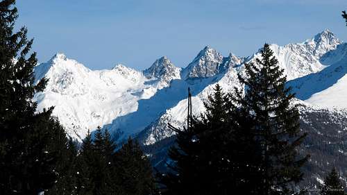
Seekogel (3352m)
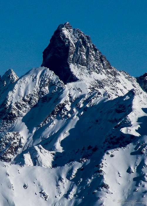
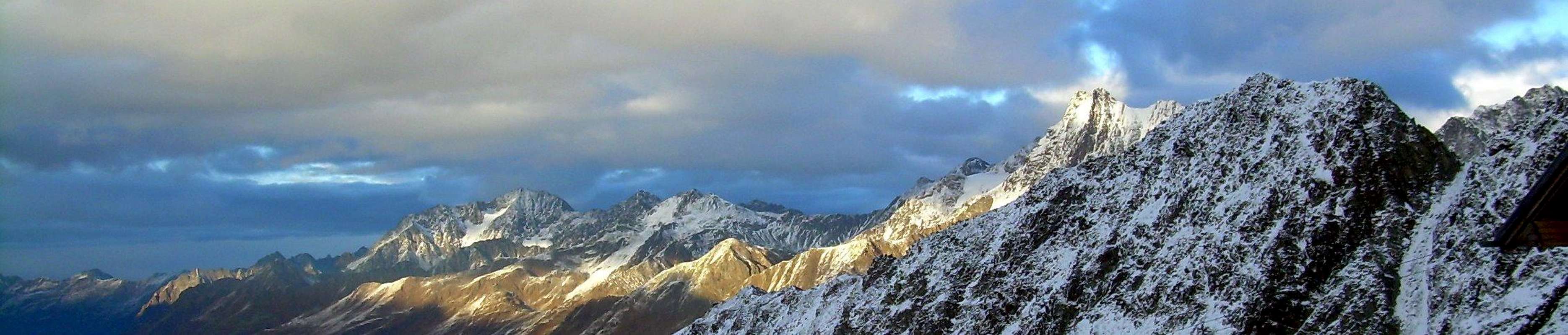
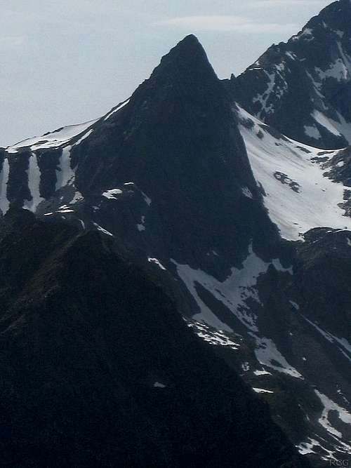
The Mighty Rofelewand (3354m, W-F.)
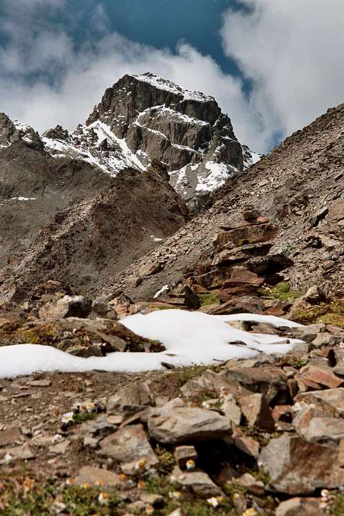
Verpeilspitze by Selinunte01
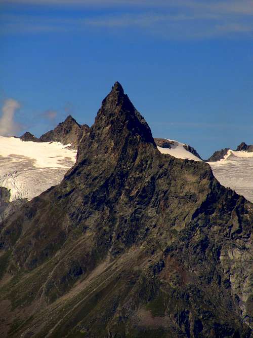
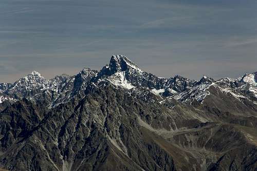
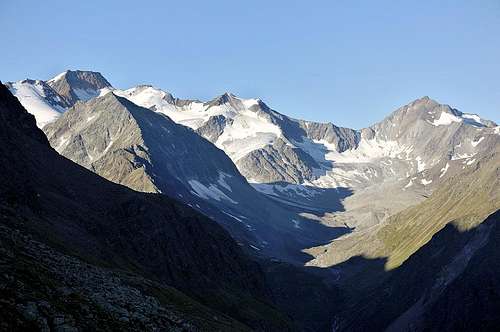
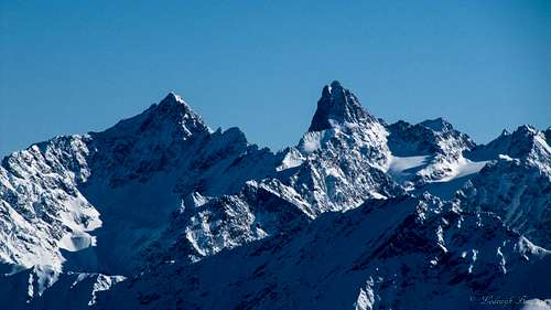
The Kaunergrat ridge is a fine mountain range with many impressive peaks. . The Kaunergrat consists of as many as 39 peaks of over 3000 meters in altitude and has a total length of about 30km. Watzespitze is with its 3534m the highest peak of this subrange of the Otztal Alps. Furthermore, Watze is among the highest peaks in Tirol and even in Austria. It has a striking appearance from all angles and it’s normal route is among the most difficult of the high mountains in Austria.
The Kaunergrat ridge is oriented in a North-South direction and is bounded by the Inntal Valley to the North and the Weisskamm Ridge to the south where the glaciated Ölgrubenjoch (3044m) forms the official southern boundary. All mountains are on Austrian ground and carry only German names. At the west side it is bordered by the Glockturmkamm and in the east by the Geigenkamm ridge. In comparison to the two neighbouring ranges the Kaunergrat ridge is most glaciated and holds many peaks above 3300 meters of altitude like Rofelewand (3350m), Verpeilspitze(3420m), Watze(3534m), Rositzkogel (3392m) and Ölgrubenspitze (S:3456m, N:3451m).
The upper northern part of the ridge is oriented NNW– SSE. The first main peaks of the ridge are Venet and Hohe Aifnerspitze. The peaks are all below 3000meters at this point. The first 3000meter peak is Dristkogel (3054m). From this point on the ridge is oriented N-S, and the peaks gradually become higher in altitude with Watze being the highest at 3534 meters. Towards the southern half of the Ridge the peaks remain between 3000 en 3500 meters in altitude. The southern part is therefore more glaciated compared to the lower northern part of the ridge.
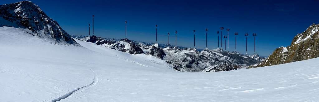
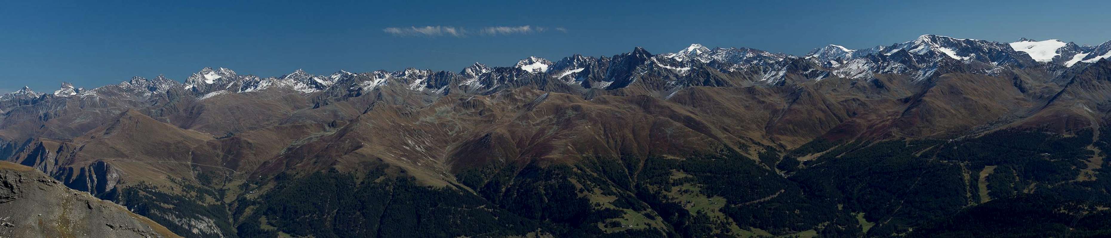
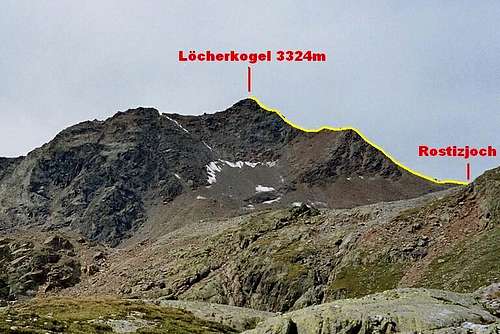
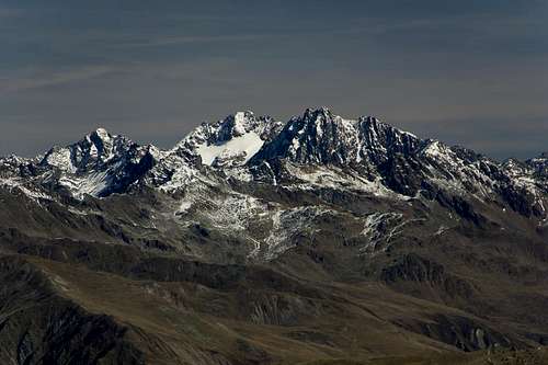
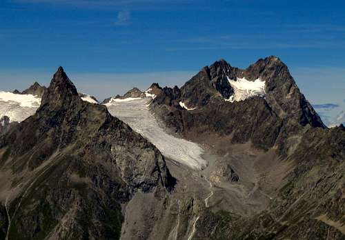
From left to right the main summits are: 1. Ölgrubenkopf 3392m, 2. Vordere Ölgrubenspitze 3452m, 3. Bliggspitze 3453m, 4. Eiskastenspitze 3371m, 5. Südlicher Hapmeskopf 3240m, 6. Nördlicher Hapmeskopf 3289m, 7. Löcherkogel 3324m, 8. Rostizkogel 3394m, 9 Watzespitze south summit 3501, 10. Watzespitze 3532m, 11. Seekogel 3357, 12. Schwabenkopf 3378m, 13. Verpeilspitze 3423m, 14. Gsallkopf 3277m, 15. Rofelewand 3353m, date: 14 september 2012.
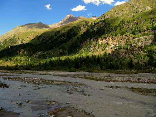
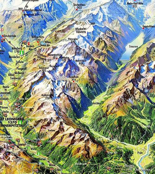
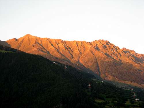
Directly to the west of the Kaunergrat ridge lies the Kaunertal valley with its main villages from north to south: Kaunerberg, Kauns, Nufels, Boden,Feichten im Kaunertal and Kuphoff. More to the south lies the Gepatch-Stausee
Reservoir. Directley to the east of the ridge lies the Pitztal valley with the main villages being from N to S: Jerzens, Zaunhof, St Leonard im Pitztal, Bodele, Kofels, Tieflehn and Mittelberg.The Kaunergrat ridge is great for mountaineering. There are many rock climbing routes on high and steep peaks like the Seekogel, Rofelewand and Watzespitze. Seekogel is, together with Watze, the most difficult mountain to climb in the area: AD+ (III+/IV). The area is great for hiking as well. Popular destinations are the Rifflsee above Mittelberg and the Hohe Aifnerspitze with great views towards the Samnaun Group en Otztal Alps. Tourists mostly go to the Pitztaler Glacier where a cableway leads up to the Hinterer Brochkogel at 3440meters. This is the highest lift in Austria. The glacier is popular for skiing in spring, winter and autumn. Views over the Kaunergrat ridge are fantastic from here.
The Kaunergrat has seen some famous climbers in the past. Hermann Buhl opened two new routes & first ascents here: The Seekarlesschneid-Nordwestpillar (V+) with H. Klier, W. Purtscheller und W. Gruber in 1946 and the Rofelewand North Ridge. The latter has not been repeated since this day.
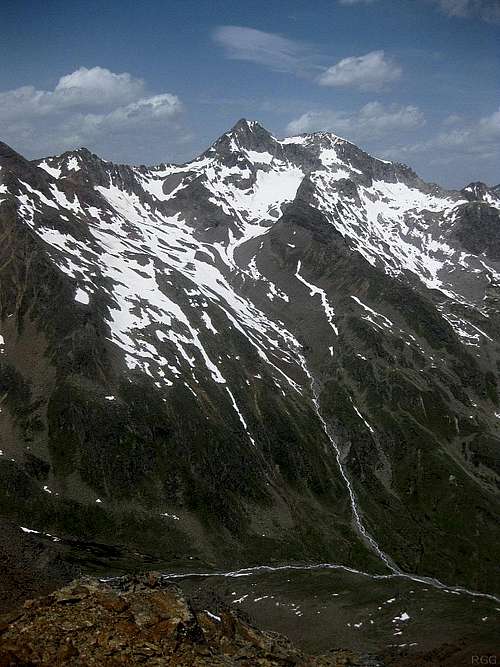
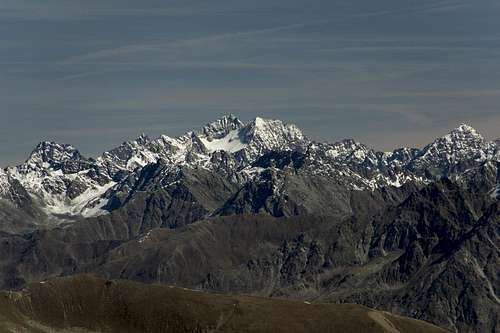
Vordere Olgrubenspitze (3456m)
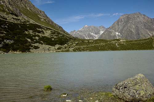
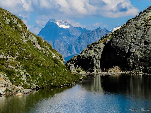
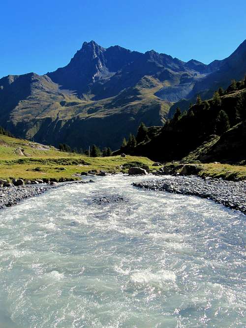
Rifflsee; Pitztal
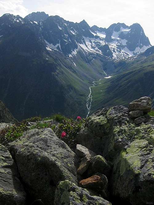
Upper Kaunertal valley & KaunergratThe Kaunergrat holds a nature park and is home to the following mountain huts: Kaunergrathütte (2817 m), Taschachhaus (2434 m), Rifflseehütte ( 2293 m) , Verpeilhütte (2025m) and Gepatschhaus (1928 m).
The ten highest mountains of the Kaunergrat are (in order of descending height): Watzespitze ( 3533 m), Bliggspitze ( 3454 m) ,Vordere Ölgrubenspitze (3452 m), Verpeilspitze ( 3423 m), Rostizkogel (3394 m), Ölgrubenkopf ( 3392 m) ,Schwabenkopf ( 3378 m) ,Eiskastenspitze (3373 m), Seekogel ( 3358 m) ,Rofelewand ( 3353 m) & Löcherkogel (3324 m).
2 - Kaunergrat on SP
- The Kaunergrat Ridge
3 - The Summits
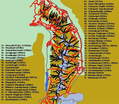
Peak Map of the Kaunergrat (by Gangolf Haub)
Schematic Map of the Kaunergrat Mountain Ridge
Venet(2512m)
Hohe Aifenspitze (2786m)
Falkauner Köpfle (2834m)
Falkauner Ölgrubenköpfe
Southern Ölgrubenkopf (2825m)
Hinterer Ölgrubenkopf (2855m)
Äusserer Ölgrubenkopf (2887m)
Stupfarriköpfle (2808m)
Schalwand (2941m)
Aherkogel (2803m)
Stallkogel (2603m)
Kitzmörder (2435m)
Vorderer Stupfarri (2870m)
Mittlerer Stupfarri (Neuberg, 2912m)
Steinmannle (2898m)
Gallrutt-Stangenkogel (2870m)
Hinterer Stupfarri (2896m)
Peischlkopf (2914m)
Wallfahrtsköpfl (2850m)
Kleiner Dristkogel (2934m)
Großer Dristkogel (3059m)
Brehnkopf (Hoher Radlstein, 3016m)
Unterer Muttler (Brühkopf, 2703m)
Gsallkopf (Griesskogel, 3278m)
Hochrinnegg (3027m, 3067m)
Schweikert (2881m)
Rofelewand (3354m)
Totenkarköpfl (3193m)
Sonnenkögel
Eastern Sonnenkogel (3163m)
Central Sonnenkogel (3130m)
Western Sonnenkogel (3008m)
Gamezkogel (3125m)
Verpeilspitze (3425m)
Parstleswand (3091m, 3085m)
Weisser Kogel (2678m)
Parstleskogel (2741m)
Schwabenkopf (3379m)
Madatschtürme
Eastern Madatschturm (2829m)
Central Madatschturm (2829m)
Western Madatschturm (2777m)
Madatschkopf (2783m)
Mooskopf (2532m)
Waze (M:3533m, S:3503m)
Wazekopf (2918m)
Seekarlesschneid (3208m)
Zuragkogel (2891m)
Brandkogel (2677m)
Steingogel (2635m)
Seekogel (3358m)
Rositzkogel (3392m)
Löcherkogel (3326m)
Hapmesköpfe
Northern Hapmeskopf (3292m)
Southern Hapmeskopf (3237m)
Wurmtaler Kopf (3228m)
Grubenkarspitze (3002m)
Grubengrat (2839m)
Vorderer Eiskastenkopf (3087m)
Eiskastenspitze (3378m)
Bliggspitze (3454m)
Äusserer Bliggkopf (2896m)
Mittlerer Eiskastenkopf (3260m)
Hinterer Eiskastenkopf (3299m)
Vordere Ölgrubenspitze (S:3456m, N:3451m)
Innerer Bliggkopf (2865m)
Hintere Ölgrubenspitze (3296m)
Wannetspitze (3100m)
Hohe Aifner Spitze (2786m)
Olgrubenkopf (2879m)
Kleiner & Grosser Dristkogel (3058m)
Gsallkopf (3277m)
Rofelewand (3354m)
Sonnenkogel (3166m)
Verpeilspitze (3427m,left)
Parstleswand (3096m)
Schwabenkopf (3378m)
Watze (3534m)
Seekarlesschneid (3207m, middle)
Seekogel (3352m)
Rositzkogel (3392m)
Locherkogel (3324m)
Wurmtaler Kopf (3228m)
Eiskastenspitze (3371m,left)
Bliggspitze (3454m)
Vordere Olgrubenspitze (3456m)4- Main Mountains to be climbed
Watzespitze
Difficulty: AD+ (IV)
Altitude Gain: 717m
Starting Point: Kaunergrat Hut (2817m)
Duration(up & Down): 6/7hours
Name:
Verpeilspitze
Difficulty: PD (II)
Altitude Gain: 1400m
Starting Point: Verpeil Hut (2015m)
Duration (up & Down): 7 hours
Rofelewand
Difficulty: PD (II)
Altitude Gain: 1300m
Starting Point: Verpeil Hut (2015m)
Duration(up & Down): 6/7hours
Hohe Aifner Spitze
Difficulty: T3
Altitude Gain: 1200m
Starting Point: Parking lot Piller hohe(1550m)
Duration(up & Down): 5/6hours
5 - Getting There
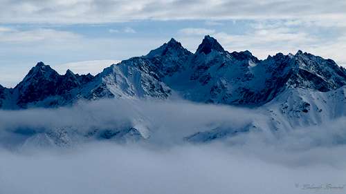
Seekogel (3353m) & Watze (3534m)
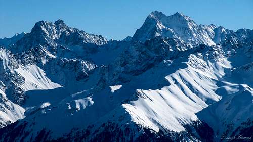
Gsallkopf (3277m) and Rofelewand (3354m)
Kaunergrat can be reached from two sides, Kaunertal Valley in the west and Pitztal Valley in the east.
From Austria:
- Take motorway A12 / E60 to Arzl/Pitztal
- Switch to L60 into the Pitztal
or:
- Take motorway A12 / E60 to Landeck
- Switch to B180 towards Prutz
- At Prutz take the L18 into the Kaunertal
From Italy:
Take Motorway A22 to Bozen / Bolzano
Switch to SS38 to Sponding / Spondinga
Stay on course on SS40 to Reschenpass / Passo di Resia where it turns into B180 north of the Austrian border
At Prutz take the L18 into the Kaunertal
or
At Fliess take the L17 into the Pitztal
From Switzerland:
Take motorway A3 and A13 to Landquart
Switch to B28 across Flüelapass to Susch
Switch to B27 to Vinadi
Across the border the road turns into B180 through Inntal Valley
At Prutz take the L18 into the Kaunertal
or
At Fliess take the L17 into the Pitztal
6 - Accommodation
Mountain Huts:
Hut
Height
Summer
Winter
Telephone
Photo
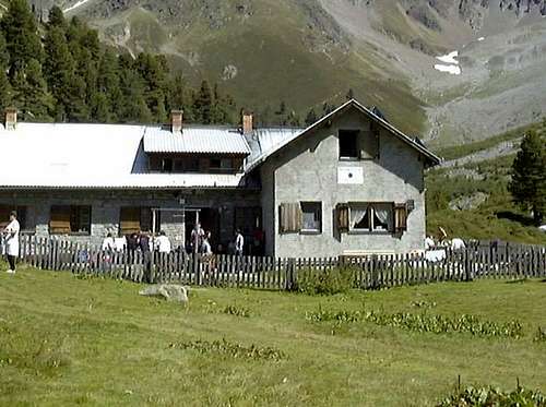
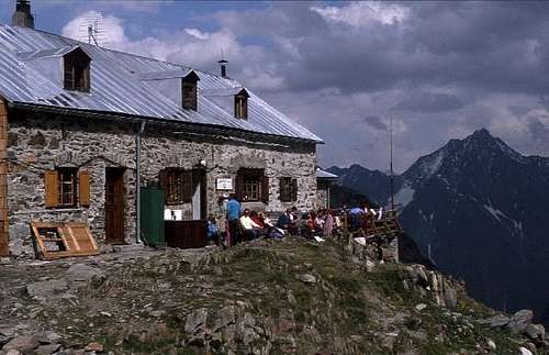
Verpeilhütte
2025m
mid June- end September
closed
+43/664/4319634
Verpeil Hut
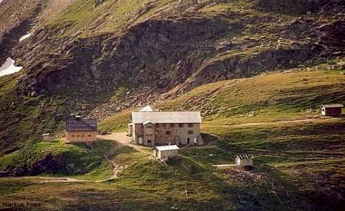
Kaunergrathütte
2817m
end june - mid september
closed
+43/5413/86242
Kaunergrat hut
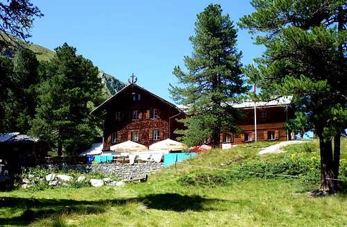
Rifflseehütte
2293m
mid june- end september
mid dec- mid april
+43/5413/86235
Rifflsee Hut
Taschachhaus
2434m
mid june- begin october
self service for 16 (Winterraum)
+43/5413/86239
Taschachhaus
Gepatschhaus
1928m
mid june- end september
2 weeks around easter
+43-664/5349044
Gepatschhaus
7 - Red Tape
There's no red tape to speak of on Kaunergrat. The southernmost part runs along the border between Austria and Italy so that taking an ID is mandatory.
8 - Weather Conditions
9- Maps & Books
8.1 - Maps
Regular Maps


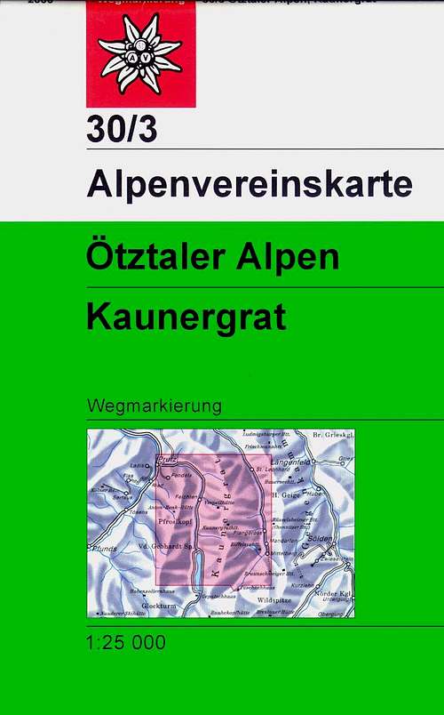

- Ötztaler Alpen, Kaunergrat
Map No: 30/3
1:25000
ISBN: 978-3928777414
- Ötztaler Alpen, Geigenkamm
Deutsche Alpenvereinskarte 30/5
1:25000
ISBN:9783928777445
- Ötztaler Alpen
Kompass Map WK43
1:50000
ISBN: 3-85491-049-5
Maps Online
8.2 - Books
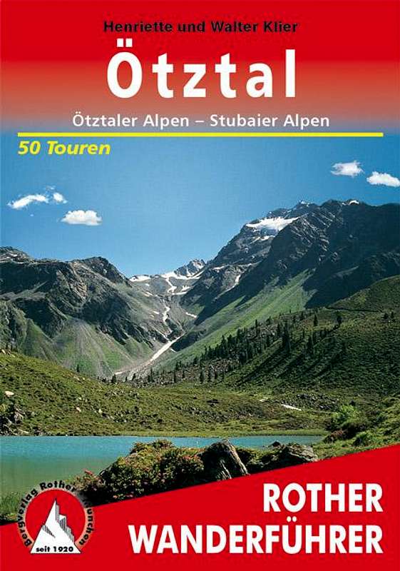
- Ötztaler Alpen
W. Klier
Alpenvereinsführer
Rother Verlag
ISBN: 3-7633-1123-8
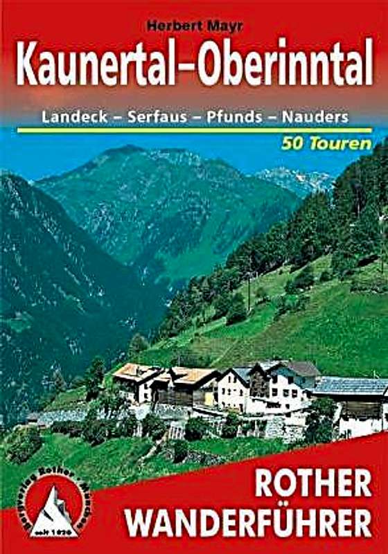
- Kaunertal – Oberinntal
Hubert Mayr
Rother Verlag
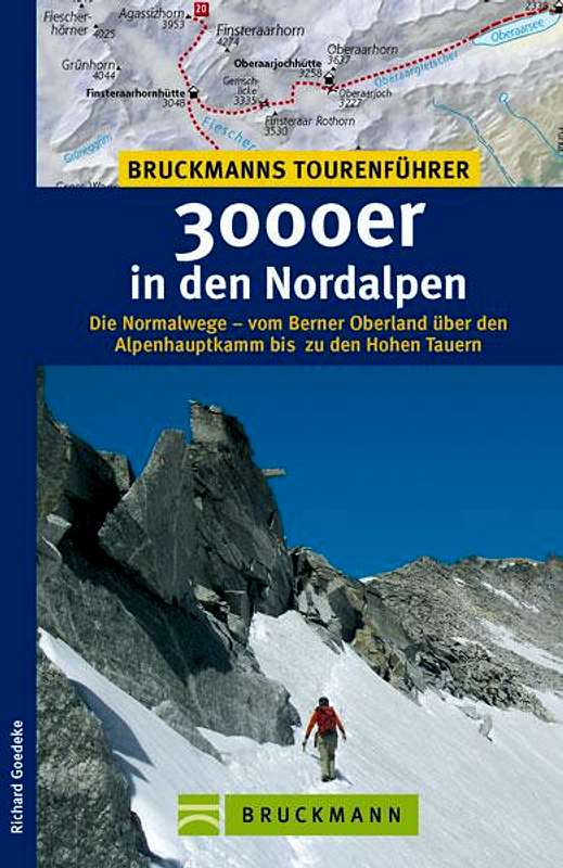
ISBN: 978-3-7633-4027-93000er in den Nordalpen
Richard Goedeke
Bruckmann
ISBN13: 9783765455438