
|
|
Mountain/Rock |
|---|---|
|
|
47.15742°N / 10.21284°E |
|
|
Hiking, Skiing |
|
|
Spring, Summer, Fall, Winter |
|
|
9216 ft / 2809 m |
|
|
Overview
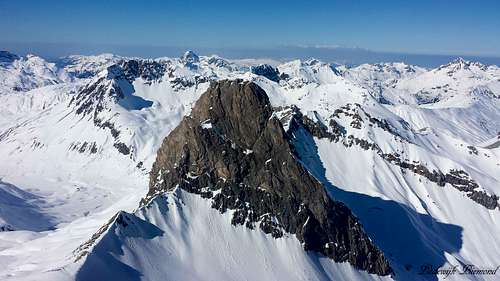
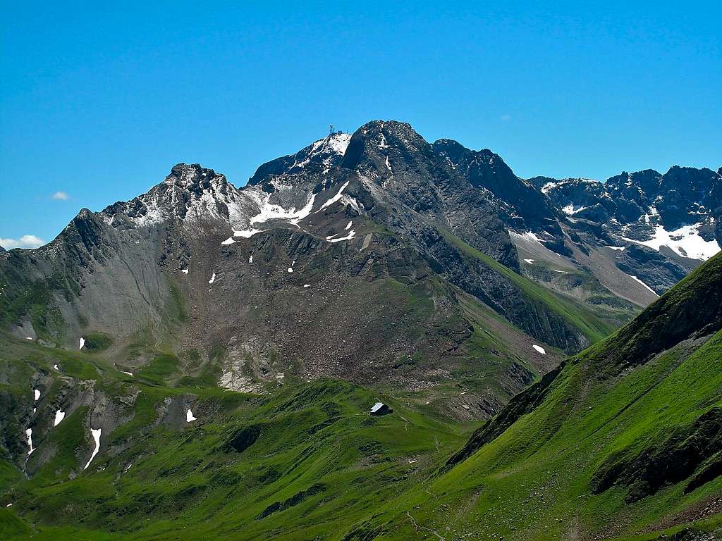 Valluga (2809m) by EricChu | 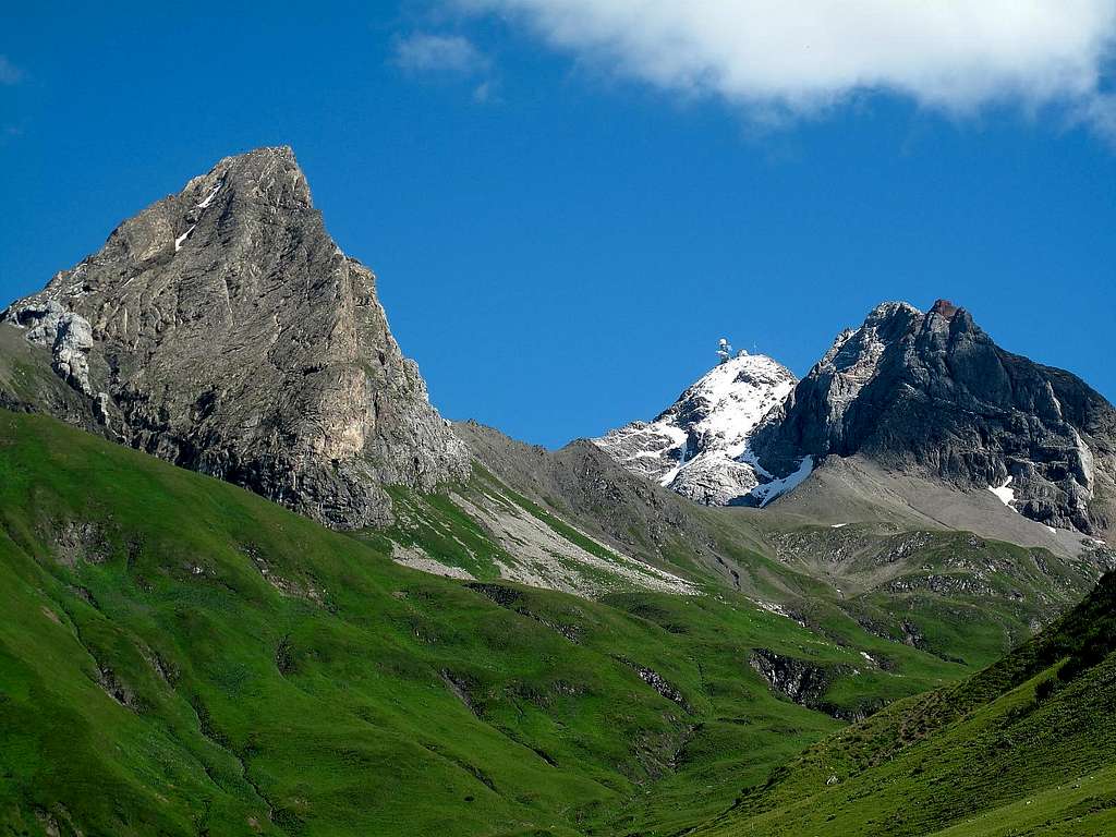 Roggspitze (2747m), Valluga (2808m) by EricChu |
Valluga is a 2809 meter high mountain in the western part of the Lechtal Alps. Valluga is the highest and probably most well-known mountain of the Arlberg region and one of the most prominent mountains of the Lechtal Alps. Furthermore, the mountain is located on the European watershed between the Rhine (North Sea) and Donau (Black Sea). Valluga is also referred to as Valfaggar, a diversion from the Reto-Romanian word Vaccaria, which means ‘Valley of Cows’.
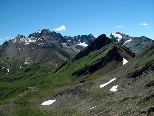
Valluga is located on the border of Tirol and Vorarlberg and is often referred to as the home mountain of St. Anton, a famous ski resort. The main summits surrounding Valluga are Paziellfernerspitzen (2712 meter) and Pazielspitze (2770 meter) to the west and Roggspitze (2747 meter) to the north. The Pazielferner, a glacier on the western flanks of Valluga, has shrunk to a small snowfield due to global warming.
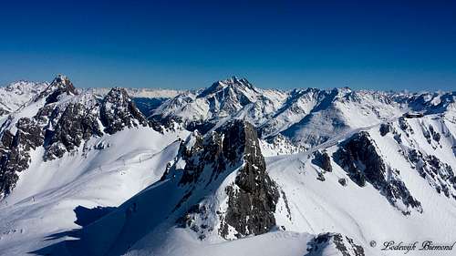 Valluga summit view towards Hoher Riffler (3168m) | 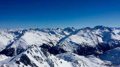 Summit view towards the Verwall Group |
For climbing Valluga there are several options. There are two mountain huts in the vicinity of Valluga. The Ulmer Hütte is located on the south side of the mountain at 2279 meters. More to the north lies the Stuttgarter Hütte (2305 meter). Both are excellent for a climb of Valluga. From the Ulmer Hut it is a 2 hour climb to the summit. More about this in the Route section. Valluga is surrounded by the large ski area called Ski Arlberg, which includes the famous villages of St. Anton and Lech. One of the lifts goes all the way up to the summit of Valluga, making the peak easy accessible. Of course there is a big downside to this: Crowds on the summit, manmade structures on the summit itself etcetera. On the other hand it also brings new possibilities, like climbing up and taking the lift down.
 Roggspitze (2747m) from Valluga | 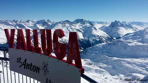 Valluga Summit |
Personally I am not a fan of these ’cableway mountains’, but Valluga is still worthy of climbing, with the main reason being the views. You can see all the way to the Lechquellengebirge and Germany in the North and towards the South all the main peaks of the Verwall Group are visible: Hoher Riffler (3168m), Kuchenspitze (3148m) and Patteriol (3068m). Also the Otztal, Silvretta and Samnaun Groups are visible.
Routes
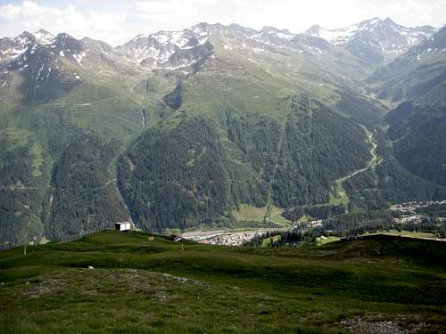
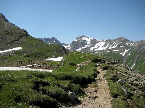
There are several routes up to Valluga. Most routes come from the south from the village St. Anton, but there also routes starting from the North (Lech and/or Zurs). The main routes are described here.
 Looking back to Galzig and St. Anton | 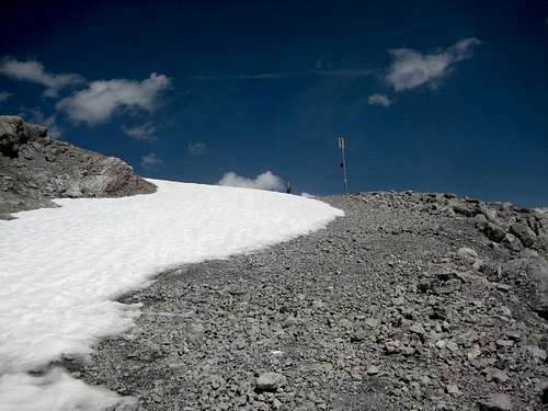 Valfagehrjoch (2539m) | 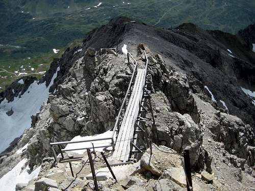 The bridge on the South Ridge |
From St. Anton follow trail 22/645 in the direction of the Ulmer Hutte (Orange Route). This trail is also referred to as the Adlerweg. Another option is to take the Galzigbahn (cableway) up to Galzig at 2082m. From here follow route 23 and 645 to the Ulmer Hut (Red route). A third option is to park your car the the Arlberg pass and hike up to the Ulmer Hut via route 21 (Purple Route). From the Ulmer Hut the trail goes to the Northeast towards the Valfagehrjoch (2539 meter). Cross the Joch an follow trail 21. You will now pass the Vallugagrat station at 2646 meters. At this point you will arrive on the south ridge of Valluga. Follow the ridge until you reach the summit of Valluga. The trail until the Ulmer Hut is graded T2. From the Ulmer Hut to the summit the trail is graded T3 with some parts of T3+.
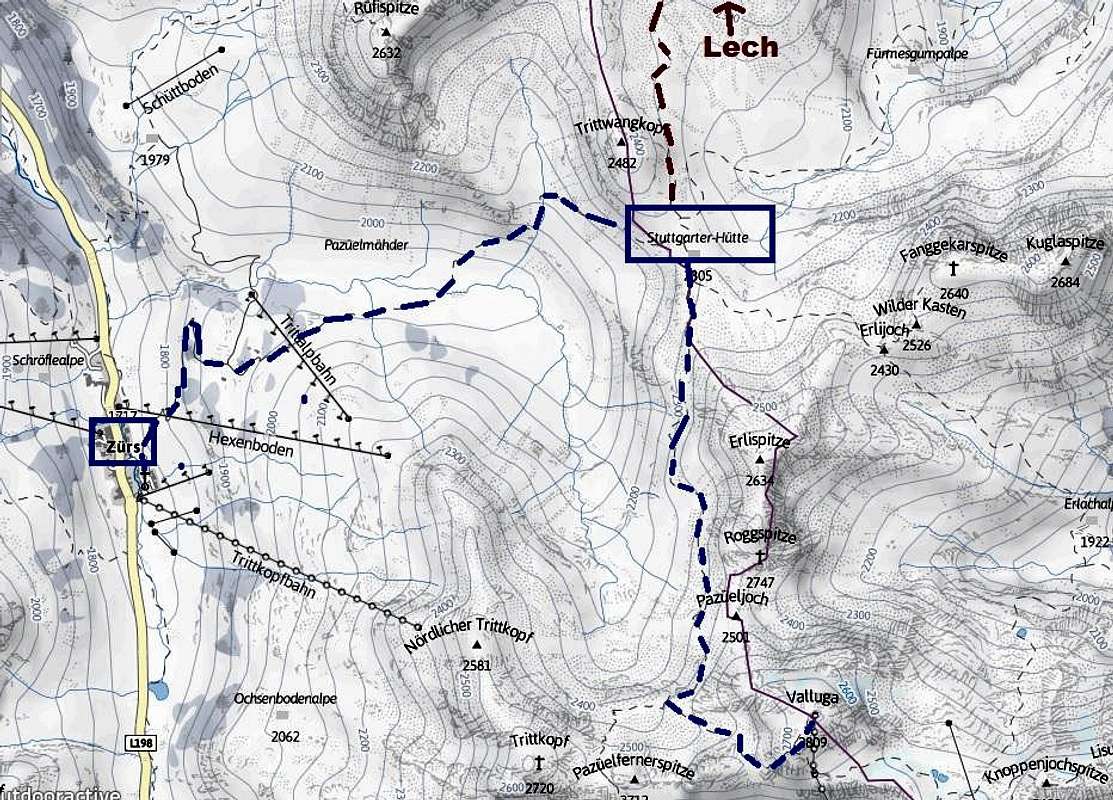
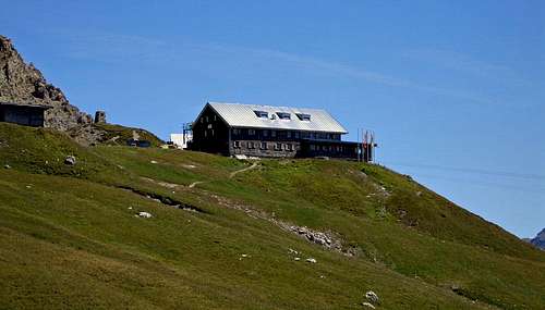
The other main route starts from the Stuttgarter Hutte. The Stuttgarte Hutte can be reached from Zurs along the A. Endress trail. This trail passes the Trittalpe at 1944meters and goes up in an eastern direction until you reach the Stuttgarter Hutte at 2310 meters (Purple Route). Another option to reach the Stuttgarter Hutte is from the Rufikopf lift. Take the cableway from Lech to the Rufikopf at 2362 meters. From here follow the marked trail towards the Rauhe Kopf Scharte at 2410 meters. Follow trail 645 towards the south until you reach the Stuttgarter Hut (Dark Red route).
 Rauhekopfscharte-Stuttg. hut trail by EricChu |  View to the western Lechtal Alps by EricChu | 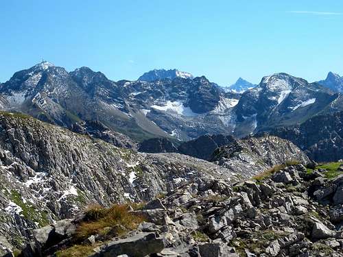 Vallluga (2809m) by EricChu |
From the Stuttgarter Hut follow the Adlerweg/Boschweg trail towards the south. You will passwest of Roggspitze. At the split-up take a left and head towards Valluga. Keep heading west until you reach the south ridge of Valluga. This last part before the south ridge contains loose rocks and is quite steep, watch your step here. At this point the route joins the one described above. Follow the South ridge up to the summit. This route is graded T3 with some parts T3+/T4-.
 The Boschweg trail near Stuttgarter Hut | 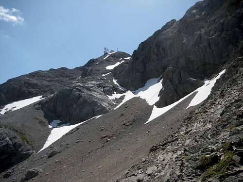 Valluga NW-Face | 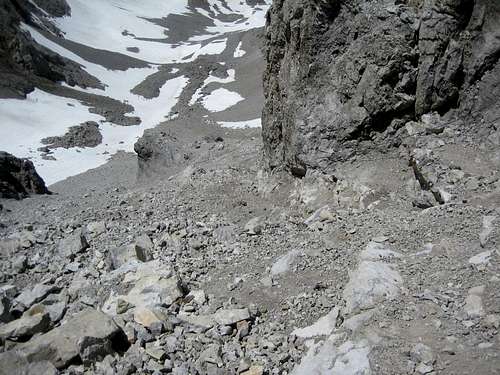 The steepest part |
A nice variation is to take the first route up and the second one down: St. Anton – Ulmer Hut – Valluga – Stuttgarter Hut – Zurs/Lech. This way you can make a multiple day tour through the area. Other, single day options, are to take the cableway up to the summit and walk back down or of course, the other way around.
For Ski-mountaineering Valluga is also a popular objective. It is the fastest way to get to Lech and Zurs without the use of buses. This route from Valluga to Zurs is not easy and it is advised to hire a guide in St. Anton
How to get There
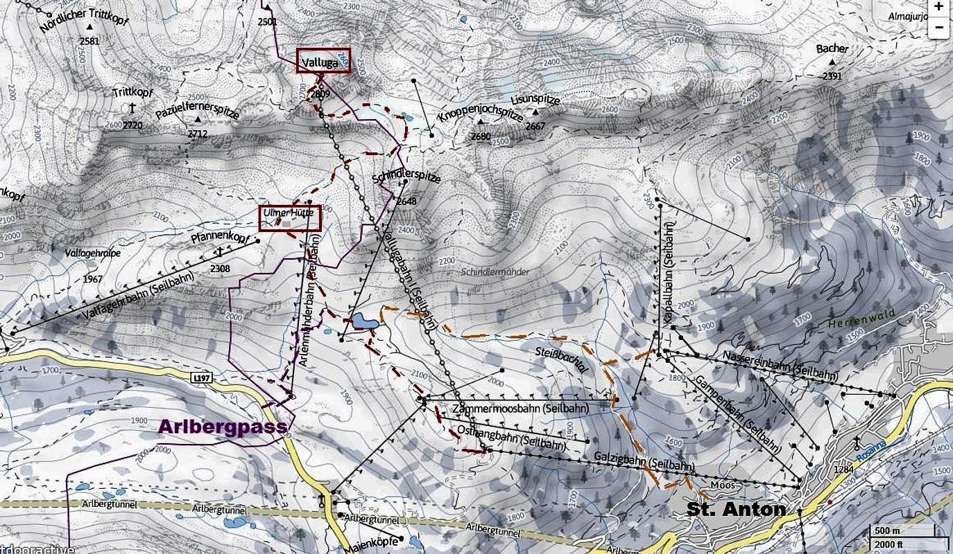
How to get There: MAP
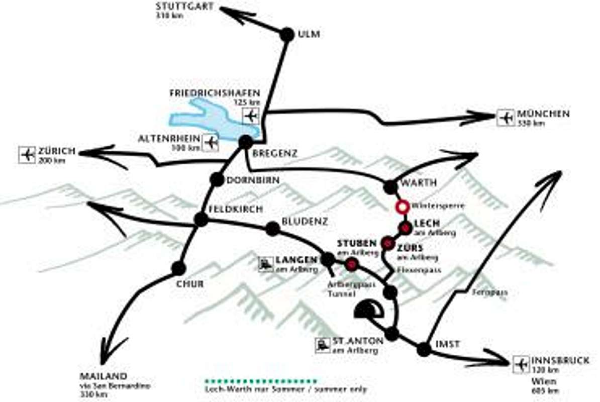
Approaching from the north: coming from Bodensee area the easiest way leads from Bregenz onthe B200 via Alberschwende and Egg to Schröcken. From the Füssen area insouthern Bavaria follow the B179 to Reutte, then the B198 leading to Warth and then to Lech. Additionally: cross the Flexenpass to reach St. Anton.
Approaching from Bludenz in Vorarlberg follow the S16 to Arlberg. From Innsbruck take theInntal-Highway via Imst and Landeck to Arlberg again. In the village of Stubenbranch north on the B198 to St. Anton and/or over the Flexenpass to Zürs and on to Lech.
For detailed information about how to get to Lech see this link: Travel information Lech There is also a description of getting to Lech by bus and train.
For detailed information about how to get to St. Anton see this link: Travel information St Anton There is also a description of getting to St. Anton by bus and train.
Mountain Huts
 | Ulmer Hutte Elevation: 2288m Telephone: +43-(0)5446-30200 Capacity: 46 beds |
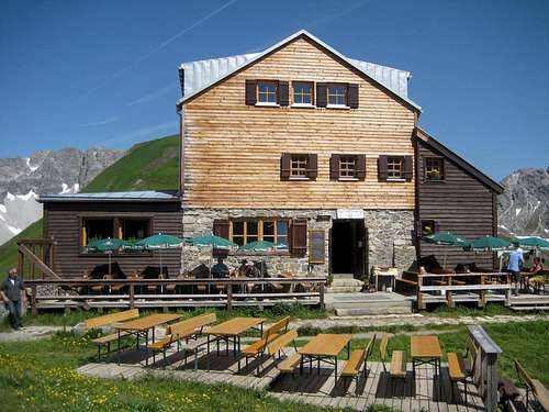 | Stuttgarter Hutte Elevation:2310m Telephone: +43-(0)676-7580250 Capacity: 56 beds |
When to Climb
Valluga is year-round accessible by cablecar. The best time for hiking/climbing Valluga is the summertime. Ski-ascents are popular as well in winter. For the route details see the ''Routes section''Weather
Maps
 | Kompass Map no. 33 Arlberg - Verwallgruppe 1:50.000 ISBN:9783990440759 |
 | Alpenvereinskarte 3/2 Lechtaler Alpen Arlbergebiet 1:25.000 EAN: 9783928777155 |
External Links
Timetable and Prices St. Anton Cableways