The page was successfully edited.

-
 5878 Hits
-
 81.84% Score
-
 14 Votes
|
|
Mountain/Rock |
|---|---|
|
|
37.81412°N / 107.44642°W |
|
|
Hinsdale |
|
|
Hiking, Mountaineering, Scrambling |
|
|
Spring, Summer, Fall, Winter |
|
|
13660 ft / 4164 m |
|
|
Overview
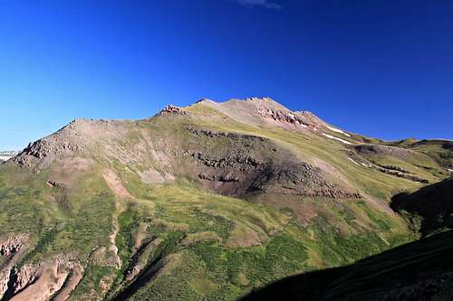
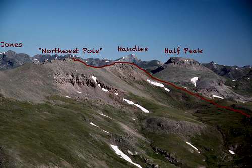
"Northwest Pole" or Peak 13,660' as called in some books is a high 13er located in San Juan Mountains, near Pole Creek Mountain. Northwest Pole combines really nice with Pole Creek Mountain (also a bicentennial peak and among the 50 highest in San Juans) and even with a centennial peak Half Peak if you really wish for a long hike.The peak does not look like much from far afar, but its summit block offers a really interesting and exposed scramble.
Northwest Pole is a bicentennial peak, meaning it belongs to the list of Highest 200 in Colorado.
Guide to the Colorado Mountains with Robert Ormes (sort of a bible of Colorado Mountains) does not offer much information (Northwest Pole is called here Peak 13,660'). There is an optional side climb of Peak 13,660' along the way. The true summit for this peak is a rotten block involving some exposed scrambling.
 Northwest Pole as seen from west slopes of Pole Creek Mountain | 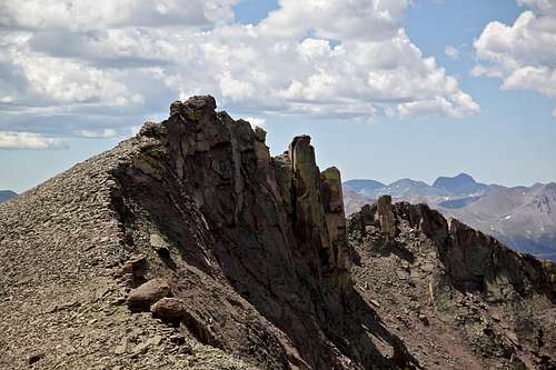 Summit block of NW Pole as seen from its North Ridge |
Colorado Rank: 167
Parents Lineage: Pole Creek
Isolation: 1.53 miles
Class: 3/4 (mostly really class 2 hiking, and only 4-5 moves of exposed scramble to gain the summit block).
- Pole Creek Mountain 1.53 miles
- Unnamed 13580 B 2.26 miles
- Unnamed 13164 2.77 miles
- "Tundra Top" 3.34 miles
- Half Peak 3.64 miles
- Greenhalgh Mountain 3.73 miles
- Carson Peak 3.85 miles
- "Cataract Peak" 3.91 miles
- Sheep Mountain A 4.43 miles
Getting There
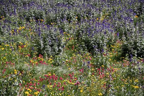
Wildflowers
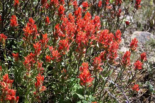
Indian Paintbrush
If driving from Silverton, drive towards Howardsville, turn east here towards Stony Pass, you need a 4 WD vehicle here. The turn off is signed - Stony Pass and Cunningham Gulch. Stony Pass is in a high alpine country, elevation 12,624 feet. It is a wonderful place in the summer with wildflowers (see photos). Head down FR 520 from Stony Pass towards Creede and Beartown, just after crossing Pole Creek there is a large meadow on the north side, this is the start of the trail.
If you have a time stop at the Stony Pass - Stony Pass Peak appears steep but the route is only class 2 and it takes about 45 min to gain the summit. The views into Grenadier range from there are amazing!
Another approach would be via Cataract Gulch - this is a long way in, consider backpacking. How to get to Cataract Gulch? From Lake City take highway 149 south, 2.5 miles. Turn right onto the road to Lake San Cristobal. Follow the paved road approximately 4 miles, then continue on dirt road for about 8.3 miles. Turn left at the fork toward Sherman; go 1.4 miles. A sign marks the trailhead to the left of the road. Cataract Trail is scenic and this route is great if you plan backpacking and doing more peaks, e.g. centennial Half Peak (centennial means among the top 100 highest in Colorado).
Route
As any mountain there are many options to get to the summit. I enjoy touring the moutains, meaning going up one way and descending some other way. My route was from Pole Creek Mountain descending its North Ridge, staying pretty high and not dropping into the drainage between Pole Creek Mountain and Northwest Pole (in the photo the drainage appears shallow, but during my hike it seemed bigger). It was hard to see which is the main summit from the descent of Pole Creek and I love hiking ridges, therefore I headed first for the sub-summit (rounded summit below Handies in the photo below) and hiked the ridge towards its main summit. The ridge I will call again North Ridge since it is north facing, and this is the most comfortable route. The summit block is surprisingly small and airy, what a fun to complete the hike!I descended from the saddle between the main summit and sub-sumit west, this route was steep, loose and I would not recommended it. I wanted to take photos from the other site and cross to the higher part of Pole Creek Trail. The better way would be continue on the summit ridge (you can walk around the summit block on its east side) and descend mostly grassy slopes south and you will end up back in the drainage between Northwest Pole and Pole Creek Mountain.
Northwest Pole
Scramble up summit block - it is definitively worth doing it. The crack felt secure although exposed. The hand and foot holds felt stable (double check of course every single hold, do not trust San Juan's rocks). I really wished to have a partner here, I could only imagine how it would be lovely to take photos of someone posing on the summit block from below.
Do not climb the crumbly face from the north. It is a separate tower. Instead step onto this first block from the north and traverse to pass this first tower (tiny gap in between this one and the main summit block) until you find a nice crack leading to the short summit walk and the actual summit. The crack felt secure with plenty of hand and footholds. I placed a couple of small cairns there. It is sweet.
Do not climb the crumbly face from the north. It is a separate tower. Instead step onto this first block from the north and traverse to pass this first tower (tiny gap in between this one and the main summit block) until you find a nice crack leading to the short summit walk and the actual summit. The crack felt secure with plenty of hand and footholds. I placed a couple of small cairns there. It is sweet.
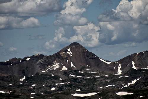
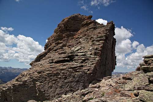 Airy and rotten summit block as seen from the north ridge approach - do not go up it, but instead step on it and traverse on a small ledge south | 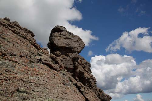 Summit block as seen from the south - I wished someone to be standing on its summit, that would make this photo so much more interesting. |
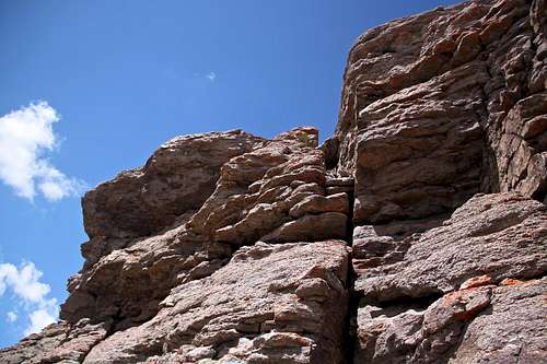 Crack on the NE side of Nortwest Pole leading to the short summit ridge | 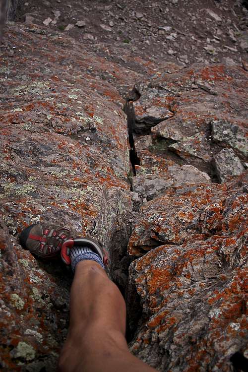 Short scramble section - view down |
Summit Views
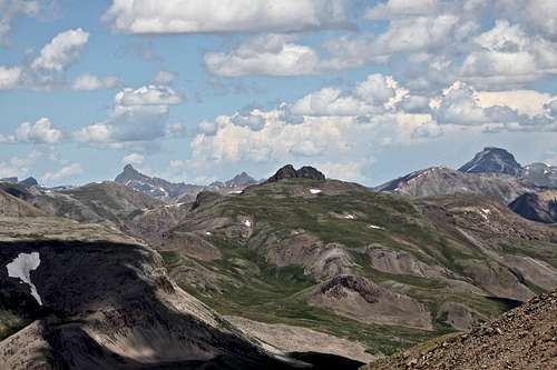 Quarter Peak (center), Uncompahgre (right), Wetterhorn (left) | 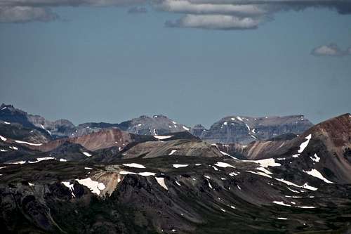 East Sneffels range: Ridgway (center), Whitehouse (right), Teakettle (far left) |
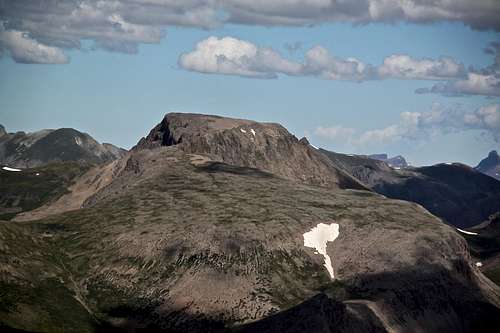 Half Peak | 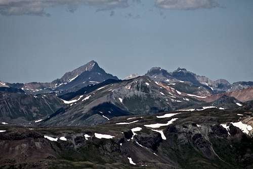 Mount Sneffels group: Sneffels and to its right Potosi and Teakettle |
 Niagara Peak | 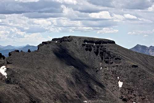 Pole Creek Mountain |
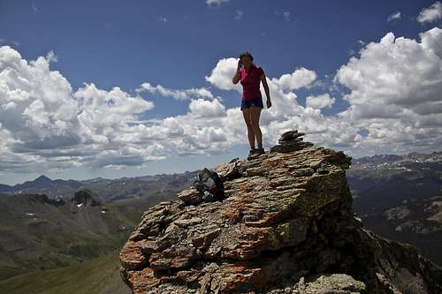 NW Pole summit | 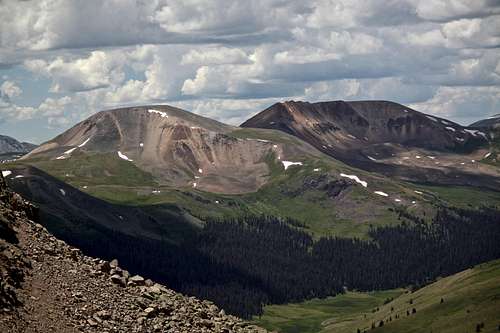 Greenhalgh and Sheep Mountain |
Red Tape
Driving 4WD roads, parking and hiking is free. There are free campsites at the Pole Creek trailhead and also at the other end - Cataract Gulch. You do need a 4WD vehicle to access Pole Creek and also high clearance since you will be crossing deep Pole Creek. You don't need 4WD if driving to Cataract Gulch TH, and Cataract Gulch is open year round. (There is good ice climbing there in the winter - The Sherman Climb).When to Climb
Summer is the easiest - nice travel over high tundra. The road to Cataract Gulch is open year round (snow plowed in the winter), but the hike from Cataract Gulch is long and does pose avalanche danger in the winter. I snow shoed part of the route into Cataract Gulch after ice climbing in the area and it seem that people use this trail at least a short way year round.The 4WD road to the start of Pole Creek Trail is closed during the winter, and usually does not open until late May, and closes typically by November (based on conditions).
The drive over Stony Pass is very popular in the summer - great wildflowers everywhere, one of the best and can be viewed from the car.
Camping
Pole Creek area offers plenty of beautiful primitive camping. There are fire sites built with stones, water from the creek. No toilet facilities.
Cataract Gulch has toilet facilities at the trailhead. Camping is available at several pullouts on the road just west of the trailhead.