
-
 12821 Hits
-
 83.69% Score
-
 17 Votes
|
|
Mountain/Rock |
|---|---|
|
|
37.94288°N / 107.74416°W |
|
|
Ouray/San Miguel |
|
|
Hiking, Mountaineering, Scrambling |
|
|
Spring, Summer, Fall, Winter |
|
|
13385 ft / 4080 m |
|
|
Overview
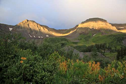 Chicago Peak and Pt. 13,242 as seen from hiking up Imogene Pass Road. The true summit of Chicago Peak is hiding behind the peak on your left.
As a bonus you can continue walking further up the ridge and reach Point 13,242 known by locals as "Little Chicago". If one wishes also to summit "T 5" which is just further up on the continuing ridge, do not expect this to be an easy task. The ridge is 5th class of climbing over multiple towers with ups and down, and a lot of loose terrain. I would not recommend to summit "T 5" from here.
I chose to combine Chicago Peak with United States Mountain, unranked 13er, and a nice looking peak one can view from Imogene Pass Road on its east = Ouray side. I will make a separate page for United States Mountain, but I would like to mention that the ridge from Point 13,242 "Little Chicago" starts very easy and ends up in 5th class exposed climbing on loose terrain.
Alternative Names: "T 6", Imogene Benchmark
What's up with all those "T" names? San Juan Range uses often these types of nomenclature, e.g. "S" peaks around Sneffels, "T" around Telluride, "V" around Vermillion. Some of the peaks later got a different name, therefore sometimes there is no continuation.
Colorado Rank: 326
Line Parents: "T 5"
Class: 2
There is not much information on-line about hiking this peak. Guide to the Colorado Mountains with Robert Ormes (sort of a bible of Colorado Mountains) does not mention much. "Those who choose to follow the main jeep road the full 7 miles from Telluride to Imogene Pass, will encounter various motorized sightseers going to, or coming from Ouray via Yankee Boy Basin. However, once on the pass, one can travel peacefully on the crest of the divide 0.7 miles north-northwest to Chicago Peak (13,385') or 0.5 mile south to Telluride Peak (13,509').
The best description I found is in Telluride Trails by Don Carmuzzi. ![Imogene Pass]() Imogene Pass with Chicago Peak in the distance
Imogene Pass with Chicago Peak in the distance
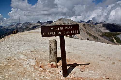 Imogene Pass with Chicago Peak in the distance
 Nearby Peaks:
- "Tomboy Peak" 13,095 feet 0.5 miles
- United States Mountain 13,036 feet (unranked) 0.99 miles
- "T 7" 13,359 feet 1.29 miles
- Telluride Peak 13,509 feet 1.33 miles
- "T 8" 13,315 feet 1.54 miles
- "T 5" 1.55 miles
- Unnamed 13510 B 1.79 miles
- Mendota Peak 13,275 feet 2.25 miles
- Hayden Mountain South 13,206 feet 2.41 miles
- Trico Peak 13,321 feet 2. 6 miles
- Potosi Peak 13,786 feet 3.25 miles
- "T 10" 13,477 feet 3.32 miles
- Mt. Emma 13,581 feet 3.34 miles
- Three Needles 13,481 feet 3.72 miles
- "Coffeepot" 13,568 feet 3.74 miles
- Mt. Sneffels 14,150 fett 4.94 miles
Getting There
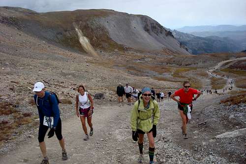 Imogene Pass run
 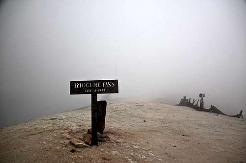 Visibility at the top of Imogene Pass
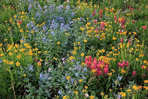 Wildflowers along Imogene Pass
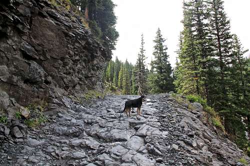 Sections of Imogene Pass road are pretty rough
History of the road: The Imogene Pass road was built in 1880 for access to Ouray from Tomboy Mine. It was named for Imogene Richardson, the wife of one of Thomas Walsh's partners in the Camp Bird Mine. Wires carrying the first commercial transmission of alternating current electricity were strung across this pass in the 1890s. The power was generated in Ames and transmitted to Ouray.
The Tomboy Mine, located in 1880 by Otis Thomas, was situated high above Telluride. Tomboy was Thoma's nickname. For several years there was little activity in Tomboy because it was hard to reach. But after the silver crash in 1893, prospectors struck gold at the Tomboy, and the mine was very productive. The Tomboy Mine was sold for $2 million to the Rothschilds of London in 1897 and continued to operated until 1927.
Imogene Pass Road Description: Imogene Pass is the second highest pass road in the United States and provides a wonderful scenic route though the San Juan Mountains. The route passes through two major mining camps: Camp Bird and Tomboy. I usually come from Ouray side since it is closer to me. The Imogene Pass run always runs from Ouray to Telluride. I have actually never driven the road, but hiked it and ran it many times.
From the Yankee Boy turnoff, the road deteriorates and high clearance 4WD is needed. The track travels through the forest and Imogene Creek Valley. There are number of shallow creek crossings, the roads narrows for the final ascent to the pass. The summit is well marked and a great place to stop. There is parking for several cars.
About two miles from the pass, the track enters the ghost town of Tomboy. The town site has several historic remains. Another couple of miles past Tomboy, the road passes through Social Tunnel, a short passage through a rocky outcrop. Near this tunnel is a good place to spot and view Ingram and Bridal Veil Falls.
Route
 Easy ridge from Imogene to Chicago
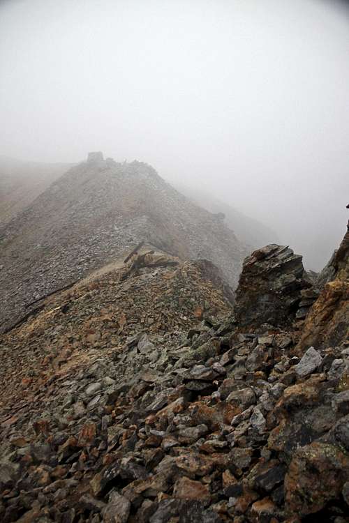 From Imogene to Chicago
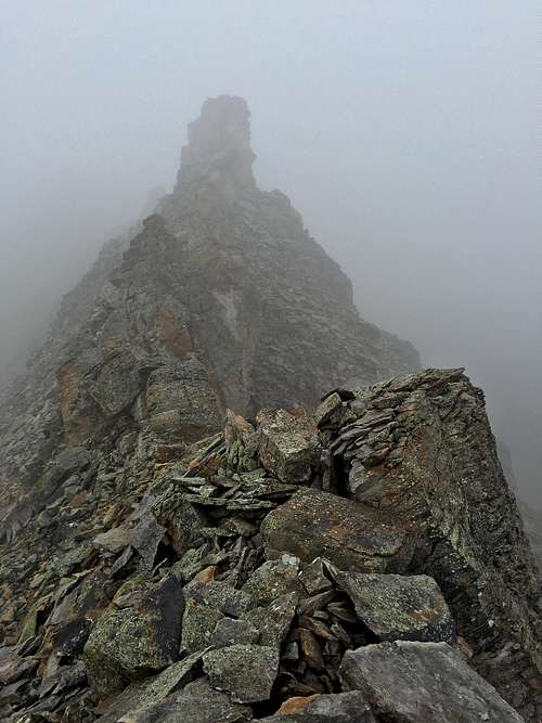 From Imogene to Chicago
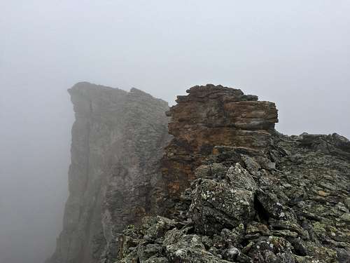 From Imogene to Chicago
Distance: a little over one mile and time max 1 hr (most likely faster).
Class: 2
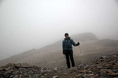
Route: From the parking area at the top of Imogene Pass walk NW on Chicago's long ridge. Initially, there is an obvious trail, which disappears after ~ 1/3 mile. When you encounter difficulties on the ridge, move to your right (Ouray's side) and move around rock obstacles. Some terrain here is on loose talus/scree - pay attention to your footing. The route finding is very obvious (it was very obvious for me even when visibility was super low). Soon you will reach Chicago's Peak south ridge and take it to the top.
If the weather is clear you can see Mount Sneffels and a number of 13ers, you can also see Ouray and Telluride. The summit has a small cairn and summit register.
Return either the same way, or continue onto Point 13,242 feet = "Little Chicago Peak" on a continuation of this ridge. I chose this option since I enjoy exploring different sides of the mountain. I also wanted to see the ridge towards "T 5" - I knew this ridge does not go from reports on 13ers.com, but still wanted to see it. And my hope was to summit United States Mountain if the weather would hold. Remember, this is a long ridge hiking, and there is no an easy escape from this ridge.
Ridge from Chicago Peak to Point 13,242 feet = "Little Chicago Peak" is just under 1 mile. Most sections of this ridge are on a stable talus and very easy, again you will encounter a few rock obstacles, which you can bypass on the east = Ouray's side. The summit of Little Chicago Peak is pretty large, it had two tiny cairns. The ridge towards "T 5" truly looked heinous, a lot of towers made from loose rocks, a true climbers hell. There is an easier way up "T 5", and no mountain is worth risking life.
Return either all the way back over Chicago Peak and back to Imogene Pass, or descend down into the saddle between Point 13,242' = "Little Chicago" and United States Mountain, then carefully move down the scree towards Rock Lake and Imogene Basin.
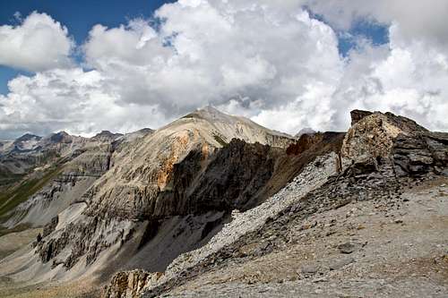
If you wish to summit United States Mountain, the ridge from Point 13,242 is very hard. It starts wide open and easy with great views of Mount Sneffels, Cirque Mountain, Teakettle, Coffeepot and Potosi Peaks (clouds lifted up by this time). The ridge gets really gnarly, exposed, tons of steep down climbs and up climbs. It is loose and a fall here would be fatal. There is a better way to get up the unranked United States Mountain.
Once you descend into Imogene Basin, find your easiest pass to join with the Imogene Pass Road. You are above the tree line and if you continue SE direction you cannot miss the road even if the visibility is low. If the visibility is good, you will see the road and you will hear jeeps and other vehicles on the road.
 Chicago Peak as seen from the start of the trail from Imogene Pass
 | 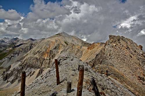 Chicago Peak
 |
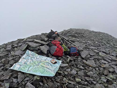 Map consultation
 | 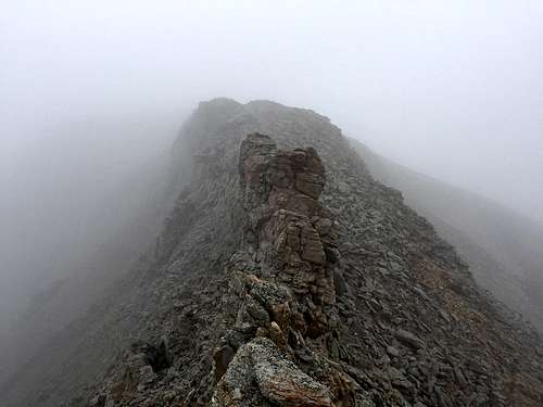 Below Little Chicago
 |
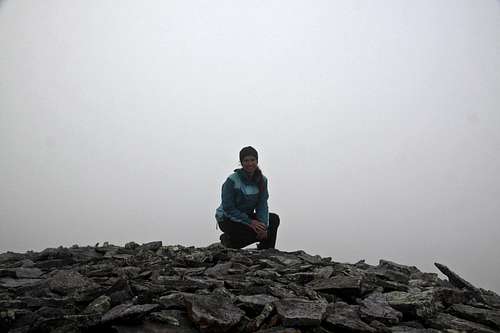 Chicago Peak summit
 | 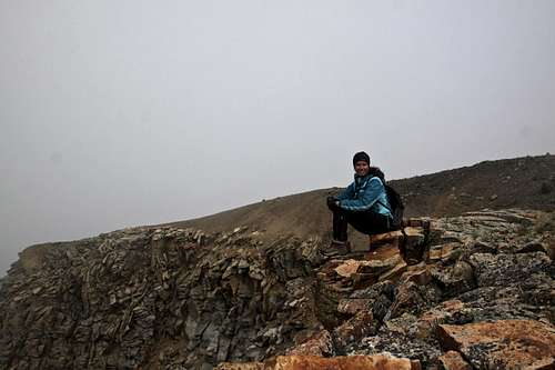 Little Chicago
 |
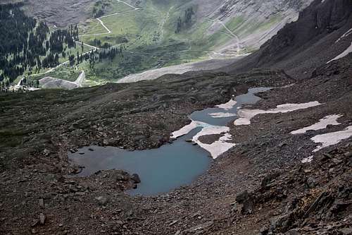 Rock Lake and Imogene Pass Rd in the distance
 | 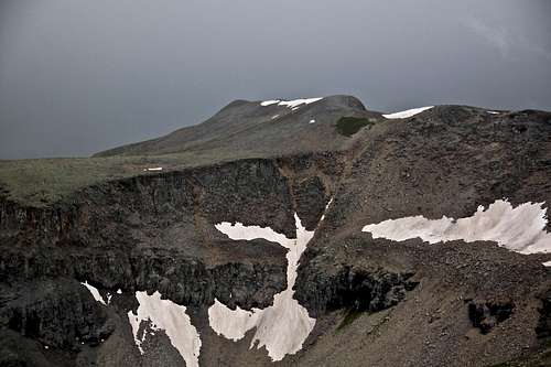 Chicago Peak zoomed and as seen from the summit of United States Mountain
 |
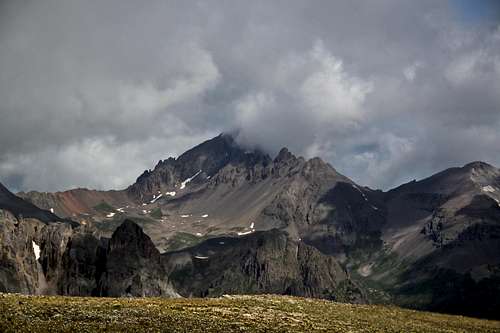 Mount Sneffels
 | 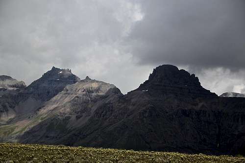 Potosi, Coffeepot and Teakettle
 |