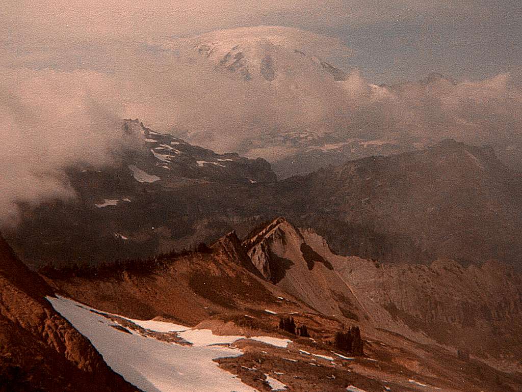
This is an interesting trail north of
Packwood in Lewis County, Washington. The
name of the waterway where the trailhead starts is Hinkle Tinkle. The trail leads up to Tatoosh Peak. This is a Tacoma Mountaineers hike that I went on in September 1984. This photo was taken from a low spot on the Tatoosh Ridge known as "Impie's Nest." I happened to catch Mount Rainier and Little Tahoma, as they continued to play peek-a-boo with the clouds.
About 12 million years ago, a body of magma
or molten lava welled up through the
Ohanapecosh Formation near Mount Rainier.
The "Tatoosh pluton" which cooled and
solidified underground, makes up the craggy
Tatoosh Range as viewed today. The rocks in
this area are composed mainly of coarse-
grained granodiorite having a "salt-and-pepper
" appearance.
Along Highway 12, to the south is Packwood and to the north is La Wis Wis Campground, near Mount Rainier NP. If you want to "tinkle"
before or after the hike, these places are
normally open for business.
This photo was taken from the same vantage point on a much clearer day.
PLEASE click.