Toggle navigation
Mountains
Routes
Images
Trip Reports
Forum
What's New
People
Areas & Ranges
Articles
Trailheads
Canyons
Huts & Campgrounds
Albums
Logistical Centers
Fact Sheets
Lists
Custom Objects
Gear
Plans & Partners
WELCOME TO SUMMITPOST
SIGN IN
REGISTER
South Face
Additional Parents
Image
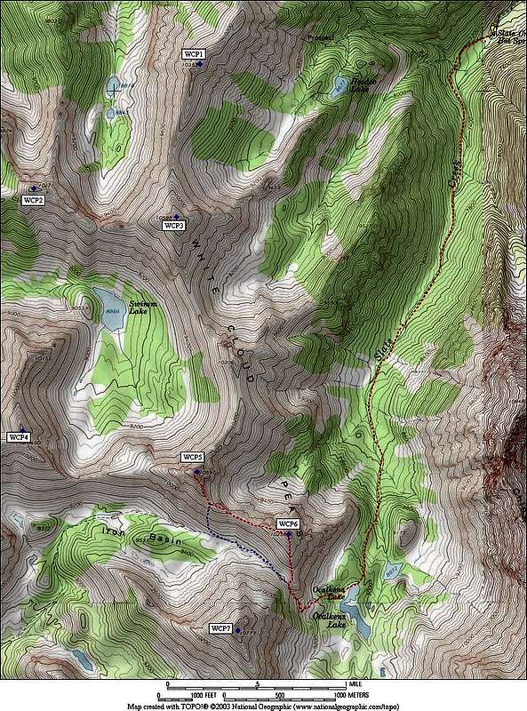
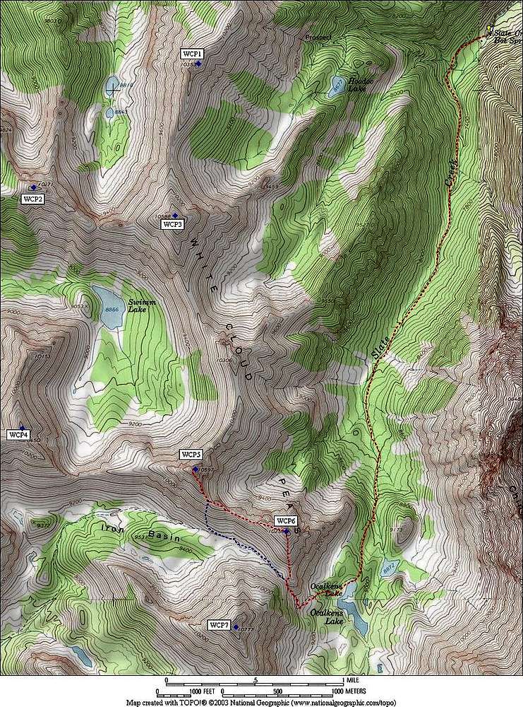
WCP-5 Route Map
View High-Resolution Image
WCP-5 Route Map
Route map for WCP-5 from the Slate Creek trailhead. Our descent route marked in blue. Round trip stats of 11 miles and 4000 feet elevation gain.
« PREV
NEXT »
Super Dave
on
Jan 10, 2010 12:06 pm
Comments & voting
Other parents
Image Type(s):
Topo/Diagram
,
Informational
Image ID:
588252
1597 Hits
77.48
% Score
8
Votes
Log in to vote
Comments
No comments posted yet.
to post!
Don't have an account?
South Face
(Route)
« PREV
Viewing
#10 of 10
GALLERY
You are at
the Last
Image
Super Dave's Image Gallery
« PREV
Viewing
#375 of 487
GALLERY
NEXT »
WCP-5
(Mountain/Rock)
Loading....
×
You need to login in order to vote!
User Name
Password
Remember me
Forgot your password?
Log me out when I close my browser.
Keep me logged in all the time.
sign in as a user
Don't have an account?
Register now for FREE
Rating available
Suggested routes for you
People who climb the same things as you
Comments Available
Create Albums
Register Here


