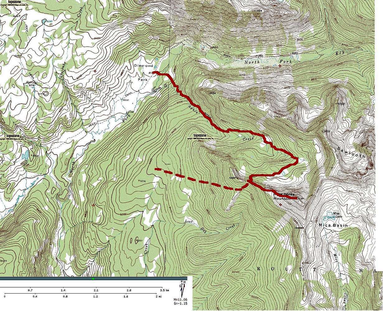
The West Ridge route on Little Agnes.
The solid red line shows the route from Diamond Park via the Mica Basin Trail. This route leaves the trail at the saddle between Little Agnes and point 10,687'. An optional route from the western flanks of Little Agnes is shown by the dashed red line. This route can be accessed from FR 433. Off-trail navigational skills are a must! The route joins the Mica Basin Trail version of the West Ridge route at the saddle between Little Agnes and point 10,687'. Mount Zirkel Wilderness, Park Range, Colorado.


