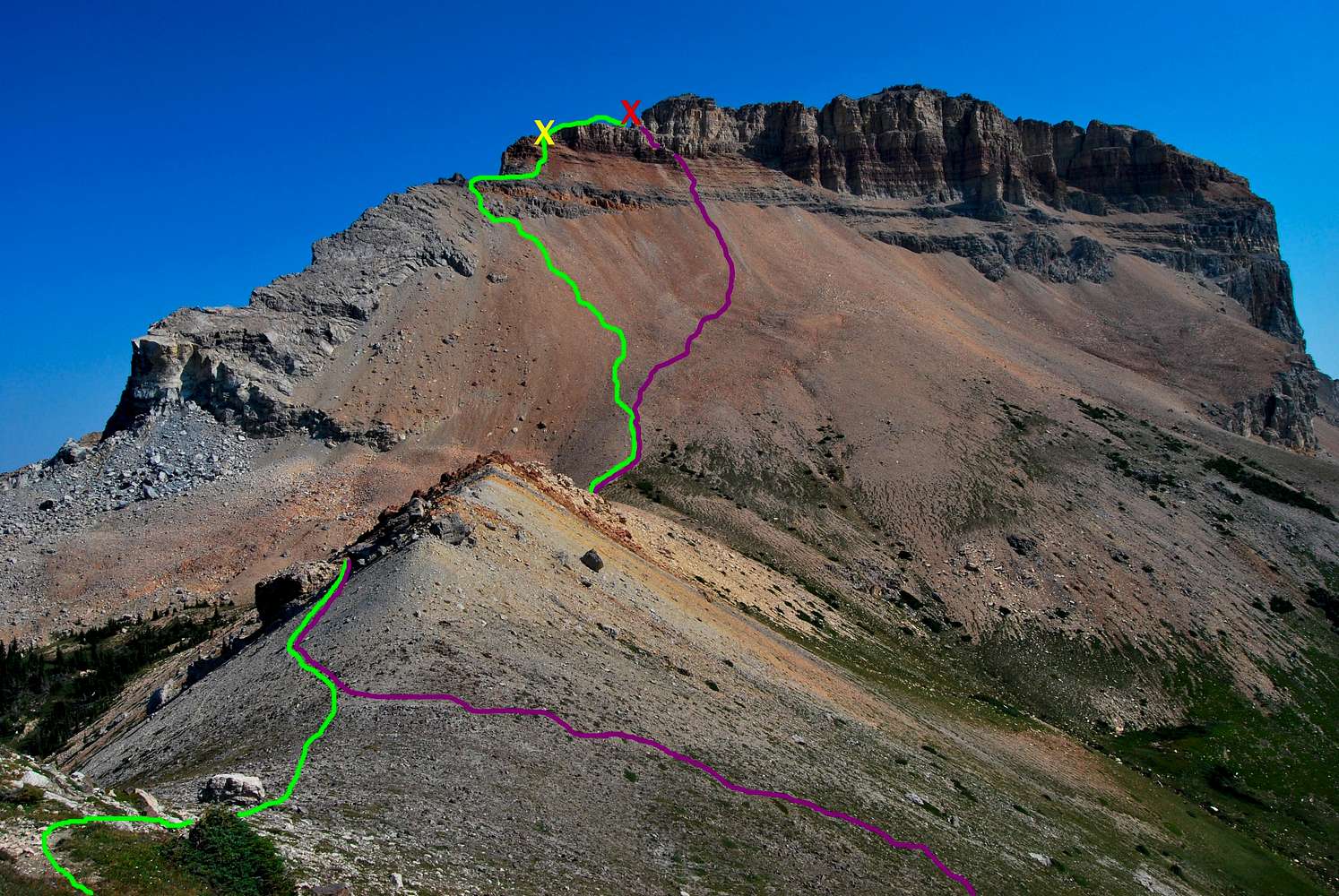
Green Line - Ascent
A great climber's trail can be followed to the saddle between Squaw Mountain and Chief Mountain. In the photo, the route disappears between some large boulders on the left side of the saddle. The rock was quite loose, so it may be worth the extra effort to traverse the top of the ridge instead. After reaching the base of Chief, it's a mighty scree slog up most of the west face. We angled left to intercept the Solid North Ridge Route, leaving the scree field to climb around rocky outcroppings and up class III gullies to gain the ridge. The yellow "X" denotes a class IV stretch of about 15 feet that leads to a slender, obscure flat topped rock. From there, the obvious notch around the north face of the summit block is easily accessed via a simple descent from the flat rock down to the great climber's trail (red "X"). The trail will lead all the way to the summit.
Purple Line - Descent
From the notch (red "X), descend down a great loose scree gully through a few class III cliff bands. Soon a great scree trail will be reached; dig in and start running! You can easily scree run about half the way down the west face, and from there it's an easy walk down game trails to the saddle leading to Squaw Mountain. We opted to detour south into grassy meadows alongside Squaw and Papoose Peak until regaining the climber's trail just east of Gable Pass Trail.
Refer to
this photo to see the west face sans photoshopped route.
September 1, 2009


Comments
Post a Comment