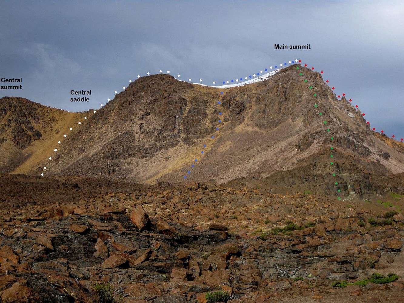
This is Nevado Huarancante from the northeast, about 1km from the main summit.
I was armed with a map, but no other information about the mountain except that I was told that it would be easy. I had a good look from the west and at the southwestern slopes, and saw a few potentially easy routes from there.
However, I had planned to go to the northern side of the mountain and try to climb it from that side, because the contours on my map suggested it might be easier from there. This picture shows no less than four possible routes up to the summit.
The main ridge runs from the southeast to the northwest. I considered four possible routes, from left to right:
| White: | To the central saddle via a short scree slope, then along the southeastern ridge to the summit. |
| Blue: | To the shallow saddle via a longer scree slope close to the summit. |
| Green: | Scramble up the northeast ridge. |
| Red: | Scramble up the northwest ridge. |
Since I was alone, and carrying a full pack, I didn't want to go scrambling without knowing what difficulties I might encounter. That meant I had to choose one of the scree slopes.
I decided on the left one, because the other one looked rather steep higher up, and it was much longer. I reckoned that I could leave my pack on the saddle before scrambling up the ridge. If the ridge itself would prove to be tricky, a viable alternative would be to traverse below it on the other side, which, as I had seen a few days before, was covered in snow and didn't appear to be too difficult (mind you, I
did pack crampons):
 A view from the other side
23 May 2011.


